


- Region
- Prešov Region, Slovakia / Poland
- Best season
- Spring, Summer
- Permits
- Confirm current permit requirements and ac…
Plan with verified data
High Tatras trip tools
Tools for a trip here
Picked for how, when and where you're going. Free, no signup.
Photos of High Tatras
How to get there
High Tatras is in Prešov Region, Slovakia / Poland. Its center point is 49.1600, 20.1300. Use these links for live turn-by-turn directions from where you are, then confirm road, trailhead and access conditions with the managing agency before you leave.
Prešov Region, Slovakia / Poland · Season: Best: July-October
- Climbing
- Mountaineering
- Hiking
The country
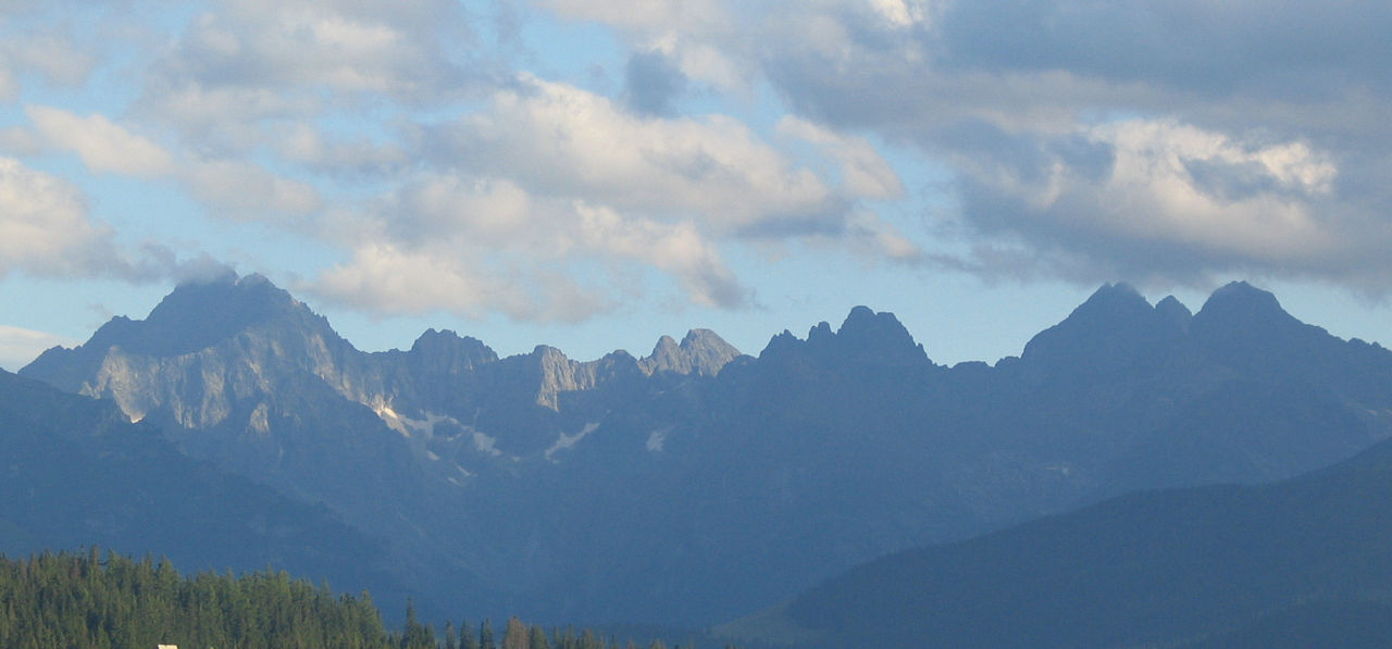
The High Tatras form a natural alpine border between Poland and Slovakia, characterized by sharp granite peaks shooting up dramatically from forested foothills. Despite their compact footprint, they possess true alpine characteristics including steep couloirs, cirques, and moraine-dammed lakes known locally as 'plesá'. The ecosystem supports brown bears, lynx, and the endemic Tatra chamois.
Why enthusiasts come
The Tatras offer world-class scrambling and via-ferrata style routes without the scale and logistical complexity of the Swiss Alps. The 'Tatranská Magistrála' trail provides a stunning multi-day traverse linking high-altitude mountain chalets. Climbers and hikers flock here for testing ascents secured by chains over thrillingly exposed gaps.
Top experiences
Climbing Rysy (2,500m) allows hikers to cross the border on foot while negotiating steep, chain-protected rock steps. On the Polish side, traversing the notorious Orla Perć (Eagle's Path) offers a highly exposed, demanding scramble along a jagged crest. The Slovak side features beautiful valley descents past Morskie Oko and Velické pleso lakes.
Planner-relevant notes
Strict national park rules strictly forbid wild camping across the entire range; nights must be spent in the heavily booked mountain huts (chatas/schroniskos). Peak bagging requires high clearance; some summits like Gerlachovský štít are only accessible with a certified mountain guide. Trails above the treeline are closed on the Slovak side from November through mid-June.
Field notes
- Start extremely early for popular routes like Rysy or Giewont to avoid human traffic jams on the chain-assisted sections.
- Late summer thunderstorms are highly dangerous on the exposed iron chains of Orla Perć.
- Most huts sell basic meals and drinks, meaning you can pack a relatively light pack for multi-day traverses.
- Mountain rescue (TOPR in Poland, HZS in Slovakia) is highly efficient, but traversing the border mid-hike means switching your emergency contact numbers.
Where on earth
Satellite imagery flying in from a world view to High Tatras, Prešov Region, Slovakia / Poland. Use the + / − buttons, or click the map to zoom with your scroll wheel; drag to pan and pinch to zoom on touch.
Coordinates
- Decimal degrees
- 49.1600, 20.1300
- Latitude (DMS)
- 49° 9′ 36.0″ N
- Longitude (DMS)
- 20° 7′ 48.0″ E
Coordinates are an access-point reference for High Tatras, not a route. Carry a paper map and confirm trailhead or put-in access with the managing agency before you go.
Topic summary
A compact, dramatic subrange of the Carpathians featuring sheer granite spires, deep tarns, and legendary hut-to-hut trekking.
Key takeaways
- Region: Prešov Region, Slovakia / Poland
- Best season: Best: July-October
- Coordinates: 49.160, 20.130
Climate suitability
Best: July-October
Keep planning
Popular pursuits at High Tatras
- Climbing
Rock and alpine lines with approach beta.
- Mountaineering
Glacier and high-route objectives with real consequence.
- Hiking
Day miles on marked trail, with route notes and trail links below.
The High Tatras in context
The High Tatras form the tallest part of the Carpathian Mountain Range and are a destination for mountain and winter sports. For a trip centered on Slovakia, they sit within a country whose outdoor attractions include nine national parks and thousands of well-marked hiking trails. The mountain landscape is the main reason to build an itinerary here, rather than treating the range as a brief stop between towns. Keep the geographic labels straight when planning: Prešov is an administrative region of Slovakia, and the city of Prešov is its administrative center, not an identified mountain trailhead. For a visit spanning Slovakia and Poland, establish which side each planned outing uses before arranging transport or choosing accommodation.
Building a walking itinerary
Hiking is a natural starting point for a High Tatras trip, but a destination-level plan is not enough to select an individual walk. Slovakia has an extensive network of well-marked trails; that national description does not establish the length, difficulty, or access arrangements of any particular mountain route. Choose an outing only after confirming its start point, endpoint, elevation profile, and current conditions. Match the day to the least experienced member of the group, and leave room to shorten the plan if conditions change. Carry navigation rather than relying on the general reputation of trail marking. Clothing for changing mountain weather, food, and sufficient water belong in the plan even when the aim is a straightforward day outdoors.
Season and trip logistics
The High Tatras support both mountain and winter sports, so the intended activity should guide the timing and equipment for a visit. A walking itinerary and a winter-sports itinerary require separate checks; do not assume that an access arrangement suitable for one will suit the other. Before committing to accommodation or transport, confirm the operating arrangements and current access information for the specific places involved. Check permission requirements with the relevant managing agency. Keep travel logistics separate from route selection: reaching the broader region does not establish how to reach a mountain starting point. Slovakia's relatively small size makes combining outdoor time with cultural stops practical, but leave enough flexibility that a fixed onward schedule does not dictate a mountain day.
Sample itineraries
- High Tatras mountain introduction · 1 day
Plan a day focused on mountain scenery in the highest part of the Carpathians. Choose a hiking outing only after checking current access, weather and trail difficulty. Keep the route within the group's ability rather than treating a summit as essential.
- Flexible mountain weekend · 2 days
Use the first day for a modest mountain outing and an assessment of conditions. Reserve the second for another hike if weather and energy allow. Select specific trails after confirming local access; this is a flexible trip structure, not a verified route.
- Winter-sports visit · 2 days
Build a two-day visit around the High Tatras' winter-sports opportunities. Confirm suitable activities, operating conditions and equipment needs before choosing a venue. Keep both days flexible rather than assuming winter conditions guarantee access.
Seasonal conditions
Spring
Check current mountain conditions before choosing travel days.
Do not assume a spring date means winter conditions have ended at higher elevations. Choose footwear, layers and outing difficulty around the actual forecast and local advice.
Summer
Choose hiking days around the mountain forecast.
The High Tatras offer mountain recreation, but a summer visit still calls for weather protection and a route matched to the group. Confirm conditions rather than assuming every high-elevation outing is suitable.
Fall
Confirm conditions and available daylight before setting an itinerary.
Keep mountain plans flexible and carry warm layers. Set a turnaround time that leaves enough daylight for the return, and check whether the chosen outing suits current conditions.
Winter
Confirm winter-sports conditions before booking activities.
Winter sports are a feature of the High Tatras. Match equipment and experience to the activity, and confirm local conditions and access rather than assuming hiking plans translate directly into winter outings.
| Season | Window | Conditions |
|---|---|---|
| Spring | Check current mountain conditions before choosing travel days. | Do not assume a spring date means winter conditions have ended at higher elevations. Choose footwear, layers and outing difficulty around the actual forecast and local advice. |
| Summer | Choose hiking days around the mountain forecast. | The High Tatras offer mountain recreation, but a summer visit still calls for weather protection and a route matched to the group. Confirm conditions rather than assuming every high-elevation outing is suitable. |
| Fall | Confirm conditions and available daylight before setting an itinerary. | Keep mountain plans flexible and carry warm layers. Set a turnaround time that leaves enough daylight for the return, and check whether the chosen outing suits current conditions. |
| Winter | Confirm winter-sports conditions before booking activities. | Winter sports are a feature of the High Tatras. Match equipment and experience to the activity, and confirm local conditions and access rather than assuming hiking plans translate directly into winter outings. |
Permits, fees & closures
Confirm current permit requirements and access rules with the managing agency for the side of the High Tatras and activity planned.
Confirm current permits, fees, and closures with the managing agency before you go.
Hazards & regulations
- Mountain weather requires flexible plans; check the forecast and turn back if conditions exceed the group's equipment or experience.
- Cold exposure is a planning concern for mountain and winter-sports outings; carry insulation and weather protection.
- Mountain terrain can demand more effort than expected; check route difficulty before committing.
- Winter activities require suitable equipment and skills; do not assume a hiking setup is sufficient.
What to pack for High Tatras
- Insulating layers
- Windproof and waterproof outer layer
- Footwear suited to the chosen terrain
- Water and food for the outing
- Navigation tools for the selected route
- Charged phone
- Headlamp
- Basic first-aid kit
- Equipment appropriate to the selected activity
- Warm gloves and hat
- Eye protection
- Spare dry layer
High Tatras FAQ
- What distinguishes the High Tatras?
- They form the tallest part of the Carpathian Mountain Range and offer mountain scenery, mountain recreation and winter sports.
- Is this a hiking or winter-sports destination?
- Both are relevant trip styles. Choose the activity first, then confirm current conditions, access and the equipment or experience it requires.
- Can a specific trail or access point be recommended here?
- No specific route or access point is established in this profile. Obtain current local route information before choosing a hike; general mountain-recreation opportunities do not establish an individual trail's suitability.
- Can the same access rules be assumed on the Slovak and Polish sides?
- Do not assume they are interchangeable. Confirm requirements with the managing agency responsible for the location and activity planned.
- How much time should a first visit allow?
- A one-day outing or flexible two-day visit can provide a practical planning framework. Neither establishes how long a particular route takes; decide that after checking distance, difficulty, access and conditions locally.