


- Region
- Poland / Slovakia
- Best season
- Spring, Summer
- Permits
- Confirm permits, entry requirements, and c…
- Managed by
- Tatra National Park, Slovakia (Tatranský Národný Park — TANAP), and Tatra National Park, Poland (Tatrzański Park Narodowy).
Plan with verified data
Tatra Mountains trip tools
Tools for a trip here
Picked for how, when and where you're going. Free, no signup.
Photos of Tatra Mountains
How to get there
Use the intended side of the range to narrow the approach. Zakopane is a geographic anchor on the Polish side, northwest of Rysy; Poprad lies south of Gerlachovský štít in Slovakia. Huty and Ždiar mark the western and eastern ends of the main ridge. Confirm onward access to the chosen route with the relevant national park.
- Zakopane
A Polish-side geographic anchor for planning in the Tatras. Rysy lies southeast of the town on the border with Slovakia; select and verify a specific trail access point separately.
- Poprad
A Slovak-side geographic anchor south of Gerlachovský štít. Its location helps orient planning, but does not establish a direct walking approach to the summit.
Sources: Wikipedia · Wikivoyage. Confirm road and trailhead conditions with the managing agency before you leave.
Poland / Slovakia · Season: Best: Jun – Sep
- Climbing
- Mountaineering
- Hiking
- Wildlife Viewing
The country
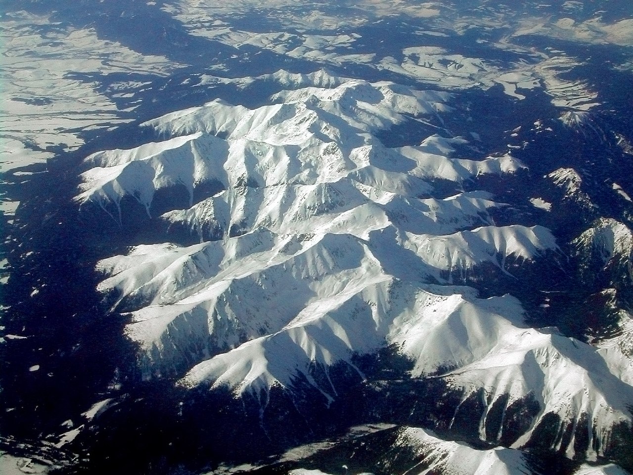
A compact granite range on the Polish-Slovak border — dozens of alpine lakes, sharp granite crests, and a hut network on both sides of the border.
Why enthusiasts come
Orla Perć (the 'Eagle's Path') is Poland's most demanding waymarked route — steel cables across exposed ridge. Rysy is a common cross-border summit day.
Planner-relevant notes
Wild camping is prohibited in the national park — huts only. Off-trail travel is not permitted in most zones.
Field notes
- Bring headlamp for pre-dawn starts on Orla Perć — cables are safer in dry rock.
- Cross-border sections need passport check-in at some huts.
- Chamois are habituated near huts but should not be fed.
Where on earth
Satellite imagery flying in from a world view to Tatra Mountains, Poland / Slovakia. Use the + / − buttons, or click the map to zoom with your scroll wheel; drag to pan and pinch to zoom on touch.
Coordinates
- Decimal degrees
- 49.1700, 20.0800
- Latitude (DMS)
- 49° 10′ 12.0″ N
- Longitude (DMS)
- 20° 4′ 48.0″ E
Coordinates are an access-point reference for Tatra Mountains, not a route. Carry a paper map and confirm trailhead or put-in access with the managing agency before you go.
Topic summary
The highest range in central Europe — Alpine terrain at Slavic prices.
Key takeaways
- Region: Poland / Slovakia
- Best season: Best: Jun – Sep
- Coordinates: 49.170, 20.080
Climate suitability
Best: Jun – Sep
Keep planning
Popular pursuits at Tatra Mountains
- Climbing
Rock and alpine lines with approach beta.
- Mountaineering
Glacier and high-route objectives with real consequence.
- Hiking
Day miles on marked trail, with route notes and trail links below.
A compact mountain range across two countries
The Tatra Mountains form the natural border between Poland and Slovakia and contain the highest mountains in the Carpathians. They belong to the Western Carpathians and are distinct from the Low Tatras, a separate range farther south in Slovakia. That distinction matters when choosing a destination or checking maps: the two names do not describe the same mountain area. The Tatras cover about 785 square kilometres, with roughly 78 percent in Slovakia and 22 percent in Poland. The range is only about 19 kilometres wide, but its main ridge extends for about 80 kilometres. For trip planning, treat this as a compact, high mountain landscape rather than assuming its small footprint makes travel through it straightforward.
Peak objectives and geographic anchors
Two peaks help orient a visit. Gerlachovský štít, entirely in Slovakia north of Poprad, is the range’s highest summit at 2,655 metres. Rysy lies on the Polish–Slovak border southeast of Zakopane and contains Poland’s highest point. These locations give useful geographic anchors, but a town’s proximity to a mountain does not establish a suitable walking approach. Choose a specific route only after checking current park guidance and matching the terrain to the group’s experience. The main ridge runs between Huty at the western end and Ždiar at the eastern end, providing another useful frame for understanding the range. Keep the intended mountain sector in mind when selecting a base; a destination anywhere in the Tatras is not automatically convenient for every objective.
Planning within the two national parks
The Tatras are protected by national parks on both sides of the border: Tatranský Národný Park, commonly called TANAP, in Slovakia, and Tatrzański Park Narodowy in Poland. Together, the parks form a transboundary biosphere reserve. This shared landscape still calls for country-specific planning: check guidance from the park responsible for the intended outing rather than assuming information for one side applies to the other. Confirm current access arrangements and route suitability directly with the relevant park before setting out. For a high mountain trip, carry layers, weather protection, water and navigation appropriate to the chosen outing. Keep plans flexible enough to shorten or change the day if conditions or the group’s ability do not suit the intended objective.
Route options
- Rysy objective
A border-peak objective southeast of Zakopane that includes Poland’s highest point. This is a destination to investigate, not a specified trail itinerary; confirm the approach, suitability and current access with the relevant park.
- Gerlachovský štít objective
The highest summit in the Tatras, at 2,655 metres, entirely within Slovakia north of Poprad. Seek current guidance from TANAP before planning an ascent; no particular approach or independent hiking access is implied.
Sample itineraries
- Polish Tatras orientation · 1 day
Focus on Tatra National Park in Poland. Use Zakopane as a geographic reference: Rysy lies southeast, on the Slovak border. Select an outing after checking current park guidance; treat a summit attempt as a separate mountain objective.
- Slovak Tatras orientation · 2 days
Spend two days exploring the Slovak side of the range, choosing outings with Tatra National Park guidance. Gerlachovský štít, north of Poprad, provides geographic context rather than an assumed walking destination. Keep the second day flexible for mountain weather.
- Two-country park introduction · 3 days
Allocate one day to each country's Tatra National Park and keep a third day flexible. Compare the two sides of this protected border range without committing to a ridge crossing. Confirm local access and suitable outings separately with each park.
Seasonal conditions
Spring
Spring mountain transition
For this high mountain range, plan conservatively for cold conditions and possible lingering snow. Check local forecasts and ground conditions before selecting elevation or terrain.
Summer
Summer mountain outings
Do not assume warm conditions at higher elevations. Carry layers and waterproof protection, and leave room to shorten an outing if mountain weather deteriorates.
Fall
Fall cooling period
Allow for cooling temperatures and less daylight. Choose an outing that leaves a generous return margin, and check for snow or ice before heading higher.
Winter
Winter mountain conditions
Treat high-elevation travel as a winter mountain undertaking. Confirm current conditions and access with the relevant park, and match terrain to winter skills and equipment.
| Season | Window | Conditions |
|---|---|---|
| Spring | Spring mountain transition | For this high mountain range, plan conservatively for cold conditions and possible lingering snow. Check local forecasts and ground conditions before selecting elevation or terrain. |
| Summer | Summer mountain outings | Do not assume warm conditions at higher elevations. Carry layers and waterproof protection, and leave room to shorten an outing if mountain weather deteriorates. |
| Fall | Fall cooling period | Allow for cooling temperatures and less daylight. Choose an outing that leaves a generous return margin, and check for snow or ice before heading higher. |
| Winter | Winter mountain conditions | Treat high-elevation travel as a winter mountain undertaking. Confirm current conditions and access with the relevant park, and match terrain to winter skills and equipment. |
Permits, fees & closures
Confirm permits, entry requirements, and current access rules with Tatra National Park in Poland or Slovakia before visiting.
Confirm current permits, fees, and closures with the managing agency before you go.
Hazards & regulations
- High mountain terrain demands conservative planning: Gerlachovský štít reaches 2,655 metres, and Rysy reaches 2,500 metres.
- Cold and changing mountain weather can make an outing more demanding; carry weather protection and be ready to turn back.
- Possible snow or ice requires a fresh assessment of equipment, skills, and route suitability before proceeding.
- An outing that exceeds available daylight or personal ability can leave little margin for a safe return.
What to pack for Tatra Mountains
- Waterproof outer layer
- Insulating layer
- Warm hat and gloves
- Map for the chosen park
- Charged phone with offline navigation
- Headlamp
- First-aid kit
- Footwear suited to mountain terrain
- Drinking water
- Food and an extra snack
- Sun protection
Tatra Mountains FAQ
- Where are the Tatra Mountains?
- The Tatras lie in the Western Carpathians and form a natural border between Poland and Slovakia. They are the highest mountains in the Carpathians.
- Which country contains more of the range?
- About 77.7% of the Tatras lies in Slovakia and about 22.3% in Poland. The range covers approximately 785 square kilometres.
- What are the highest points?
- Gerlachovský štít, entirely in Slovakia north of Poprad, is the highest peak at 2,655 metres. Rysy, on the border southeast of Zakopane, is Poland's highest point at 2,500 metres.
- Are the Tatras the same as the Low Tatras?
- No. The Low Tatras are a separate mountain range farther south in Slovakia. Check the park and destination names carefully when planning.
- How is the range protected?
- Tatra National Park in Slovakia and Tatra National Park in Poland protect the range. Together, they form a transboundary biosphere reserve in UNESCO's World Network of Biosphere Reserves.
- Does a peak's location establish visitor access?
- No. A named summit is not an access recommendation. Confirm suitable routes, current conditions, and visitor requirements with the relevant national park before planning an ascent.