



- Region
- Vestland and Telemark, Norway
- Best season
- Spring, Summer
- Permits
- Confirm current access rules and any permi…
Plan with verified data
Hardangervidda National Park trip tools
Tools for a trip here
Picked for how, when and where you're going. Free, no signup.
Photos of Hardangervidda National Park
How to get there
The Bergen Line railway and Norwegian National Road 7 cross Hardangervidda. Choose onward access to match the intended part of the park; a plateau crossing is not itself a specified park trailhead. The park extends from Uvdalen in Numedal in the east to Røvilseggi in Ullensvang in the west.
- Uvdalen, Numedal
An eastern access area to investigate when planning a trip: the park extends to this valley. Select a specific starting point and connecting path before travelling.
- Eidfjord, Hardanger
A western planning point associated with the historic Nordmannsslepa crossing, which links Eidfjord with places east of the plateau. Confirm the intended trail connection rather than assuming a single departure point.
Sources: Wikipedia · Wikivoyage. Confirm road and trailhead conditions with the managing agency before you leave.
Vestland and Telemark, Norway · Season: Best: July-August (trekking), March-April (ski touring)
- Climbing
- Mountaineering
- Winter Camping
- Skiing
- Hiking
- Backpacking
- Wildlife Viewing
The country
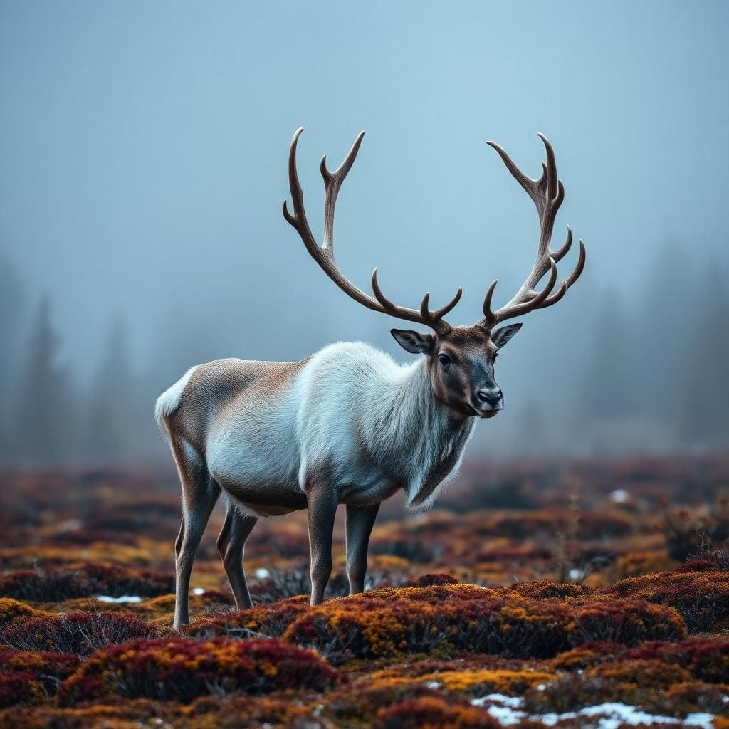
Hardangervidda is the largest alpine plateau in Europe, shaped by glacial remnants into broad moors, shallow lakes, and barren rocky outcrops. The tundra-like landscape supports Europe's largest wild reindeer herd and an array of arctic flora. To the west, the gentle plateau gives way to dramatic fjords and steep valleys.
Why enthusiasts come
Summer backpackers are drawn to the immense network of trails connected by the Norwegian Trekking Association's (DNT) remote cabins. In winter, relentless winds and moderate gradients make it a premier global destination for expedition snow-kiting and pulk-hauling multi-day ski tours. The raw exposure offers true polar-prep training conditions.
Top experiences
Trekking from Finse to Haukeliseter traverses the heart of the plateau, navigating rivers and rolling ridges. Climbing Hårteigen, a distinctive hat-shaped peak, provides panoramic views across the barren expanse. Winter expeditions often cross the Hardangerjøkulen glacier, testing navigation skills in frequent whiteouts.
Planner-relevant notes
DNT cabins range from staffed lodges serving meals to self-service huts stocked with provisions; a standard key is required for access. Weather on the plateau is notoriously fickle, shifting from sunny to freezing rain or snow year-round. Wild camping is legal anywhere under the 'Right to Roam,' provided you leave no trace.
Field notes
- When navigating in low visibility, rely heavily on GPS trails and compass bearings, as the featureless terrain makes visual orientation nearly impossible.
- Late summer brings heavy mosquito activity near the boggy lakes; bring a quality head net and repellent.
- Resupply is easy if utilizing the DNT self-service huts, which are stocked with dry goods, canned food, and fuel.
- The train station at Finse sits at 1,222 meters and has no road access, acting as an atmospheric portal straight into the high backcountry.
Where on earth
Satellite imagery flying in from a world view to Hardangervidda National Park, Vestland and Telemark, Norway. Use the + / − buttons, or click the map to zoom with your scroll wheel; drag to pan and pinch to zoom on touch.
Coordinates
- Decimal degrees
- 60.1500, 7.5000
- Latitude (DMS)
- 60° 8′ 60.0″ N
- Longitude (DMS)
- 7° 30′ 0.0″ E
Coordinates are an access-point reference for Hardangervidda National Park, not a route. Carry a paper map and confirm trailhead or put-in access with the managing agency before you go.
Topic summary
A vast, rolling alpine plateau offering incredible wind-swept wilderness for multi-day trekking and legendary winter kite-skiing.
Key takeaways
- Region: Vestland and Telemark, Norway
- Best season: Best: July-August (trekking), March-April (ski touring)
- Coordinates: 60.150, 7.500
Climate suitability
Best: July-August (trekking), March-April (ski touring)
Keep planning
Popular pursuits at Hardangervidda National Park
- Climbing
Rock and alpine lines with approach beta.
- Mountaineering
Glacier and high-route objectives with real consequence.
- Winter Camping
Cold-season travel and camp craft; layering matters more than mileage.
- Skiing
Ski-touring access when the road closes for the season.
- Hiking
Day miles on marked trail, with route notes and trail links below.
- Backpacking
Multi-day travel with everything on your back — see the packing blocks below.
Animals around Hardangervidda National Park





A national park across the high plateau
Hardangervidda National Park protects 3,422 square kilometres of Norway’s mountain plateau, extending across Vestland, Telemark and Buskerud. Its eastern reach lies at Uvdalen in Numedal, while Røvilseggi in Ullensvang marks its western extent. Established in 1981, the park occupies roughly half of Hardangervidda, the largest highland plateau in Northern Europe. The landscape’s defining feature is its breadth: this is a wide mountain plain rather than a destination centred on one summit. Hiking, climbing, fishing and cross-country skiing all draw visitors here. Plan around the particular part of the plateau a trip will explore, rather than treating the national park as a single arrival point. Its scale makes access choice and the relationship between a starting point, paths and overnight stops important parts of preparation.
Paths, huts and crossings
The Norwegian Mountain Touring Association, known as DNT, maintains a comprehensive network of huts and paths across Hardangervidda. That network provides a framework for planning walking trips, but an itinerary still needs to connect a suitable access point with the intended paths and overnight stops. Ancient trails also cross the plateau, reflecting its long role as a link between western and eastern Norway. Nordmannsslepa is one example, linking Eidfjord in Hardanger and Veggli in Numedal with Hol and Uvdal. Treat that historic connection as a route to investigate, not as a fully specified walking itinerary. The Bergen Line railway and Norwegian National Road 7 both cross the plateau, offering transport corridors to consider when matching travel arrangements to a chosen walking area.
Reindeer country with a long human history
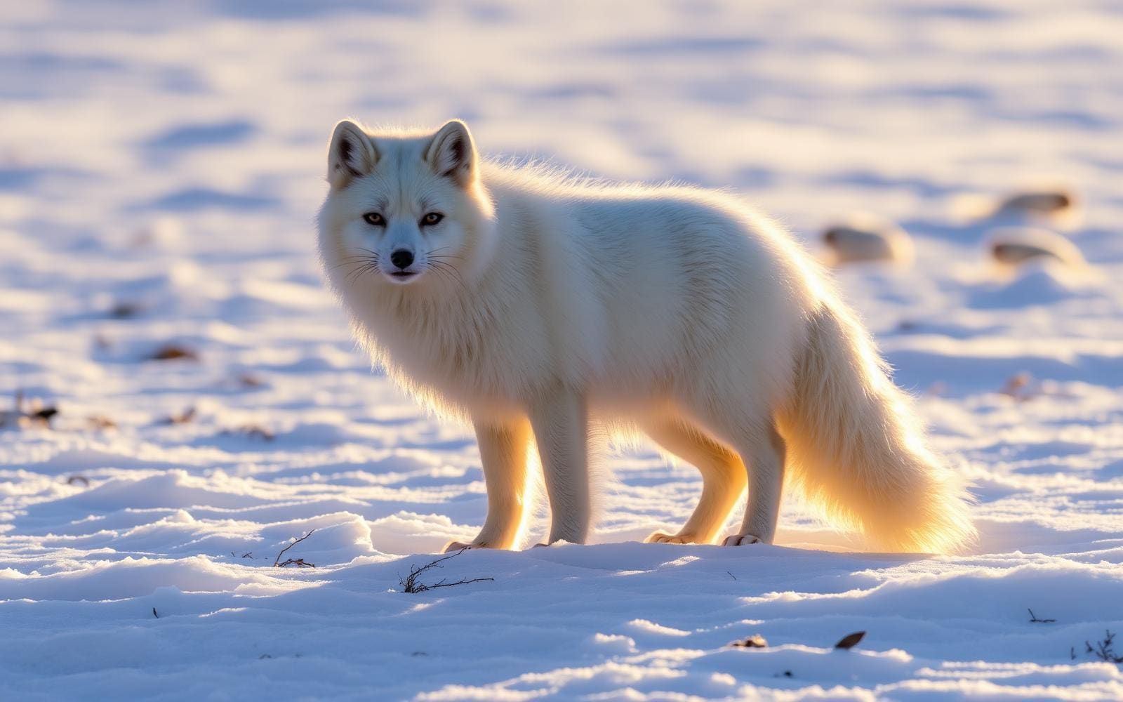
Hardangervidda supports wild reindeer herds among the largest in the world and protects the southernmost populations of several arctic animals and plants. Wildlife is part of the reason to travel carefully here, not simply something to look for along the way. Give animals space and avoid following or approaching herds. The plateau’s human history is closely connected to that same wildlife: several hundred nomadic Stone Age settlements have been found in the area, most likely associated with reindeer migration. Together with the ancient crossing trails, those sites show that this broad upland has long been a travelled and inhabited landscape. Leave archaeological remains undisturbed, keep wildlife viewing at a distance, and prepare for mountain weather when choosing clothing and equipment.
Route options
- DNT paths across Hardangervidda
Build a walking itinerary around the Norwegian Mountain Touring Association’s network of paths and huts. Choose the particular path connections and overnight stops before deciding the trip’s length or demands.
- Nordmannsslepa
Investigate this ancient cross-plateau trail linking western and eastern Norway, connecting Eidfjord in Hardanger and Veggli in Numedal with Hol and Uvdal. Establish the exact alignment and access arrangements for the section intended.
Sample itineraries
- Hardangervidda plateau day hike · 1 day
Plan an out-and-back walk on the DNT path network across Hardangervidda. Choose the turnaround point for conditions and the group's ability rather than committing to a plateau crossing. Confirm the starting point and current path conditions before setting out.
- DNT hut-and-path walking trip · 3 days
Build a short walking trip around DNT's network of huts and paths. Select overnight stops only after checking hut availability and the terrain between them. Leave room to shorten the trip if plateau weather makes onward travel unsuitable.
Seasonal conditions
Spring
Spring transition
Treat a high-plateau spring as a transition rather than an assured hiking season. Check snow cover and current travel conditions before choosing walking or skiing equipment.
Summer
Summer walking season
Hiking is a principal activity on Hardangervidda. Plan for exposure on the broad mountain plateau, carry warm and waterproof layers, and check conditions rather than assuming every path is suitable.
Fall
Autumn transition
Keep walking plans flexible as colder weather and shorter daylight reduce the margin for delays. Confirm conditions and overnight arrangements before committing to a hut-based trip.
Winter
Winter snow season
Cross-country skiing is an established activity here. Plateau travel requires cold-weather equipment, reliable navigation and a plan that fits daylight, weather and the group's winter skills.
| Season | Window | Conditions |
|---|---|---|
| Spring | Spring transition | Treat a high-plateau spring as a transition rather than an assured hiking season. Check snow cover and current travel conditions before choosing walking or skiing equipment. |
| Summer | Summer walking season | Hiking is a principal activity on Hardangervidda. Plan for exposure on the broad mountain plateau, carry warm and waterproof layers, and check conditions rather than assuming every path is suitable. |
| Fall | Autumn transition | Keep walking plans flexible as colder weather and shorter daylight reduce the margin for delays. Confirm conditions and overnight arrangements before committing to a hut-based trip. |
| Winter | Winter snow season | Cross-country skiing is an established activity here. Plateau travel requires cold-weather equipment, reliable navigation and a plan that fits daylight, weather and the group's winter skills. |
Permits, fees & closures
Confirm current access rules and any permit requirements with the park's managing agency, particularly before fishing.
Confirm current permits, fees, and closures with the managing agency before you go.
Hazards & regulations
- Exposure on the broad mountain plateau: carry protection against wind, rain and cold even on a short walk.
- Poor visibility can make plateau navigation difficult; do not rely solely on seeing the next path marker.
- Snow and cold can change the equipment and skills needed for a planned walking trip.
- Overcommitting between overnight stops can leave little margin for worsening weather; verify the plan before departure.
- Wild reindeer need space. Avoid approaching herds or obstructing their movement.
What to pack for Hardangervidda National Park
- Waterproof jacket and trousers
- Insulating layers
- Warm hat and gloves
- Map and compass
- Offline navigation with backup power
- First-aid kit and emergency shelter
- Headlamp
- Food with an emergency reserve
- Water containers and treatment method
- Footwear suited to current conditions
- Cross-country skiing equipment for a winter ski trip
Hardangervidda National Park FAQ
- Where is Hardangervidda National Park?
- The park lies in Buskerud, Vestland and Telemark. It extends across the Hardanger mountain plateau, from the Uvdalen valley in Numedal in the east to the Røvilseggi ridge in Ullensvang in the west.
- Is the national park the same as the whole plateau?
- No. The national park covers roughly half of Hardangervidda. The park measures 3,422 square kilometres, while the wider plateau is Northern Europe's largest highland plateau.
- What activities can be planned here?
- Hiking, climbing, fishing and cross-country skiing are established activities. DNT maintains a network of huts and paths across Hardangervidda. Match the activity to current conditions and confirm any applicable rules before departure.
- What transport corridors cross Hardangervidda?
- The Bergen Line railway and Norwegian National Road 7 cross the plateau. These are regional transport corridors, not a complete trailhead plan; confirm the connection to the chosen walking or skiing start.
- What is the Nordmannsslepa?
- Nordmannsslepa is an ancient trail linking Eidfjord in Hardanger and Veggli in Numedal with Hol and Uvdal. It forms part of the plateau's historic network connecting western and eastern Norway.
- What human history is visible in the area's story?
- Several hundred nomadic Stone Age settlements have been found here, probably connected to reindeer migration. Ancient trails also reflect the plateau's long role as a connection between eastern and western Norway.