


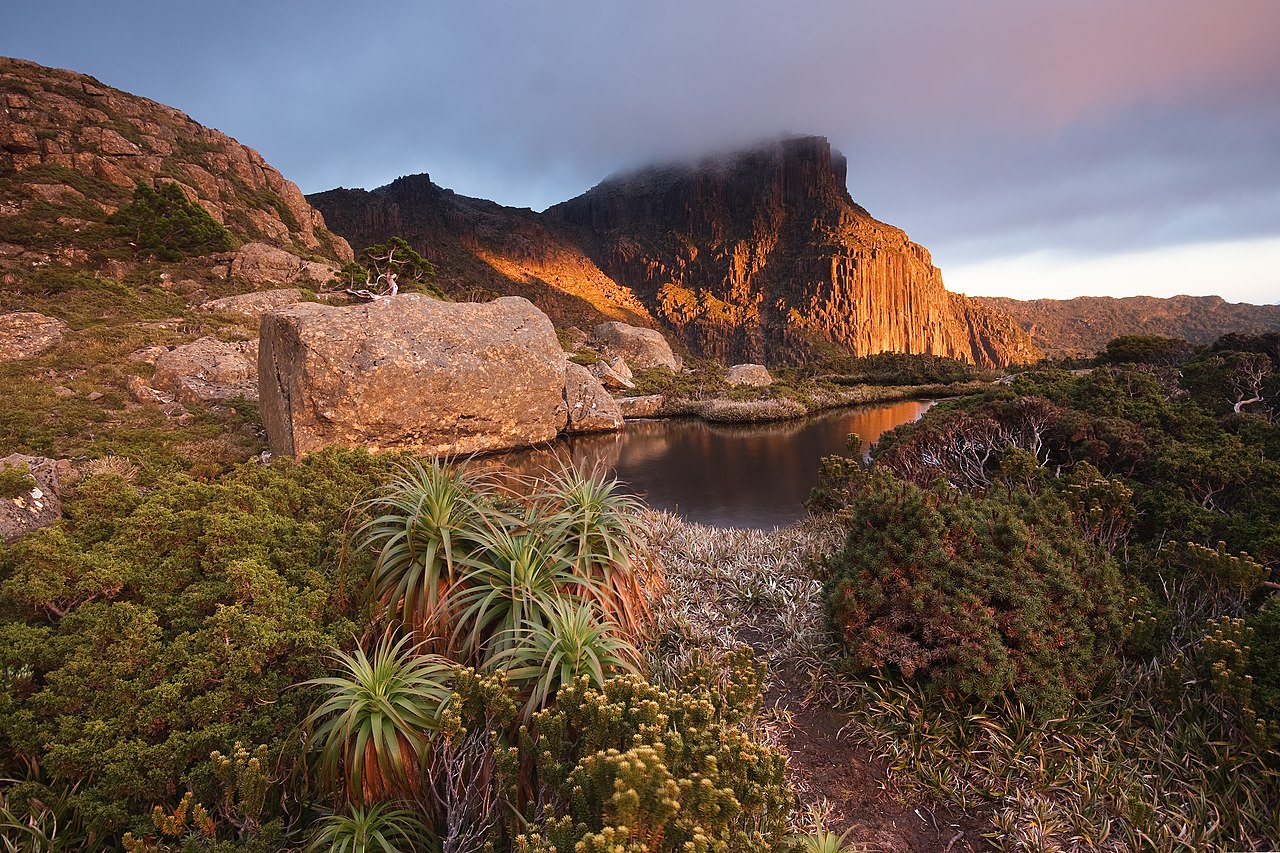
- Region
- Tasmania, Australia
- Best season
- Spring, Summer
- Permits
- A valid parks pass is required to enter So…
- Managed by
- Tasmania Parks and Wildlife Service
Plan with verified data
Southwest National Park trip tools
Tools for a trip here
Picked for how, when and where you're going. Free, no signup.
Photos of Southwest National Park
How to get there
The park’s only road leads to Strathgordon. The southern and western reaches have no vehicle access and are reached on foot, by boat or by light aircraft. Melaleuca, in the far southwest, has an airstrip and very basic facilities. Choose the access method around the part of the park being visited.
- Strathgordon
Hydroelectricity township reached by the park’s only road; the principal named option for a vehicle-based approach.
- Melaleuca
Small locality in the far southwest with an airstrip and very basic facilities, mainly managed by the Parks and Wildlife Service.
Sources: parks.tas.gov.au · Wikipedia · Wikivoyage. Confirm road and trailhead conditions with the managing agency before you leave.
Tasmania, Australia · Season: Best: January - February
- Climbing
- Mountaineering
- Birdwatching
- Hiking
- Canoeing
- Fishing
The country
The Western Arthurs are a jagged quartzite mountain range sculpted by ancient glaciation in deep southwest Tasmania. Reaching them requires crossing massive buttongrass plains (the infamous 'Arthur Plains') that are little more than horizontal swamps. Once in the range, the terrain abruptly shifts to wildly exposed ridges and hanging glacial tarns.
Why enthusiasts come
This traverse is a rite of passage for elite Australian bushwalkers. It offers virtually no standard hiking; progressing involves hauling packs up near-vertical gullies and lowering off cliffs. The isolation is near-absolute, dropping hikers into an environment battered by unceasing Roaring Forties storm systems off the Southern Ocean.
Top experiences
The descent into Lake Oberon is a stunning reveal of a pitch-black lake rimmed by enormous walls of white quartzite. Negotiating the Beggary Bumps is a terrifying mixture of vertical mud-climbing and hauling oneself upward using only tree roots. Standing atop Mount Sirius provides a bird's-eye view of the chain of 30 glacial lakes.
Planner-relevant notes
The Western Arthurs Traverse takes 5 to 7 days, but you must carry 2 extra days of food due to high probability of being pinned in your tent by storms. A National Park Pass is required, and walkers must sign the logbook at Scotts Peak. Pack hauling on a rope is mandatory through several steep rock chimneys; bring a 15m length of cord.
Field notes
- The 'mud' on the access plains can easily swallow a hiker to the waist; use trekking poles to probe depth.
- Tents must have a slim profile and substantial storm viability; campsites are tiny, exposed wooden platforms or rocky ledges.
- Do not hike this route in high winds or snow; the quartzite rock turns slick, and the ridges are narrow.
- Water is plentiful at the lakes, but it is deeply stained brown by tannins; it is safe to drink but visually alarming.
Where on earth
Satellite imagery flying in from a world view to Southwest National Park, Tasmania, Australia. Use the + / − buttons, or click the map to zoom with your scroll wheel; drag to pan and pinch to zoom on touch.
Coordinates
- Decimal degrees
- -43.1550, 146.2230
- Latitude (DMS)
- 43° 9′ 18.0″ S
- Longitude (DMS)
- 146° 13′ 22.8″ E
Coordinates are an access-point reference for Southwest National Park, not a route. Carry a paper map and confirm trailhead or put-in access with the managing agency before you go.
Topic summary
Notoriously extreme weather and continuous precipitous scrambling define Australia's most formidable alpine traverse.
Key takeaways
- Region: Tasmania, Australia
- Best season: Best: January - February
- Coordinates: -43.155, 146.223
Climate suitability
Best: January - February
Keep planning
Popular pursuits at Southwest National Park
- Climbing
Rock and alpine lines with approach beta.
- Mountaineering
Glacier and high-route objectives with real consequence.
- Birdwatching
Migration windows and the habitat that concentrates birds.
- Hiking
Day miles on marked trail, with route notes and trail links below.
- Canoeing
Paddle routes, portages, and put-ins.
- Fishing
Resident gamefish, seasons, and the water that holds them.
Animals around Southwest National Park


A vast southwest wilderness
Southwest National Park covers 6,183 square kilometres in southwestern Tasmania, making it the state’s largest national park. It forms part of the Tasmanian Wilderness World Heritage Area, with Franklin-Gordon Wild Rivers National Park to the north and Hartz Mountains National Park to the east. Rugged country and glacial lakes define the landscape, but remoteness is the main consideration when planning a visit. This is not a park linked together by a network of visitor roads. Its southern and western reaches lie far from vehicle access, and reaching them requires travel on foot, by boat or by light aircraft. Choose the part of the park to visit before arranging transport: a road-based trip and a journey into the remote southwest involve very different preparations.
Access shapes the trip
The road to the hydroelectricity township of Strathgordon is the park’s only road, making it the key option for a vehicle-based approach. In the far southwest, Melaleuca provides an airstrip and very basic facilities, mainly managed by the Parks and Wildlife Service. Treat those facilities as a limited foothold in remote country, rather than as a substitute for carrying what the trip requires. Elsewhere in the southern and western reaches, access is by foot, boat or light aircraft rather than by car. Transport choices therefore need to come before a detailed itinerary. A valid parks pass is required for entry to Tasmania’s national parks, including Southwest National Park. Arrange the appropriate pass and confirm current access conditions with Tasmania Parks and Wildlife Service before departure.
Weather, self-reliance and a long human history
Unpredictable severe weather is a defining feature of Southwest National Park. Plan clothing, shelter and spare supplies around that exposure, not simply around conditions at the start of the journey. Remote travel also calls for a realistic turnaround plan and enough flexibility to change course when weather makes the original plan unsuitable. The park has had little permanent habitation, but its human history extends much further back: evidence records Aboriginal Tasmanian visits over at least 25,000 years. European settlers made occasional journeys into the area from the nineteenth century. That history sits alongside a landscape with relatively little human modification. Keep the scale of the country and the limited access in mind throughout planning; reaching a remote location is only part of the trip, and getting back needs equal attention.
Route options
- Road approach to Strathgordon
Use the road to Strathgordon for a vehicle-based visit. This approach does not provide vehicle access to the park’s remote southern and western reaches.
- Light-aircraft approach to Melaleuca
Reach the far southwest by light aircraft using Melaleuca’s airstrip. Plan around very basic facilities and the park’s unpredictable severe weather.
Sample itineraries
- Strathgordon road-access introduction · 1 day
Plan a road-based introduction using the park's only road, to Strathgordon. Keep the day focused on the road-accessible area rather than attempting to reach the remote southern or western interior. Carry supplies and adjust plans to the weather.
- Melaleuca fly-in visit · 1 day
Consider a day visit to Melaleuca by light aircraft, subject to confirmed transport and suitable weather. The airstrip provides access to the remote southwest, but facilities are very basic. Arrange return transport before departure and carry supplies for an unexpected delay.
Seasonal conditions
Spring
Throughout spring
Plan around unpredictable severe weather rather than assuming mild conditions. Keep remote travel plans flexible and carry waterproof clothing and warm layers.
Summer
Throughout summer
Summer should not be treated as a guarantee of settled weather. The park's remoteness and severe weather require preparation even for short visits.
Fall
Throughout autumn
Use current forecasts to guide plans. Remote southern and western areas lack vehicular access, so allow flexibility for weather affecting travel on foot, by boat or by light aircraft.
Winter
Throughout winter
Take a conservative approach to this rugged, remote landscape. Prepare for severe weather and do not rely on Melaleuca's very basic facilities to meet all shelter or supply needs.
| Season | Window | Conditions |
|---|---|---|
| Spring | Throughout spring | Plan around unpredictable severe weather rather than assuming mild conditions. Keep remote travel plans flexible and carry waterproof clothing and warm layers. |
| Summer | Throughout summer | Summer should not be treated as a guarantee of settled weather. The park's remoteness and severe weather require preparation even for short visits. |
| Fall | Throughout autumn | Use current forecasts to guide plans. Remote southern and western areas lack vehicular access, so allow flexibility for weather affecting travel on foot, by boat or by light aircraft. |
| Winter | Throughout winter | Take a conservative approach to this rugged, remote landscape. Prepare for severe weather and do not rely on Melaleuca's very basic facilities to meet all shelter or supply needs. |
Permits, fees & closures
A valid parks pass is required to enter Southwest National Park. Passes can be purchased through Tasmania Parks and Wildlife Service.
Fees: Daily pass, up to 24 hours: $49.15 per vehicle with up to eight people, or $24.55 per person arriving by bus, cycle or on foot. Holiday pass, up to two months: $98.35 per vehicle or $49.20 per person. Children under five are free. Fees are reviewed annually.
Reservations: Confirm any trip-specific booking or overnight walker registration requirements with Tasmania Parks and Wildlife Service before departure.
Official source: Park passes and entry fees | Parks & Wildlife Service Tasmania · Verified October 2, 2026
Hazards & regulations
- Unpredictable severe weather can disrupt plans. Carry protection from rain and cold, and be prepared to turn back.
- The southern and western reaches have no vehicular access. Do not plan on a roadside exit from these areas.
- Melaleuca has only very basic facilities. Arrive self-sufficient rather than expecting extensive services or supplies.
- Rugged wilderness and remoteness make conservative route choices important. Match any walking plan to navigation skills and available supplies.
What to pack for Southwest National Park
- Waterproof jacket and trousers
- Warm insulating layers
- Weatherproof bags for spare clothing
- Navigation tools appropriate to the planned route
- Emergency communication device
- First-aid kit
- Emergency shelter
- Food for the planned visit and unexpected delays
- Drinking water
- Water treatment equipment for remote travel
Southwest National Park FAQ
- Where is Southwest National Park?
- It occupies southwestern Tasmania and forms part of the Tasmanian Wilderness World Heritage Area. At 6,183 square kilometres, it is Tasmania's largest national park.
- Can the whole park be explored by car?
- No. The only road within the area leads to Strathgordon. The southern and western reaches are far from vehicular access and are reached on foot, by boat or by light aircraft.
- What facilities are available at Melaleuca?
- Melaleuca has an airstrip and very basic facilities, mainly managed by Tasmania Parks and Wildlife Service. Plan to be self-sufficient and confirm transport arrangements before travelling.
- What is the landscape like?
- The park contains rugged wilderness and glacial lakes, with very little permanent habitation. Its scale, limited access and unpredictable severe weather are central considerations when planning a visit.
- Can the Southern Lights be seen here?
- The park is known as a place to see the Southern Lights. Sightings are not guaranteed; keep any viewing plan flexible and prepare for the park's unpredictable weather.
- What is known about the park's human history?
- Evidence indicates Aboriginal Tasmanians have visited the area for at least 25,000 years. European settlers made occasional visits from the nineteenth century, but permanent habitation has remained very limited.