



Reader rating
Rate it and you move it. Community ratings re-rank this product inside its Top 10 list.
Expert-picked, reader-ranked. Our editors choose the products and the launch order; member star ratings move picks up or down over time.
Accessed from the remote Little Indian Sioux North entry, this loop delivers a true wilderness experience with minimal portage difficulty for the reward. You'll paddle through a series of lakes and river sections, eventually reaching the stunning Gillis Lake. The initial portages are straightforward. The area is known for its excellent fishing and high chances of spotting moose and other wildlife due to its remoteness. Campsites are generally well-spaced and offer a genuine backcountry feel. Nearest town is Orr or Ely, but it's a longer drive to this entry point. This route is best for those seeking solitude and willing to drive a bit further for it. It's a multi-day trip, typically 4-6 days. Bugs can be fierce in early summer, and the remoteness means you need to be self-sufficient. This is a highly rewarding route for those who want to feel truly away from it all.
Pros
- Exceptional solitude and wilderness feel
- High chances of moose and other wildlife sightings
- Excellent fishing opportunities
- Generally manageable portages for the reward
- Well-spaced, pristine backcountry campsites
Cons
- Longer drive to the remote entry point
- Potential for intense insect activity in early summer
- Requires strong self-sufficiency and preparedness
- Weather can change rapidly, necessitating caution
Best uses
- True wilderness immersion
- Disconnecting from daily life
- Serious fishing expeditions
- Wildlife viewing
Specifications
- Location
- BWCAW, Minnesota
- Entry Point
- 14 (Little Indian Sioux North)
- Typical Duration
- 4-6 days
- Primary Activity
- Flatwater Canoeing, Wilderness Camping
- Terrain
- Lakes, Rivers, Forested Portages
Best for
True wilderness immersion, Disconnecting from daily life, Serious fishing expeditions, Wildlife viewing
The Pine Lake to Gillis Lake Loop, accessed via Entry Point 14 (Little Indian Sioux North), stands out as a genuine wilderness immersion in the Boundary Waters Canoe Area Wilderness. This multi-day route traverses a network of lakes and river sections, rewarding paddlers with a profound sense of solitude. The initial portages, while present, are generally manageable, making the entry relatively smooth for what you get in return. It’s a route that demands self-sufficiency and a willingness to commit to a longer drive, but for those seeking to truly disconnect, the payoff is substantial. Characterized by its pristine waters and diverse landscapes, the loop eventually leads to the iconic Gillis Lake, a jewel within the BWCAW. The journey is not just about reaching a destination but experiencing the gradual unfolding of an untouched environment. Expect ample opportunities for quiet observation, excellent fishing, and a strong possibility of wildlife encounters, particularly moose, due to the area's relative remoteness compared to more heavily trafficked entry points. Campsites are often well-dispersed, reinforcing the backcountry feel and ensuring a quiet night under the stars. This isn't a route for a quick weekend paddle; it's an investment in a deeper wilderness experience, typically requiring four to six days to fully appreciate.
Geography & Terrain
This loop navigates through classic Boundary Waters geography, characterized by glacial lakes interconnected by narrow rivers and portages through dense boreal forest. The landscape is a mosaic of granite outcroppings, towering pines, birch, and aspen. Water levels can vary, affecting river sections and the ease of some portages. Expect generally calm waters on the larger lakes, though wind can always be a factor. The topography around the lakes is typically rolling, providing varied views from campsites and portage trails. The wilderness here is truly untamed, offering an authentic experience of Minnesota's north woods.
Best Season & Weather
The ideal window for this loop is late spring (late May/early June) or early fall (September). Late spring offers lush greenery and longer daylight hours, though insect activity can be significant, especially after rain. Early fall brings vibrant foliage, fewer insects, and cooler, crisp air, often with stable weather. Summer (July/August) can be pleasant but is also the warmest and can see more thunderstorms. Water temperatures are typically comfortable for swimming by mid-summer. Always check the forecast leading up to your trip; weather in the BWCAW can change rapidly, necessitating preparedness for rain, wind, and temperature shifts.
Wildlife Encounters
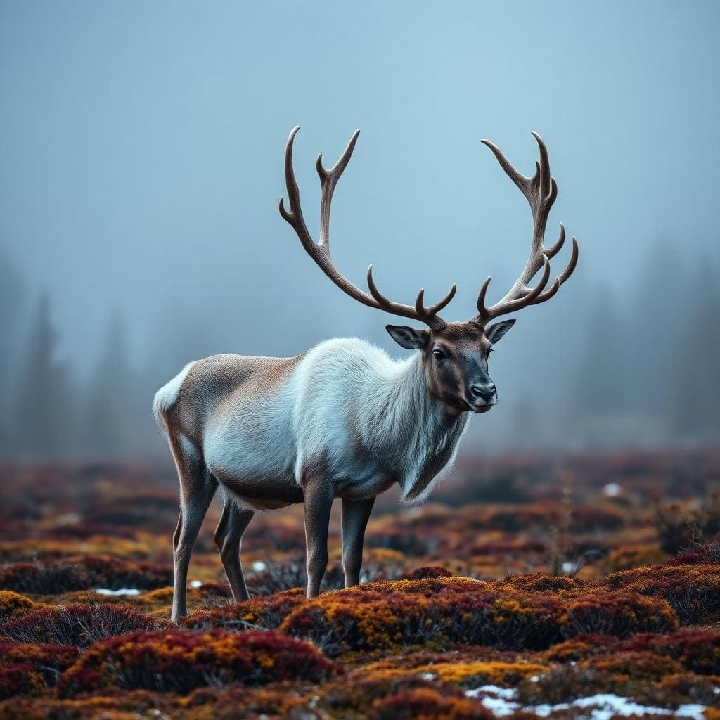
The remoteness of this route significantly increases chances for diverse wildlife sightings. Moose are frequently observed in marshy areas and along lake shores, especially during dawn and dusk. Black bears are present throughout the BWCAW; proper food storage is paramount. You're also likely to spot deer, beaver, otter, and various small mammals. Birdlife is abundant, with loons providing their iconic calls, along with eagles, ospreys, and numerous songbirds. Keeping a respectful distance and observing silently will maximize your opportunities for these memorable encounters.
Key Routes & Attractions
The loop begins on the Little Indian Sioux River, transitioning through a series of smaller lakes before reaching the larger, more expansive bodies of water culminating in Gillis Lake. The journey itself is the primary attraction, with each paddle stroke revealing new vistas. Excellent fishing for walleye, northern pike, and smallmouth bass is a consistent draw. Specific points of interest are often unmarked or known only by local tradition; the joy is in discovery. Solitude, pristine campsites, and the challenge of navigating the wilderness are the core attractions of this route. Explore side bays and smaller connecting lakes for a deeper dive into the area.
Permits & Access
A quota-based permit is required for any overnight stay in the BWCAW, obtained through Recreation.gov. Entry Point 14 (Little Indian Sioux North) requires specific reservations, especially during peak season. Day use does not require a permit. Additionally, a Minnesota state fishing license is necessary if you plan to fish. Access to Entry Point 14 involves a longer drive on unpaved roads after leaving paved routes from towns like Orr or Ely. This remoteness contributes to the area’s low visitor numbers, enhancing the wilderness experience. Plan your logistics carefully, including shuttle services if needed, as cellular service is non-existent beyond the immediate access points.
Honest Trade-offs
While offering exceptional solitude, this route's remoteness means a longer drive to the entry point, adding travel time and logistics. The relative lack of crowds means fewer maintained portage trails in some spots compared to more popular routes, potentially requiring more effort. Bugs, particularly mosquitoes and black flies, can be intense from late spring through mid-summer; bug spray and head nets are not optional. You must be entirely self-sufficient, capable of handling minor repairs, navigation challenges, and any medical situations, as help is hours away. The reward is profound, but it comes with a legitimate commitment to wilderness preparedness and a tolerance for natural discomforts.
How we picked
We built this ranking from trip reports, agency data, permit records, and our editors' own time on the ground. 10 places made the final cut out of a much longer working list, and each one had to clear the same set of criteria before it earned a spot.
- Quality of the terrain
- Landscape, route variety, and whether the place rewards multiple days rather than one overlook.
- Season and weather windows
- How long the reliable window is, and how badly the shoulder seasons punish a bad forecast.
- Access and permits
- Trailhead logistics, permit odds, quotas, and how much lead time a trip realistically takes.
- Solitude vs. crowding
- How far you have to walk before the place feels like wilderness instead of a queue.
- Wildlife and ecology
- What you can reasonably expect to see, and what you have to plan around.
- Risk and skill required
- Navigation, water crossings, exposure, and rescue distance — stated plainly.
Pine Lake to Gillis Lake Loop (Entry Point 14, Little Indian Sioux North) — frequently asked questions
- Is Pine Lake to Gillis Lake Loop (Entry Point 14, Little Indian Sioux North) worth the trip?
- We rank it #8 in BWCA Flatwater Canoe Routes. Accessed from the remote Little Indian Sioux North entry, this loop delivers a true wilderness experience with minimal portage difficulty for the reward. You'll paddle through a series of lakes and river sections, eventually reaching the stunning Gillis Lake.
- Who is Pine Lake to Gillis Lake Loop (Entry Point 14, Little Indian Sioux North) best for?
- Best for true wilderness immersion, disconnecting from daily life, serious fishing expeditions and wildlife viewing. Standouts: exceptional solitude and wilderness feel and high chances of moose and other wildlife sightings.
- What are the drawbacks of Pine Lake to Gillis Lake Loop (Entry Point 14, Little Indian Sioux North)?
- Longer drive to the remote entry point, Potential for intense insect activity in early summer and Requires strong self-sufficiency and preparedness.
- What are the key details for Pine Lake to Gillis Lake Loop (Entry Point 14, Little Indian Sioux North)?
- Location: BWCAW, Minnesota · Entry Point: 14 (Little Indian Sioux North) · Typical Duration: 4-6 days · Primary Activity: Flatwater Canoeing, Wilderness Camping · Terrain: Lakes, Rivers, Forested Portages
- Geography & Terrain — what should I know about the Pine Lake to Gillis Lake Loop (Entry Point 14, Little Indian Sioux North)?
- This loop navigates through classic Boundary Waters geography, characterized by glacial lakes interconnected by narrow rivers and portages through dense boreal forest. The landscape is a mosaic of granite outcroppings, towering pines, birch, and aspen.
- Best Season & Weather — what should I know about the Pine Lake to Gillis Lake Loop (Entry Point 14, Little Indian Sioux North)?
- The ideal window for this loop is late spring (late May/early June) or early fall (September). Late spring offers lush greenery and longer daylight hours, though insect activity can be significant, especially after rain.
Where on earth
Satellite imagery flying in from a world view to Pine Lake to Gillis Lake Loop (Entry Point 14, Little Indian Sioux North), Alberta, Canada. Use the + / − buttons, or click the map to zoom with your scroll wheel; drag to pan and pinch to zoom on touch.
Pine Lake, AB T0M 1R0, Canada · 52.110, -113.481
Wildlife found around Pine Lake to Gillis Lake Loop (Entry Point 14, Little Indian Sioux North)







Compare side by side
Put the Pine Lake to Gillis Lake Loop (Entry Point 14, Little Indian Sioux North) against any other pick on this list — specs, price, pros, cons and reader ratings.