



- Region
- Mexico
- Best season
- Spring, Summer
- Permits
- Confirm permit requirements, access rules …
Plan with verified data
Baja California Sur trip tools
Tools for a trip here
Picked for how, when and where you're going. Free, no signup.
Photos of Baja California Sur
How to get there
Baja California Sur is in Mexico. Its center point is 24.1400, -110.3100. Use these links for live turn-by-turn directions from where you are, then confirm road, trailhead and access conditions with the managing agency before you leave.
- La Paz
The state capital and largest city; a city-level starting point for planning, rather than a specified trailhead or coastal launch.
- Cabo San Lucas
A tourist resort destination in Baja California Sur. Confirm the specific outdoor access point separately from the city base.
- San José del Cabo
A separate tourist resort destination from Cabo San Lucas; specify the intended city when arranging the trip.
Mexico · Season: Best: Nov – Apr (whale season Jan–Mar)
- Canoeing
- Kayaking
- Desert Hiking
- Canyoneering
- Snorkeling
- Diving
- Wildlife Viewing
The country
A 1,600 km desert peninsula with the Pacific on one side and the Sea of Cortez on the other. Sonoran cardón cactus above, whale-shark and gray-whale nursery below.
Why enthusiasts come
Sea kayak the islands off La Paz. Snorkel with whale sharks Oct–Apr. Gray whale nurseries at Bahía Magdalena Jan–Mar are a global bucket-list wildlife experience.
Planner-relevant notes
Kayak permits for national park islands via CONANP. Water on desert traverses must be cached — no springs in most drainages.
Field notes
- Afternoon 'Coromuel' winds on the Sea of Cortez pick up fast — cross at dawn.
- Whale-shark tours are regulated — go with certified operators.
- Bring reef-safe sunscreen; enforcement in marine protected areas is real.
Where on earth
Satellite imagery flying in from a world view to Baja California Sur, Mexico. Use the + / − buttons, or click the map to zoom with your scroll wheel; drag to pan and pinch to zoom on touch.
Coordinates
- Decimal degrees
- 24.1400, -110.3100
- Latitude (DMS)
- 24° 8′ 24.0″ N
- Longitude (DMS)
- 110° 18′ 36.0″ W
Coordinates are an access-point reference for Baja California Sur, not a route. Carry a paper map and confirm trailhead or put-in access with the managing agency before you go.
Topic summary
Desert peninsula between two seas — sea kayaking, whale sharks, and empty Pacific beaches.
Key takeaways
- Region: Mexico
- Best season: Best: Nov – Apr (whale season Jan–Mar)
- Coordinates: 24.140, -110.310
Climate suitability
Best: Nov – Apr (whale season Jan–Mar)
Keep planning
Popular pursuits at Baja California Sur
- Canoeing
Paddle routes, portages, and put-ins.
- Kayaking
Sheltered and open-water paddling lines.
- Desert Hiking
Water carries and heat management drive the plan.
- Canyoneering
Narrows, downclimbs, and flash-flood timing.
- Snorkeling
Clear-water days and shore entries.
- Diving
Charter access and seasonal visibility.
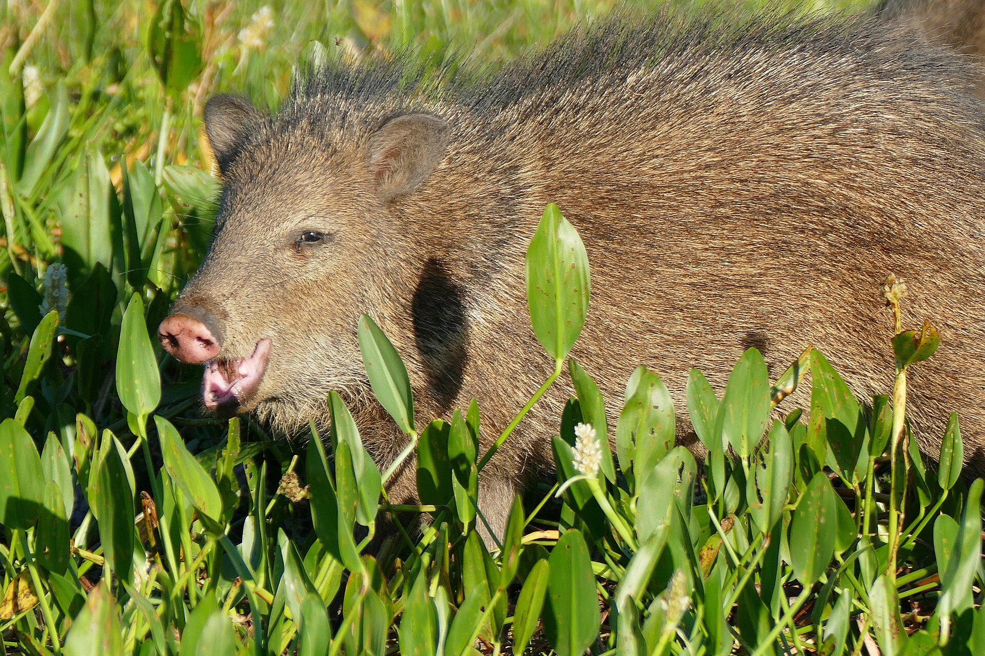
Animals around Baja California Sur



A state between two bodies of water
Baja California Sur occupies the southern half of Mexico’s Baja California Peninsula, with the Pacific Ocean to the west and the Gulf of California to the east. Its northern boundary meets the state of Baja California south of the 28th parallel. That geography is the starting point for planning: the Pacific side and the Gulf side are distinct parts of a large destination, not interchangeable descriptions of one stretch of coast. The state covers 73,909 square kilometres and is Mexico’s least densely populated state. Keep the scope of a trip realistic rather than treating the whole southern peninsula as a single stop. Choose a coastal focus and a city base before working out individual outings and transport.
La Paz and the two Cabo cities
La Paz is the state capital and its largest city. Cabo San Lucas and San José del Cabo are its named tourist resort destinations. These three cities offer concrete starting points for narrowing a state-wide trip, but their names alone do not establish access to any particular beach, trail, launch site or protected area. For an outdoor itinerary, distinguish the city where the trip is based from the actual place where an activity begins. Confirm that connection before committing to a day’s plan. The same care applies to choosing between Cabo San Lucas and San José del Cabo: they are separate destinations, so specify which one is intended when arranging accommodation, transport or meeting details.
Keep the outdoor plan geographically focused
The strongest organizing feature here is the peninsula itself: ocean on the west, gulf on the east, and a land boundary with Baja California to the north. Across the Gulf of California lie Sonora and Sinaloa, with which the state shares maritime borders; those borders should not be read as transport connections. The state also includes the uninhabited Rocas Alijos in the Pacific Ocean, separate from the mainland peninsula. For practical trip planning, concentrate on a defined part of the peninsula rather than assuming every place within the state belongs in one itinerary. Coastal outings call for checking local weather and water conditions, carrying suitable supplies, and matching the day’s activity to the actual access point and conditions.
Route options
- Pacific coast focus
Use the state’s western, Pacific-facing side as a broad itinerary focus. This is a geographic planning option, not a defined driving, walking or paddling route.
- Gulf of California coast focus
Concentrate planning on the state’s eastern, Gulf-facing side. Select and confirm individual access points before turning this geographic focus into an outdoor route.
Sample itineraries
- La Paz base · 2 days
Base in La Paz, Baja California Sur’s capital and largest city. Spend one day exploring the city and leave the second flexible for a coastal outing selected after checking local access and weather.
- Cabo San Lucas and San José del Cabo · 3 days
Divide the first two days between Cabo San Lucas and San José del Cabo. Keep the third day open for additional time in either resort town or a locally confirmed coastal activity. Check transport arrangements before committing to the sequence.
Seasonal conditions
Spring
Check conditions for the intended travel dates
Plan coastal activities around local forecasts rather than a statewide seasonal assumption. Baja California Sur borders both the Pacific Ocean and the Gulf of California; check the conditions at the specific destination.
Summer
Check conditions for the intended travel dates
For outdoor days, check temperatures and marine weather before departure. Carry drinking water and sun protection, and adjust the length of outings to actual conditions.
Fall
Check conditions for the intended travel dates
Keep coastal plans flexible until local weather and access are confirmed. Do not assume an outing on the Pacific side will have the same conditions as one on the Gulf of California.
Winter
Check conditions for the intended travel dates
Check air temperature, wind and water conditions separately when planning coastal time. Pack layers and confirm whether the chosen activity is suitable that day.
| Season | Window | Conditions |
|---|---|---|
| Spring | Check conditions for the intended travel dates | Plan coastal activities around local forecasts rather than a statewide seasonal assumption. Baja California Sur borders both the Pacific Ocean and the Gulf of California; check the conditions at the specific destination. |
| Summer | Check conditions for the intended travel dates | For outdoor days, check temperatures and marine weather before departure. Carry drinking water and sun protection, and adjust the length of outings to actual conditions. |
| Fall | Check conditions for the intended travel dates | Keep coastal plans flexible until local weather and access are confirmed. Do not assume an outing on the Pacific side will have the same conditions as one on the Gulf of California. |
| Winter | Check conditions for the intended travel dates | Check air temperature, wind and water conditions separately when planning coastal time. Pack layers and confirm whether the chosen activity is suitable that day. |
Permits, fees & closures
Confirm permit requirements, access rules and any booking requirements with the managing agency for each planned outdoor site.
Confirm current permits, fees, and closures with the managing agency before you go.
Hazards & regulations
- Coastal water conditions: check local guidance before entering the Pacific Ocean or Gulf of California; shoreline access alone does not establish that swimming is safe.
- Weather exposure: check the local forecast before coastal outings and carry layers appropriate to the conditions.
- Sun exposure and inadequate drinking water: carry sun protection and enough water for the planned outing rather than assuming supplies will be available.
What to pack for Baja California Sur
- Drinking water
- Sun protection
- Comfortable walking footwear
- Small first-aid kit
- Wind-resistant layer
- Layers matched to the forecast
- Water-resistant protection for phone and essentials
- Maps for the chosen destination
- Confirmed transport details
- Local access and activity information
Baja California Sur FAQ
- Where is Baja California Sur?
- It occupies the southern half of Mexico’s Baja California Peninsula, south of the 28th parallel. Baja California borders it to the north, the Pacific Ocean lies to the west, and the Gulf of California lies to the east.
- Is Baja California Sur the same state as Baja California?
- No. Baja California Sur and Baja California are separate Mexican states. Baja California Sur occupies the southern part of the peninsula.
- Which cities can anchor a visit?
- La Paz is the state capital and largest city. Cabo San Lucas and San José del Cabo are resort towns. Choose a base around the specific activities and transport arrangements confirmed for the trip.
- Can one coastal forecast cover the whole trip?
- Do not rely on a single forecast for both coasts. Check the specific location and activity, especially before swimming or going onto the water.
- How should outdoor access be checked?
- Identify the exact site before travel, then confirm access and any permit or booking requirements with its managing agency. A general destination plan is not confirmation that a particular outdoor site is accessible.