



- Region
- Chiapas, Mexico
- Best season
- Spring, Summer
- Permits
- Confirm current entry requirements and any…
- Managed by
- National Commission of Protected Natural Areas (CONANP)
Plan with verified data
Cañón del Sumidero National Park trip tools
Tools for a trip here
Picked for how, when and where you're going. Free, no signup.
Photos of Cañón del Sumidero National Park
How to get there
The canyon lies just north of Chiapa de Corzo in Chiapas, southern Mexico, and the park borders Tuxtla Gutiérrez. For a boat visit, head to Chiapa de Corzo and confirm the precise river boarding location with the operator before setting out.
- Chiapa de Corzo
The departure town for boats taking visitors onto the Grijalva River to see the canyon. Confirm the exact boarding location and itinerary with the operator.
- Tuxtla Gutiérrez
The city borders the national park and provides a geographic approach to the area, rather than a specified river boarding point. For the boat-based canyon visit, plan around departures from Chiapa de Corzo.
Sources: Wikipedia · Wikivoyage. Confirm road and trailhead conditions with the managing agency before you leave.
Chiapas, Mexico · Season: Best: November - February
- Canoeing
- Kayaking
- Climbing
- Winter Camping
- Skiing
- Desert Hiking
- Canyoneering
- Birdwatching
The country
The canyon was violently formed by tectonic faulting and the erosive power of the Grijalva River, resulting in staggering vertical limestone cliffs over 1,000 meters high. The canyon walls host unique microclimates from arid top rims to weeping cloud forests clinging to the mid-levels. Crocodiles, spider monkeys, and countless tropical bird species populate the dense jungle banks of the river.
Why enthusiasts come
Paddlers who reject motorized tours bring kayaks to explore deep, hidden alcoves and massive waterfalls inaccessible to larger craft. Rock climbers are pioneering massive, highly committing multi-pitch traditional routes on the sheer, vertical jungle walls.
Top experiences
Paddling beneath the 'Christmas Tree' waterfall—a massive natural canopy of moss and cascading water—gives a true sense of the canyon's scale. Hiking the demanding rim trails near Tuxtla Gutiérrez provides dizzying, top-down perspectives over the winding chasm.
Planner-relevant notes
Navigating the river requires caution as the commercial speedboat traffic is heavy, fast, and creates significant wake. Pollution washing down the river from upstream cities can be severe after heavy rains, making the water unsafe for swimming. Climbing the walls requires prior clearance with park authorities due to loose rock and nesting bird protections.
Field notes
- Launch your kayak at absolute first light from Chiapa de Corzo to experience the canyon before the roar of tourist boats begins.
- Large American crocodiles sun themselves on the mud banks; maintain at least 15 meters of distance and do not dangle limbs over your boat.
- The intense humidity essentially eliminates chalk usefulness for climbers; expect slick holds and heavy sweat out on the walls.
- Drink strictly bottled water; under no circumstances should you ingest spray or splash from the main Grijalva channel.
Where on earth
Satellite imagery flying in from a world view to Cañón del Sumidero National Park, Chiapas, Mexico. Use the + / − buttons, or click the map to zoom with your scroll wheel; drag to pan and pinch to zoom on touch.
Coordinates
- Decimal degrees
- 16.8283, -93.0900
- Latitude (DMS)
- 16° 49′ 41.9″ N
- Longitude (DMS)
- 93° 5′ 24.0″ W
Coordinates are an access-point reference for Cañón del Sumidero National Park, not a route. Carry a paper map and confirm trailhead or put-in access with the managing agency before you go.
Topic summary
Vertical limestone walls rise thousands of feet above the Grijalva River, offering intense jungle kayaking, climbing, and incredible biodiversity.
Key takeaways
- Region: Chiapas, Mexico
- Best season: Best: November - February
- Coordinates: 16.828, -93.090
Climate suitability
Best: November - February
Keep planning
Popular pursuits at Cañón del Sumidero National Park
- Canoeing
Paddle routes, portages, and put-ins.
- Kayaking
Sheltered and open-water paddling lines.
- Climbing
Rock and alpine lines with approach beta.
- Desert Hiking
Water carries and heat management drive the plan.
- Canyoneering
Narrows, downclimbs, and flash-flood timing.
- Birdwatching
Migration windows and the habitat that concentrates birds.
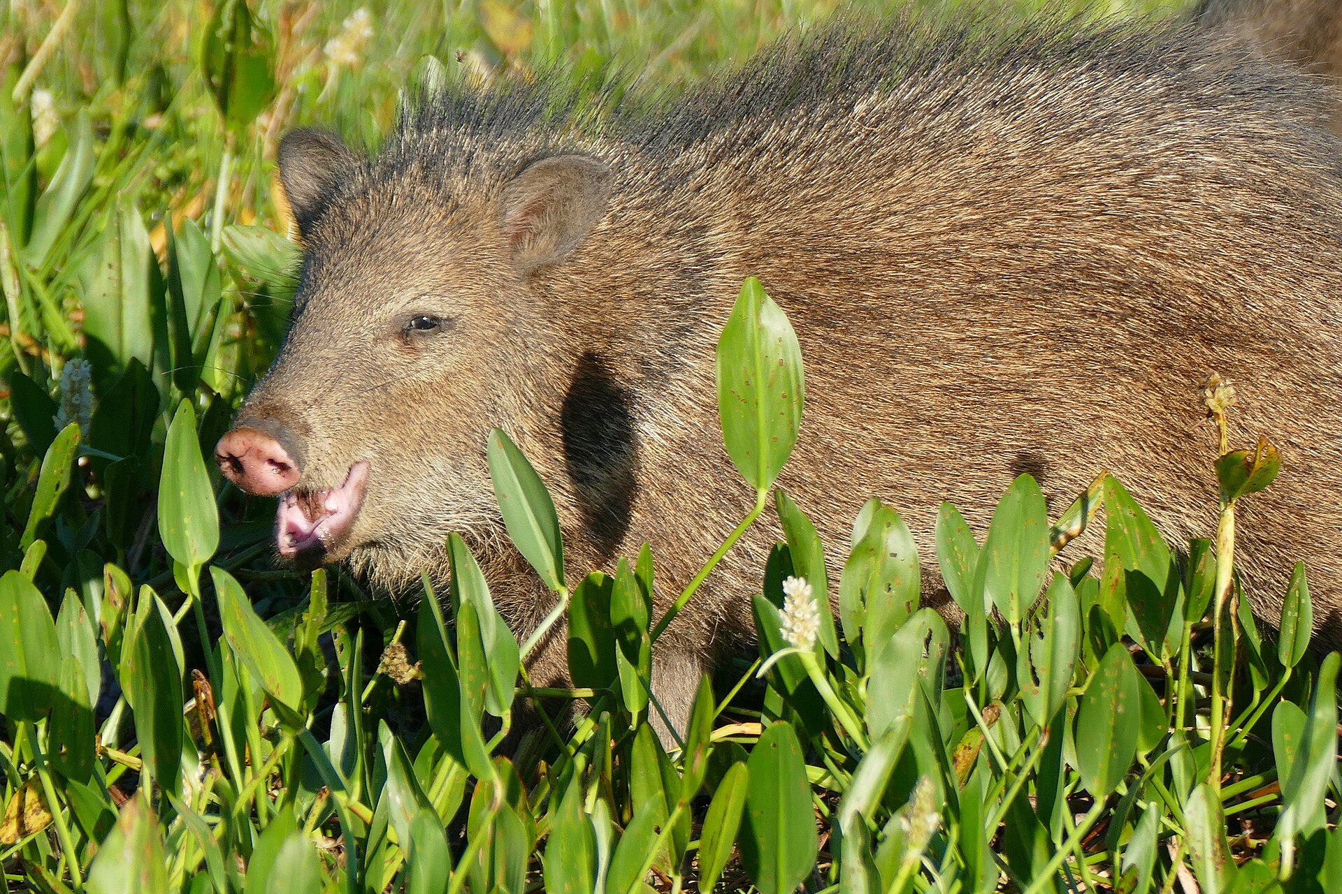
Animals around Cañón del Sumidero National Park



A river canyon beside Chiapas’s cities
Cañón del Sumidero National Park protects a deep cut through the landscape just north of Chiapa de Corzo in Chiapas, southern Mexico. The Grijalva River runs between vertical walls that reach as high as 1,000 metres, turning sharply through a narrow canyon passage 13 kilometres long. Those dimensions describe the canyon itself, not a guaranteed boat-trip distance. Fracturing of the earth’s crust and subsequent river erosion shaped the gorge, and the river remains the defining feature of a visit. The surrounding federally protected park covers 21,789 hectares across four municipalities and borders Tuxtla Gutiérrez. This is therefore not an isolated wilderness destination: a substantial protected landscape sits directly beside urban areas. Plan around the river and the scale of the walls rather than assuming that national park status means an extensive network of visitor trails.
Seeing the canyon from the Grijalva
Boat trips departing from Chiapa de Corzo are the main visitor experience described for the canyon. From river level, the steep walls and abrupt bends give the landscape its shape: the river changes direction by as much as 90 degrees within the narrow passage. At the canyon’s northern end, Chicoasén Dam and its artificial reservoir connect the gorge to a wider system of water storage and hydroelectric generation on the Grijalva. Do not assume that every boat outing reaches the dam or follows an identical itinerary; confirm the actual turnaround point and boarding location with the operator. For a river outing, carry drinking water and sun protection, keep essential belongings protected from splashes, and use a properly fitted life jacket. Choose the outing according to its confirmed itinerary rather than treating the canyon’s length as a published tour specification.
Forest protection and a pressured river
Most of the park’s vegetation is low- to medium-height deciduous rainforest, with smaller areas of mixed pine-oak forest and grassland. The protected area therefore includes more than the rock walls visible from a boat, and its conservation challenges extend beyond the canyon. Nearby urban growth has brought encroachment and settlement onto park land. Upstream urban areas and logging industries have also contributed to serious river pollution. The narrow gorge, converging water flows, and Chicoasén Dam encourage solid waste to accumulate, with as much as 5,000 tons removed from the Grijalva each year. Expect a landscape where major natural features coexist with visible human pressures, rather than assuming uniformly clean water. Keep rubbish secured during boat travel and carry it out. The park is administered by Mexico’s National Commission of Protected Natural Areas, known as CONANP.
Route options
- Chiapa de Corzo boat outing
A boat-based visit departing from Chiapa de Corzo to view the canyon from the Grijalva River. Confirm the trip’s extent and turnaround point; reaching Chicoasén Dam should not be assumed.
- Grijalva River narrow canyon passage13 kilometres of narrow canyon passage; not a confirmed tour distance.
The defining scenic stretch within the boat-visit corridor, with walls reaching 1,000 metres and river bends of up to 90 degrees. This is a geographic segment of the river outing, not a separate established trail or a guaranteed complete boat itinerary.
Sample itineraries
- Chiapa de Corzo canyon boat visit · 1 day
Start in Chiapa de Corzo, where sightseeing boats embark on the Grijalva River. See the canyon from water level, with vertical walls reaching 1,000 metres and sharp river bends through the narrow passage. Confirm the boat itinerary locally rather than assuming it covers the canyon's full 13-kilometre length.
- Two-day visit with a flexible boat day · 2 days
Use Chiapa de Corzo as the starting point. On the first day, confirm boat arrangements and current conditions; take the canyon trip on the second. Keep attention on the river-carved walls and surrounding deciduous rainforest. This is a relaxed alternative to a one-day visit, not a separate park route.
Seasonal conditions
Spring
Spring visits
Check local weather and boat operations before departure. The main visitor experience is on the river, so prepare for outdoor exposure and keep essential belongings protected from water.
Summer
Summer visits
Check the forecast rather than assuming a particular rainfall pattern. Carry drinking water and sun protection for a boat outing, and adjust plans to current river and weather conditions.
Fall
Fall visits
Confirm river conditions and boat availability locally. Much of the surrounding forest is deciduous, so vegetation appearance can vary; do not plan around a guaranteed foliage display.
Winter
Winter visits
Check departure-day temperatures and weather before dressing for the boat trip. Bring an adaptable layer for outdoor travel; a winter visit should not be treated as a guarantee of clear weather.
| Season | Window | Conditions |
|---|---|---|
| Spring | Spring visits | Check local weather and boat operations before departure. The main visitor experience is on the river, so prepare for outdoor exposure and keep essential belongings protected from water. |
| Summer | Summer visits | Check the forecast rather than assuming a particular rainfall pattern. Carry drinking water and sun protection for a boat outing, and adjust plans to current river and weather conditions. |
| Fall | Fall visits | Confirm river conditions and boat availability locally. Much of the surrounding forest is deciduous, so vegetation appearance can vary; do not plan around a guaranteed foliage display. |
| Winter | Winter visits | Check departure-day temperatures and weather before dressing for the boat trip. Bring an adaptable layer for outdoor travel; a winter visit should not be treated as a guarantee of clear weather. |
Permits, fees & closures
Confirm current entry requirements and any permit arrangements with CONANP, the park's managing agency.
Confirm current permits, fees, and closures with the managing agency before you go.
Hazards & regulations
- The Grijalva River has serious upstream pollution and accumulations of solid waste. Carry drinking water and avoid unnecessary contact with river water or debris.
- Boat travel requires water-safety precautions. Wear a properly fitted life jacket and follow the operator's instructions.
- Canyon walls rise as high as 1,000 metres. Do not treat steep canyon terrain as informal walking access.
- River outings involve outdoor exposure. Check the forecast and carry sun protection, water, and weather-appropriate clothing.
What to pack for Cañón del Sumidero National Park
- Properly fitted life jacket supplied or confirmed with the operator
- Water-resistant bag for phone and essentials
- Secure footwear
- Drinking water
- Sun hat and sunscreen
- Adaptable clothing layer
- Rain protection suited to the forecast
- Reusable water bottle
- Small bag for carrying out personal rubbish
Cañón del Sumidero National Park FAQ
- Where is Cañón del Sumidero National Park?
- The canyon lies just north of Chiapa de Corzo in Chiapas, southern Mexico. The surrounding national park borders Tuxtla Gutiérrez and protects 21,789 hectares across four municipalities.
- How do visitors usually see the canyon?
- Visitors commonly take boats departing from Chiapa de Corzo on the Grijalva River. Confirm the actual route and operating arrangements locally.
- How large is the canyon?
- The narrow passage extends for 13 kilometres, with vertical walls reaching 1,000 metres. The river makes turns of up to 90 degrees. These dimensions describe the canyon, not a guaranteed boat-trip distance.
- What landscapes surround the river?
- Most park vegetation is low- to medium-height deciduous rainforest, with smaller areas of mixed pine-oak forest and grassland. The Chicoasén Dam and its reservoir lie at the canyon's northern end.
- Why can rubbish collect in the canyon?
- Upstream urban areas and logging industries contribute pollution. The narrow canyon, converging water flows, and Chicoasén Dam encourage waste to accumulate. Carry out personal rubbish and avoid contact with floating debris.
- Who manages the national park?
- CONANP, Mexico's National Commission of Protected Natural Areas, administers the park. Confirm current visitor requirements directly with the agency before travel.