



- Region
- Texas
- Country
- United States
- Best for
- fly fishing, fishing
- Best season
- Spring, Summer
- Permits
- Confirm Contee Lake access requirements wi…
- Managed by
- Texas Parks and Wildlife Department is the regional paddling-trail contact. Matagorda Island Wildlife Management Area is cooperatively managed by Texas Parks and Wildlife Department and the U.S. Fish and Wildlife Service; confirm jurisdiction for Contee Lake directly.
Plan with verified data
Contee Lake, Port O'Connor trip tools
Tools for a trip here
Picked for how, when and where you're going. Free, no signup.
How to get there
In Port O’Connor, follow Highway 185/Adams Street east to S 2nd Street and turn right with the highway. Continue four blocks, then turn left on Commerce Street. The Little Jetties put-in is where Commerce Street and Washington Street meet the Gulf Intracoastal Waterway. These directions reach the regional paddling trail launch, not a confirmed Contee Lake access point.
- Little Jetties
Public-right-of-way launch where Washington Street ends at the Gulf Intracoastal Waterway, at 28.4448, -96.4022. A small parking lot is available; the closest public restroom is at Kingfisher Park on Park Street. The Pass Cavallo Trail heads east around the south jetty. Matagorda Island Trail marker 1 is 1.1 miles west at Fisherman’s Cut.
- The Fishing Center
Privately owned boat ramp and bait stand at 28.4386, -96.4140, with parking and a restroom in the store. Fishing supplies, snacks, drinks and ice are sold here. This is the closest listed access to marker 1 at Fisherman’s Cut; reaching it requires paddling across the Gulf Intracoastal Waterway.
- Froggies
Port O’Connor Paddling Trail access point at 28.4320, -96.4329. Confirm launch arrangements and available facilities before relying on this access.
Sources: tpwd.texas.gov · Wikipedia · Wikivoyage. Confirm road and trailhead conditions with the managing agency before you leave.
Texas · United States · Season: Spring through fall
- Canoeing
- Kayaking
- Fishing
- Winter Camping
- Skiing
- Sea Kayaking
- Beachcombing
- Wildlife Viewing
Overview
Contee Lake, a back lake system reachable from Port O'Connor, is a hidden gem for fly anglers seeking solitude and aggressive redfish. This area is part of a complex marsh network, offering superb wind protection and a nutrient-rich environment. The lake itself is relatively shallow, with a mix of soft mud and scattered shell, surrounded by thick marsh grass. Redfish here are often found in tight schools, aggressively feeding on bait pushed in by the tide. Access is by boat from Port O'Connor, navigating through a series of narrow cuts and channels. Due to its more remote nature, angler pressure is significantly lower than in more open bay systems. Ideal during fall and winter, when the water is clearer and fish are active. Anglers need good shallow-water boat handling skills and an appreciation for wilderness. The tight quarters and aggressive fish make for an exciting, close-quarters sight-casting experience.
Why it stands out
Excellent protection from strong winds
Often holds tight schools of aggressive redfish
Remote and less pressured than open bay areas
Ideal for kayak or shallow-draft skiff exploration
Pristine marsh environment with abundant wildlife
Know before you go
Challenging navigation through narrow cuts
Soft mud bottoms can be difficult to wade extensively
Mosquitoes and biting flies are prevalent in warm months
Limited area compared to open flats; can be fished out quickly by a single boat
Planning notes
Where: Texas, United States Best season: Spring through fall Good for: Fly Fishing, Fishing Featured on: Top 10 Fly Fishing Flat Spots for Redfish on the Texas Middle Coast (#7) Access point: Port O'Connor, TX 77982, USA
Check current permits, closures and fire restrictions with the managing agency before you commit to dates.
Field notes
- Excellent protection from strong winds
- Often holds tight schools of aggressive redfish
- Remote and less pressured than open bay areas
- Ideal for kayak or shallow-draft skiff exploration
- Pristine marsh environment with abundant wildlife
Where on earth
Satellite imagery flying in from a world view to Contee Lake, Port O'Connor, United States. Use the + / − buttons, or click the map to zoom with your scroll wheel; drag to pan and pinch to zoom on touch.
Coordinates
- Decimal degrees
- 28.4476, -96.4054
- Latitude (DMS)
- 28° 26′ 51.3″ N
- Longitude (DMS)
- 96° 24′ 19.3″ W
Coordinates are an access-point reference for Contee Lake, Port O'Connor, not a route. Carry a paper map and confirm trailhead or put-in access with the managing agency before you go.
Topic summary
Contee Lake, a back lake system reachable from Port O'Connor, is a hidden gem for fly anglers seeking solitude and aggressive redfish.
Key takeaways
- Region: Texas
- Country: United States
- Best season: Spring through fall
- Good for: fly fishing, fishing
- Coordinates: 28.448, -96.405
Intended uses
- fly fishing
- fishing
Climate suitability
Spring through fall
Keep planning
Popular pursuits at Contee Lake, Port O'Connor
- Canoeing
Paddle routes, portages, and put-ins.
- Kayaking
Sheltered and open-water paddling lines.
- Fishing
Resident gamefish, seasons, and the water that holds them.
- Winter Camping
Cold-season travel and camp craft; layering matters more than mileage.
- Skiing
Ski-touring access when the road closes for the season.
- Sea Kayaking
Coastal crossings, tides, and protected camps.
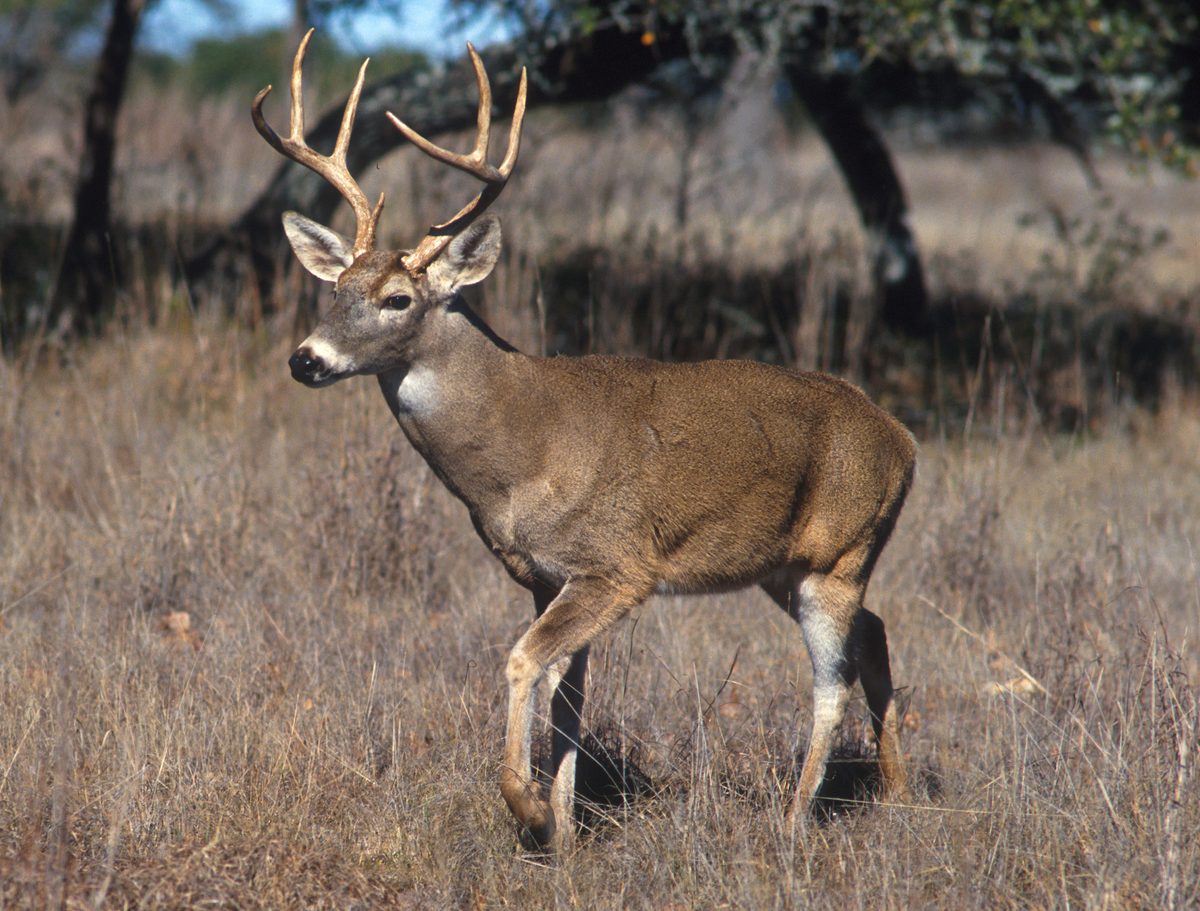
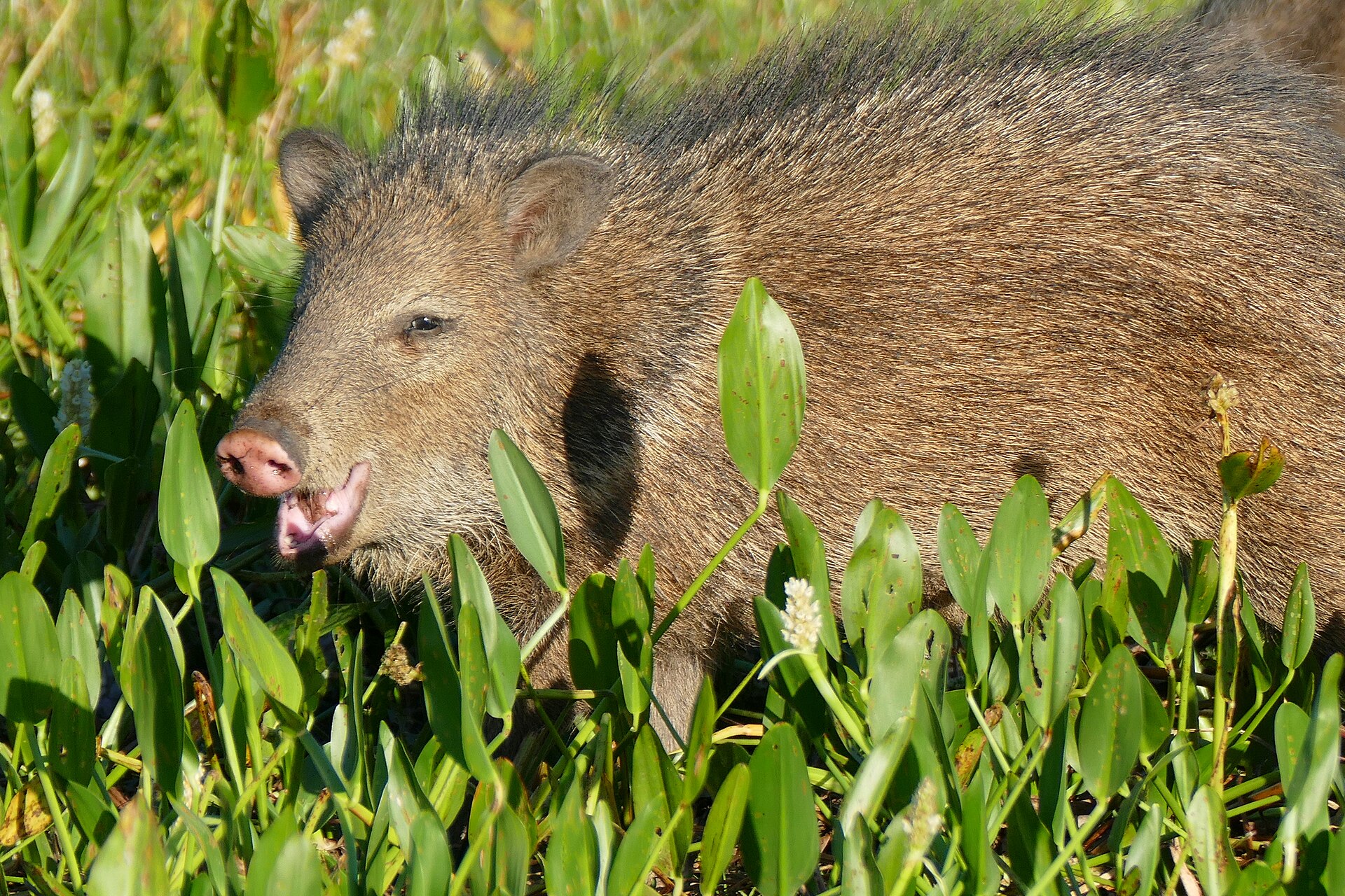
Animals around Contee Lake, Port O'Connor


Port O’Connor paddling context
For a trip centered on Contee Lake, confirm the lake’s location and approach before launching; the regional route options below describe the Port O’Connor Paddling Trail, not a verified route into the lake. This coastal network links six trails across roughly 40 miles along Espiritu Santo and Matagorda Bays and through the saltwater marsh of Mules Slough/Fish Pond. Paddling here means moving between bayous, marsh waters and open-water stretches rather than following a single enclosed lake shoreline. The interconnected trails support outings lasting several hours, a full day or multiple days, depending on the chosen route and conditions. Birdwatching and fishing are major reasons to slow down along the way. Choose a defined route and turnaround plan before departure, rather than treating the connected waterways as an invitation to keep extending the day.
Wind, tides and boat traffic
Wind is the main planning constraint on the Port O’Connor trails. Strong southerly winds occur in spring and summer, while northerly winds affect winter and spring paddling. Strong northers can change conditions rapidly from fall through spring. Check the local forecast and tides before departure, and allow for a slower return if conditions change. Estimated paddling speed is 1–2 miles per hour, depending on water levels, wind and experience. Some trails may not be floatable at low tide, and shallow spots can require pulling a kayak. Oyster reefs can damage boats, while faster-moving powerboats require particular attention. Motorboat activity is especially important between markers 2 and 3 of the Matagorda Island Trail. Wear a life jacket, carry plenty of drinking water, sunscreen and insect repellent, and remember that waterfowl hunters also use the area.
Wildlife, shore access and island overnights
The small islands bordering the paddling trails support shorebirds and migratory birds, including pelicans, herons, egrets, roseate spoonbills, ducks and sandhill cranes. Bottlenose dolphins are also seen along the trail, and the area is known for redfish, speckled trout and drum. Watch wildlife without crowding it, and do not assume nearby shorelines are public landing places; private land requires the owner’s permission. For a longer regional outing, the Matagorda Island Trail reaches a primitive campground on Matagorda Island. A same-day round trip is not recommended because of the distance. There is no automobile access, and the picnic site has tables but no water or restrooms. Day use near paddling sign 35 is allowed within the campground area. Overnight camping, hiking, biking or touring the island requires either a Limited Public Use Permit or an Annual Public Hunting Permit.
Route options
- Barroom Bay TrailApproximately 8 miles round trip
The shortest of the six named round-trip loops in the interconnected Port O’Connor network. Plan using the regional estimate of 1–2 miles per hour and account for wind and tides.
- Pass Cavallo/J-hook TrailApproximately 11 miles round trip
A regional loop reached from Little Jetties by heading east around the south jetty. Check weather and tidal conditions before choosing this outing.
- Mules Slough TrailApproximately 13 miles round trip
An interconnected loop in the coastal network that includes the Mules Slough/Fish Pond saltwater marsh. Low water can make portions of the trail system too shallow to float.
- Fish Pond TrailApproximately 16 miles round trip
A longer regional loop within the interconnected bay-and-marsh system. Allow substantial paddling time and carry enough drinking water for the full outing.
- Matagorda Island TrailApproximately 25 miles round trip
The network’s main spine reaches the Matagorda Island campground and picnic area. A round trip in one day is not recommended. Plan an overnight with the required island permit, carry all drinking water, and use particular caution around motorboats between markers 2 and 3.
Sample itineraries
- Port O’Connor Back Bay Introduction · 1 day
Launch at The Fishing Center, cross the Gulf Intracoastal Waterway cautiously, and enter Fisherman’s Cut for access to the Back Bay system. Keep this an out-and-back paddle suited to wind, tides, and ability, with time for birdwatching. Confirm Contee Lake access separately before including it.
- Barroom Bay Trail · 1 day
Plan a full day for the approximately 8-mile round-trip Barroom Bay Trail. Use the Port O’Connor trail map to identify connections from your launch. Allow for a paddling pace of 1–2 miles per hour, plus stops, and check tides before committing to shallow sections.
- Matagorda Island Overnight · 2 days
Follow the approximately 25-mile round-trip Matagorda Island Trail, camping at the primitive campground before returning. Carry all drinking water and obtain the required island-use permit. A same-day round trip is not recommended; assess wind and forecast conditions for both travel days.
Seasonal conditions
Spring
Spring
Strong southerly and northerly winds can affect the interconnected bays and marsh trails. Northers can change conditions rapidly. Check the forecast and tide levels before launching, and shorten exposed paddles when conditions warrant.
Summer
Summer
Periodic strong southerly winds are the main seasonal concern identified for the trail. Carry plenty of drinking water, sunscreen, and insect repellent. Check tides rather than assuming shallow marsh routes will remain floatable.
Fall
Fall
Strong northers can bring rapid weather changes. Plan open-water travel around the forecast and maintain flexibility in route length. Low tides can make some trail sections impassable without pulling the kayak.
Winter
Winter
Periodic strong northerly winds can make exposed paddling difficult. Rapid changes associated with northers remain a concern. The area also attracts waterfowl hunters; remain alert to other users.
| Season | Window | Conditions |
|---|---|---|
| Spring | Spring | Strong southerly and northerly winds can affect the interconnected bays and marsh trails. Northers can change conditions rapidly. Check the forecast and tide levels before launching, and shorten exposed paddles when conditions warrant. |
| Summer | Summer | Periodic strong southerly winds are the main seasonal concern identified for the trail. Carry plenty of drinking water, sunscreen, and insect repellent. Check tides rather than assuming shallow marsh routes will remain floatable. |
| Fall | Fall | Strong northers can bring rapid weather changes. Plan open-water travel around the forecast and maintain flexibility in route length. Low tides can make some trail sections impassable without pulling the kayak. |
| Winter | Winter | Periodic strong northerly winds can make exposed paddling difficult. Rapid changes associated with northers remain a concern. The area also attracts waterfowl hunters; remain alert to other users. |
Permits, fees & closures
Confirm Contee Lake access requirements with TPWD. On Matagorda Island, overnight camping, hiking, biking, or touring requires a Limited Public Use Permit or Annual Public Hunting Permit. These are sold wherever hunting or fishing licenses are sold. Picnic day use near paddling sign #35 is permissible within the campground area.
Official source: Port O'Connor Paddling Trail - TPWD - Texas.gov · Verified September 18, 2026
Hazards & regulations
- Strong wind is the trail’s biggest potential hazard. Open-water crossings and rapidly arriving northers require close attention to forecasts.
- Fast-moving powerboats use portions of the trail heavily. Exercise particular caution between Markers 2 and 3 of the Matagorda Island Trail and when crossing the Gulf Intracoastal Waterway.
- Oyster reefs can damage kayaks. Watch the water ahead and avoid contact with exposed reefs.
- Low tides can leave routes too shallow to float. Tides below 0.0 feet may require pulling a kayak across shallow spots.
- The Matagorda Island picnic and campground area has no drinking water or restrooms. Carry sufficient water for the entire trip.
- Waterfowl hunting occurs in the area. Stay alert to hunting activity while navigating marshes and bays.
What to pack for Contee Lake, Port O'Connor
- Properly fitted lifejacket, worn while paddling
- Port O’Connor paddling trail map and GPS points
- Local weather forecast and tide information
- Plenty of drinking water
- Sunscreen and sun-protective clothing
- Insect repellent
- Required island-use permit
- Primitive camping shelter and sleeping equipment
- Food and all drinking water for the stay
- Bags to pack out waste
Contee Lake, Port O'Connor FAQ
- Do these itineraries provide a confirmed route to Contee Lake?
- No. These itineraries cover the Port O’Connor Paddling Trail, not a confirmed Contee Lake route. Verify the lake’s location, legal access, and navigable connections with TPWD before planning a lake-specific paddle.
- Where can paddlers launch in Port O’Connor?
- Little Jetties has a small parking lot where Washington Street meets the Gulf Intracoastal Waterway. The privately owned Fishing Center offers a ramp, parking, and a store restroom, with the closest access to Marker #1 at Fisherman’s Cut. Froggies is another listed trail access point.
- How extensive is the paddling trail?
- The system comprises six interconnected trails along 40 miles through Espiritu Santo and Matagorda Bays and the Mules Slough/Fish Pond saltwater marsh. Options range from several-hour outings to multiday trips. Estimate 1–2 miles per hour, depending on wind, water levels, and paddling skill.
- How do tides affect route choice?
- Tides above 1 foot generally allow paddling throughout the trail system. Below 0.0 feet, occasional shallow sections may require pulling a kayak. Check current tidal conditions before departure; some trails may not be floatable at low tide.
- Can Matagorda Island be reached by car?
- No automobile access is available. The Matagorda Island Trail ends at the island campground. Picnic tables are available, but there is no water or restroom at the site. The approximately 25-mile round trip is not recommended as a single-day paddle.
- Can paddlers land anywhere along the trail?
- Do not assume adjacent land is public. Some shoreline property is private, and landowner permission is needed before using it. Respect signs, fences, purple markings, and other notices; keep noise down and carry out litter.