



- Region
- State of Mexico/Puebla, Mexico
- Best season
- Spring, Summer
- Permits
- Confirm entry requirements, permits and cu…
Plan with verified data
Iztaccíhuatl-Popocatépetl National Park trip tools
Tools for a trip here
Picked for how, when and where you're going. Free, no signup.
Photos of Iztaccíhuatl-Popocatépetl National Park
How to get there
Amecameca de Juárez is south of Mexico City in the State of Mexico, between the city and the Iztaccíhuatl and Popocatépetl volcanoes. It lies on the Ruta de los Volcanes tourist route. Confirm the onward approach to the intended park destination before travelling.
- Amecameca de Juárez
A regional gateway between Mexico City and the volcanoes, with mountain sightseeing, local food and cultural attractions. This is a town-based starting point, not a specified park entrance.
- Hacienda de Zoquiapán area
An area included within the national park’s protected landscape. Confirm the appropriate approach and visitor access before treating it as an entry point.
Sources: Wikipedia · Wikivoyage. Confirm road and trailhead conditions with the managing agency before you leave.
State of Mexico/Puebla, Mexico · Season: Best: November - March
- Climbing
- Mountaineering
- Winter Camping
- Skiing
- Hiking
The country
The park encapsulates the dramatic saddle separating two massive, snow-capped volcanoes central to Aztec mythology. Iztaccíhuatl—the 'White Woman'—is a sprawling, multi-peaked dormant volcano holding several high altitude glaciers. Immediately adjacent is Popocatépetl, a highly active stratovolcano constantly venting massive plumes of ash and sulfur.
Why enthusiasts come
Climbers use the lengthy, undulating ridge traverse of Iztaccíhuatl as a premier test of multi-day endurance and glacier skills. Trekkers hike the lower passes to safely photograph the explosive eruptions of Popo from a breathtaking high-alpine vantage point.
Top experiences
The intense 'Arista del Sol' standard route demands a brutal 10-12 hour summit push crossing false summits and the Ayoloco glacier. Basecamping at the Altzomoni hut offers a high-altitude refuge to stage early morning ascents and view the adjacent eruptions.
Planner-relevant notes
Climbing Popocatépetl is completely and strictly forbidden due to extreme, frequent explosive activity and lethal volcanic gas. Approaching Iztaccíhuatl requires checking in at the Paso de Cortés ranger station to prove you have adequate mountaineering equipment. The extreme altitude profile implies a genuine risk of HAPE and HACE; a rigorous, staged acclimatization plan is imperative.
Field notes
- Carry a dust mask or respirator; depending on the wind, Popocatépetl will dump fine, abrasive volcanic ash directly onto your climb.
- The 'Knees' section of Izta involves heavily eroded, sandy scree that makes downhill travel exhausting and slippery.
- Despite its latitude, winter storm temperatures near the summit drop to -15°C (5°F); pack a substantial down belay jacket.
- The Grupo de los Cien hut at 4,700m is famously squalid and often overcrowded; bringing a robust 4-season tent is vastly preferable.
Where on earth
Satellite imagery flying in from a world view to Iztaccíhuatl-Popocatépetl National Park, State of Mexico/Puebla, Mexico. Use the + / − buttons, or click the map to zoom with your scroll wheel; drag to pan and pinch to zoom on touch.
Coordinates
- Decimal degrees
- 19.1167, -98.6333
- Latitude (DMS)
- 19° 7′ 0.1″ N
- Longitude (DMS)
- 98° 37′ 59.9″ W
Coordinates are an access-point reference for Iztaccíhuatl-Popocatépetl National Park, not a route. Carry a paper map and confirm trailhead or put-in access with the managing agency before you go.
Topic summary
This high-altitude volcanic landscape offers serious ridge traverses and technical mountaineering over glaciers, with views of an active neighboring peak.
Key takeaways
- Region: State of Mexico/Puebla, Mexico
- Best season: Best: November - March
- Coordinates: 19.117, -98.633
Climate suitability
Best: November - March
Keep planning
Popular pursuits at Iztaccíhuatl-Popocatépetl National Park
- Climbing
Rock and alpine lines with approach beta.
- Mountaineering
Glacier and high-route objectives with real consequence.
- Winter Camping
Cold-season travel and camp craft; layering matters more than mileage.
- Skiing
Ski-touring access when the road closes for the season.
- Hiking
Day miles on marked trail, with route notes and trail links below.
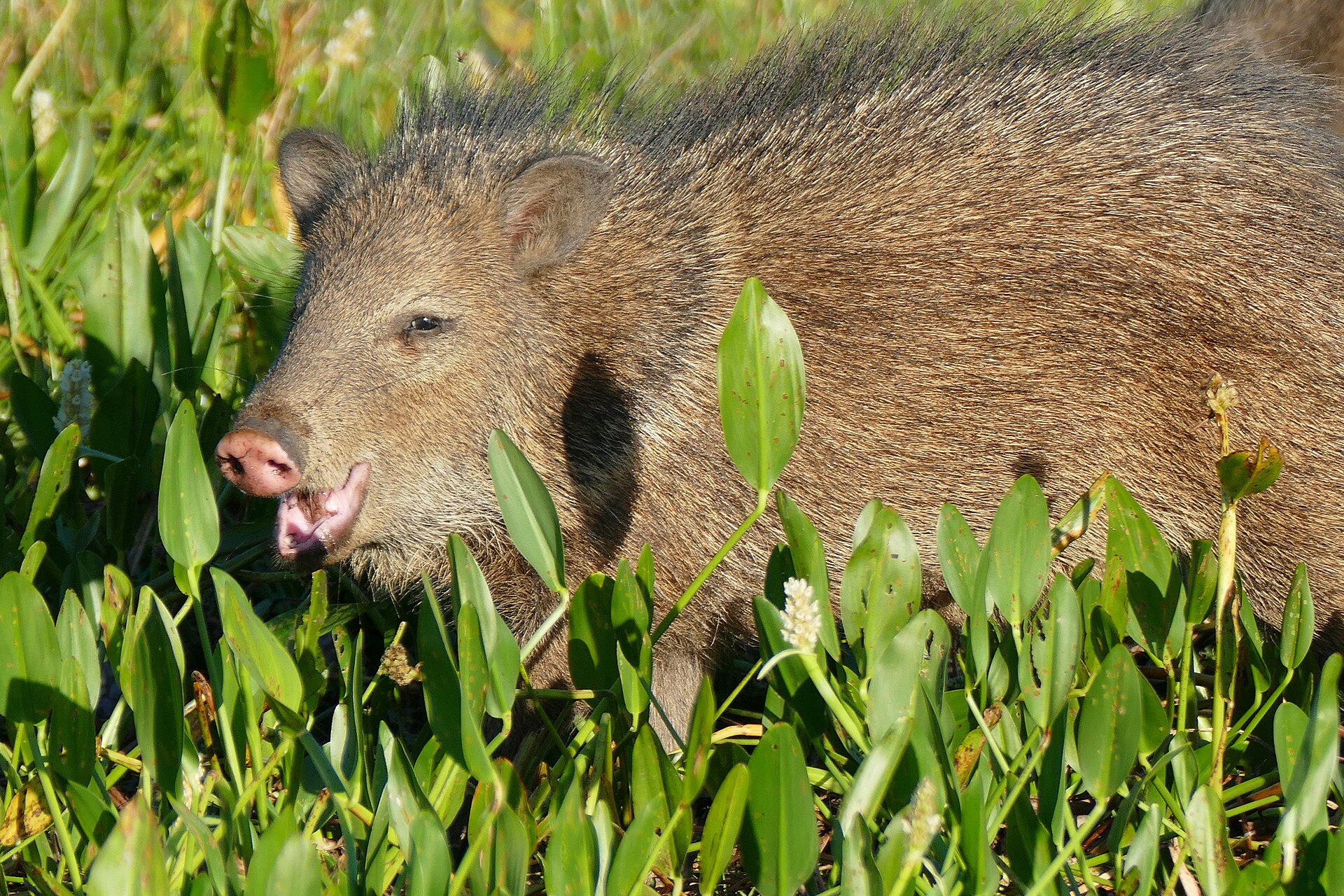
Animals around Iztaccíhuatl-Popocatépetl National Park



Two high volcanoes and a broader protected landscape
Iztaccíhuatl-Popocatépetl National Park lies along the borders of the State of Mexico, Puebla and Morelos, protecting 39,819.08 hectares around two of Mexico’s highest mountains. Popocatépetl rises to 5,426 metres and is the country’s second-highest peak; Iztaccíhuatl reaches 5,230 metres and ranks third. Also known as Izta-Popo Zoquiapan National Park, the protected area extends beyond the two volcanoes to the Hacienda de Zoquiapán area and the annexed areas of Zoquiapan, Ixtlahuacán and the Frío de Juárez River. That scope matters when planning: a visit to the surrounding landscape is not the same undertaking as a high-mountain outing. Start by deciding whether the goal is mountain scenery, time in the gateway town or a more demanding outdoor trip, then confirm the access appropriate to that plan.
Amecameca as a regional starting point
Amecameca de Juárez sits south of Mexico City, between the capital and the Iztaccíhuatl and Popocatépetl volcanoes of the Sierra Nevada. Its position makes it a useful starting point for understanding the region, though reaching town should not be confused with reaching a confirmed park entrance or trailhead. The area attracts weekend visitors from Mexico City, Puebla and Morelos for mountain scenery, local food and cultural stops. Amecameca is also on the Ruta de los Volcanes tourist route. The Sanctuary of the Señor del Sacromonte and Panohaya Hacienda offer named sightseeing options to build into a town-based visit. Keep these cultural stops distinct from plans inside the national park; a regional sightseeing itinerary does not establish access to either volcano.
Match the outing to the elevation
The defining planning consideration here is the scale of the mountains: both named summits exceed 5,000 metres. A scenic visit around Amecameca and an outing high on a volcano require very different preparation. For any high-elevation plan, allow time to adjust, keep the day within the group’s abilities and be prepared to turn back rather than treat a summit as an obligation. Carry water, sun protection and layers suitable for changing mountain weather. Confirm current access and conditions with the managing authority before choosing a mountain objective, particularly where volcanic terrain is involved. The presence of a peak within a national park should never be taken as permission to climb it. No season should be treated as a substitute for checking conditions close to departure.
Route options
- Ruta de los Volcanes
A regional tourist-route option that includes Amecameca. Suitable as a framework for planning mountain scenery and town stops; it is not a specified hiking route or an established approach to either summit.
- Amecameca cultural sightseeing
Build a town-based sightseeing itinerary around the Sanctuary of the Señor del Sacromonte and Panohaya Hacienda, with time for local food. This is an alternative to a high-mountain outing, not a marked park trail.
Sample itineraries
- Amecameca and the volcano landscape · 1 day
Base a day in Amecameca de Juárez, between Mexico City and the Sierra Nevada volcanoes. Pair mountain scenery and local food with the Sanctuary of the Señor del Sacromonte. Confirm park access with the managing agency before adding an outing inside the park.
- Amecameca and a park outing · 2 days
Spend the first day in Amecameca, visiting Panohaya Hacienda and enjoying local food. Reserve the second day for a park outing appropriate to current access and weather. Confirm a suitable route with the managing agency; do not treat either volcano summit as a casual extension.
Seasonal conditions
Spring
Spring
Plan around mountain elevation rather than assuming warm conditions throughout the park. Check forecasts for the elevation of the intended outing and confirm current access before leaving Amecameca.
Summer
Summer
Summer does not remove the demands of high-elevation terrain. Carry layers, water and weather protection, and choose an outing that matches current conditions and the group's acclimatization.
Fall
Fall
Check current mountain conditions rather than relying on a fixed seasonal window. Keep plans flexible and allow a town-based alternative in Amecameca if the intended park outing is unsuitable.
Winter
Winter
Take cold exposure seriously in this high-mountain setting. Check conditions at the planned elevation, carry insulating layers and avoid committing to terrain beyond the group's equipment or experience.
| Season | Window | Conditions |
|---|---|---|
| Spring | Spring | Plan around mountain elevation rather than assuming warm conditions throughout the park. Check forecasts for the elevation of the intended outing and confirm current access before leaving Amecameca. |
| Summer | Summer | Summer does not remove the demands of high-elevation terrain. Carry layers, water and weather protection, and choose an outing that matches current conditions and the group's acclimatization. |
| Fall | Fall | Check current mountain conditions rather than relying on a fixed seasonal window. Keep plans flexible and allow a town-based alternative in Amecameca if the intended park outing is unsuitable. |
| Winter | Winter | Take cold exposure seriously in this high-mountain setting. Check conditions at the planned elevation, carry insulating layers and avoid committing to terrain beyond the group's equipment or experience. |
Permits, fees & closures
Confirm entry requirements, permits and current access with the park's managing agency.
Confirm current permits, fees, and closures with the managing agency before you go.
Hazards & regulations
- High elevation: Iztaccíhuatl reaches 5,230 m and Popocatépetl reaches 5,426 m. Allow time to acclimatize and descend if altitude symptoms develop.
- Cold exposure: these high mountains require insulating layers and weather protection, even when conditions in town feel comfortable.
- Overcommitting to a mountain objective: a sightseeing visit near the volcanoes is not equivalent to a summit attempt. Match plans to experience and verified conditions.
What to pack for Iztaccíhuatl-Popocatépetl National Park
- Insulating layers
- Weatherproof outer layer
- Warm hat and gloves
- Sturdy footwear suited to the intended outing
- Drinking water
- Food
- Sun protection
- Basic first-aid supplies
- Navigation tools for a confirmed route
- Charged phone
- Backup power
- Current access information from the managing agency
Iztaccíhuatl-Popocatépetl National Park FAQ
- Where is Iztaccíhuatl-Popocatépetl National Park?
- The park lies along the borders of the states of México, Puebla and Morelos. It protects the landscape surrounding the Iztaccíhuatl and Popocatépetl volcanoes in Mexico.
- What makes the park distinctive?
- Its defining landmarks are Mexico's second- and third-highest peaks: Popocatépetl at 5,426 m and Iztaccíhuatl at 5,230 m. The protected area covers 39,819.08 hectares and also includes the Hacienda de Zoquiapán area.
- Is Amecameca a useful base for a visit?
- Amecameca de Juárez lies south of Mexico City, between the city and the volcanoes. It offers mountain scenery, local food and cultural stops, making it a practical place to combine town time with a separately confirmed park outing.
- What else can be visited around Amecameca?
- Town-area attractions include the Sanctuary of the Señor del Sacromonte and Panohaya Hacienda. Amecameca is also on the Ruta de los Volcanes tourist route.
- Can either volcano summit be included in a casual visit?
- Do not assume summit access or suitability. Both peaks exceed 5,000 m. Confirm current access with the managing agency and assess acclimatization, equipment and mountain experience before considering any high-elevation objective.
- Does the park have another name?
- It is also known as Izta-Popo Zoquiapan National Park.