



- Region
- Chiapas, Mexico
- Best season
- Spring, Summer
- Permits
- Confirm entry requirements, authorized acc…
Plan with verified data
Montes Azules Biosphere Reserve trip tools
Tools for a trip here
Picked for how, when and where you're going. Free, no signup.
Photos of Montes Azules Biosphere Reserve
How to get there
Montes Azules Biosphere Reserve is in Chiapas, Mexico. Its center point is 16.5000, -91.0000. Use these links for live turn-by-turn directions from where you are, then confirm road, trailhead and access conditions with the managing agency before you leave.
Chiapas, Mexico · Season: Best: January - May
- Rafting
- Winter Camping
- Skiing
- Hiking
- Backpacking
- Wildlife Viewing
- Canoeing
- Fishing
The country
Protecting the core of the immense Selva Lacandona, this biosphere reserve is a sweltering, dense maze of mahogany, cedar, and creeping vines. The ecosystem is dominated by the Usumacinta and Lacantún river basins, which border Guatemala and slice through deep limestone gorges. It is one of Mexico's most biologically dense hotbeds, crawling with howler monkeys, tapirs, harpy eagles, and jaguars.
Why enthusiasts come
Hardcore explorers arrive for extreme jungle trekking, requiring machete work, severe humidity tolerance, and navigation through trackless wilderness. River runners use the Usumacinta for multi-day rafting expeditions that link intense Class IV whitewater with unexcavated Maya archaeological sites.
Top experiences
Paddling the turbulent Usumacinta River allows rafters to camp on pristine jungle beaches beneath the roar of howler monkeys. Trekking into the ancient ruins of Yaxchilán directly from the riverbank offers a haunting glimpse into lost civilizations swallowed by the forest.
Planner-relevant notes
Entering the deep reserve without a local Lacandon indigenous guide is both highly disrespectful and intensely dangerous. Malaria and dengue fever are endemic, demanding aggressive DEET application, permethrin-treated clothing, and proper prophylactics. The river borders Guatemala, requiring participants in rafting expeditions to carry passports and navigate complex military checkpoints.
Field notes
- Jungle rot sets in quickly; bring extensive antifungal powders and dedicated dry camp clothes wrapped in watertight bags.
- Check your boots rigorously every single morning for scorpions and highly venomous fer-de-lance snakes.
- A heavy-duty hammock with an integrated bug net and oversized rainfly is vastly superior to a tent in the muddy, insect-ridden environment.
- River fluctuations dictate passage; if heavy rains hit upstream in Guatemala, the Usumacinta becomes a dangerous, debris-filled torrent.
Where on earth
Satellite imagery flying in from a world view to Montes Azules Biosphere Reserve, Chiapas, Mexico. Use the + / − buttons, or click the map to zoom with your scroll wheel; drag to pan and pinch to zoom on touch.
Coordinates
- Decimal degrees
- 16.5000, -91.0000
- Latitude (DMS)
- 16° 30′ 0.0″ N
- Longitude (DMS)
- 91° 0′ 0.0″ W
Coordinates are an access-point reference for Montes Azules Biosphere Reserve, not a route. Carry a paper map and confirm trailhead or put-in access with the managing agency before you go.
Topic summary
Deep river expeditions penetrate North America's largest remaining rainforest, offering exceptional jungle survival trekking, rafting, and ancient Maya ruins.
Key takeaways
- Region: Chiapas, Mexico
- Best season: Best: January - May
- Coordinates: 16.500, -91.000
Climate suitability
Best: January - May
Keep planning
Popular pursuits at Montes Azules Biosphere Reserve
- Rafting
Whitewater sections and the flows that make them run.
- Hiking
Day miles on marked trail, with route notes and trail links below.
- Backpacking
Multi-day travel with everything on your back — see the packing blocks below.
- Wildlife Viewing
Best light, best season, and where animals move.
- Canoeing
Paddle routes, portages, and put-ins.
- Fishing
Resident gamefish, seasons, and the water that holds them.
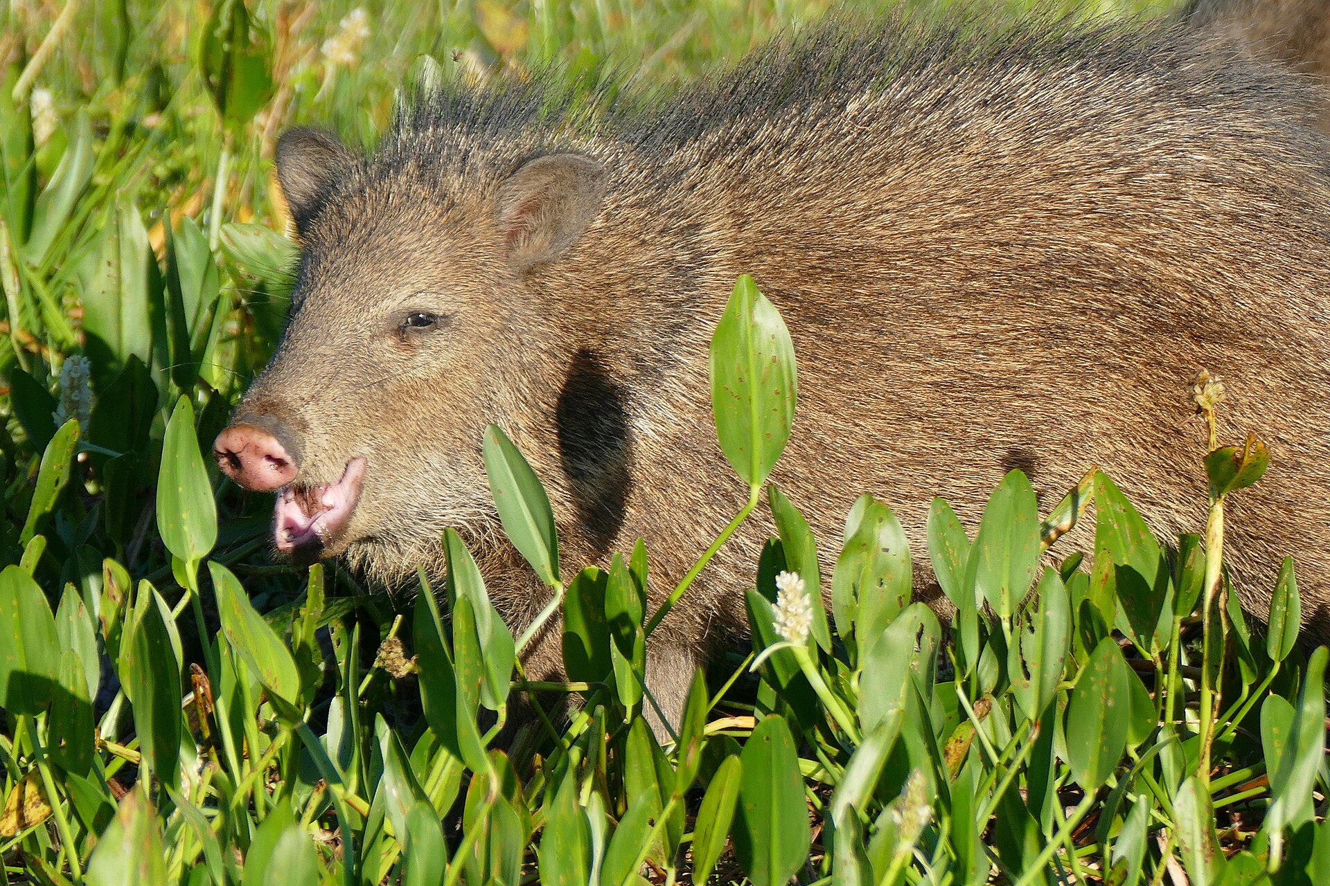
Animals around Montes Azules Biosphere Reserve



Setting in southern Mexico
Montes Azules Biosphere Reserve is in Chiapas, Mexico. Chiapas lies in the country's far south, bordering Guatemala to the southeast and the Mexican states of Oaxaca, Veracruz, and Tabasco from west to northeast. The state's wider landscape includes jungle, mountain lakes, canyons, and waterfalls, along with remote archaeological sites. That regional variety provides context for a visit, but it should not be treated as a description of any particular route inside Montes Azules. A practical reserve itinerary needs more specific information: a verified entrance, an agreed destination, and a way to reach and leave it. Avoid building a trip around a map label alone or assuming that nearby attractions connect directly with reserve access.
Community context and historical tensions
Chiapas is home to many Mayan communities that preserve longstanding traditions. Its recent history also includes conflict involving the Mexican government, Indigenous peoples, subsistence farmers, and the Zapatista movement. The Zapatista uprising began in January 1994, followed by a ceasefire, negotiations, and years of political and community tensions. This history matters when approaching travel in the region, but it does not establish present-day conditions at Montes Azules or on any approach road. Seek current, locally specific advice rather than treating past conflict as either a blanket warning or proof that an area is now accessible. Respect community decisions about entry, ask before photographing people, and avoid assuming that permission from one community applies to another.
Plan around confirmed access
For a Montes Azules visit, the essential planning task is to confirm the actual access arrangements before committing to transport or an overnight itinerary. Confirm entry requirements with the managing agency, and establish which entrance and activities are appropriate for the intended visit. Do not assume that a named biosphere reserve has a public trailhead, marked walking routes, or transport available on arrival. Ask specifically about the return journey, local guidance, communications, and what supplies must be carried. Chiapas includes remote jungle destinations, so regional travel descriptions alone are not enough to judge the demands of an outing here. Leave route distance, walking time, and difficulty undecided until a specific, locally verified itinerary is available.
Sample itineraries
- One-day visit, subject to access confirmation · 1 day
Treat this as a planning outline, not a verified route. Before traveling to Montes Azules, confirm an authorized entry point, local access conditions and a suitable day activity with the managing agency. Keep the outing within that confirmed plan.
- Two-day visit with advance local arrangements · 2 days
Use the first day for arrival and local access checks. Reserve the second for an activity confirmed by the managing agency. Arrange accommodation separately; do not assume camping or overnight stays inside Montes Azules are available.
Seasonal conditions
Spring
No verified seasonal window.
Spring conditions at Montes Azules are not established here. Check local weather and access before choosing activities.
Summer
No verified seasonal window.
Summer rainfall, temperatures and route conditions are not established here. Confirm conditions locally rather than assuming access will be straightforward.
Fall
No verified seasonal window.
Fall conditions are not established here. Keep travel plans flexible until local weather and authorized access are confirmed.
Winter
No verified seasonal window.
Winter conditions are not established here. Do not assume cooler or drier weather without checking the local forecast.
| Season | Window | Conditions |
|---|---|---|
| Spring | No verified seasonal window. | Spring conditions at Montes Azules are not established here. Check local weather and access before choosing activities. |
| Summer | No verified seasonal window. | Summer rainfall, temperatures and route conditions are not established here. Confirm conditions locally rather than assuming access will be straightforward. |
| Fall | No verified seasonal window. | Fall conditions are not established here. Keep travel plans flexible until local weather and authorized access are confirmed. |
| Winter | No verified seasonal window. | Winter conditions are not established here. Do not assume cooler or drier weather without checking the local forecast. |
Permits, fees & closures
Confirm entry requirements, authorized access and any booking requirements with the managing agency before traveling.
Confirm current permits, fees, and closures with the managing agency before you go.
Hazards & regulations
- Regional remoteness: Chiapas includes remote jungle destinations. Confirm transport and assistance options for the specific outing rather than assuming services are nearby.
- Jungle travel: if the confirmed outing enters jungle terrain, use a locally verified route and avoid unplanned detours.
- Historical social tensions and armed conflict affected Chiapas. This history does not establish present conditions at Montes Azules; seek current local access and safety advice.
What to pack for Montes Azules Biosphere Reserve
- Drinking water appropriate to the confirmed outing
- Food and a basic first-aid kit
- Weather protection chosen after checking the forecast
- Offline navigation information for the confirmed route
- Charged phone and backup power
- Managing-agency and transport contact details
Montes Azules Biosphere Reserve FAQ
- Where is Montes Azules Biosphere Reserve?
- The destination is in Chiapas, southern Mexico. Chiapas borders Guatemala to the southeast.
- Which entrance or route should be used?
- No specific entrance or route can be identified here. Obtain an authorized access point and a locally confirmed route from the managing agency before setting out.
- Can visitors camp inside the reserve?
- Camping availability and overnight access are not established here. Confirm both with the managing agency before packing for an overnight stay.
- What is the best season to visit?
- A reliable reserve-specific seasonal recommendation cannot be made here. Check local weather and access conditions before committing to dates.
- Does the history of conflict describe current visitor safety?
- No. Chiapas experienced armed conflict and social tensions, but that history alone does not establish current safety at Montes Azules. Obtain current local advice for the intended approach and activity.
- What should visitors know about local communities?
- Chiapas has many Mayan communities that preserve longstanding traditions. Respect local instructions, ask before photographing people and confirm permission before entering community land.