



- Region
- Texas
- Country
- United States
- Best for
- fly fishing, fishing
- Best season
- Spring, Summer
- Permits
- Confirm San José Island and Poco Bayou req…
Plan with verified data
Poco Bayou & Big Thicket, San Jose Island trip tools
Tools for a trip here
Picked for how, when and where you're going. Free, no signup.
How to get there
Port Aransas on Mustang Island lies beyond Aransas Pass at San José Island’s southern end. A transport service, public landing, road approach, and onward route to Poco Bayou or an island feature called Big Thicket are not confirmed. Arrange lawful access and return transport before departure.
- Aransas Pass
Geographic orientation point at San José Island’s southern end, across from Mustang Island and Port Aransas. Public landing or launch access is not confirmed; do not confuse the passage with the mainland city of the same name.
- Cedar Bayou
Northern orientation point where San José Island was formerly separated from Matagorda Island. The bayou no longer runs freely between the islands. Neither public access nor a navigable through-connection is confirmed.
Sources: nps.gov · Wikipedia · Wikivoyage. Confirm road and trailhead conditions with the managing agency before you leave.
Texas · United States · Season: Spring through fall
- Canoeing
- Kayaking
- Fishing
- Winter Camping
- Skiing
- Sea Kayaking
- Beachcombing
- Wildlife Viewing
Overview
The Poco Bayou and Big Thicket areas on the backside of San Jose Island represent some of the most remote and rewarding fly fishing on the Middle Coast. This intricate labyrinth of shallow bays, marsh cuts, and oyster lakes provides incredible protection from all but the strongest winds. The bottom is a mix of soft mud, shell, and healthy grass, supporting an abundance of baitfish and crustaceans that redfish thrive on. What makes this area special is its isolation; fewer anglers make the trip, meaning less pressure on the fish. You'll often have vast stretches of productive water entirely to yourself. Access is strictly by boat from Port Aransas or Aransas Pass. Best fished in fall, winter, and spring, though early mornings in summer can be productive before the heat sets in. Anglers should be comfortable poling a skiff or kayaking long distances and have good navigation skills, as the channels can be confusing. Be prepared for truly wild conditions.
Why it stands out
Extensive marsh system with superb wind protection
Abundant grass beds holding high numbers of redfish
True wilderness experience with minimal angling pressure
Opportunities for 'in-your-face' shots at tailing fish
Excellent birdwatching and wildlife viewing
Know before you go
Requires good navigational skills; easy to get lost
Soft mud bottoms in some areas can be challenging to wade
No services or amenities; pack everything in and out
Mosquitoes and biting flies can be relentless in warm weather
Planning notes
Where: Texas, United States Best season: Spring through fall Good for: Fly Fishing, Fishing Featured on: Top 10 Fly Fishing Flat Spots for Redfish on the Texas Middle Coast (#2) Access point: San José Island, Texas, USA
Check current permits, closures and fire restrictions with the managing agency before you commit to dates.
Field notes
- Extensive marsh system with superb wind protection
- Abundant grass beds holding high numbers of redfish
- True wilderness experience with minimal angling pressure
- Opportunities for 'in-your-face' shots at tailing fish
- Excellent birdwatching and wildlife viewing
Where on earth
Satellite imagery flying in from a world view to Poco Bayou & Big Thicket, San Jose Island, United States. Use the + / − buttons, or click the map to zoom with your scroll wheel; drag to pan and pinch to zoom on touch.
Coordinates
- Decimal degrees
- 28.0439, -96.9102
- Latitude (DMS)
- 28° 2′ 38.0″ N
- Longitude (DMS)
- 96° 54′ 36.7″ W
Coordinates are an access-point reference for Poco Bayou & Big Thicket, San Jose Island, not a route. Carry a paper map and confirm trailhead or put-in access with the managing agency before you go.
Topic summary
The Poco Bayou and Big Thicket areas on the backside of San Jose Island represent some of the most remote and rewarding fly fishing on the Middle Coast.
Key takeaways
- Region: Texas
- Country: United States
- Best season: Spring through fall
- Good for: fly fishing, fishing
- Coordinates: 28.044, -96.910
Intended uses
- fly fishing
- fishing
Climate suitability
Spring through fall
Keep planning
Popular pursuits at Poco Bayou & Big Thicket, San Jose Island
- Canoeing
Paddle routes, portages, and put-ins.
- Kayaking
Sheltered and open-water paddling lines.
- Fishing
Resident gamefish, seasons, and the water that holds them.
- Winter Camping
Cold-season travel and camp craft; layering matters more than mileage.
- Skiing
Ski-touring access when the road closes for the season.
- Sea Kayaking
Coastal crossings, tides, and protected camps.
Animals around Poco Bayou & Big Thicket, San Jose Island



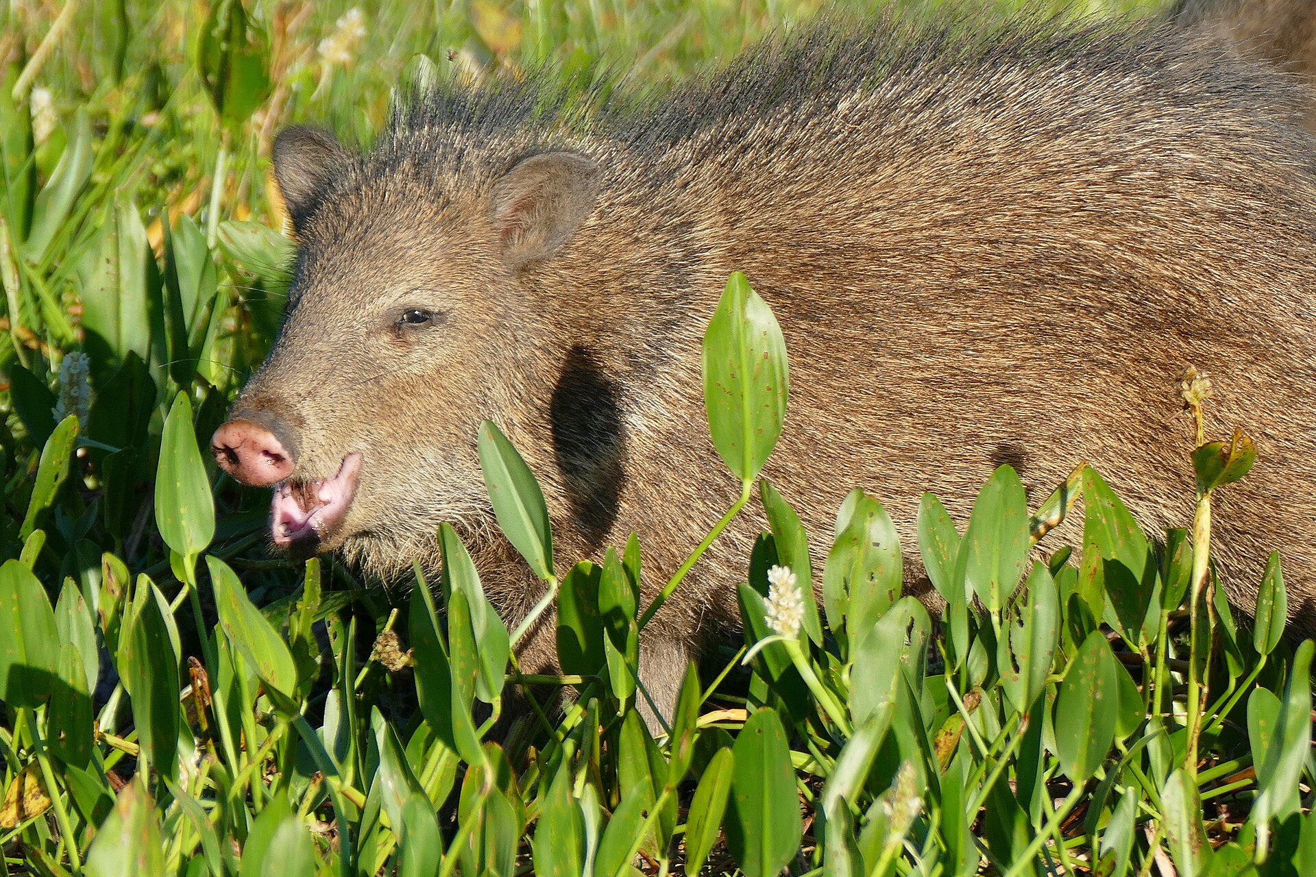
San José Island: the coastal setting
San José Island, also called Saint Joseph Island, is a Texas Gulf Coast barrier island. It runs generally northeast–southwest, with the Gulf of Mexico to the east and south, Aransas Bay to the west, and Mesquite Bay to the north. At 21 miles long and 5 miles wide, it is a substantial coastal landscape rather than a single bayou stop. Those dimensions describe the island, not a walking or paddling route. Plan around a specific shoreline and confirmed access arrangement rather than treating the whole island as one outing. The identity and location of Poco Bayou and an island feature called Big Thicket remain unconfirmed here. Neither name should be used as a navigation target without checking a reliable local map and confirming access.
Southern and northern landmarks
Aransas Pass marks the southern end of San José Island. This is the water passage, not the mainland City of Aransas Pass. Across the passage lie Mustang Island and the town of Port Aransas. Jetties extend into the Gulf from both Mustang Island and San José Island, making the passage an important landmark for understanding the island’s southern geography. Their presence does not establish a public landing, walking route, or crossing. At the northern end, Cedar Bayou formerly separated San José Island from Matagorda Island, but it no longer runs freely between the islands. Do not build a through-paddling itinerary around an assumed open connection there. For any coastal outing, check current weather and water conditions, carry drinking water and sun protection, and establish a dependable return arrangement before setting out.
Keep Big Thicket planning separate
Big Thicket National Preserve is managed by the National Park Service, but it should not be treated as a confirmed San José Island destination or as the authority for island access. Its visitor contact is in Kountze, Texas. The preserve requires no entrance pass and charges no entrance fee. Backcountry camping, hunting, and trapping there require free permits; those rules apply to the preserve and must not be transferred to Poco Bayou or San José Island. For an island trip, first establish the exact intended location, the responsible land manager or owner, and whether the proposed landing and activity are allowed. Confirm permit requirements directly with that authority. Until those basics are settled, use the coastal landmarks below for orientation only, not as verified trailheads, boat launches, or public access points.
Route options
- Aransas Pass and the southern end
A possible area to investigate for a southern-shore outing, not a verified route. Jetties extend into the Gulf from San José Island and Mustang Island. Confirm lawful access and a specific itinerary before planning travel along the shore or onto a jetty.
- Mesquite Bay and Cedar Bayou
A northern-island planning area rather than an established paddling route. Mesquite Bay borders the island to the north, and Cedar Bayou marks its former separation from Matagorda Island. Confirm access and current water connections; do not assume a through-passage.
Sample itineraries
- San José Island coastal orientation · 1 day
Plan a daytime visit only after confirming lawful access and transport. Use the island’s geography to orient the outing: Gulf of Mexico to the east and south, Aransas Bay to the west, and Mesquite Bay to the north. Keep the route within confirmed accessible areas.
- Big Thicket National Preserve planning visit · 1 day
Treat Big Thicket National Preserve as a separate destination, not an established stop on San José Island. Start with the Big Thicket Visitor Center to confirm suitable activities and current conditions. Arrange the required permit before any backcountry camping.
Seasonal conditions
Spring
Confirm local conditions before departure
For San José Island, base plans on the coastal forecast and confirmed access rather than a presumed seasonal opening. Check wind, rain, and water conditions before committing to an exposed shoreline outing.
Summer
Confirm local conditions before departure
On this Gulf barrier island, prepare for sun exposure and carry drinking water. Adjust the outing to the forecast and available shade; do not assume water supplies or visitor facilities.
Fall
Confirm local conditions before departure
Check coastal weather and transport arrangements before leaving. Do not assume Cedar Bayou provides a navigable passage: it no longer runs freely between San José Island and Matagorda Island.
Winter
Confirm local conditions before departure
Pack wind protection and layers suited to the forecast for an exposed coastal visit. Confirm access and return arrangements rather than assuming year-round transport or facilities.
| Season | Window | Conditions |
|---|---|---|
| Spring | Confirm local conditions before departure | For San José Island, base plans on the coastal forecast and confirmed access rather than a presumed seasonal opening. Check wind, rain, and water conditions before committing to an exposed shoreline outing. |
| Summer | Confirm local conditions before departure | On this Gulf barrier island, prepare for sun exposure and carry drinking water. Adjust the outing to the forecast and available shade; do not assume water supplies or visitor facilities. |
| Fall | Confirm local conditions before departure | Check coastal weather and transport arrangements before leaving. Do not assume Cedar Bayou provides a navigable passage: it no longer runs freely between San José Island and Matagorda Island. |
| Winter | Confirm local conditions before departure | Pack wind protection and layers suited to the forecast for an exposed coastal visit. Confirm access and return arrangements rather than assuming year-round transport or facilities. |
Permits, fees & closures
Confirm San José Island and Poco Bayou requirements with the relevant managing agency. At Big Thicket National Preserve, backcountry camping, hunting, and trapping require permits. These preserve rules do not establish permission for activities on San José Island.
Fees: Big Thicket National Preserve has no entrance fee and requires no entrance pass. Its backcountry camping, hunting, and trapping permits are free. These fee details apply only to the preserve.
Official source: Fees & Passes - Big Thicket National Preserve (U.S. National Park Service) · Verified September 18, 2026
Hazards & regulations
- Exposed coastal conditions: check wind and weather before a San José Island outing, and shorten plans when conditions exceed the group’s abilities.
- Open-water exposure: the island borders the Gulf of Mexico and two bays. Use appropriate flotation for any boating activity.
- Passage uncertainty: Cedar Bayou no longer runs freely between San José Island and Matagorda Island; do not rely on it as a through-route.
- Navigation confusion: Aransas Pass at the island’s southern end is a waterway, not the mainland city of the same name.
What to pack for Poco Bayou & Big Thicket, San Jose Island
- Sun hat and sunscreen
- Wind-resistant layer
- Weather-appropriate clothing
- Drinking water
- Map showing San José Island and surrounding waters
- Charged phone in a waterproof case
- Confirmed access and return arrangements
- Properly fitted personal flotation device
- Waterproof storage for essentials
- Emergency signaling equipment
Poco Bayou & Big Thicket, San Jose Island FAQ
- Is Big Thicket National Preserve part of San José Island?
- Do not treat them as one destination. Big Thicket National Preserve has its own visitor center and National Park Service rules. No connection to an island location called Big Thicket is established here.
- Where is Poco Bayou, and how is it accessed?
- Its location and access cannot be confirmed here. Verify the exact place name, land manager, and lawful approach before planning a route.
- What surrounds San José Island?
- The Gulf of Mexico lies east and south, Aransas Bay lies west, and Mesquite Bay lies north. Aransas Pass separates the southern end from Mustang Island and the town of Port Aransas.
- Can Cedar Bayou be used as a through-route?
- Do not assume so. Cedar Bayou no longer runs freely between San José Island and Matagorda Island. Confirm current passage conditions locally before considering any water route.
- Does a Big Thicket camping permit authorize island camping?
- No island camping authorization is established by the preserve’s permit requirements. Confirm San José Island camping permission separately with the relevant land manager.
- Is a ferry, launch, or walking route confirmed?
- No specific transport service, launch point, or walking route is confirmed here. Establish access and a reliable return plan before departure.