



- Region
- Querétaro, Mexico
- Best season
- Spring, Summer
- Permits
- Confirm current entry requirements, site a…
Plan with verified data
Sierra Gorda Biosphere Reserve trip tools
Tools for a trip here
Picked for how, when and where you're going. Free, no signup.
Photos of Sierra Gorda Biosphere Reserve
How to get there
A northern road approach starts in Rioverde, San Luis Potosí, outside Sierra Gorda, and continues south on highway 69 before turning west onto highway 120. Rioverde’s Mercado Colón is a supply stop before continuing. Jalpan de Serra and Pinal de Amoles are useful towns for connectivity during the journey.
- Rioverde
An approach town in San Luis Potosí, outside Sierra Gorda. Replenish supplies at Mercado Colón before following highway 69 south.
- Juntas del Concá
A river stop where the river meets highway 69, with a camping area described beneath the bridge. Confirm current access and overnight arrangements locally.
- Jalpan de Serra
A town stop where internet and a comfortable workplace may be available; useful for handling online planning before continuing to less-connected locations.
- Pinal de Amoles
Another town option for finding internet and a place to work along a Sierra Gorda road trip.
Sources: Wikipedia · danggoodlife.com. Confirm road and trailhead conditions with the managing agency before you leave.
Querétaro, Mexico · Season: Best: November - April
- Mountaineering
- Winter Camping
- Skiing
- Desert Hiking
- Canyoneering
- Hiking
- Backpacking
- Wildlife Viewing
The country
The Sierra Gorda is an incredibly varied karst landscape featuring dramatic limestone mountains plunging into humid subtropical river valleys. It transitions from arid semi-desert to lush cloud forests within mere miles, harboring intense biodiversity including jaguars and military macaws. Enormous sinkholes (sótanos) and complex cave systems penetrate the limestone bedrock.
Why enthusiasts come
Canyoneers and spelunkers flock to explore the deep subterranean rivers and towering canyon grottos formed by tropical erosion. Ecotourists traverse the winding highlands to experience pristine jungle trekking paired with ancient Franciscan mission history.
Top experiences
A grueling uphill pre-dawn trek to the edge of the massive Sótano del Barro rewards hikers with hundreds of macaws spiraling out of the 400-meter deep abyss. Swimming and wading through the narrow, turquoise river gorge to reach the waterfalls of Puente de Dios is an essential wet-canyon adventure.
Planner-relevant notes
Heavy summer rains (June-September) frequently cause flash flooding, completely cutting off the narrow canyon trails and access roads. Many of the premier remote sites sit on ejido (communal) land, requiring small access fees and local guides. The winding mountain roads are highly prone to rockfalls and dense fog, demanding extremely cautious driving.
Field notes
- Carry specialized canyoneering boots and a drybag backpack; reaching the best waterfalls requires full submersion wading.
- Temperatures in the river valleys are sweltering, while the cloud forest ridges freeze at night; pack highly adaptable layers.
- Guides for the Sótano del Barro must be arranged in the village of Santa María de los Cocos the night before.
- Purify all water drawn from the streams, as agricultural runoff from the high plateaus can seep into the karst system.
Where on earth
Satellite imagery flying in from a world view to Sierra Gorda Biosphere Reserve, Querétaro, Mexico. Use the + / − buttons, or click the map to zoom with your scroll wheel; drag to pan and pinch to zoom on touch.
Coordinates
- Decimal degrees
- 21.3167, -99.6000
- Latitude (DMS)
- 21° 19′ 0.1″ N
- Longitude (DMS)
- 99° 35′ 60.0″ W
Coordinates are an access-point reference for Sierra Gorda Biosphere Reserve, not a route. Carry a paper map and confirm trailhead or put-in access with the managing agency before you go.
Topic summary
Complex tropical topography protects stunningly diverse ecosystems, drawing rugged explorers to deep sinkholes, narrow canyons, and hidden jungle rivers.
Key takeaways
- Region: Querétaro, Mexico
- Best season: Best: November - April
- Coordinates: 21.317, -99.600
Climate suitability
Best: November - April
Keep planning
Popular pursuits at Sierra Gorda Biosphere Reserve
- Mountaineering
Glacier and high-route objectives with real consequence.
- Desert Hiking
Water carries and heat management drive the plan.
- Canyoneering
Narrows, downclimbs, and flash-flood timing.
- Hiking
Day miles on marked trail, with route notes and trail links below.
- Backpacking
Multi-day travel with everything on your back — see the packing blocks below.
- Wildlife Viewing
Best light, best season, and where animals move.
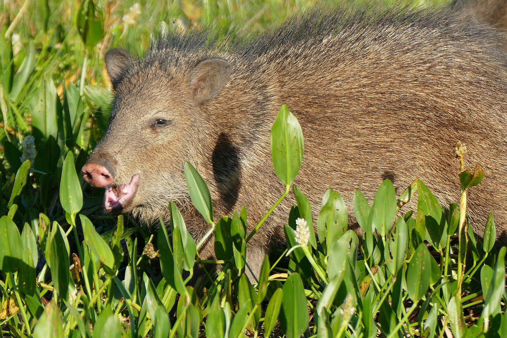
Animals around Sierra Gorda Biosphere Reserve



A rugged reserve in northern Querétaro
Sierra Gorda is a mountain landscape of steep slopes, deep canyons and sharply contrasting habitats in northern Querétaro. The wider ecological region extends into Guanajuato, Hidalgo and San Luis Potosí, so a trip described as a Sierra Gorda itinerary may include stops outside the Querétaro reserve. The Querétaro biosphere reserve was established in 1997. Its terrain belongs to the Huasteca Karst, where erosion of limestone has created distinctive formations, including pit caves known locally as sótanos. Plan around the mountain landscape rather than treating the area as one compact attraction. A road-based visit can connect towns, river stops and different environments, while leaving time to appreciate the changes between them. Jalpan de Serra and Pinal de Amoles are useful town stops within that broader journey.
Why the habitats change so quickly
The reserve’s biological variety comes from differences in elevation, rainfall, sunlight and temperature across exceptionally broken terrain. Mountains intercept moisture arriving from the Gulf of Mexico, producing a generally moist eastern side and a western side characterized by semiarid scrub. Those contrasts make the journey between places part of the outdoor experience: vegetation and conditions need not remain the same throughout a day of travel. Pack for both wet conditions and exposed, drier settings rather than assuming one forecast describes the whole region. Carry drinking water and layers suited to changing conditions. The steep mountains, deep canyons and limestone pits also call for conservative decisions on foot. Keep sightseeing within terrain that matches the group’s experience, and do not treat a cave opening as an invitation to descend.
Planning a town-and-river road trip
One approach begins in Rioverde, in San Luis Potosí, then follows highway 69 south and highway 120 west. Rioverde is outside Sierra Gorda, and nearby Laguna de la Media Luna should be treated as an optional extension rather than a reserve attraction. Within the road-trip corridor, Juntas del Concá provides a river stop where the water meets highway 69. Jalpan de Serra and Pinal de Amoles offer opportunities to find internet and a place to work, but connectivity should not be assumed at overnight stops away from towns. Download navigation information before leaving connected areas. For a broader visit, the region also contains the Franciscan Missions in the Sierra Gorda of Querétaro World Heritage Site. Confirm current access and overnight arrangements locally before committing to a stop.
Route options
- Rioverde–highway 69–highway 120 road approach
Travel south from Rioverde on highway 69, then west on highway 120. This is a road-trip corridor rather than a hiking route, and its starting point lies outside Sierra Gorda. Juntas del Concá offers a river stop along highway 69.
- Laguna de la Media Luna extension
Add a separate visit from Rioverde to this protected lagoon outside Sierra Gorda. Activities include swimming, snorkeling and scuba diving. The approach changes from pavement to a very bumpy dirt road; assess current road conditions for the vehicle before proceeding.
Sample itineraries
- Pinal de Amoles and Jalpan de Serra · 2 days
Spend a day around each town, using them as places to organize supplies and check onward conditions. Keep time flexible for the rugged mountain terrain. Download navigation before leaving town rather than relying on mobile service.
- Juntas del Concá and Jalpan de Serra · 3 days
Plan a river stop at Juntas del Concá along highway 69, then continue toward Jalpan de Serra. Leave a day for exploring the surrounding Sierra Gorda landscape. Confirm local access and overnight permission before settling near the bridge.
- Mountains and Franciscan Missions · 3 days
Combine Pinal de Amoles and Jalpan de Serra with a visit to the Franciscan Missions in the Sierra Gorda of Querétaro. Balance mountain scenery with cultural stops, confirming individual mission access locally. Avoid packing the schedule tightly in this steep, deeply dissected landscape.
Seasonal conditions
Spring
Check forecasts for each stop
Plan around elevation and exposure rather than one reserve-wide forecast. Sierra Gorda's mountains create sharply different microenvironments, with a generally moist eastern side and semiarid scrub to the west.
Summer
Check local conditions before departure
Temperature, sunlight and rainfall vary across the terrain. Carry drinking water and sun protection for exposed scrub country, plus rain protection when traveling through wetter mountain environments.
Fall
Mid- to late October
Rain can affect an October journey. Keep river stops and outdoor plans flexible, and pack waterproof protection. Conditions still vary with elevation and between the wetter east and drier west.
Winter
Check elevation-specific forecasts
Do not assume conditions in town represent the surrounding mountains. Use adjustable layers and check forecasts for the elevations on the day's route; the region has substantial variation in altitude and temperature.
| Season | Window | Conditions |
|---|---|---|
| Spring | Check forecasts for each stop | Plan around elevation and exposure rather than one reserve-wide forecast. Sierra Gorda's mountains create sharply different microenvironments, with a generally moist eastern side and semiarid scrub to the west. |
| Summer | Check local conditions before departure | Temperature, sunlight and rainfall vary across the terrain. Carry drinking water and sun protection for exposed scrub country, plus rain protection when traveling through wetter mountain environments. |
| Fall | Mid- to late October | Rain can affect an October journey. Keep river stops and outdoor plans flexible, and pack waterproof protection. Conditions still vary with elevation and between the wetter east and drier west. |
| Winter | Check elevation-specific forecasts | Do not assume conditions in town represent the surrounding mountains. Use adjustable layers and check forecasts for the elevations on the day's route; the region has substantial variation in altitude and temperature. |
Permits, fees & closures
Confirm current entry requirements, site access and overnight permissions with the managing agency before traveling.
Confirm current permits, fees, and closures with the managing agency before you go.
Hazards & regulations
- High, steep mountains and deep canyons demand conservative route choices. Avoid approaching unprotected edges.
- Limestone pit caves, locally called sótanos, create serious fall hazards. Keep clear of openings and do not enter without appropriate expertise and equipment.
- Rain and wet ground can complicate travel in rugged terrain. Reassess river stops and footing after rainfall.
- Mobile service may be absent away from towns. Save maps offline and share travel plans before leaving coverage.
- Semiarid western areas require careful water planning. Carry enough drinking water rather than assuming it will be available along the way.
What to pack for Sierra Gorda Biosphere Reserve
- Footwear with dependable grip
- Adjustable clothing layers
- Waterproof jacket
- Sun hat and sunscreen
- Offline maps
- Backup power
- First-aid kit
- Drinking water
- Food for delays
- Dry bag for electronics
- Change of clothes
- Secure footwear for wet ground
- Bag for carrying out rubbish
Sierra Gorda Biosphere Reserve FAQ
- What landscape should travelers expect?
- Expect steep mountains, deep canyons and limestone formations, including pit caves called sótanos. Moisture from the Gulf of Mexico contributes to a wetter eastern side, while the west is generally semiarid scrub.
- Which towns are useful for trip logistics?
- Jalpan de Serra and Pinal de Amoles are useful places to look for internet and organize onward travel. Connectivity outside towns is less dependable, so download maps and essential information in advance.
- Is Laguna de la Media Luna inside Sierra Gorda?
- No. Laguna de la Media Luna near Rioverde, in San Luis Potosí, is an optional extension outside Sierra Gorda. Keep it separate from plans focused on the Querétaro reserve.
- Where is Juntas del Concá?
- Juntas del Concá is a river stop where the river meets highway 69. An entrance near the bridge leads toward the riverside area. Confirm current access and overnight permission locally.
- Can nature travel be combined with cultural stops?
- Yes. The region is home to the Franciscan Missions in the Sierra Gorda of Querétaro, a World Heritage Site. Include mission visits alongside mountain travel, checking individual site access before setting out.
- Why does the reserve have such varied habitats?
- Rugged terrain creates major differences in elevation, rainfall, sunlight and temperature. These microenvironments support a wide diversity of plant and animal life, so nearby stops can have noticeably different conditions.