



- Region
- Chiapas, Mexico
- Best season
- Spring, Summer
- Permits
- Confirm current entry requirements and per…
Plan with verified data
Volcán Tacaná Biosphere Reserve trip tools
Tools for a trip here
Picked for how, when and where you're going. Free, no signup.
Photos of Volcán Tacaná Biosphere Reserve
How to get there
The reserve is at Tacaná Volcano in Chiapas, Mexico, on the Guatemala border. Confirm the approach and entry point locally before travelling; no specific road, trailhead, or transport connection is established here.
Sources: Wikipedia · Wikivoyage. Confirm road and trailhead conditions with the managing agency before you leave.
Chiapas, Mexico · Season: Best: December - April
- Climbing
- Mountaineering
- Birdwatching
- Hiking
- Backpacking
- Wildlife Viewing
The country
Straddling the border of Mexico and Guatemala, this towering extinct volcano is the second highest peak in Central America. The ascent features profound ecological transitions, starting in sweltering coffee plantations, pushing steeply through wet, bromeliad-choked cloud forests, and finishing in alpine scrub. The caldera features multiple old craters, fumeroles, and dark volcanic rock that dominate the skyline.
Why enthusiasts come
Trekkers seek out the brutal vertical ascent to achieve the novelty of camping directly on an international border line. Bird watchers endure the jungle heat to spot the elusive resplendent quetzal lurking in the dense upper cloud forest canopy.
Top experiences
The intense 8-10 hour climb from Talquián tests endurance with a relentless, staircase-like grade through the humid jungle. Pitching a tent in the high saddle just below the summit allows hikers to watch the sunrise illuminate a sea of clouds covering two countries.
Planner-relevant notes
The climb is physically punishing due to the combination of tropical heat at the base and near-freezing temperatures at the summit. Water sources are incredibly scarce above the cloud forest line; hikers must haul all cooking and drinking water for the summit camp. The trails run freely back and forth across the border, but hikers must return to their starting country to avoid complex immigration violations.
Field notes
- Hire a local mule handler in Talquián to carry heavy water loads up to the high camp, saving your legs for the steep final push.
- The 'Plan de las Ardillas' camp is frequently windy and completely exposed; secure guylines robustly to large rocks.
- During Easter week (Semana Santa), thousands of locals summit the volcano, creating a massive, noisy festival at the caldera.
- Descend carefully; the upper trails consist of notoriously loose, deep volcanic ash that acts like ball bearings under your boots.
Where on earth
Satellite imagery flying in from a world view to Volcán Tacaná Biosphere Reserve, Chiapas, Mexico. Use the + / − buttons, or click the map to zoom with your scroll wheel; drag to pan and pinch to zoom on touch.
Coordinates
- Decimal degrees
- 15.1300, -92.1100
- Latitude (DMS)
- 15° 7′ 48.0″ N
- Longitude (DMS)
- 92° 6′ 36.0″ W
Coordinates are an access-point reference for Volcán Tacaná Biosphere Reserve, not a route. Carry a paper map and confirm trailhead or put-in access with the managing agency before you go.
Topic summary
An extinct stratovolcano on the Guatemalan border challenges trekkers with steep cloud forests, immense biodiversity, and high-altitude caldera camping.
Key takeaways
- Region: Chiapas, Mexico
- Best season: Best: December - April
- Coordinates: 15.130, -92.110
Climate suitability
Best: December - April
Keep planning
Popular pursuits at Volcán Tacaná Biosphere Reserve
- Climbing
Rock and alpine lines with approach beta.
- Mountaineering
Glacier and high-route objectives with real consequence.
- Birdwatching
Migration windows and the habitat that concentrates birds.
- Backpacking
Multi-day travel with everything on your back — see the packing blocks below.
- Wildlife Viewing
Best light, best season, and where animals move.
Animals around Volcán Tacaná Biosphere Reserve



A volcanic reserve on the Guatemala border
Volcán Tacaná Biosphere Reserve protects 6,378 hectares around Tacaná Volcano in Chiapas, Mexico, on the border with Guatemala. Established in 2006, it is a UNESCO Biosphere Reserve within the Central America Volcanic Arc, also identified as the Nucleo Centroamericano. The volcanic edifice and its high-mountain landscapes are central to the reserve’s character: this is a protected mountain environment, not simply a volcano viewpoint. Its geophysical features have scientific importance, while its fragile ecosystems support a rich variety of wild plants and animals. For trip planning, distinguish the reserve’s location from practical access to the mountain. A border setting alone does not establish a crossing, trailhead, or through-route. Confirm the intended approach and local access arrangements before committing to a mountain itinerary.
Fragile high-mountain ecosystems
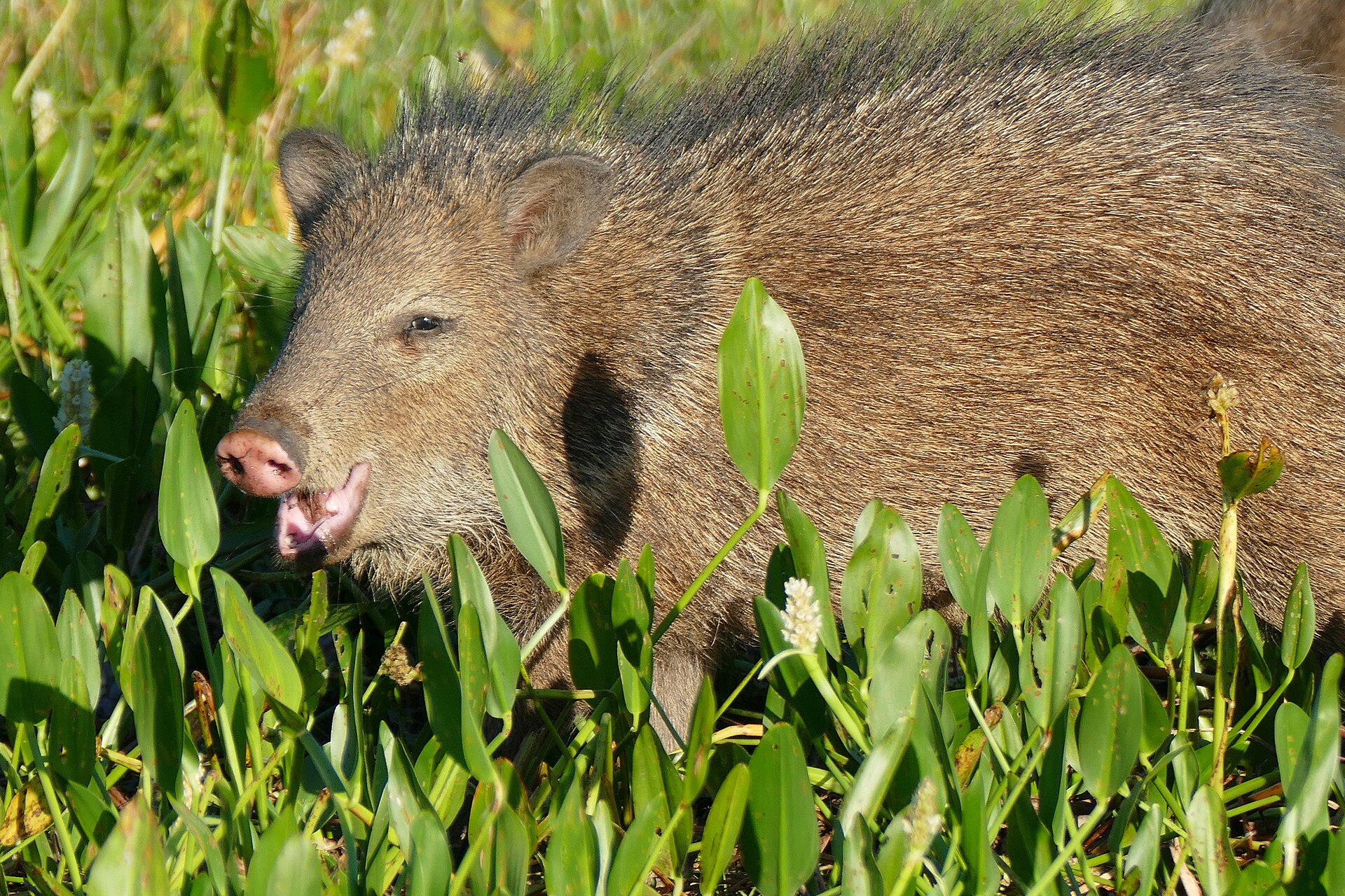
The reserve’s biodiversity and high endemism are especially associated with its high-mountain ecosystem and volcanic landscapes. Its wild flora and fauna have cultural, scientific, economic, and biological importance, making habitat protection a practical concern for visitors rather than just a designation on a map. Plan a low-impact outing: avoid disturbing vegetation, leave plants and other natural objects in place, and give wildlife space. The ecological description supports an interest in mountain habitats and volcanic landforms, but not a species checklist or a promise of particular sightings. Keep expectations focused on the environment as a whole. A careful visit should leave room to observe changes in vegetation and terrain without treating sensitive ground as an invitation to explore off established paths.
Rainfall and a working landscape
Average annual rainfall can amount to 2,000–5,000 millimetres, so wet-weather preparation belongs at the centre of a visit. Carry rain protection, protect essential gear from moisture, and allow flexibility when weather makes a mountain outing unsuitable. Annual rainfall totals do not identify a dependable dry window; check conditions close to departure rather than assuming a particular month will be clear. The reserve is also a working landscape. Coffee-growing, flower-growing, bee-keeping, agriculture, and tourism are among its human activities. Visitors should respect cultivated areas and avoid assuming that agricultural land provides public access to the volcano. Plan around both the fragility of the mountain ecosystems and the livelihoods present within the reserve, with access confirmed locally before setting out.
Sample itineraries
- Tacaná landscape and ecology visit · 1 day
Plan a day focused on Tacaná’s volcanic landscape and high-mountain ecosystems. Confirm suitable visitor areas and access with the managing agency before choosing an outing. Keep the schedule flexible for rain and avoid disturbing fragile vegetation.
- Mountain biodiversity and working landscapes · 2 days
Devote one day to observing the reserve’s mountain landscapes and another to learning about local coffee-growing, flower-growing or bee-keeping, if visits can be arranged. Confirm access and host availability beforehand; these activities are not established visitor attractions.
Seasonal conditions
Spring
Confirm local conditions before travel.
Spring-specific weather patterns are not established here. The reserve’s high-mountain setting and substantial annual rainfall warrant rain protection and a flexible outdoor plan.
Summer
Confirm local conditions before travel.
Do not assume clear weather for mountain outings. Annual rainfall can reach 2,000–5,000 millimetres, but that total does not establish summer rainfall or reliable access.
Fall
Confirm local conditions before travel.
Check current rain and mountain conditions rather than assuming fall is dry. Plan around the weather and protect equipment from moisture.
Winter
Confirm local conditions before travel.
Winter temperatures and access conditions are not established here. Bring adaptable layers for the high-mountain environment and verify conditions before committing to an outing.
| Season | Window | Conditions |
|---|---|---|
| Spring | Confirm local conditions before travel. | Spring-specific weather patterns are not established here. The reserve’s high-mountain setting and substantial annual rainfall warrant rain protection and a flexible outdoor plan. |
| Summer | Confirm local conditions before travel. | Do not assume clear weather for mountain outings. Annual rainfall can reach 2,000–5,000 millimetres, but that total does not establish summer rainfall or reliable access. |
| Fall | Confirm local conditions before travel. | Check current rain and mountain conditions rather than assuming fall is dry. Plan around the weather and protect equipment from moisture. |
| Winter | Confirm local conditions before travel. | Winter temperatures and access conditions are not established here. Bring adaptable layers for the high-mountain environment and verify conditions before committing to an outing. |
Permits, fees & closures
Confirm current entry requirements and permitted activities with the reserve’s managing agency.
Confirm current permits, fees, and closures with the managing agency before you go.
Hazards & regulations
- Substantial rainfall can leave visitors and equipment soaked; carry reliable rain protection.
- Wet ground can reduce footing. Choose outings suited to conditions and wear footwear with traction.
- High-mountain outings can be physically demanding. Match plans to fitness and allow time to turn back.
What to pack for Volcán Tacaná Biosphere Reserve
- Waterproof outer layer
- Adaptable insulating layers
- Dry storage for clothing and electronics
- Footwear with reliable traction
- Drinking water
- Food for the planned outing
- Basic first-aid kit
- Binoculars
- Camera
- Bag for carrying out all litter
Volcán Tacaná Biosphere Reserve FAQ
- Where is Volcán Tacaná Biosphere Reserve?
- The reserve surrounds Tacaná Volcano in Chiapas, Mexico, on the border with Guatemala. The volcano belongs to the Central America Volcanic Arc.
- What does the reserve protect?
- Its 6,378 hectares protect fragile ecosystems with rich biodiversity and high endemism, particularly in high-mountain environments. The volcanic landscape also has important geophysical features.
- Is a summit route described here?
- No specific summit route, trailhead or access point is established here. Ask the managing agency about appropriate routes and current conditions before planning a climb.
- What wildlife should visitors expect?
- The reserve supports a rich variety of wild flora and fauna, but individual species are not identified here. Focus on careful observation, keep your distance from animals and avoid disturbing vegetation.
- What human activities take place in the reserve?
- Coffee-growing, flower-growing, bee-keeping, agriculture and tourism occur within the reserve. Their presence does not imply public access; arrange any visits and obtain permission before entering working areas.
- What is the best season to visit?
- A reliable best-season recommendation cannot be made from the available climate detail. Annual rainfall can amount to 2,000–5,000 millimetres. Check local forecasts and access conditions before choosing dates.