


Reader rating
Rate it and you move it. Community ratings re-rank this product inside its Top 10 list.
Expert-picked, reader-ranked. Our editors choose the products and the launch order; member star ratings move picks up or down over time.
Sunny, mild desert days — perfect for the valley trails.
Pros
- Mild December temperatures eliminate extreme desert heat risks
- Extensive, exceptionally maintained trail networks across two distinct districts
- High-elevation backcountry in the Rincon Mountains offers genuine wilderness isolation
- Unmatched density of mature giant saguaro forests in the Tucson Mountain District
Cons
- No frontcountry or vehicle camping options within park boundaries
- Urban Tucson divides the park, requiring a 30- to 45-minute drive between units
- Cactus thorns and sharp caliche rock demand constant trail vigilance
Best uses
- Winter desert day hiking
- Cold-weather trail running
- Rugged backcountry winter backpacking
- Desert landscape photography
Specifications
- Location
- Southern Arizona, flanking Tucson
- Districts
- Tucson Mountain (West), Rincon Mountain (East)
- December Highs
- 65°F to 72°F
- December Lows
- 38°F to 44°F
- Backcountry Permits
- Required via Recreation.gov (East only)
- Drive-in Camping
- None within park boundaries
Best for
Winter desert day hiking, Cold-weather trail running, Rugged backcountry winter backpacking, Desert landscape photography
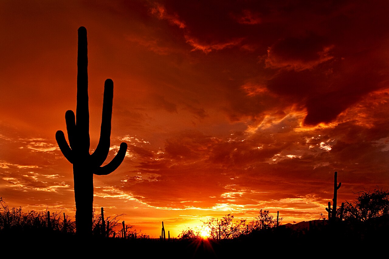
Split by Tucson, Saguaro National Park preserves two distinct expressions of the Sonoran Desert. The Tucson Mountain District in the west holds denser cactus forests and tighter wash networks, while the eastern Rincon Mountain District rises from valley floor scrub into high-elevation pine-oak woodlands above 8,000 feet. In summer, the heat can be dangerous, but December flips the script entirely. Daytime temperatures hover comfortably in the mid-sixties, turning what is often a survival exercise into one of the most accessible winter hiking destinations in the American Southwest. Winter conditions remove the oppressive desert heat, letting you log big trail days without carrying gallons of water per person. Clear skies dominate, humidity is near zero, and the low sun casts long shadows through the cactus spines early and late in the day. The trade-off is cold desert nights that easily dip toward freezing once the sun drops behind the Tucson Mountains. Because the park hugs the municipal edges of Tucson, it lacks the deep, unbroken isolation of Big Bend or Death Valley. You will hear city hum on lower trails, and you cannot camp from your vehicle inside either district. Even so, the sheer density of the columnar giants and the high-grade trail maintenance make it an unmatched cold-weather desert sanctuary.
Two Distinct Districts
Visitors often assume Saguaro is a single contiguous unit, but the park is split by thirty miles of Tucson city streets. Saguaro West, or the Tucson Mountain District, sits at a lower elevation and packs a much denser concentration of saguaros into a smaller footprint. It is ideal for short day hikes, sunset photographers, and visitors with limited time. Saguaro East, the Rincon Mountain District, is vastly larger, wilder, and climbs dramatically up to Mica Mountain at 8,666 feet. While the west district features fast access and dramatic vistas, the east holds true wilderness backcountry with distinct ecological life zones shifting from desert scrub to ponderosa pine. Linking both in a single weekend is common practice, but each demands a different tactical approach to route planning and time management.
Winter Weather Dynamics
December provides the most reliable hiking weather of the year in the Sonoran Desert. Average daytime highs hover between 65 and 70 degrees, meaning you can hike exposed ridgelines at noon without risking heat illness. The air is dry and visibility often extends dozens of miles across southern Arizona's basin-and-range landscape. However, radiant cooling after sunset is sudden. The moment the sun dips below the horizon, temperatures plunge thirty degrees within two hours, frequently settling in the mid-thirties by dawn. Packing requires breathable midlayers for midday ascents and proper thermal layers or down jackets for the trailheads. Occasional winter low-pressure systems can push through, dusting the high peaks of the Rincons with snow while dropping brief, cold rain showers across the desert floor.
Key Footpaths and Summits
For ambitious day hikers, the west district offers the King Canyon Trail to Wasson Peak, climbing roughly 1,700 vertical feet to the highest point in the Tucson Mountains. The summit offers an unobstructed panorama across the valley toward the Rincons, Santa Catalinas, and Baboquivari Peak. Over in the east district, the Douglas Spring Trail climbs out of the cactus forest into rugged foothill terrain, serving as the main western portal into the Rincon wilderness. For those keeping mileage short, the paved Desert Ecology Trail in the east and the Valley View Overlook Trail in the west give immediate access to desert flora without technical trail footwork. December footing is dry, loose decomposed granite, requiring supportive footwear with sticky rubber outsoles.
Backcountry Realities
Backcountry travel is exclusive to the Rincon Mountain District, where five designated wilderness campgrounds offer an escape from urban proximity. Manning Camp, situated near 8,000 feet, provides a dependable water source and an alpine cabin setting rarely associated with a saguaro park. Reaching these sites requires committing to grueling, uninterrupted climbs of four to six thousand feet of elevation gain over ten or more miles. In December, water is more reliable in backcountry springs than in summer, but flows remain seasonal and should never be assumed without consulting rangers. Reliable filtration is mandatory, as is cold-weather gear rated for freezing temperatures at altitude. Fires are restricted or prohibited depending on drought status, making efficient camp stoves critical for multi-day push routes.
Desert Hazards and Terrain
Even under pleasant December skies, the Sonoran Desert remains unforgiving to careless travelers. Jumping cholla, prickly pear, and catclaw acacia line every narrow singletrack; brushing against them often means pulling out pliers or a fine-toothed comb to extract barbed spines. Rattlesnakes are mostly dormant during cool winter mornings, but they will occasionally sun themselves on south-facing rocks during warm afternoons. Footing is dominated by sharp gravel, loose scree, and exposed caliche, which can grind down soft running shoes quickly. Dehydration remains a stealth threat because the low winter humidity wicks sweat away before you notice heavy exertion. Carrying at least two to three liters of water per person on moderate day hikes remains a sound baseline rule.
Access and Urban Interface
One operational hurdle is the lack of drive-in campgrounds within either district. Visitors must rely on private RV parks, nearby county parks like Gilbert Ray Campground in Tucson Mountain Park, or municipal hotels. Reaching either district requires navigating city roads or suburban parkways, meaning morning commutes can impact trailhead arrival times. Parking lots at popular west side trailheads like King Canyon fill early on winter weekends when locals take advantage of prime temperatures. Entrance passes are standard federal park passes, purchasable at the Red Hills or Rincon Mountain visitor centers. Because you are never far from town, cell coverage is generally strong in lower elevations, but drops quickly once you venture into interior Rincon canyons.
How we picked
We built this ranking from trip reports, agency data, permit records, and our editors' own time on the ground. 10 places made the final cut out of a much longer working list, and each one had to clear the same set of criteria before it earned a spot.
- Quality of the terrain
- Landscape, route variety, and whether the place rewards multiple days rather than one overlook.
- Season and weather windows
- How long the reliable window is, and how badly the shoulder seasons punish a bad forecast.
- Access and permits
- Trailhead logistics, permit odds, quotas, and how much lead time a trip realistically takes.
- Solitude vs. crowding
- How far you have to walk before the place feels like wilderness instead of a queue.
- Wildlife and ecology
- What you can reasonably expect to see, and what you have to plan around.
- Risk and skill required
- Navigation, water crossings, exposure, and rescue distance — stated plainly.
Saguaro National Park — frequently asked questions
- Is Saguaro National Park worth the trip?
- We rank it #7 in US Destinations in December. Sunny, mild desert days — perfect for the valley trails.
- Who is Saguaro National Park best for?
- Best for winter desert day hiking, cold-weather trail running, rugged backcountry winter backpacking and desert landscape photography. Standouts: mild december temperatures eliminate extreme desert heat risks and extensive, exceptionally maintained trail networks across two distinct districts.
- What are the drawbacks of Saguaro National Park?
- No frontcountry or vehicle camping options within park boundaries, Urban Tucson divides the park, requiring a 30- to 45-minute drive between units and Cactus thorns and sharp caliche rock demand constant trail vigilance.
- What are the key details for Saguaro National Park?
- Location: Southern Arizona, flanking Tucson · Districts: Tucson Mountain (West), Rincon Mountain (East) · December Highs: 65°F to 72°F · December Lows: 38°F to 44°F · Backcountry Permits: Required via Recreation.gov (East only)
- Two Distinct Districts — what should I know about the Saguaro National Park?
- Visitors often assume Saguaro is a single contiguous unit, but the park is split by thirty miles of Tucson city streets. Saguaro West, or the Tucson Mountain District, sits at a lower elevation and packs a much denser concentration of saguaros into a smaller footprint.
- Winter Weather Dynamics — what should I know about the Saguaro National Park?
- December provides the most reliable hiking weather of the year in the Sonoran Desert. Average daytime highs hover between 65 and 70 degrees, meaning you can hike exposed ridgelines at noon without risking heat illness.
Where on earth
Satellite imagery flying in from a world view to Saguaro National Park, Arizona, United States. Use the + / − buttons, or click the map to zoom with your scroll wheel; drag to pan and pinch to zoom on touch.
Saguaro National Park, Arizona, USA · 32.183, -110.613
Wildlife found around Saguaro National Park








Compare side by side
Put the Saguaro National Park against any other pick on this list — specs, price, pros, cons and reader ratings.