



Reader rating
Rate it and you move it. Community ratings re-rank this product inside its Top 10 list.
Expert-picked, reader-ranked. Our editors choose the products and the launch order; member star ratings move picks up or down over time.
A circuit for experienced wilderness navigators, this challenging loop stitches together the arid mesa tops south of the river with the deep gorge of the West Fork. Starting near the Gila Visitor Center, the route heads south and west on the Granny Mountain Trail (Trail 160). It climbs over exposed volcanic ridges and through juniper grasslands, offering unbroken lines of sight back across the entire Gila River basin. After cresting the slopes of Granny Mountain, the trail makes a technical drop through side canyons to link up with the West Fork Trail (Trail 151). The shift in environment is jarring: you trade dry, wind-scoured basalt rock for the perennial, shaded waters of the West Fork. Heading downstream, you navigate dozens of creek crossings beneath massive amphitheaters of gray tuff and red rhyolite, eventually completing the circuit back at the trailhead. This route demands strict water discipline during the Granny Mountain section. In spring or fall, that dry upland stretch can run hot and completely dry. It serves as an exceptional shoulder-season route precisely because its lower-to-mid elevation keeps it clear of snow long before the high crest melts out. **Highlights** - Mileage: 26 to 30 miles - Elevation change: Approximately 3,100 feet - Wide-open, expansive ridgeline views from Granny Mountain - Total seclusion on the upland trail segments - Re-entry into the canyon via the dramatic upper West Fork gorges **Watch-outs** - Long, continuous dry stretches on Trail 160 requiring heavy water carries - Trail markers and cairns can be sparse on rocky mesa tops - Significant sun exposure on the climb up Granny Mountain
Pros
- Dramatic ecological transition from arid mesa tops to lush canyon riparian zone
- Substantially less foot traffic than the classic Lower West Fork corridor
- Expansive, panoramic views across the Mogollon Range from upland ridges
- Reliable, abundant water and established gravel campsites along the river
Cons
- Demands a heavy, four-to-five-liter dry water carry over Granny Mountain
- Faint tread and sparse cairns require active, continuous wilderness navigation
- Dozens of cold river crossings cause persistent foot soak and gear wear
Best uses
- Experienced wilderness navigators
- Shoulder-season desert backpacking
- High-isolation canyon loops
- Rugged physical conditioning trips
Specifications
- Distance
- 26 to 30 miles
- Elevation Gain
- 3,100 feet
- Route Type
- Loop
- Trailhead
- Gila Visitor Center / Woody's Corral
- Permits
- Free self-issue at trailhead register
- Best Season
- April to May, October to November
- Difficulty
- Strenuous
Best for
Experienced wilderness navigators, Shoulder-season desert backpacking, High-isolation canyon loops, Rugged physical conditioning trips
The Granny Mountain to West Fork loop delivers one of the sharpest ecological contrasts in the Southwest. Leaving the Gila Visitor Center area, Trail 160 grinds up onto the sun-blasted volcanic tablelands south of the river, trading the lush riparian corridor for pinon-juniper scrub, basalt scree, and vast sightlines stretching toward the Mogollon Crest. It is an uncompromising upland route where shade is scarce and water sources are virtually nonexistent. After clearing the shoulder of Granny Mountain, the trail plunges down steep, brushy side drainages to intersect the West Fork of the Gila River along Trail 151. The environmental shift is immediate and dramatic. You drop out of baking chaparral directly into a cool, shadowed canyon flanked by towering rhyolite amphitheaters and ancient ponderosa pines. From there, the route follows the perennial river downstream, requiring dozens of wet crossings over polished river rock before closing the loop. This circuit demands respect because it forces you to manage two diametrically opposed backpacking challenges in a single trip. You must haul punishing water loads across arid, sun-drenched mesa tops, then transition immediately to all-day river wading where foot maceration and hypothermia become real concerns. For backpackers with proven route-finding skills and dialed-in foot systems, it offers profound solitude and some of the rawest backcountry terrain in New Mexico.
Terrain and Topography
The circuit begins on hardpacked volcanic dirt before ascending rough, fractured basalt ridges toward Granny Mountain. Tread on Trail 160 is frequently faint, littered with loose scree, and choked by mountain mahogany and scrub oak that scratch exposed shins. Once across the high divide, the drop toward the West Fork is steep, loose, and relentless, losing over a thousand feet in short order through unmaintained side ravines. Reaching the canyon floor changes the footing entirely. The West Fork corridor consists of cobble bars, sand flats, and slick bedrock shelves. You will negotiate constant transitions between dry riverbanks and knee-deep river channels, making stable footing and ankle protection critical when stepping blind into murky current.
Navigation and Route Finding
Do not expect well-defined tread or obvious signage along the upland portion of this loop. Trail 160 crosses open slickrock benches and cattle-grazed meadows where cairns are small, widely spaced, or knocked over by wildlife. Faint game trails easily decoy hikers off the ridge spine down into dead-end draws. Carrying an updated topographic map, a compass, and a reliable GPS device with offline tracks is non-negotiable. Once on Trail 151 in the West Fork canyon, primary navigation simplifies because the canyon walls hem you in, but locating optimal crossing points and tracking where the trail cuts across gravel bars still requires constant situational awareness and trail sense.
Water Strategy and Management
The primary objective hazard on this route is managing water across the Granny Mountain segment. Trail 160 is notoriously dry; intermittent springs and seasonal livestock tanks indicated on topo maps are frequently bone-dry, stagnant, or fouled by cattle. Plan to carry four to five liters per person from the start to bridge the full mesa traverse until reaching the West Fork. Once you hit Trail 151, the situation reverses entirely. The West Fork runs perennially with cold, clear water, giving you endless opportunities to hydrate and cook. Always treat or filter canyon water, as upstream wildlife and open-range livestock make giardia and cryptosporidium persistent risks throughout the Gila watershed.
Seasonal Windows and Weather
Shoulder seasons provide the only realistic window to hike this loop safely. Mid-spring, specifically April through early May, brings moderate daytime temperatures on the exposed ridges, though early runoff can turn river crossings swift and frigid. October through early November is arguably the prime window, featuring stable autumn weather, lower river flows, and vibrant golden cottonwoods along the canyon floor. Summer is dangerous due to triple-digit heat on the mesa and violent monsoon storms from July through August that trigger life-threatening flash floods in narrow gorges. Winter brings sub-freezing canyon nights, ice on river margins, and numb limbs during repeated deep wades.
River Crossings and Footwear
Navigating the West Fork requires dozens of wet river crossings, meaning your feet will stay soaked for the entire canyon descent. Attempting to strip off boots at every crossing is impractical and burns daylight. Instead, hike in breathable, fast-draining trail running shoes paired with synthetic or wool socks that retain warmth when wet. Neoprene booties are an excellent addition during chilly autumn mornings when mountain water numbs the toes. Trekking poles are essential tools for probing deep holes, balancing against pushy currents, and stabilizing your pack weight on mossy river stones. Keep a clean, dry pair of socks sealed in your sleep kit to prevent skin maceration at camp.
Wildlife and Wilderness Hazards
The stark transition between mesa and river bottom concentrates diverse wildlife throughout the corridor. Black bears frequent the canyon bottoms in autumn to forage on berries, while rattlesnakes are common on the sun-warmed rocky slopes of Granny Mountain from spring through fall. Store all food and scented items in certified bear canisters or hang them properly away from your tent. Outside of wildlife, physical hazards stem from rugged isolation. Cell service does not exist anywhere along this route. Self-rescue is grueling due to steep canyon topography and heavy brush, making a satellite communicator an indispensable piece of safety gear for emergency communication.
How we chose
We built this ranking from land-manager and agency sources, permit records and published trip reports. Each of the 10 places was compared against the same criteria below. This is desk research unless a pick is marked field tested.
- Quality of the terrain
- Landscape, route variety, and whether the place rewards multiple days rather than one overlook.
- Season and weather windows
- How long the reliable window is, and how badly the shoulder seasons punish a bad forecast.
- Access and permits
- Trailhead logistics, permit odds, quotas, and how much lead time a trip realistically takes.
- Solitude vs. crowding
- How far you have to walk before the place feels like wilderness instead of a queue.
- Wildlife and ecology
- What you can reasonably expect to see, and what you have to plan around.
- Risk and skill required
- Navigation, water crossings, exposure, and rescue distance — stated plainly.
Granny Mountain to West Fork Loop — frequently asked questions
- Is Granny Mountain to West Fork Loop worth the trip?
- We rank it #9 in Top 10 Gila Wilderness Loops. A circuit for experienced wilderness navigators, this challenging loop stitches together the arid mesa tops south of the river with the deep gorge of the West Fork. Starting near the Gila Visitor Center, the route heads south and west on the Granny Mountain Trail (Trail 160).
- Who is Granny Mountain to West Fork Loop best for?
- Best for experienced wilderness navigators, shoulder-season desert backpacking, high-isolation canyon loops and rugged physical conditioning trips. Standouts: dramatic ecological transition from arid mesa tops to lush canyon riparian zone and substantially less foot traffic than the classic lower west fork corridor.
- What are the drawbacks of Granny Mountain to West Fork Loop?
- Demands a heavy, four-to-five-liter dry water carry over Granny Mountain, Faint tread and sparse cairns require active, continuous wilderness navigation and Dozens of cold river crossings cause persistent foot soak and gear wear.
- What are the key details for Granny Mountain to West Fork Loop?
- Distance: 26 to 30 miles · Elevation Gain: 3,100 feet · Route Type: Loop · Trailhead: Gila Visitor Center / Woody's Corral · Permits: Free self-issue at trailhead register
- Terrain and Topography — what should I know about the Granny Mountain to West Fork Loop?
- The circuit begins on hardpacked volcanic dirt before ascending rough, fractured basalt ridges toward Granny Mountain. Tread on Trail 160 is frequently faint, littered with loose scree, and choked by mountain mahogany and scrub oak that scratch exposed shins.
- Navigation and Route Finding — what should I know about the Granny Mountain to West Fork Loop?
- Do not expect well-defined tread or obvious signage along the upland portion of this loop. Trail 160 crosses open slickrock benches and cattle-grazed meadows where cairns are small, widely spaced, or knocked over by wildlife.
Where on earth
Satellite imagery flying in from a world view to Granny Mountain to West Fork Loop, Arkansas, United States. Use the + / − buttons, or click the map to zoom with your scroll wheel; drag to pan and pinch to zoom on touch.
West Fork, AR 72774, USA · 35.931, -94.180
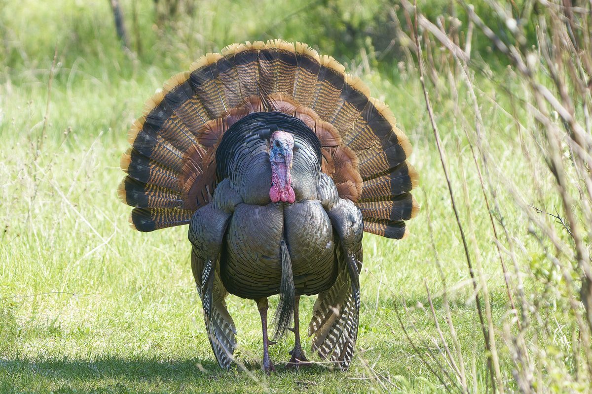
Wildlife found around Granny Mountain to West Fork Loop

Compare side by side
Put the Granny Mountain to West Fork Loop against any other pick on this list — specs, price, pros, cons and reader ratings.