



Reader rating
Rate it and you move it. Community ratings re-rank this product inside its Top 10 list.
Expert-picked, reader-ranked. Our editors choose the products and the launch order; member star ratings move picks up or down over time.
Positioned in the cooler, northern reaches of the wilderness near the old mining outpost of Willow Creek, this circuit showcases the Gila’s alpine transitions. Starting from the Iron Creek Trailhead, the route tracks Iron Creek Trail (Trail 171) through dense stands of Douglas-fir, aspen, and spruce—a landscape that looks more like the central Rockies than the desert Southwest. The route ties into the Lilley Park Trail (Trail 164) and descends toward the upper West Fork. The descent along the upper West Fork is one of the quietest river miles in the entire national forest. Unlike the lower canyon, the cliffs are less sheer, but the creek is crystalline, clear, and cold, surrounded by thick grassy benches and mature ponderosas. After cruising the river bottoms, you climb back out along connecting mesa trails to return to the northern trailhead. This loop has a much shorter shoulder season than the visitor-center loops. Spring access roads from Reserve or Mogollon can be snow-drifted and muddy well into May. Mid-to-late October is the sweet spot: the aspens light up the northern slopes, elk are bugling throughout the drainages, and the trails are free of summer brush. **Highlights** - Mileage: 23 to 27 miles - Elevation change: Approximately 2,900 feet - Rich spruce-fir and aspen forest ecosystems rarely seen in the southern Gila - Solitary backcountry trout streams on the upper West Fork - Incredible fall elk viewing and bugling across high parks **Watch-outs** - High elevation base (7,500+ feet) creates hard sub-freezing nights in shoulder months - Forest road access from Willow Creek can be impassable when wet or unplowed - Remote wilderness territory with zero cell coverage across the entire zone
Pros
- Spectacular fall foliage with dense stands of turning aspen
- World-class elk bugling and solitude during the autumn shoulder season
- Cold, clear stream crossings that stay far shallower than lower river canyons
- Rare alpine conifer ecosystems distinct from the rest of the Gila
Cons
- Unpaved access roads become severely compromised during rain or snow
- Sub-freezing overnight temperatures arrive early in the fall season
- Heavy blowdowns and faint trail tread can complicate navigation
Best uses
- Autumn aspen backpacking
- Solitary backcountry fly fishing
- Elk rut observation trips
- High-elevation summer hiking
Specifications
- Mileage
- 23 to 27 miles
- Elevation Range
- Approx. 7,300 to 9,100 feet
- Trailhead
- Iron Creek Trailhead
- Managing Agency
- Gila National Forest
- Permit Required
- Self-issue at trailhead register
- Difficulty
- Moderate to strenuous
Best for
Autumn aspen backpacking, Solitary backcountry fly fishing, Elk rut observation trips, High-elevation summer hiking
Tucked into the northern fringe of the Gila Wilderness near the historic outpost of Willow Creek, this loop trades the sun-blasted canyon benches of the southern trailheads for cool, dense timber. Leaving the Iron Creek Trailhead, the route cuts immediately into high-elevation mixed conifer, where thick stands of Douglas-fir, Engelmann spruce, and quaking aspen look far more like northern New Mexico or southern Colorado than typical southwestern backcountry. It is an alpine sanctuary that runs significantly cooler and wetter than the heavily visited river corridors near the Gila Cliff Dwellings. The descent off the high timbered plateau into the upper West Fork of the Gila River reveals one of the most secluded stream corridors in the Southwest. Unlike the sheer, narrow box canyons downstream, the upper river meanders through wide meadows, mature ponderosa flats, and open gravel bars fed by crystalline springs. After following the riverbed, the route ascends back through open mesa parks to complete the circuit. Isolation is the defining trait here. While the southern river forks draw casual day-trippers and weekend packs, the northern access roads deter casual travel. You will encounter genuine wilderness silence, brisk mountain nights, and long stretches where the only tracks on the trail belong to elk and black bears.
High Country Terrain
Starting well above seven thousand feet, this circuit traverses an ecological transition zone defined by steep drainages, volcanic soils, and moist north-facing slopes. Iron Creek Trail cuts through damp bottomlands crowded with ferns, alder, and towering Douglas-fir before climbing out onto dry pine benches and high meadows. The transition to Lilley Park and the subsequent descent into the upper West Fork requires negotiating rocky switchbacks and rolling plateau edges where ancient volcanic bedrock breaks through thin topsoil. Once along the river, the grade levels out considerably, tracing alluvial flats dotted with massive ponderosa pines and cobble bars. Elevation change is steady rather than technical, but sustained climbs out of the canyon test your legs on loose gravel and duff.
Weather and Season Windows
Because this loop sits significantly higher than the southern wilderness entrances, its operational window is narrow. Spring arrives late, often leaving deep drifts on shaded northern aspects and turning unpaved forest roads into impassable clay soup well into May. Summer brings welcome relief from desert heat, but afternoon monsoon storms between July and August routinely hammer the ridges with lightning, hail, and localized flash floods. The definitive sweet spot falls between late September and late October. By then, the monsoons have subsided, daytime temperatures hover in the comfortable sixties, and golden aspens contrast sharply against dark evergreen ridges. Overnight temperatures regularly plummet well below freezing by mid-autumn, demanding a reliable cold-weather sleep system.
Upper West Fork Waters
The upper reaches of the West Fork provide a completely different character than the lower river corridor. The water runs exceptionally clear, cold, and brisk, sustained by perennial high-country springs and shaded runs. River crossings are frequent along the canyon floor, but unless heavy monsoon runoff is actively pushing the gauge, the water rarely rises past mid-calf. This makes for straightforward wading compared to the powerful waist-deep currents found downstream in early spring. These isolated headwaters also serve as vital habitat for native trout populations. While water is plentiful through both Iron Creek and the West Fork, long stretches across the connecting mesas and parks are bone dry, requiring planned fills before making the climb out.
Wildlife Encounters
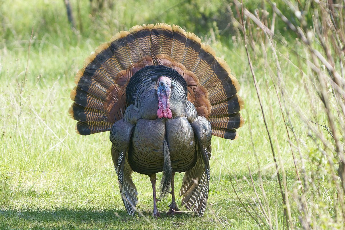
Solitude brings abundant wildlife, and this loop is prime territory for Rocky Mountain elk. During the autumn rut, bull bugles echo relentlessly across Lilley Park and down through the river bottom from dusk until well after sunrise. Black bears are common throughout the oak brush and berry thickets, foraging heavily before winter sets in; hard-sided bear canisters or methodical hangs are essential backcountry practice here. Cougar sign is frequently spotted along dusty segments of trail, though sightings remain rare. Birders will notice northern goshawks and Mexican spotted owls tucked into deep spruce pockets. The absence of heavy human traffic keeps animals behaving naturally, meaning quiet hikers often see wildlife right on the trail.
Logistics and Road Access
Reaching the Iron Creek Trailhead demands deliberate planning and a dependable vehicle. Access routes typically run via Reserve or across the harrowing, winding gravel of New Mexico Highway 159 through the ghost town of Mogollon toward Willow Creek. Winter storms and summer washouts regularly degrade these unpaved forest roads, leaving high-clearance four-wheel-drive vehicles as the only responsible choice. There are no services, reliable fuel stops, or tow operations within easy reach of the trailhead. Once on foot, wilderness permits are simple and free, obtained via self-registration at the trailhead kiosk. Cell phone coverage is entirely nonexistent throughout the basin, making a two-way satellite communicator a non-negotiable safety item for remote travel.
Route Finding and Hazards
Maintenance on northern wilderness trails is sporadic at best. Downed timber is an ongoing reality along Iron Creek and the connecting mesa segments, often requiring hikers to scramble over sprawling blowdowns or navigate detours through dense brush. Trail tread can fade completely where the route cuts across grassy parks or gravel stream bars, demanding comfort with topographic maps and basic navigation tools. Beyond the navigational hurdles, early freezes present a genuine hazard; wet wading shoes that do not dry in the afternoon sun will freeze solid overnight. Pack ample insulating layers, monitor changing weather systems closely, and carry extra trekking poles to maintain balance over slick river cobbles.
How we chose
We built this ranking from land-manager and agency sources, permit records and published trip reports. Each of the 10 places was compared against the same criteria below. This is desk research unless a pick is marked field tested.
- Quality of the terrain
- Landscape, route variety, and whether the place rewards multiple days rather than one overlook.
- Season and weather windows
- How long the reliable window is, and how badly the shoulder seasons punish a bad forecast.
- Access and permits
- Trailhead logistics, permit odds, quotas, and how much lead time a trip realistically takes.
- Solitude vs. crowding
- How far you have to walk before the place feels like wilderness instead of a queue.
- Wildlife and ecology
- What you can reasonably expect to see, and what you have to plan around.
- Risk and skill required
- Navigation, water crossings, exposure, and rescue distance — stated plainly.
Iron Creek to West Fork Mesa Loop — frequently asked questions
- Is Iron Creek to West Fork Mesa Loop worth the trip?
- We rank it #8 in Top 10 Gila Wilderness Loops. Positioned in the cooler, northern reaches of the wilderness near the old mining outpost of Willow Creek, this circuit showcases the Gila’s alpine transitions. Starting from the Iron Creek Trailhead, the route tracks Iron Creek Trail (Trail 171) through dense stands of Douglas-fir, aspen, and spruce—a landscape that…
- Who is Iron Creek to West Fork Mesa Loop best for?
- Best for autumn aspen backpacking, solitary backcountry fly fishing, elk rut observation trips and high-elevation summer hiking. Standouts: spectacular fall foliage with dense stands of turning aspen and world-class elk bugling and solitude during the autumn shoulder season.
- What are the drawbacks of Iron Creek to West Fork Mesa Loop?
- Unpaved access roads become severely compromised during rain or snow, Sub-freezing overnight temperatures arrive early in the fall season and Heavy blowdowns and faint trail tread can complicate navigation.
- What are the key details for Iron Creek to West Fork Mesa Loop?
- Mileage: 23 to 27 miles · Elevation Range: Approx. 7,300 to 9,100 feet · Trailhead: Iron Creek Trailhead · Managing Agency: Gila National Forest · Permit Required: Self-issue at trailhead register
- High Country Terrain — what should I know about the Iron Creek to West Fork Mesa Loop?
- Starting well above seven thousand feet, this circuit traverses an ecological transition zone defined by steep drainages, volcanic soils, and moist north-facing slopes. Iron Creek Trail cuts through damp bottomlands crowded with ferns, alder, and towering Douglas-fir before climbing out onto dry pine benches and high…
- Weather and Season Windows — what should I know about the Iron Creek to West Fork Mesa Loop?
- Because this loop sits significantly higher than the southern wilderness entrances, its operational window is narrow. Spring arrives late, often leaving deep drifts on shaded northern aspects and turning unpaved forest roads into impassable clay soup well into May.
Where on earth
Satellite imagery flying in from a world view to Iron Creek to West Fork Mesa Loop, Arkansas, United States. Use the + / − buttons, or click the map to zoom with your scroll wheel; drag to pan and pinch to zoom on touch.
West Fork, AR 72774, USA · 35.931, -94.180
Wildlife found around Iron Creek to West Fork Mesa Loop

Compare side by side
Put the Iron Creek to West Fork Mesa Loop against any other pick on this list — specs, price, pros, cons and reader ratings.