


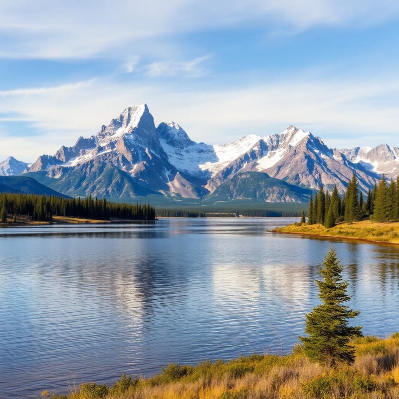
The Gila Wilderness—designated in 1924 as the world’s first protected wilderness area—remains one of the most rugged, water-sculpted landscapes in the American Southwest. Encompassing over 550,000 acres of southwestern New Mexico, the terrain swings from high pine-clad ridges above 10,000 feet to incised volcanic gorges where rivers cut through hundreds of feet of rhyolite and basalt. It is a land shaped by contradictory forces: geothermal springs feeding chilly mountain flows, baking exposed mesa tops giving way to lush cottonwood bottoms, and catastrophic fire scars sitting adjacent to old-growth ponderosa forests. Shoulder seasons (March through May, and late September through November) are the prime windows for backpacking here. Summer brings monsoons, flash floods, and brutal canyon heat, while midwinter freezes the high Mogollon crest and turns frequent river crossings into hypothermia traps. Spring brings snowmelt that fuels the rivers and geothermal pools, though it can turn ankle-deep wades into waist-deep torrents. Fall offers stable, crisp weather, golden cottonwood canopies, and predictable river levels, making it the most forgiving window for route planning. Selecting a true loop in the Gila requires careful navigation. The trail system is vast, but trail maintenance varies drastically due to recent burns and remote terrain. The routes below prioritize dependable canyon water sources, strategic hot spring stops, and realistic route viability when the desert shoulder seasons arrive.
Quick picks


Rank this list
Loading community ratings… Ratings re-order the picks — they never change which products make the list.
Sign in to add your own ratings — it's free.
- Pros
- Thermal soaking pool positioned midway through a classic wilderness canyon
- Towering volcanic rhyolite walls deliver unmatched backcountry scenery
- Continuous water source eliminates the need to carry heavy multi-day fluid weight
- No permit quotas or competitive advance reservation systems required
Cons- Constant fording guarantees soaking wet footwear for multiple days
- Heavy campsite competition near the hot springs on shoulder-season weekends
- Spring snowmelt runoff and summer monsoons create serious flash flood risks
Key features- Distance
- 12 to 14 miles loop
- Elevation Change
- 1,200 feet gain and loss
- Water Fords
- 25 to 30 river crossings
- Permit
- Free, self-issued at trailhead
- Difficulty
- Moderate to strenuous
- Primary Trailhead
- TJ Corral Trailhead
Best forShoulder-season three-day loops, Thermal soak recovery trips, Intermediate canyon backpacking, Southwestern river trek training
Pros- Thermal soaking pool positioned midway through a classic wilderness canyon
- Towering volcanic rhyolite walls deliver unmatched backcountry scenery
- Continuous water source eliminates the need to carry heavy multi-day fluid weight
- No permit quotas or competitive advance reservation systems required
Cons- Constant fording guarantees soaking wet footwear for multiple days
- Heavy campsite competition near the hot springs on shoulder-season weekends
- Spring snowmelt runoff and summer monsoons create serious flash flood risks
Assessed by Wild10 Editorial Team against our ranking criteria.No ratings yet - Pros
- Connects both major forks of the Gila River into a complete wilderness survey
- Exceptional solitude and sprawling campsites throughout The Meadows
- Direct trail access to Jordan Hot Springs on the return trek
- Vivid contrast between steep volcanic gorges and quiet pine parklands
Cons- Dozens of deep crossings make foot maceration and cold water exposure constant risks
- Post-burn blowdown and faint tread complicate travel through the high connector trail
- Canyon bottoms act as cold-air sinks with freezing late-season night temperatures
Key features- Distance
- 36 to 42 miles (route dependent)
- Elevation Gain
- Approx. 3,200 feet total
- Route Type
- Semi-loop / Connector circuit
- Trailheads
- Gila Visitor Center / TJ Corral
- Permits
- Free self-registration at trailhead
- Crossings
- 80+ river wades
Best forAutumn wilderness expeditions, Experienced off-grid navigators, Endurance-oriented multi-day trekkers, Remote backcountry hot-spring loops
Pros- Connects both major forks of the Gila River into a complete wilderness survey
- Exceptional solitude and sprawling campsites throughout The Meadows
- Direct trail access to Jordan Hot Springs on the return trek
- Vivid contrast between steep volcanic gorges and quiet pine parklands
Cons- Dozens of deep crossings make foot maceration and cold water exposure constant risks
- Post-burn blowdown and faint tread complicate travel through the high connector trail
- Canyon bottoms act as cold-air sinks with freezing late-season night temperatures
Assessed by Wild10 Editorial Team against our ranking criteria.No ratings yet - Pros
- Truly primitive hot springs with zero commercial infrastructure
- High level of backcountry solitude compared to popular Gila forks
- Dynamic contrast between lush canyon bottom and arid ridge walking
- Exceptional fall weather window with manageable water levels
Cons- Requires high-clearance 4WD and a river ford to reach the trailhead
- Challenging off-trail boulder scrambling over slick, wet bedrock
- Complete absence of water sources along the Skeleton Ridge return
Key features- Distance
- 18 to 22 miles
- Elevation Gain
- 2,500 to 3,000 feet
- Route Type
- Rugged semi-loop
- Land Manager
- Gila National Forest
- Best Window
- October to mid-November
- Trailhead Access
- High-clearance 4WD with river ford
Best forExperienced desert canyon backpackers, Fall shoulder-season wilderness treks, Primitive hot spring seekers, Self-reliant off-trail navigators
Pros- Truly primitive hot springs with zero commercial infrastructure
- High level of backcountry solitude compared to popular Gila forks
- Dynamic contrast between lush canyon bottom and arid ridge walking
- Exceptional fall weather window with manageable water levels
Cons- Requires high-clearance 4WD and a river ford to reach the trailhead
- Challenging off-trail boulder scrambling over slick, wet bedrock
- Complete absence of water sources along the Skeleton Ridge return
Assessed by Wild10 Editorial Team against our ranking criteria.No ratings yet - Pros
- Substantially less foot traffic than the neighboring Middle Fork corridor
- Dramatic scenery shift between river canyon walls and ponderosa plateau meadows
- Historic log-built Prior Cabin offers an authentic glimpse into wilderness history
- Pristine, pine-cushioned backcountry campsites throughout the high country
Cons- Water on the upper mesa is seasonal, unreliable, and often stagnant
- Extensive deadfall and downed timber slow travel across plateau trails
- Spring river crossings can be swift, cold, and challenging during snowmelt
Key features- Total Distance
- 24 to 28 miles depending on side trips
- Elevation Gain
- Approximately 2,800 feet
- Route Type
- Lollipop loop
- Starting Point
- West Fork Trailhead near Gila Visitor Center
- Optimal Seasons
- Late April to May, late September to October
- Permit Requirement
- Free self-issue registration at trailhead
Best forThree-day shoulder-season wilderness loops, Backcountry historical exploration, Solitude-focused canyon backpacking, Self-reliant desert-mountain trekking
Pros- Substantially less foot traffic than the neighboring Middle Fork corridor
- Dramatic scenery shift between river canyon walls and ponderosa plateau meadows
- Historic log-built Prior Cabin offers an authentic glimpse into wilderness history
- Pristine, pine-cushioned backcountry campsites throughout the high country
Cons- Water on the upper mesa is seasonal, unreliable, and often stagnant
- Extensive deadfall and downed timber slow travel across plateau trails
- Spring river crossings can be swift, cold, and challenging during snowmelt
Assessed by Wild10 Editorial Team against our ranking criteria.No ratings yet - Pros
- Complete wilderness solitude far from heavily trafficked hot spring corridors
- Stunning, dramatic geology with towering volcanic cliffs and sheer canyon boxes
- Cold, perennial waters hosting rare native Gila trout populations
- Demanding, authentic backcountry route-finding test for veteran hikers
Cons- Deadly flash flood risk inside Mogollon Box during summer monsoon months
- Extremely faint and eroded tread requires persistent route-finding
- Brutal, unshaded elevation gain over loose scree and crumbling rock
Key features- Distance
- 20 to 24 miles depending on route
- Elevation Gain
- Over 4,000 feet of climbing
- Difficulty
- Very strenuous
- Best Window
- April to May or October
- Land Manager
- Gila National Forest
- Permit
- Self-issue at trailhead, free
Best forExperienced desert canyon backpacking, Late spring wilderness treks, Solitude-focused remote expeditions, Backcountry native trout angling
Pros- Complete wilderness solitude far from heavily trafficked hot spring corridors
- Stunning, dramatic geology with towering volcanic cliffs and sheer canyon boxes
- Cold, perennial waters hosting rare native Gila trout populations
- Demanding, authentic backcountry route-finding test for veteran hikers
Cons- Deadly flash flood risk inside Mogollon Box during summer monsoon months
- Extremely faint and eroded tread requires persistent route-finding
- Brutal, unshaded elevation gain over loose scree and crumbling rock
Assessed by Wild10 Editorial Team against our ranking criteria.No ratings yet - Pros
- Spectacular transitions from sheer canyon slots to alpine summits
- Panoramic 100-mile views stretching west into Arizona from the crest
- Absolute backcountry solitude once past the developed day-use area
- Direct trail access to Whitewater Baldy, the Gila's highest point
Cons- Brutal deadfall and heavy brush make ridge navigation exceptionally slow
- High lightning exposure along the Mogollon Crest during summer monsoons
- Scarce and unreliable water sources across the upper high-elevation miles
Key features- Route Type
- Semiloop or loop
- Distance
- 22 to 26 miles
- Elevation Gain
- 4,500+ feet
- High Point
- 10,895 feet (Whitewater Baldy)
- Trailhead
- Catwalk Recreation Area
- Best Season
- Late September to mid-October
Best forRugged fall peak bagging, Experienced desert mountain traversing, Challenging off-trail wilderness navigation
Pros- Spectacular transitions from sheer canyon slots to alpine summits
- Panoramic 100-mile views stretching west into Arizona from the crest
- Absolute backcountry solitude once past the developed day-use area
- Direct trail access to Whitewater Baldy, the Gila's highest point
Cons- Brutal deadfall and heavy brush make ridge navigation exceptionally slow
- High lightning exposure along the Mogollon Crest during summer monsoons
- Scarce and unreliable water sources across the upper high-elevation miles
Assessed by Wild10 Editorial Team against our ranking criteria.No ratings yet - Pros
- Accessible earlier in spring than high-elevation crest routes
- Sweeping views across the southern Gila Wilderness and Black Range
- Direct trail access to Jordan Hot Springs for a backcountry soak
- Dynamic landscape shift from arid volcanic ridges to lush river canyon
Cons- Zero water sources along the steep climb and ridge traverse
- Trail 161 is heavily brushed with aggressive catclaw and scrub oak
- Dozens of river crossings require constant wet-foot hiking
Key features- Trailhead
- Woody's Corral Trailhead
- Distance
- 19 to 22 miles
- Elevation Gain
- Approximately 2,600 feet
- Route Type
- Semi-loop with connector trails
- Best Season
- Late March to May, October to November
- Jurisdiction
- Gila National Forest, Wilderness Ranger District
Best forShoulder-season desert backpacking, Weekend wilderness loop routes, Hikers seeking thermal springs, Mixed canyon and ridge hiking
Pros- Accessible earlier in spring than high-elevation crest routes
- Sweeping views across the southern Gila Wilderness and Black Range
- Direct trail access to Jordan Hot Springs for a backcountry soak
- Dynamic landscape shift from arid volcanic ridges to lush river canyon
Cons- Zero water sources along the steep climb and ridge traverse
- Trail 161 is heavily brushed with aggressive catclaw and scrub oak
- Dozens of river crossings require constant wet-foot hiking
Assessed by Wild10 Editorial Team against our ranking criteria.No ratings yet - Pros
- Spectacular fall foliage with dense stands of turning aspen
- World-class elk bugling and solitude during the autumn shoulder season
- Cold, clear stream crossings that stay far shallower than lower river canyons
- Rare alpine conifer ecosystems distinct from the rest of the Gila
Cons- Unpaved access roads become severely compromised during rain or snow
- Sub-freezing overnight temperatures arrive early in the fall season
- Heavy blowdowns and faint trail tread can complicate navigation
Key features- Mileage
- 23 to 27 miles
- Elevation Range
- Approx. 7,300 to 9,100 feet
- Trailhead
- Iron Creek Trailhead
- Managing Agency
- Gila National Forest
- Permit Required
- Self-issue at trailhead register
- Difficulty
- Moderate to strenuous
Best forAutumn aspen backpacking, Solitary backcountry fly fishing, Elk rut observation trips, High-elevation summer hiking
Pros- Spectacular fall foliage with dense stands of turning aspen
- World-class elk bugling and solitude during the autumn shoulder season
- Cold, clear stream crossings that stay far shallower than lower river canyons
- Rare alpine conifer ecosystems distinct from the rest of the Gila
Cons- Unpaved access roads become severely compromised during rain or snow
- Sub-freezing overnight temperatures arrive early in the fall season
- Heavy blowdowns and faint trail tread can complicate navigation
Assessed by Wild10 Editorial Team against our ranking criteria.No ratings yet - Pros
- Dramatic ecological transition from arid mesa tops to lush canyon riparian zone
- Substantially less foot traffic than the classic Lower West Fork corridor
- Expansive, panoramic views across the Mogollon Range from upland ridges
- Reliable, abundant water and established gravel campsites along the river
Cons- Demands a heavy, four-to-five-liter dry water carry over Granny Mountain
- Faint tread and sparse cairns require active, continuous wilderness navigation
- Dozens of cold river crossings cause persistent foot soak and gear wear
Key features- Distance
- 26 to 30 miles
- Elevation Gain
- 3,100 feet
- Route Type
- Loop
- Trailhead
- Gila Visitor Center / Woody's Corral
- Permits
- Free self-issue at trailhead register
- Best Season
- April to May, October to November
Best forExperienced wilderness navigators, Shoulder-season desert backpacking, High-isolation canyon loops, Rugged physical conditioning trips
Pros- Dramatic ecological transition from arid mesa tops to lush canyon riparian zone
- Substantially less foot traffic than the classic Lower West Fork corridor
- Expansive, panoramic views across the Mogollon Range from upland ridges
- Reliable, abundant water and established gravel campsites along the river
Cons- Demands a heavy, four-to-five-liter dry water carry over Granny Mountain
- Faint tread and sparse cairns require active, continuous wilderness navigation
- Dozens of cold river crossings cause persistent foot soak and gear wear
Assessed by Wild10 Editorial Team against our ranking criteria.No ratings yet - Pros
- Bypasses numerous lower-river crossings during cold spring runoff
- Fast, smooth walking across scenic high-plateau grasslands
- Dramatic visual contrast dropping from open mesa into sheer canyon walls
- Direct, efficient backcountry access to Jordan Hot Springs
Cons- Zero water sources along the exposed mesa section
- Steep, loose scree descent off the rim demands careful footing
- High flash-flood hazard inside the Little Bear Canyon slot section
Key features- Total Distance
- 16 to 19 miles depending on river exit
- Elevation Change
- Approximately 1,800 feet
- Route Type
- Semi-loop / balloon route
- Difficulty
- Moderate
- Primary Management
- Gila National Forest, Wilderness District
- Optimal Seasons
- April to May, September to November
Best forEarly spring wilderness backpacking, Shoulder-season hot spring trips, High-water river bypass itineraries, Fast-paced canyon loop treks
Pros- Bypasses numerous lower-river crossings during cold spring runoff
- Fast, smooth walking across scenic high-plateau grasslands
- Dramatic visual contrast dropping from open mesa into sheer canyon walls
- Direct, efficient backcountry access to Jordan Hot Springs
Cons- Zero water sources along the exposed mesa section
- Steep, loose scree descent off the rim demands careful footing
- High flash-flood hazard inside the Little Bear Canyon slot section
Assessed by Wild10 Editorial Team against our ranking criteria.No ratings yet


Compare all 10 picks at a glance
Editorial ranking, what each pick is best at, and how we assessed it. Tap a name to jump to the full write-up.
| # | Pick | Best for | Key spec | Evidence |
|---|---|---|---|---|
| 1 | Middle Fork to Little Bear Canyon Loop Gila Wilderness, New Mexico | Shoulder-season three-day loops | Distance: 12 to 14 miles loop | Research only |
| 2 | The Meadows via West Fork and Middle Fork Gila Wilderness, New Mexico | Autumn wilderness expeditions | Distance: 36 to 42 miles (route dependent) | Research only |
| 3 | Turkey Creek Hot Springs Loop Gila Wilderness, New Mexico | Experienced desert canyon backpackers | Distance: 18 to 22 miles | Research only |
| 4 | West Fork to Prior Cabin and Woodland Park Gila Wilderness, New Mexico | Three-day shoulder-season wilderness loops | Total Distance: 24 to 28 miles depending on side trips | Research only |
| 5 | Rain Creek to Mogollon Creek Loop Gila Wilderness, New Mexico | Experienced desert canyon backpacking | Distance: 20 to 24 miles depending on route | Research only |
| 6 | Whitewater Creek to Crest Trail Loop Gila Wilderness, New Mexico | Rugged fall peak bagging | Route Type: Semiloop or loop | Research only |
| 7 | Jerky Mountain to Middle Fork Loop Gila Wilderness, New Mexico | Shoulder-season desert backpacking | Trailhead: Woody's Corral Trailhead | Research only |
| 8 | Iron Creek to West Fork Mesa Loop Gila Wilderness, New Mexico | Autumn aspen backpacking | Mileage: 23 to 27 miles | Research only |
| 9 | Granny Mountain to West Fork Loop Gila Wilderness, New Mexico | Experienced wilderness navigators | Distance: 26 to 30 miles | Research only |
| 10 | Aeroplane Mesa to Little Bear Canyon Loop Gila Wilderness, New Mexico | Early spring wilderness backpacking | Total Distance: 16 to 19 miles depending on river exit | Research only |
How we chose
Last updated
Ranked by Wild10 Editorial Team, Research desk
We built this ranking from land-manager and agency sources, permit records and published trip reports. Each of the 10 places was compared against the same criteria below. This is desk research unless a pick is marked field tested.
- Quality of the terrain
- Landscape, route variety, and whether the place rewards multiple days rather than one overlook.
- Season and weather windows
- How long the reliable window is, and how badly the shoulder seasons punish a bad forecast.
- Access and permits
- Trailhead logistics, permit odds, quotas, and how much lead time a trip realistically takes.
- Solitude vs. crowding
- How far you have to walk before the place feels like wilderness instead of a queue.
- Wildlife and ecology
- What you can reasonably expect to see, and what you have to plan around.
- Risk and skill required
- Navigation, water crossings, exposure, and rescue distance — stated plainly.
How often we recheck this: Reviewed on a rolling basis and rechecked at least once a year, or sooner if a pick is discontinued, revised, or beaten by something new.
Best of the Best · Head to Head
Middle Fork to Little Bear Canyon Loop vs The Meadows via West Fork and Middle Fork
#1 vs #2 — side-by-side specs, pros & cons, and the final verdict.
Compare any two picks
Build your own side-by-side
Choose any two of these 10 picks and compare specs, price, pros, cons and reader ratings.
Topic summary
Proven multi-day circuits through New Mexico’s premier wilderness, balancing canyon river crossings, hidden hot springs, and shoulder-season viability.
Key takeaways
- #1 Middle Fork to Little Bear Canyon Loop — Gila Wilderness, New Mexico
- #2 The Meadows via West Fork and Middle Fork — Gila Wilderness, New Mexico
- #3 Turkey Creek Hot Springs Loop — Gila Wilderness, New Mexico
- #4 West Fork to Prior Cabin and Woodland Park — Gila Wilderness, New Mexico
- #5 Rain Creek to Mogollon Creek Loop — Gila Wilderness, New Mexico
- #6 Whitewater Creek to Crest Trail Loop — Gila Wilderness, New Mexico
Intended uses
Places
Verification notes
Editorial ranked list, 10 entries. Evidence mix — 10 research only. Buy links open the maker or a retailer search.
Best top 10 gila wilderness loops for a specific job
Skip the ranking — jump to the pick that matches how you actually use it.
- Best for shoulder-season three-day loops
- #1 Middle Fork to Little Bear Canyon Loop — Gila Wilderness, New MexicoThis is the signature weekend loop in the Gila Wilderness, packing towering canyon walls, dozens of river wades, and natural thermal soaking into a manageable sub-15-mile footprint. Starting at the TJ Corral Trailhead near the Gila Cliff Dwellings National Monument, the route ascends a sun-baked bench before plunging into the cool, slot-like narrows of Little Bear Canyon. When Little Bear hits the Middle Fork of the Gila River, the walls flare open to expose massive rhyolite spires and lush gravel bars. Jordan Hot Springs sits roughly halfway through the circuit. The pool hovers around 94 degrees Fahrenheit—lukewarm compared to high-temp tubs, but ideal for a long recovery soak after hours of wet-boot hiking. Continuing downstream along the Middle Fork River Trail (Trail 157), you negotiate roughly 25 to 30 river crossings between the spring and the Visitor Center. Each crossing ranges from mid-calf to thigh-deep depending on spring runoff. Shoulder seasons present opposing dynamics here. October and early November offer reliable knee-deep water, vibrant yellow cottonwood leaves, and minimal flash flood risk. April and May are warmer, but heavy high-country snowmelt can push river crossings past the safety threshold. Monitor the USGS Gila River discharge gauge near Gila before committing to the river canyon. **Highlights** - Mileage: 12 to 14 miles round-trip - Elevation change: Approximately 1,200 feet - Jordan Hot Springs soaking pool nestled beneath rock alcoves - Dramatic transition through the Little Bear Canyon narrows - Plentiful dispersed gravel-bar campsites shaded by boxelders and ponderosas **Watch-outs** - 30+ river crossings requiring dedicated drainage footwear and neoprene socks - High spring runoff can turn calm fords into dangerous waist-deep currents - High campsite competition near Jordan Hot Springs on spring and fall weekendsRead the full profile
- Best for autumn wilderness expeditions
- #2 The Meadows via West Fork and Middle Fork — Gila Wilderness, New MexicoFor backpackers seeking a comprehensive multi-day expedition that covers the full character of the central Gila, this grand circuit connects the West Fork and Middle Fork drainages via a high traverse at The Meadows. Departing from the Gila Visitor Center, the loop follows the West Fork Trail (Trail 151) upstream through dramatic cutbanks and sheer volcanic cliffs before ascending out of the canyon toward Lilley Park and dropping into the wide, grassy valley known as The Meadows. From The Meadows, you pick up the Middle Fork Trail (Trail 157) and follow it downstream all the way back to the start, passing Jordan Hot Springs on the final leg. This route links over 50 miles of trail and requires more than 80 river crossings, making constant wet-foot travel an unavoidable reality. The reward is total immersion: you transition from narrow river corridors up through ponderosa parklands, across high pine flats, and back down into geothermal alcoves. Early fall is the premier window for this route. Spring snows can linger across Lilley Mountain and the high connector trails, masking tread and creating icy deadfall. By mid-October, the upper plateau is crisp, daytime temperatures in the canyons are mild, and river flows are manageable. **Highlights** - Mileage: 36 to 42 miles depending on junction choices - Elevation change: Approximately 3,200 feet - Complete survey of both major forks of the Gila River - Solitude in the expansive, grassy flat of The Meadows - Integration of Jordan Hot Springs on the return leg **Watch-outs** - Over 80 total river crossings across the itinerary - Trail tread through Lilley Park can be obscured by post-fire grass and fallen pine - Bitter cold drainage temperatures in the deep canyons during late October nightsRead the full profile
- Best for experienced desert canyon backpackers
- #3 Turkey Creek Hot Springs Loop — Gila Wilderness, New MexicoLocated on the southwestern margin of the Gila Wilderness near the town of Cliff, Turkey Creek offers a rougher, less manicured alternative to the developed trails near the visitor center. The route combines the Turkey Creek Trail (Trail 155) with portions of the Skeleton Ridge Trail or high mesa cattle paths to construct an aggressive shoulder-season loop. Turkey Creek itself runs through an incised, boulder-choked volcanic gorge that demands route-finding and hand-over-foot rock scrambling. The real prize is Turkey Creek Hot Springs, an unmaintained, primitive collection of rock-walled pools built directly into the canyon floor. Water temperatures can push 105 degrees Fahrenheit at the main source, requiring bathers to adjust stone walls to let in cold creek water for balance. Unlike Jordan Hot Springs, reaching Turkey Creek requires true canyon scrambling along slick, water-polished bedrock. Spring runoff often renders the lower gorge impassable, making autumn the definitive choice here. Even in low water, the trail vanishes frequently into gravel banks and thorny willow thickets. A high return along Skeleton Ridge gives massive panoramas of the Mogollon Range, but carries zero water—carry sufficient supply when climbing out of the canyon. **Highlights** - Mileage: 18 to 22 miles - Elevation change: 2,500 to 3,000 feet - Truly primitive hot springs with adjustable thermal soaking pools - Intensely rugged canyon topography with minimal trail development - Sweeping ridgeline perspectives of the outer Mogollon mountains **Watch-outs** - 4WD high-clearance vehicle required to reach the river-crossing trailhead - Unmarked scrambles over wet boulders with significant slip hazards - Skeleton Ridge section is entirely dry; cache or carry enough water for the climbRead the full profile
- Best for three-day shoulder-season wilderness loops
- #4 West Fork to Prior Cabin and Woodland Park — Gila Wilderness, New MexicoThis circuit trades the heavy canyon foot traffic of the lower Middle Fork for the elevated ponderosa forests and historic homestead lands of the central wilderness. Starting along the West Fork Trail (Trail 151), you hike deep into the canyon past white volcanic ash formations and sheer rock overhangs before turning north up Woodland Park Trail (Trail 207). The trail climbs steeply out of the bottomland to the undulating ponderosa and Douglas-fir forests of Woodland Park and the historic site of Prior Cabin. Prior Cabin serves as an evocative mid-trip marker, showcasing early 20th-century forest service and ranching survival in the Gila interior. From here, the route loops back via Lilley Park or the Prior Creek drainage before descending back to the West Fork. The elevation changes yield a stark ecological contrast: you wake up to cottonwood leaves floating downstream in canyon pools and finish the afternoon walking pine-needle beds at 7,500 feet. Shoulder-season timing requires attention to seasonal water points. While the West Fork never dries, creeks on the upper mesa like Prior Creek can reduce to stagnant pools by late May or freeze solid by mid-November. Fall trips should pack a reliable filter and check recent ranger reports on high-country springs. **Highlights** - Mileage: 24 to 28 miles - Elevation change: Approximately 2,800 feet - Historic log-built Prior Cabin site and upland meadow systems - Lower West Fork river canyon with fewer crowds than the Middle Fork - High-canopy ponderosa forests offering soft, pine-cushioned camps **Watch-outs** - Water availability dries up rapidly once above the West Fork canyon rim - Ridgetop trail sections contain significant deadfall from legacy fires - Spring mornings above 7,000 feet frequently dip well below freezingRead the full profile
- Best for experienced desert canyon backpacking
- #5 Rain Creek to Mogollon Creek Loop — Gila Wilderness, New MexicoIf you want the raw, punishing heart of the southern Mogollon Mountains without the tourist traffic, the Rain Creek to Mogollon Creek circuit is unmatched. Starting from the Rain Creek Trailhead near Glenwood, this loop uses Trail 189 and Trail 153 to plunge into deep, isolated canyons and climb punishing volcanic divides below 74 Mountain and the Mogollon Crest. There are no developed thermal tubs here—just steep scree, steep water, and severe solitude. Mogollon Creek is a formidable mountain stream carving through an immense, steep-walled box canyon. The hiking here involves navigating chaotic boulder jams, finding faint cairns through brush, and crossing forceful, cold water. Reaching the high saddle between Rain Creek and Mogollon Creek requires a grueling climb with loose rock and severe sun exposure, but the vistas into the Gila's core wilderness are among the most jagged in the state. This loop is best attempted in late spring after snow clears the passes, or in October when the weather stabilizes. Avoid this canyon during late summer at all costs, as the sheer walls of the Mogollon Box turn the creek into a deadly trap during afternoon thunderstorms. **Highlights** - Mileage: 20 to 24 miles - Elevation change: 4,000+ feet - Immense geological scale inside the seldom-visited Mogollon Creek canyon - Pristine native Gila trout habitat in cold, shaded creek runs - Total solitude far from the visitor center trailheads **Watch-outs** - Extremely rough tread with frequent washouts, requiring expert navigation - Brutal climbs on loose gravel with little tree canopy - The Mogollon Creek Box is severely prone to flash flooding and traps hikersRead the full profile
- Best for rugged fall peak bagging
- #6 Whitewater Creek to Crest Trail Loop — Gila Wilderness, New MexicoAnchored by the Catwalk Recreation Area outside Glenwood, this loop attacks the highest elevations of the Gila Wilderness. Starting through the historic, planked walkways suspended over the narrow slot of Whitewater Canyon, the route leaves the day-hikers behind on Whitewater Trail (Trail 207). It ascends aggressively out of the gorge onto the Mogollon Crest Trail (Trail 182), tracing the backbone of the range near Whitewater Baldy—the Gila's highest point at 10,895 feet. The high-elevation portion of the loop traverses the extensive burn area left by the historic Whitewater-Baldy Complex fire. While the tree skeleton landscape offers zero shade, it opens up 100-mile visibility stretching west toward Arizona's White Mountains and south to the desert plains. From the crest, the loop descends back via the Gold Dust Trail or Hummingbird Saddle to rejoin the canyon base. Seasonality is tricky here. The crest is buried in snow and battered by gale-force winds until late May, while early fall provides a narrow, idyllic window of crisp air and golden aspens. Summer is dangerous due to daily lightning strikes on the exposed ridge. Carry a handsaw or be prepared to crawl; downfall across Trail 182 is continuous. **Highlights** - Mileage: 22 to 26 miles - Elevation change: Over 4,500 feet - Dramatic start through the engineered gorge of the Catwalk - Vast, unobstructed views along the 10,000-foot Mogollon Crest - Access to Whitewater Baldy peak summit **Watch-outs** - Massive deadfall and fallen snags create slow, physically taxing miles - High exposure to lightning on the crest; clear the ridge by early afternoon - Very limited reliable water sources on the upper ridgelinesRead the full profile
- Best for shoulder-season desert backpacking
- #7 Jerky Mountain to Middle Fork Loop — Gila Wilderness, New MexicoThis loop is designed for hikers who want to sample both the river canyon and the dry, piñon-juniper mesa rims that characterize the lower Gila. Starting at Woody's Corral, the route climbs up and over Jerky Mountain via Trail 161. The high trail provides expansive southern views back toward the Black Range before descending steeply down through the side drainages into the Middle Fork canyon floor, several miles upstream from the hot springs. Once on the canyon floor, you turn south onto the Middle Fork River Trail (Trail 157) and begin the watery trek downstream. By approaching the river from above Jerky Mountain, you experience the dramatic canyon widening and narrowing cycles without repeating ground. You can pitch camp along sandy benches beneath massive Arizona sycamores, complete the short detour to Jordan Hot Springs, and then exit via Little Bear Canyon or the main river cut. Shoulder-season execution is straightforward. The Jerky Mountain traverse melts out earlier in the spring than the high Mogollon crest, making it fully functional by late March or early April when the high ridges are still snowbound. In autumn, the contrast between the dry mesa descent and the vibrant canyon floor is striking. **Highlights** - Mileage: 19 to 22 miles - Elevation change: Approximately 2,600 feet - Superb aerial views of the canyon network from Jerky Mountain ridge - Mixes dry desert mountain climbing with classic Gila river hiking - Access to Jordan Hot Springs on the final descent **Watch-outs** - The climb up Jerky Mountain is completely dry; carry full water from the trailhead - Sharp catclaw and scrub oak encroach on the upland singletrack - Steep descent into the Middle Fork features loose gravel and poor footingRead the full profile
- Best for autumn aspen backpacking
- #8 Iron Creek to West Fork Mesa Loop — Gila Wilderness, New MexicoPositioned in the cooler, northern reaches of the wilderness near the old mining outpost of Willow Creek, this circuit showcases the Gila’s alpine transitions. Starting from the Iron Creek Trailhead, the route tracks Iron Creek Trail (Trail 171) through dense stands of Douglas-fir, aspen, and spruce—a landscape that looks more like the central Rockies than the desert Southwest. The route ties into the Lilley Park Trail (Trail 164) and descends toward the upper West Fork. The descent along the upper West Fork is one of the quietest river miles in the entire national forest. Unlike the lower canyon, the cliffs are less sheer, but the creek is crystalline, clear, and cold, surrounded by thick grassy benches and mature ponderosas. After cruising the river bottoms, you climb back out along connecting mesa trails to return to the northern trailhead. This loop has a much shorter shoulder season than the visitor-center loops. Spring access roads from Reserve or Mogollon can be snow-drifted and muddy well into May. Mid-to-late October is the sweet spot: the aspens light up the northern slopes, elk are bugling throughout the drainages, and the trails are free of summer brush. **Highlights** - Mileage: 23 to 27 miles - Elevation change: Approximately 2,900 feet - Rich spruce-fir and aspen forest ecosystems rarely seen in the southern Gila - Solitary backcountry trout streams on the upper West Fork - Incredible fall elk viewing and bugling across high parks **Watch-outs** - High elevation base (7,500+ feet) creates hard sub-freezing nights in shoulder months - Forest road access from Willow Creek can be impassable when wet or unplowed - Remote wilderness territory with zero cell coverage across the entire zoneRead the full profile
Our editors test the gear, pick the ten, and set the order the day a list publishes. After that, the ranking is live: every member star rating feeds the community order, so picks climb or slide as real owners report back. Editorial judgment decides what earns a spot — you help decide where it sits.
- Editors set the field
Verified specs, feature and use-case comparison, and outside sources choose the ten and the published order; field-tested picks are labeled.
- Readers re-rank it
Your 1–5 star ratings drive the community order on every list.
- Rankings keep moving
Picks rise or fall over time — nothing is frozen at launch day.
Award picks
The ranking above is price-blind and judged on merit. These awards call out the pick we'd hand a specific person with a specific need.
Best Overall: Middle Fork to Little Bear Canyon Loop — Gila Wilderness, New Mexico
This is the signature weekend loop in the Gila Wilderness, packing towering canyon walls, dozens of river wades, and natural thermal soaking into a manageable sub-15-mile…
Ranked #1Runner-Up: The Meadows via West Fork and Middle Fork — Gila Wilderness, New Mexico
For backpackers seeking a comprehensive multi-day expedition that covers the full character of the central Gila, this grand circuit connects the West Fork and Middle Fork…
Ranked #2Best for Solitude: Turkey Creek Hot Springs Loop — Gila Wilderness, New Mexico
Located on the southwestern margin of the Gila Wilderness near the town of Cliff, Turkey Creek offers a rougher, less manicured alternative to the developed trails near the…
Ranked #3Best for First-Timers: Jerky Mountain to Middle Fork Loop — Gila Wilderness, New Mexico
This loop is designed for hikers who want to sample both the river canyon and the dry, piñon-juniper mesa rims that characterize the lower Gila.
Ranked #7Best Big-Mountain Objective: West Fork to Prior Cabin and Woodland Park — Gila Wilderness, New Mexico
This circuit trades the heavy canyon foot traffic of the lower Middle Fork for the elevated ponderosa forests and historic homestead lands of the central wilderness.
Ranked #4Best Water Trip: Iron Creek to West Fork Mesa Loop — Gila Wilderness, New Mexico
Positioned in the cooler, northern reaches of the wilderness near the old mining outpost of Willow Creek, this circuit showcases the Gila’s alpine transitions.
Ranked #8For classic geothermal soaking paired with sheer volcanic canyon walls, run the Middle Fork to Little Bear Canyon Loop or extend it into the full Meadows Circuit. Hikers craving high-altitude solitude and severe topography should head for the Mogollon Crest or Rain Creek, provided they are prepared for deadfall and exposed ridgelines.
How to choose between these top 10 gila wilderness loops
Every pick on this page was judged against the same criteria. If you want the short answer, Middle Fork to Little Bear Canyon Loop by Gila Wilderness, New Mexico is the one we point most people at. If you want to decide for yourself, here is what actually separates a good top 10 gila wilderness loop from an expensive one.
Quality of the terrain
Landscape, route variety, and whether the place rewards multiple days rather than one overlook.
Season and weather windows
How long the reliable window is, and how badly the shoulder seasons punish a bad forecast.
Access and permits
Trailhead logistics, permit odds, quotas, and how much lead time a trip realistically takes.
Solitude vs. crowding
How far you have to walk before the place feels like wilderness instead of a queue.
Wildlife and ecology
What you can reasonably expect to see, and what you have to plan around.
Risk and skill required
Navigation, water crossings, exposure, and rescue distance — stated plainly.
Match the trip to your season and skill
The right top 10 gila wilderness loops depends on what you are actually doing with it: Shoulder-season three-day loops; Thermal soak recovery trips; Intermediate canyon backpacking; Southwestern river trek training; Autumn wilderness expeditions; Experienced off-grid navigators. Start from the use case, then work down the ranking until you hit the first pick that covers it.
Common mistakes
- Booking travel before checking permit windows and quota draw dates.
- Planning peak-season mileage without a weather-day buffer.
- Assuming an access road or ferry runs year-round.
- Ignoring local fire, bear, and camping regulations for the unit you are entering.
Frequently asked questions
- What is the best top 10 gila wilderness loops?
- Middle Fork to Little Bear Canyon Loop by Gila Wilderness, New Mexico takes the top spot. This is the signature weekend loop in the Gila Wilderness, packing towering canyon walls, dozens of river wades, and natural thermal soaking into a manageable sub-15-mile footprint.
- How did The Wild10 choose and rank these top 10 gila wilderness loops?
- We judged every pick against the same criteria — quality of the terrain, season and weather windows, access and permits, solitude vs. crowding — and ranked them on merit regardless of price. Proven multi-day circuits through New Mexico’s premier wilderness, balancing canyon river crossings, hidden hot springs, and shoulder-season viability.
- Which of these top 10 gila wilderness loops is easiest to plan on a budget?
- Aeroplane Mesa to Little Bear Canyon Loop by Gila Wilderness, New Mexico — Serving as a tactical variation to the crowded standard hot springs corridor, this loop approaches the canyon bottom from the vast open plains of Aeroplane Mesa.
- Middle Fork to Little Bear Canyon Loop vs The Meadows via West Fork and Middle Fork — which should I pick?
- Middle Fork to Little Bear Canyon Loop ranks first: This is the signature weekend loop in the Gila Wilderness, packing towering canyon walls, dozens of river wades, and natural thermal soaking into a manageable… The Meadows via West Fork and Middle Fork is the close second: For backpackers seeking a comprehensive multi-day expedition that covers the full character of the central Gila, this grand circuit connects the West Fork and… Our full head-to-head compares them side by side.
- How often is this list updated?
- We review this ranking on a rolling basis and update it whenever a pick is discontinued, meaningfully revised, or beaten by something new. Rankings are editorial — brands do not see them before publication and affiliate links never change the order.
Get The Field List
One short, honest email a week: gear we actually trust, planning guides, and survival-TV coverage. Free, unsubscribe anytime.