



- Region
- Chihuahua, Mexico
- Best season
- Spring, Summer
- Permits
- Confirm current access and permit requirem…
Plan with verified data
Barrancas del Cobre trip tools
Tools for a trip here
Picked for how, when and where you're going. Free, no signup.
Photos of Barrancas del Cobre
How to get there
ChePe connects Chihuahua City and Los Mochis on the Gulf of California coast through the Copper Canyon region. The Chihuahua City departure point is on Calle Méndez. The canyon railway corridor includes Creel and Canyon Urique on the way to Los Mochis. Confirm current services and boarding locations before travel.
- Chihuahua City
Inland starting point for the ChePe railway journey through the Sierra Madre Occidental and Copper Canyon; the departure point is on Calle Méndez.
- Creel
A named point on the canyon railway corridor between Creel and Los Mochis, where ChePe runs along Canyon Urique. Confirm arrangements for any exploration beyond the train.
- Los Mochis
Gulf of California coast endpoint of the ChePe railway connection through the canyon region to Chihuahua City.
Sources: emnrd.nm.gov · Wikipedia · Wikivoyage. Confirm road and trailhead conditions with the managing agency before you leave.
Chihuahua, Mexico · Season: Best: October - April
- Desert Hiking
- Canyoneering
- Hiking
- Backpacking
- Canoeing
- Fishing
- Hot Springs
The country
This massive network of six distinct canyons is considerably deeper and deeper than the Grand Canyon, carved into the volcanic tuff of the Sierra Madre Occidental. The rims feature cool, pine-oak highlands, while the deep canyon bottoms plunge into subtropical deserts supporting citrus and agave. The terrain is dramatically vertical, defined by sheer drops, hidden hot springs, and boulder-choked rivers.
Why enthusiasts come
Extreme distance runners revere the region as the home of the Raramuri (Tarahumara), famous for their legendary endurance over punishing terrain. Serious backpackers descend the canyon walls via ancient, faint footpaths looking for ultimate off-grid physical challenges.
Top experiences
Trekking from the rim at Divisadero down the steep, crumbling 1,800-meter descent to the Urique River tests the strongest knees. Riding the El Chepe train allows trekkers to access remote launching points like Bahuichivo for multi-day loop hikes.
Planner-relevant notes
Trails are incredibly vague, utilized primarily by goat herders and local indigenous runners; GPS and local guiding are heavily advised. Water sources at the bottom can be contaminated by upstream mining; aggressive filtration and purification are necessary. The region is heavily utilized by cartel growers; hikers must stay on known routes and absolutely avoid the summer monsoon season.
Field notes
- Carry ample small-denomination pesos; trading with the Raramuri communities for tortillas and beans is often the only resupply.
- Temperatures swing violently from freezing at the 2,400-meter rim to 35°C (95°F) at the canyon floor on the same day.
- Do not hike 'bushwhack' styles through dense side ravines; you risk stumbling into illegal cultivation plots.
- Machete-wielding local guides can be hired in Creel and are incredibly valuable for navigating the maze-like river bottoms.
Where on earth
Satellite imagery flying in from a world view to Barrancas del Cobre, Chihuahua, Mexico. Use the + / − buttons, or click the map to zoom with your scroll wheel; drag to pan and pinch to zoom on touch.
Coordinates
- Decimal degrees
- 27.5333, -107.7667
- Latitude (DMS)
- 27° 31′ 59.9″ N
- Longitude (DMS)
- 107° 46′ 0.1″ W
Coordinates are an access-point reference for Barrancas del Cobre, not a route. Carry a paper map and confirm trailhead or put-in access with the managing agency before you go.
Topic summary
A labyrinth of massive arid canyons offers complex and committing deep-desert backpacking and interactions with indigenous Raramuri culture.
Key takeaways
- Region: Chihuahua, Mexico
- Best season: Best: October - April
- Coordinates: 27.533, -107.767
Climate suitability
Best: October - April
Keep planning
Popular pursuits at Barrancas del Cobre
- Desert Hiking
Water carries and heat management drive the plan.
- Canyoneering
Narrows, downclimbs, and flash-flood timing.
- Hiking
Day miles on marked trail, with route notes and trail links below.
- Backpacking
Multi-day travel with everything on your back — see the packing blocks below.
- Canoeing
Paddle routes, portages, and put-ins.
- Fishing
Resident gamefish, seasons, and the water that holds them.
Animals around Barrancas del Cobre
 Wildlife guideBlack bearUrsus americanus
 Big gameMule DeerOdocoileus hemionus
 GamefishLargemouth BassMicropterus nigricans
 Wildlife guideCougarPuma concolor
 Big gameJavelinaPecari tajacu
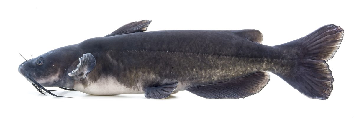 GamefishChannel CatfishIctalurus punctatus
 Wildlife guideWild turkeyMeleagris gallopavo
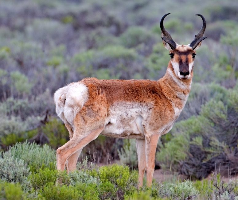 Big gamePronghorn AntelopeAntilocapra americana
A canyon system in southwestern Chihuahua
Barrancas del Cobre, also called Copper Canyon, is a canyon system in the Sierra Tarahumara of southwestern Chihuahua, Mexico. It lies within the broader Sierra Madre Occidental, the mountain range that dominates much of the state's terrain. This is not a single canyon with one obvious starting point: planning begins with choosing how to move through a larger mountain landscape. Rugged mountains and wide river valleys characterize the region, a useful correction to the idea that Chihuahua is entirely desert. For an outdoor trip, the central choice is between seeing the canyons along the railway corridor and exploring on foot, by bicycle, on horseback, or by road. Those approaches require different arrangements and should not be treated as interchangeable.
The railway provides a clear travel corridor
The Ferrocarril Chihuahua al Pacífico, commonly called ChePe, is the most popular way to explore Copper Canyon. The railway links Chihuahua City with Los Mochis on the Gulf of California coast, passing through the Sierra Madre Occidental. Within the canyon region, it runs along Canyon Urique between Creel and Los Mochis. These named places provide a useful framework for organizing a trip, but a railway journey and a walking itinerary are different undertakings. Decide whether the train itself is the main experience or transportation for a separate outdoor outing. Confirm current services, boarding arrangements, and onward transportation before committing to a plan. Do not assume that a rail stop provides direct access to a suitable hiking or riding route.
Planning time beyond the train
Hiking, biking, driving, and horseback riding are all ways to explore Copper Canyon. The important next step is to turn a general activity into a specific, locally confirmed itinerary rather than treating the canyon system as one route. In rugged mountain terrain, choose an outing that matches the group's fitness and experience, and establish the return arrangements before setting out. Carry water, food, weather-appropriate layers, and navigation suited to the chosen activity. Check the forecast for the part of the canyon system being visited rather than relying on conditions in a distant city. For any independent outing, confirm the access arrangements and any permit requirements with the relevant managing agency. Keep the plan flexible until the route and transportation are settled.
Route options
- ChePe through Canyon Urique
Explore by rail along the corridor between Creel and Los Mochis. ChePe runs along Canyon Urique, offering a train-based approach to the canyon system rather than a self-guided trail itinerary.
- Copper Canyon hiking
Walking is an established way to explore the canyon system. Choose a specific itinerary and confirm its starting point, terrain, access, and return arrangements locally before setting out; this is an activity option, not a defined trail.
- Copper Canyon horseback exploration
Horseback riding is another way to explore the region. Arrange a specific route and confirm its suitability for the group's riding experience rather than assuming access throughout the canyon system.
Sample itineraries
- Creel and the Canyon Urique rail corridor · 2 days
Use Creel as the starting point for a rail-focused visit along Canyon Urique toward Los Mochis. Treat this as a planning outline, not a confirmed train schedule; check services and overnight arrangements before choosing the segment to travel.
- Copper Canyon on foot · 3 days
Allow an arrival day to confirm local hiking options, a day for a walk matched to fitness and conditions, and a flexible departure day. The canyon system's rugged terrain calls for a specific route plan; do not assume a rim-to-river outing fits this schedule.
Seasonal conditions
Spring
Confirm timing locally
Plan around the forecast for the actual canyon area and elevation being visited. Chihuahua has varied climates; statewide conditions are not a reliable guide to a particular mountain outing.
Summer
Confirm timing locally
Check local weather before committing to hiking, biking or horseback riding. Match water supplies, clothing and effort to the forecast rather than assuming all parts of the canyon system have similar conditions.
Fall
Confirm timing locally
Keep outdoor plans flexible and confirm conditions for the chosen route. A rail journey through the canyon system and a walk in rugged mountain terrain require different preparation.
Winter
Confirm timing locally
Check mountain temperatures and the forecast before packing. Carry layers appropriate to the expected conditions, and confirm that planned outdoor activities and transport arrangements are practical.
| Season | Window | Conditions |
|---|---|---|
| Spring | Confirm timing locally | Plan around the forecast for the actual canyon area and elevation being visited. Chihuahua has varied climates; statewide conditions are not a reliable guide to a particular mountain outing. |
| Summer | Confirm timing locally | Check local weather before committing to hiking, biking or horseback riding. Match water supplies, clothing and effort to the forecast rather than assuming all parts of the canyon system have similar conditions. |
| Fall | Confirm timing locally | Keep outdoor plans flexible and confirm conditions for the chosen route. A rail journey through the canyon system and a walk in rugged mountain terrain require different preparation. |
| Winter | Confirm timing locally | Check mountain temperatures and the forecast before packing. Carry layers appropriate to the expected conditions, and confirm that planned outdoor activities and transport arrangements are practical. |
Permits, fees & closures
Confirm current access and permit requirements with the managing agency for the specific area and activity.
Official source: Fees & Permits - State Parks - EMNRD - NM.Gov · Verified October 2, 2026
Hazards & regulations
- Rugged mountain terrain can make walking demanding; choose an outing that leaves enough energy for the return.
- Deep canyon terrain requires careful route planning. Do not estimate walking effort from a map's horizontal distance alone.
- Chihuahua's varied climate makes broad regional weather assumptions unreliable; check conditions for the specific area being visited.
What to pack for Barrancas del Cobre
- Footwear suited to rugged terrain
- Route map and navigation tools
- Daypack
- Basic first-aid kit
- Layers matched to the local forecast
- Weather protection
- Drinking water appropriate to the outing
- Food for the planned activity
Barrancas del Cobre FAQ
- Where is Barrancas del Cobre?
- Barrancas del Cobre, or Copper Canyon, is a canyon system in the Sierra Tarahumara of southwestern Chihuahua, Mexico. It lies within the Sierra Madre Occidental mountain region.
- Is Copper Canyon a single canyon?
- No. It is a canyon system. Canyon Urique is the main canyon identified along the ChePe rail corridor between Creel and Los Mochis.
- How can the area be explored?
- Options include hiking, biking, driving, horseback riding and train travel. Rail is the most popular approach. Confirm specific routes and arrangements locally before planning an independent outdoor outing.
- Which train travels through Copper Canyon?
- The Ferrocarril Chihuahua al Pacífico, also called ChePe, travels through Copper Canyon. The canyon rail corridor includes Creel and Los Mochis, with Los Mochis toward the Gulf of California coast. Confirm current services before booking.
- Can a hiking route be chosen on arrival?
- Use arrival time to establish a specific route, check conditions and judge the effort involved. Hiking is an established way to explore, but the rugged terrain makes it important not to assume an unspecified walk is straightforward.