


Beyond Alone · Best: July-October
High Tatras
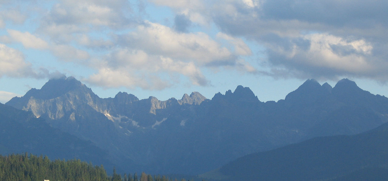
A compact, dramatic subrange of the Carpathians featuring sheer granite spires, deep tarns, and legendary hut-to-hut trekking.
Prešov Region, Slovakia / Poland
Where on earth
Satellite imagery flying in from a world view to High Tatras, Prešov Region, Slovakia / Poland. Use the + / − buttons, or click the map to zoom with your scroll wheel; drag to pan and pinch to zoom on touch.
- Region
- Prešov Region, Slovakia / Poland
- Climbing
- Mountaineering
- Hiking
- Area/Length
- 785 sq km
- Elevation
- 1,000m to 2,655m (Gerlachovský štít)
- Best window
- August to September
- Key draws
- Chain-assisted scrambles, alpine lakes, chamois
- Access
- Train/bus to Poprad (Slovakia) or Zakopane (Poland)
Topic summary
A compact, dramatic subrange of the Carpathians featuring sheer granite spires, deep tarns, and legendary hut-to-hut trekking. The High Tatras form a natural alpine border between Poland and Slovakia, characterized by sharp granite peaks shooting up dramatically from forested foothills. Despite their compact footprint, they possess true alpine c
Key takeaways
- Area/Length: 785 sq km
- Elevation: 1,000m to 2,655m (Gerlachovský štít)
- Best window: August to September
- Key draws: Chain-assisted scrambles, alpine lakes, chamois
- Access: Train/bus to Poprad (Slovakia) or Zakopane (Poland)
Intended uses
- Wilderness trip planning and destination research
- Access: Train/bus to Poprad (Slovakia) or Zakopane (Poland)
Verification notes
Compiled from published show records, regional agencies, and topographical / satellite imagery. Region: Prešov Region, Slovakia / Poland. Coordinates: 49.160, 20.130.
The country
The High Tatras form a natural alpine border between Poland and Slovakia, characterized by sharp granite peaks shooting up dramatically from forested foothills. Despite their compact footprint, they possess true alpine characteristics including steep couloirs, cirques, and moraine-dammed lakes known locally as 'plesá'. The ecosystem supports brown bears, lynx, and the endemic Tatra chamois.
Why enthusiasts come
The Tatras offer world-class scrambling and via-ferrata style routes without the scale and logistical complexity of the Swiss Alps. The 'Tatranská Magistrála' trail provides a stunning multi-day traverse linking high-altitude mountain chalets. Climbers and hikers flock here for testing ascents secured by chains over thrillingly exposed gaps.
Top experiences
Climbing Rysy (2,500m) allows hikers to cross the border on foot while negotiating steep, chain-protected rock steps. On the Polish side, traversing the notorious Orla Perć (Eagle's Path) offers a highly exposed, demanding scramble along a jagged crest. The Slovak side features beautiful valley descents past Morskie Oko and Velické pleso lakes.
Planner-relevant notes
Strict national park rules strictly forbid wild camping across the entire range; nights must be spent in the heavily booked mountain huts (chatas/schroniskos). Peak bagging requires high clearance; some summits like Gerlachovský štít are only accessible with a certified mountain guide. Trails above the treeline are closed on the Slovak side from November through mid-June.
Field notes
- Start extremely early for popular routes like Rysy or Giewont to avoid human traffic jams on the chain-assisted sections.
- Late summer thunderstorms are highly dangerous on the exposed iron chains of Orla Perć.
- Most huts sell basic meals and drinks, meaning you can pack a relatively light pack for multi-day traverses.
- Mountain rescue (TOPR in Poland, HZS in Slovakia) is highly efficient, but traversing the border mid-hike means switching your emergency contact numbers.
Frequently asked about High Tatras
- Where is High Tatras?
- High Tatras is in Prešov Region, Slovakia / Poland. A compact, dramatic subrange of the Carpathians featuring sheer granite spires, deep tarns, and legendary hut-to-hut trekking.
- How do you get to High Tatras?
- Access: Train/bus to Poprad (Slovakia) or Zakopane (Poland). Expect a multi-leg trip — flights to the nearest hub, then float plane, boat, or 4WD depending on conditions.
Build a ten for High Tatras
Assemble your own 10-item Alone loadout tuned to this biome — cold, wet, and food strategy already scoped.
Open the builderShelter that suits this terrain
Browse shelter builds and site-selection guides matched to conditions like the ones here.
The gear behind what you just read
Ranked lists for the exact categories that decide a season.
- Top 10 Winter JacketsDown parkas, synthetic belay pieces, and heavy wool coats for real cold.See the ranking
- Top 10 Merino Wool Base LayersNext-to-skin wool that works in real cold, real heat, and days between washes.See the ranking
- Top 10 Three-Season Sleeping BagsDown and synthetic bags that cover the honest 20°F–40°F working range.See the ranking
- Top 10 Winter Camping LocationsCold-country trips built around snow, ice, and quiet skies.See the ranking
- Best Cold-Weather HatsWool watch caps, ushankas, and windproof beanies for real winter.See the ranking