



Reader rating
Rate it and you move it. Community ratings re-rank this product inside its Top 10 list.
Expert-picked, reader-ranked. Our editors choose the products and the launch order; member star ratings move picks up or down over time.
This circuit trades the heavy canyon foot traffic of the lower Middle Fork for the elevated ponderosa forests and historic homestead lands of the central wilderness. Starting along the West Fork Trail (Trail 151), you hike deep into the canyon past white volcanic ash formations and sheer rock overhangs before turning north up Woodland Park Trail (Trail 207). The trail climbs steeply out of the bottomland to the undulating ponderosa and Douglas-fir forests of Woodland Park and the historic site of Prior Cabin. Prior Cabin serves as an evocative mid-trip marker, showcasing early 20th-century forest service and ranching survival in the Gila interior. From here, the route loops back via Lilley Park or the Prior Creek drainage before descending back to the West Fork. The elevation changes yield a stark ecological contrast: you wake up to cottonwood leaves floating downstream in canyon pools and finish the afternoon walking pine-needle beds at 7,500 feet. Shoulder-season timing requires attention to seasonal water points. While the West Fork never dries, creeks on the upper mesa like Prior Creek can reduce to stagnant pools by late May or freeze solid by mid-November. Fall trips should pack a reliable filter and check recent ranger reports on high-country springs. **Highlights** - Mileage: 24 to 28 miles - Elevation change: Approximately 2,800 feet - Historic log-built Prior Cabin site and upland meadow systems - Lower West Fork river canyon with fewer crowds than the Middle Fork - High-canopy ponderosa forests offering soft, pine-cushioned camps **Watch-outs** - Water availability dries up rapidly once above the West Fork canyon rim - Ridgetop trail sections contain significant deadfall from legacy fires - Spring mornings above 7,000 feet frequently dip well below freezing
Pros
- Substantially less foot traffic than the neighboring Middle Fork corridor
- Dramatic scenery shift between river canyon walls and ponderosa plateau meadows
- Historic log-built Prior Cabin offers an authentic glimpse into wilderness history
- Pristine, pine-cushioned backcountry campsites throughout the high country
Cons
- Water on the upper mesa is seasonal, unreliable, and often stagnant
- Extensive deadfall and downed timber slow travel across plateau trails
- Spring river crossings can be swift, cold, and challenging during snowmelt
Best uses
- Three-day shoulder-season wilderness loops
- Backcountry historical exploration
- Solitude-focused canyon backpacking
- Self-reliant desert-mountain trekking
Specifications
- Total Distance
- 24 to 28 miles depending on side trips
- Elevation Gain
- Approximately 2,800 feet
- Route Type
- Lollipop loop
- Starting Point
- West Fork Trailhead near Gila Visitor Center
- Optimal Seasons
- Late April to May, late September to October
- Permit Requirement
- Free self-issue registration at trailhead
Best for
Three-day shoulder-season wilderness loops, Backcountry historical exploration, Solitude-focused canyon backpacking, Self-reliant desert-mountain trekking
Climbing from the shaded canyon floor of the West Fork Gila River onto the high volcanic plateaus around Prior Cabin offers backpackers a complete cross-section of southwest New Mexico's premier wilderness. The route leaves behind the high-density day-hike traffic of the nearby hot springs corridor, trading crowded gravel bars for towering rhyolite cliffs, cold canyon fords, and silent ponderosa meadows. It captures the dual character of the Gila: riparian trench carving through raw volcanic geology below, and airy, high-elevation pine country above. Once out of the river corridor, the landscape transforms abruptly. The trail climbs roughly 2,800 feet into Woodland Park and the open benchlands of the central wilderness, where grassy savannahs and mixed conifer stands replace the riverside cottonwoods. Prior Cabin sits as a weathered reminder of early forest service patrol and homestead era ranching, tucked into a pocket of backcountry where nights are dead silent and light pollution is non-existent. This loop requires methodical planning around water sources and route-finding through historic fire footprints, but it rewards self-reliant backpackers with deep backcountry solitude.
Canyon Bottom to High Mesa
The loop begins along Trail 151, tracking the West Fork through sheer volcanic cliffs, pocket meadows, and sweeping alcoves sculpted by millennia of floodwaters. You crisscross the shallow riverbed multiple times before hanging a turn onto Trail 207 to begin the sustained grunt out of the canyon. The grade climbs relentlessly through rock breaks and piñon-juniper scrub before leveling onto the pine benches of Woodland Park. Up here, the terrain shifts into expansive, rolling flats shaded by massive ponderosa pines and Douglas-firs. Walking this upper plateau feels completely detached from the enclosed rock world below, offering long sightlines and open, sun-warmed forest floors.
Seasonal Windows and Weather
Shoulder seasons provide the sweet spot for this route, though each brings distinct operational challenges. Spring yields flowing creeks and crisp days, but high-country nights above 7,000 feet routinely drop well below freezing through early May, and early-season snowmelt can turn lower canyon crossings into thigh-deep torrents. Fall brings stable weather, golden cottonwoods, and crisp autumn air, but surface water becomes scarce on the mesa. Midsummer brings monsoon storms that transform dry washes into impassable flash floods and turn exposed upland plateaus into lightning traps. Winter trips are viable for experienced parties, but snowdrifts can quickly obliterate unmaintained mesa tread.
Water Strategy and Caching
Water availability divides strictly along elevation lines. The West Fork is perennial and reliable, requiring only standard filtration to handle clear, sediment-free mountain water. Once you begin climbing toward Woodland Park and Prior Cabin, water management becomes critical. Upper drainages like Prior Creek and local mesa springs fluctuate wildly depending on recent precipitation. During dry autumns, charted springs may reduce to muddy seeps or disappear altogether, forcing you to pack heavy water loads out of the river. Never leave the West Fork without checking current water reports at the ranger station, and always carry treatment methods suited for stagnant pools.
Wildlife and Apex Encounters
The transition zones between riverbed and high timber harbor healthy wildlife populations. Rocky Mountain elk herds frequent Woodland Park and the meadows surrounding Prior Cabin, filling late September evenings with echoing bugles. Black bears are common throughout the river canyon, drawn to oak scrub and berry patches along the water; diligent food hangs or bear canisters are non-negotiable. Cougar and Mexican gray wolf activity is documented across this sector of the Gila, though sightings remain rare. Keep an eye out for rattlesnakes sunning on rocky southern aspects along the climb, particularly during warm spring afternoons.
Route Navigation and Deadfall
The Gila Wilderness experiences minimal mechanized trail maintenance, and legacy wildfire scars have left thousands of acres of standing dead timber. While the canyon floor tread is generally obvious, upland segments on Trail 207 and around Lilley Park regularly suffer from extensive blowdowns and jackstraw timber. You will inevitably lose time navigating around fallen ponderosas, scrambling over root balls, and picking up faint tread through overgrown meadow grass. A paper topographic map, reliable compass, and offline satellite navigation are required tools here; relying on trail markers or worn pathways across open meadows will quickly lead you astray.
Permits and Logistics
Access is exceptionally straightforward, starting at the paved West Fork Trailhead near Gila Cliff Dwellings National Monument. There are no quotas, advanced lottery systems, or backcountry camping fees for backpackers; you simply register your group at the self-pay kiosk at the trailhead. Overnight parking is generally secure, but do not leave valuables in view. Stock use is allowed along this corridor, meaning trailheads may feature horse trailers, and certain canyon campsites see heavy equestrian use. Practice strict Leave No Trace principles, especially around the fragile historic logs of Prior Cabin, where campfires and vandalism have threatened the integrity of the site.
How we chose
We built this ranking from land-manager and agency sources, permit records and published trip reports. Each of the 10 places was compared against the same criteria below. This is desk research unless a pick is marked field tested.
- Quality of the terrain
- Landscape, route variety, and whether the place rewards multiple days rather than one overlook.
- Season and weather windows
- How long the reliable window is, and how badly the shoulder seasons punish a bad forecast.
- Access and permits
- Trailhead logistics, permit odds, quotas, and how much lead time a trip realistically takes.
- Solitude vs. crowding
- How far you have to walk before the place feels like wilderness instead of a queue.
- Wildlife and ecology
- What you can reasonably expect to see, and what you have to plan around.
- Risk and skill required
- Navigation, water crossings, exposure, and rescue distance — stated plainly.
West Fork to Prior Cabin and Woodland Park — frequently asked questions
- Is West Fork to Prior Cabin and Woodland Park worth the trip?
- We rank it #4 in Top 10 Gila Wilderness Loops. This circuit trades the heavy canyon foot traffic of the lower Middle Fork for the elevated ponderosa forests and historic homestead lands of the central wilderness. Starting along the West Fork Trail (Trail 151), you hike deep into the canyon past white volcanic ash formations and sheer rock overhangs before turning…
- Who is West Fork to Prior Cabin and Woodland Park best for?
- Best for three-day shoulder-season wilderness loops, backcountry historical exploration, solitude-focused canyon backpacking and self-reliant desert-mountain trekking. Standouts: substantially less foot traffic than the neighboring middle fork corridor and dramatic scenery shift between river canyon walls and ponderosa plateau meadows.
- What are the drawbacks of West Fork to Prior Cabin and Woodland Park?
- Water on the upper mesa is seasonal, unreliable, and often stagnant, Extensive deadfall and downed timber slow travel across plateau trails and Spring river crossings can be swift, cold, and challenging during snowmelt.
- What are the key details for West Fork to Prior Cabin and Woodland Park?
- Total Distance: 24 to 28 miles depending on side trips · Elevation Gain: Approximately 2,800 feet · Route Type: Lollipop loop · Starting Point: West Fork Trailhead near Gila Visitor Center · Optimal Seasons: Late April to May, late September to October
- Canyon Bottom to High Mesa — what should I know about the West Fork to Prior Cabin and Woodland Park?
- The loop begins along Trail 151, tracking the West Fork through sheer volcanic cliffs, pocket meadows, and sweeping alcoves sculpted by millennia of floodwaters. You crisscross the shallow riverbed multiple times before hanging a turn onto Trail 207 to begin the sustained grunt out of the canyon.
- Seasonal Windows and Weather — what should I know about the West Fork to Prior Cabin and Woodland Park?
- Shoulder seasons provide the sweet spot for this route, though each brings distinct operational challenges. Spring yields flowing creeks and crisp days, but high-country nights above 7,000 feet routinely drop well below freezing through early May, and early-season snowmelt can turn lower canyon crossings into…
Where on earth
Satellite imagery flying in from a world view to West Fork to Prior Cabin and Woodland Park, Arkansas, United States. Use the + / − buttons, or click the map to zoom with your scroll wheel; drag to pan and pinch to zoom on touch.
West Fork, AR 72774, USA · 35.931, -94.180
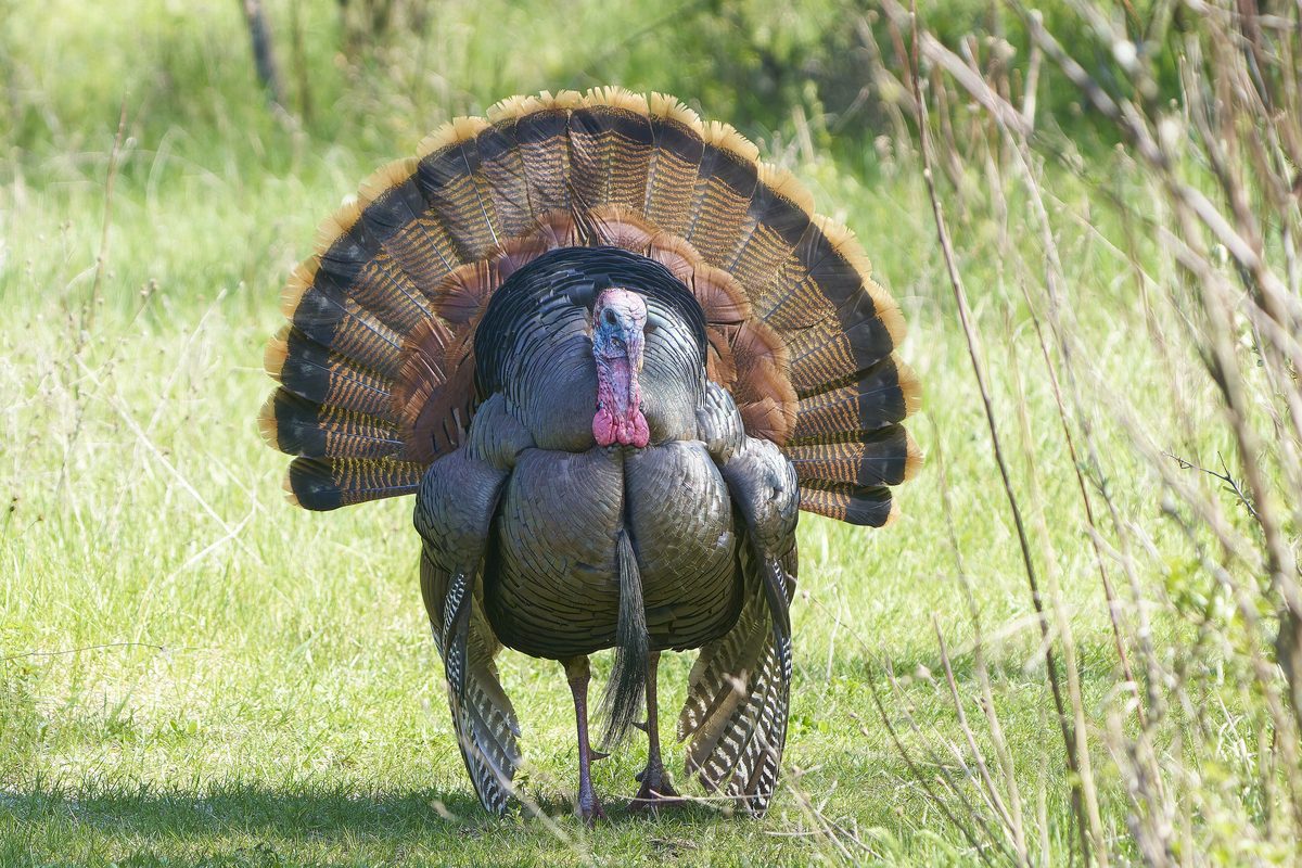
Wildlife found around West Fork to Prior Cabin and Woodland Park

Compare side by side
Put the West Fork to Prior Cabin and Woodland Park against any other pick on this list — specs, price, pros, cons and reader ratings.