


Reader rating
Rate it and you move it. Community ratings re-rank this product inside its Top 10 list.
Expert-picked, reader-ranked. Our editors choose the products and the launch order; member star ratings move picks up or down over time.
Waterfalls at full snowmelt flow; wildflowers on the east end.
Pros
- High-energy waterfall flows fueled by peak spring snowmelt
- Rapid transition from rain-drenched canyons to sunny desert bluffs
- Spectacular early-season balsamroot and lupine blooms
- Extensive network of challenging day hikes within an hour of Portland
Cons
- Frequent gale-force winds funneling through the river corridor
- Severe trailhead parking congestion on dry spring weekends
- Abundant poison oak and active ticks along eastern trails
Best uses
- Early-season hill training
- Spring waterfall photography
- Bimodal weather road trips
- Wildflower day hiking
Specifications
- Managing Agency
- US Forest Service / CRGNSA
- April Highs
- 55°F to 64°F
- Primary Access
- Interstate 84 (OR) and Highway 14 (WA)
- Key Terrain
- Basalt cliffs, temperate rainforest, oak savannah
- Required Passes
- Northwest Forest Pass or America the Beautiful
- Seasonal Hazard
- High canyon winds, slick basalt, poison oak
Best for
Early-season hill training, Spring waterfall photography, Bimodal weather road trips, Wildflower day hiking
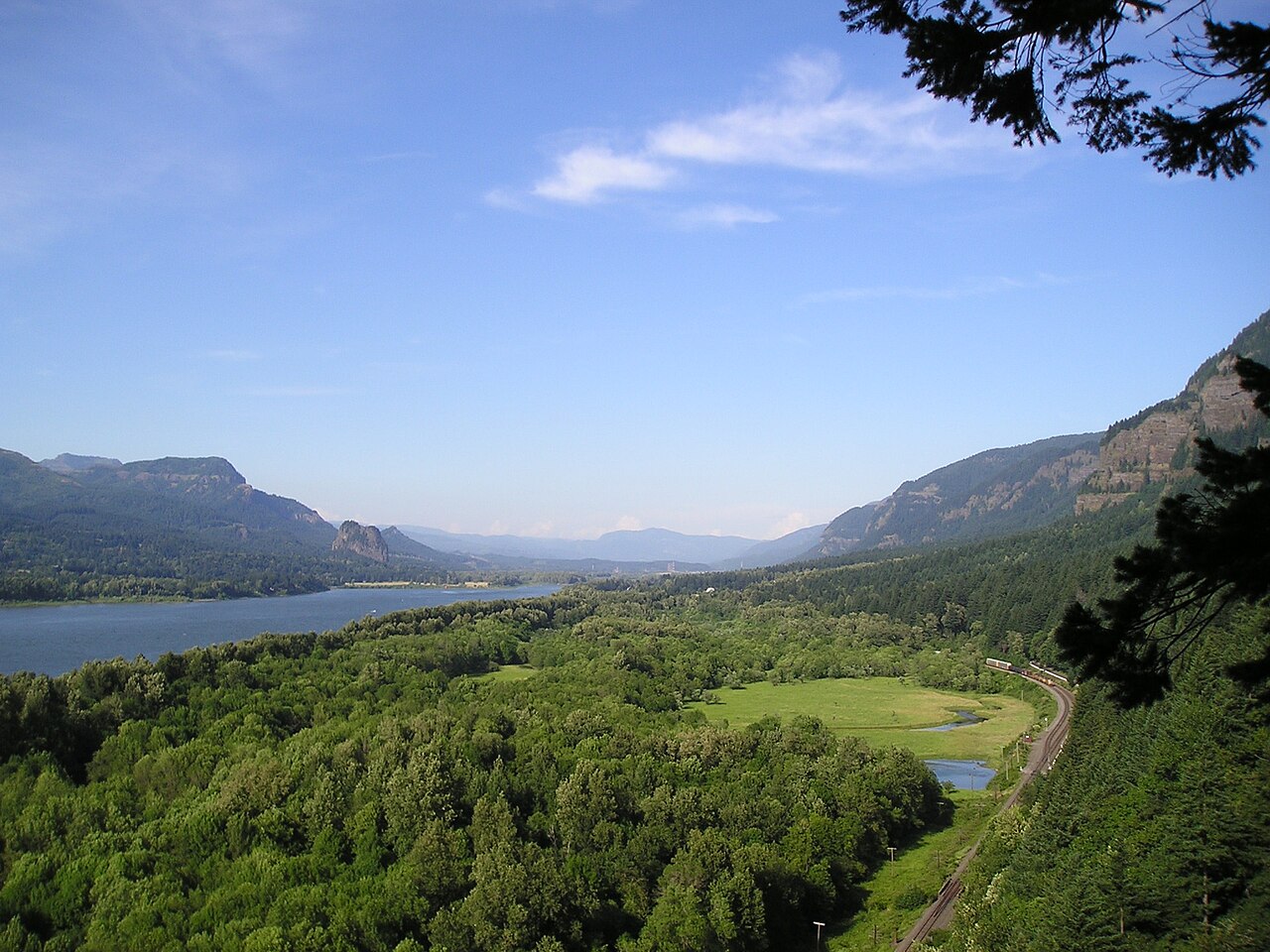
Carving an eighty-mile trench through the Cascade Range, the Columbia River Gorge acts as a massive wind tunnel and ecological divider between the wet marine forests of western Oregon and the arid plateau to the east. April catches this landscape in mid-stride. Heavy snowpack melting off Mount Hood and Mount Adams fuels the western waterfalls into deafening torrents, while thirty miles downriver, rain-shadow sunshine kicks off the first major wildflower display of the Pacific Northwest. Visiting during early spring means packing for two distinct climates in a single morning. You can stand in the freezing spray of Multnomah or Latourell Falls under dripping hemlocks at dawn, then drive forty minutes east to hike dry, exposed grasslands above Lyle or Rowena Crest by midday. The weather can swing from horizontal sleet to sixty-degree sunbreaks in an afternoon, but the reward is seeing the gorge at its most energetic before summer bake and wildfire smoke set in.
The Climate Divide
The dramatic shift in precipitation across a relatively short stretch of highway defines any trip here. The western gates around Corbett receive upwards of seventy-five inches of rain annually, nursing deep moss, sword ferns, and dense stands of Douglas fir. By the time you reach The Dalles on the eastern boundary, annual rainfall drops below fifteen inches. In April, this gradient works heavily in your favor. If a lingering North Pacific front blankets the waterfall corridor in persistent drizzle, you can push past Hood River into the rain shadow to find clear skies and dry tread on the eastern bluffs. Understanding this divide allows you to salvage wet days by simply driving twenty miles east.
Peak Waterfall Runoff
April delivers the highest water volumes of the year to the gorge's legendary basalt amphitheatres. Snowmelt from the upper Cascade slopes combines with spring rain, turning creeks like Oneonta, McCord, and Wahkeena into turbulent torrents. Multnomah Falls draws the standard bus crowds, but better hiking sits along the Wahkeena-Multnomah loop or the stair-step climb to Upper Latourell Falls. Expect trail surfaces to be thoroughly soaked, with heavy spray blowing hundreds of feet from the plunge pools. Wet basalt is notoriously slick, and wooden boardwalks carry a film of algae this time of year. Bring dedicated waterproof shells and footwear with aggressive rubber lugs rather than smooth trail runners.
Eastern Wildflower Blooms
While the western gorge is dripping wet, the open slopes between Mosier and Lyle turn vivid yellow and purple. Arrowleaf balsamroot and Columbia desert parsley open first, followed closely by lupine. Catherine Creek and the Tom McCall Nature Preserve at Rowena Crest offer premier early-season walking along old wagon roads and basalt rims. These trails are fully exposed to sun and wind, lacking canopy cover entirely. The blooms peak depending on spring temperatures, often hitting prime form between mid-April and early May. Keep to established paths; the thin scabland soils host sensitive biocrusts that take decades to recover once crushed by off-trail foot traffic.
Trail Conditions and Hazards
Spring trails in the gorge present a specific set of objective hazards that catch casual hikers off guard. Relentless gorge winds can gust over forty miles per hour along exposed ridges like Angels Rest and Dog Mountain, radically dropping effective temperatures and challenging balance near cliff edges. Poison oak wakes up aggressively in April across the eastern oak savannahs, its oily red leaves blending into trailside brush. Eastern slopes also host active populations of western rattlesnakes emerging to sun themselves on basalt talus by midday. Ticks are abundant in the high grass; run a thorough check on your gear and dog after every hike.
Logistics and Permits
Managing logistics requires staying ahead of seasonal regulations and crowd spikes. Dog Mountain, the premier steep spring workout on the Washington side, mandates weekend permits starting in late April to control heavy traffic during flower season. Along the Historic Columbia River Highway in Oregon, waterfall corridor timed-use permits usually resume in late May, giving April visitors slightly more flexibility, though trailhead lots still fill completely before nine in the morning on clear weekends. If you want parking at Wahkeena or Horsetail, arrive near daybreak. State park lots generally require either an Oregon State Parks pass or daily fee payment, distinct from federal trailheads requiring Forest passes.
How we picked
We built this ranking from trip reports, agency data, permit records, and our editors' own time on the ground. 10 places made the final cut out of a much longer working list, and each one had to clear the same set of criteria before it earned a spot.
- Quality of the terrain
- Landscape, route variety, and whether the place rewards multiple days rather than one overlook.
- Season and weather windows
- How long the reliable window is, and how badly the shoulder seasons punish a bad forecast.
- Access and permits
- Trailhead logistics, permit odds, quotas, and how much lead time a trip realistically takes.
- Solitude vs. crowding
- How far you have to walk before the place feels like wilderness instead of a queue.
- Wildlife and ecology
- What you can reasonably expect to see, and what you have to plan around.
- Risk and skill required
- Navigation, water crossings, exposure, and rescue distance — stated plainly.
Columbia River Gorge — frequently asked questions
- Is Columbia River Gorge worth the trip?
- We rank it #9 in US Destinations in April. Waterfalls at full snowmelt flow; wildflowers on the east end.
- Who is Columbia River Gorge best for?
- Best for early-season hill training, spring waterfall photography, bimodal weather road trips and wildflower day hiking. Standouts: high-energy waterfall flows fueled by peak spring snowmelt and rapid transition from rain-drenched canyons to sunny desert bluffs.
- What are the drawbacks of Columbia River Gorge?
- Frequent gale-force winds funneling through the river corridor, Severe trailhead parking congestion on dry spring weekends and Abundant poison oak and active ticks along eastern trails.
- What are the key details for Columbia River Gorge?
- Managing Agency: US Forest Service / CRGNSA · April Highs: 55°F to 64°F · Primary Access: Interstate 84 (OR) and Highway 14 (WA) · Key Terrain: Basalt cliffs, temperate rainforest, oak savannah · Required Passes: Northwest Forest Pass or America the Beautiful
- The Climate Divide — what should I know about the Columbia River Gorge?
- The dramatic shift in precipitation across a relatively short stretch of highway defines any trip here. The western gates around Corbett receive upwards of seventy-five inches of rain annually, nursing deep moss, sword ferns, and dense stands of Douglas fir.
- Peak Waterfall Runoff — what should I know about the Columbia River Gorge?
- April delivers the highest water volumes of the year to the gorge's legendary basalt amphitheatres. Snowmelt from the upper Cascade slopes combines with spring rain, turning creeks like Oneonta, McCord, and Wahkeena into turbulent torrents.
Where on earth
Satellite imagery flying in from a world view to Columbia River Gorge, Oregon, United States. Use the + / − buttons, or click the map to zoom with your scroll wheel; drag to pan and pinch to zoom on touch.
Columbia River Gorge National Scenic Area, Oregon, USA · 45.709, -121.752
Wildlife found around Columbia River Gorge








Compare side by side
Put the Columbia River Gorge against any other pick on this list — specs, price, pros, cons and reader ratings.