


Updated October 2026 · 10 picks re-checked for availability and current spec, reader ratings refreshed live.
Every destination has a best month. These ten US picks are at their best in April — for weather, wildlife, access, or simply the absence of crowds. Conditions vary year to year; check current forecasts and park alerts before you go.
The short answer

Peak spring wildflower season — over 1,500 flowering plant species.
Why it wins
Dogwoods and redbuds bloom along Skyline Drive; trails reopen.
Why it wins
Warm days, flowing waterfalls, and full spring color in the canyon.
Why it winsCompare all 10 picks at a glance
Editorial ranking, what each pick is best at, and how we assessed it. Tap a name to jump to the full write-up.
| # | Pick | Best for | Key spec | Evidence |
|---|---|---|---|---|
| 1 | Great Smoky Mountains National Park North Carolina / Tennessee | Spring botanical day hikes | Total Area: 522,427 acres | Research only |
| 2 | Zion National Park Utah | Exposed sandstone ridge hiking | Location: Southwest Utah | Research only |
| 3 | Shenandoah National Park Virginia | Early season waterfall hiking | Location: Virginia Blue Ridge Mountains | Research only |
| 4 | Moab Utah | Early-season slickrock mountain biking | Base Elevation: 4,026 feet (town of Moab) | Research only |
| 5 | Grand Canyon National Park Arizona | Multi-day corridor backpacking | Location: Northern Arizona | Research only |
| 6 | Antelope Valley California | Spring landscape photography | Elevation: 2,600 to 3,000 feet | Research only |
| 7 | Channel Islands National Park California | Spring coastal backpacking | Location: Santa Barbara Channel, California | Research only |
| 8 | Big Bend National Park Texas | High-country mountain ridge hiking | Total Acreage: 801,163 acres | Research only |
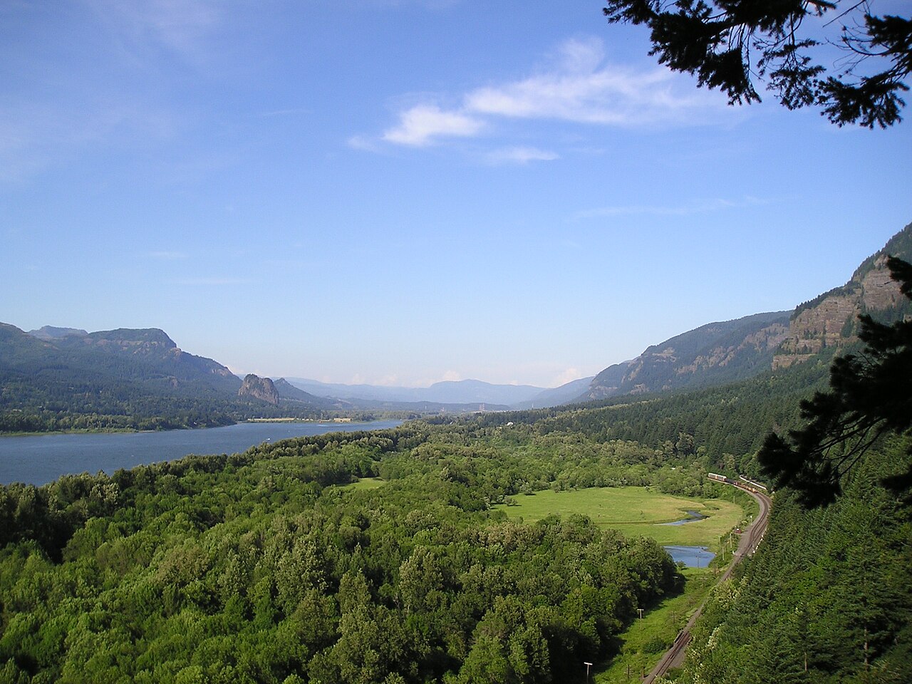
| 9 | Columbia River Gorge Oregon / Washington | Early-season hill training | Managing Agency: US Forest Service / CRGNSA | Research only |
| 10 | Assateague Island Maryland / Virginia | Shoulder-season beach backpacking | Managing Agency: National Park Service and USFWS | Research only |
How we picked
Ranked by Adele Marchetti, Destinations Editor
We built this ranking from trip reports, agency data, permit records, and our editors' own time on the ground. 10 places made the final cut out of a much longer working list, and each one had to clear the same set of criteria before it earned a spot.
- Quality of the terrain
- Landscape, route variety, and whether the place rewards multiple days rather than one overlook.
- Season and weather windows
- How long the reliable window is, and how badly the shoulder seasons punish a bad forecast.
- Access and permits
- Trailhead logistics, permit odds, quotas, and how much lead time a trip realistically takes.
- Solitude vs. crowding
- How far you have to walk before the place feels like wilderness instead of a queue.
- Wildlife and ecology
- What you can reasonably expect to see, and what you have to plan around.
- Risk and skill required
- Navigation, water crossings, exposure, and rescue distance — stated plainly.
How often we recheck this: Reviewed on a rolling basis and rechecked at least once a year, or sooner if a pick is discontinued, revised, or beaten by something new.
Best of the Best · Head to Head
Great Smoky Mountains National Park vs Zion National Park
#1 vs #2 — side-by-side specs, pros & cons, and the final verdict.
Compare any two picks
Build your own side-by-side
Choose any two of these 10 picks and compare specs, price, pros, cons and reader ratings.
Topic summary
Ten US destinations where April is the right month — weather, wildlife, and crowds all considered.
Key takeaways
- #1 Great Smoky Mountains National Park — North Carolina / Tennessee
- #2 Zion National Park — Utah
- #3 Shenandoah National Park — Virginia
- #4 Moab — Utah
- #5 Grand Canyon National Park — Arizona
- #6 Antelope Valley — California
Intended uses
Places
Verification notes
Editorial ranked list, 10 entries. Evidence mix — 10 research only. Buy links open the maker or a retailer search. Last reviewed October 2026.
Best us destinations in april for a specific job
Skip the ranking — jump to the pick that matches how you actually use it.
- Best for spring botanical day hikes
- #1 Great Smoky Mountains National Park — North Carolina / TennesseePeak spring wildflower season — over 1,500 flowering plant species.Read the full profile
- Best for exposed sandstone ridge hiking
- #2 Zion National Park — UtahWarm days, flowing waterfalls, and full spring color in the canyon.Read the full profile
- Best for early season waterfall hiking
- #3 Shenandoah National Park — VirginiaDogwoods and redbuds bloom along Skyline Drive; trails reopen.Read the full profile
- Best for early-season slickrock mountain biking
- #4 Moab — UtahPrime desert season — warm days, cool nights, wildflowers on the mesas.Read the full profile
- Best for multi-day corridor backpacking
- #5 Grand Canyon National Park — ArizonaRim-to-river hiking season opens; inner canyon is warm but not lethal.Read the full profile
- Best for spring landscape photography
- #6 Antelope Valley — CaliforniaCalifornia poppy reserve blooms in good rain years.Read the full profile
- Best for spring coastal backpacking
- #7 Channel Islands National Park — CaliforniaWildflower peak on the islands; nesting seabirds arrive.Read the full profile
- Best for high-country mountain ridge hiking
- #8 Big Bend National Park — TexasLast reliable month before the desert heats up.Read the full profile
Our editors test the gear, pick the ten, and set the order the day a list publishes. After that, the ranking is live: every member star rating feeds the community order, so picks climb or slide as real owners report back. Editorial judgment decides what earns a spot — you help decide where it sits.
- Editors set the field
Hands-on testing and spec research choose the ten and the published order.
- Readers re-rank it
Your 1–5 star ratings drive the community order on every list.
- Rankings keep moving
Picks rise or fall over time — nothing is frozen at launch day.
Rank this list
Loading community ratings… Ratings re-order the picks — they never change which products make the list.
Sign in to add your own ratings — it's free.
- Pros
- World-class spring ephemeral wildflower displays across lower and mid-elevation coves
- Peak early-season wildlife viewing with active black bears and reintroduced elk
- No general park entrance fee required for highway driving and scenic passes
- Expansive network of more than 800 miles of maintained backcountry footpaths
Cons- Extreme weather volatility with frequent cold soaking rains and high-elevation freezes
- Severe vehicle traffic around Cades Cove and Newfound Gap on mild weekends
- Mandatory parking permits and competitive backcountry shelter reservations
Key features- Total Area
- 522,427 acres
- Highest Elevation
- 6,643 feet (Clingmans Dome)
- Wildflower Peak
- Mid to late April
- Parking Fee
- Tag required for stops over 15 minutes
- Backcountry Access
- Advance permit required for all sites
- Average Rainfall
- 4 to 7 inches in April
Best forSpring botanical day hikes, Early-season shoulder backpacking, Dawn wildlife photography, Strenuous ridge-line trail running
Pros- World-class spring ephemeral wildflower displays across lower and mid-elevation coves
- Peak early-season wildlife viewing with active black bears and reintroduced elk
- No general park entrance fee required for highway driving and scenic passes
- Expansive network of more than 800 miles of maintained backcountry footpaths
Cons- Extreme weather volatility with frequent cold soaking rains and high-elevation freezes
- Severe vehicle traffic around Cades Cove and Newfound Gap on mild weekends
- Mandatory parking permits and competitive backcountry shelter reservations
Assessed by Adele Marchetti against our ranking criteria.No ratings yet - Pros
- Moderate daytime temperatures make high-exposure rim hikes comfortable
- Seasonal snowmelt feeds roaring waterfalls and lush hanging canyon gardens
- Fresh spring foliage provides striking color contrast against red sandstone walls
- Bighorn sheep are highly active and easily visible along the eastern highway
Cons- The Narrows frequently closes throughout the month due to high spring runoff
- Peak spring break crowds create major shuttle lines and parking shortages
- Chain routes like Angels Landing require navigating a competitive permit lottery
Key features- Location
- Southwest Utah
- April High / Low
- 73°F / 45°F
- Primary Access
- Mandatory Zion Canyon Shuttle
- Key Permit
- Angels Landing day-use permit
- Elevation Range
- 3,666 to 8,726 feet
- Primary Hazard
- Cold water runoff and flash flooding
Best forExposed sandstone ridge hiking, Spring landscape photography, Desert slickrock scrambling, Shoulder-season family road trips
Pros- Moderate daytime temperatures make high-exposure rim hikes comfortable
- Seasonal snowmelt feeds roaring waterfalls and lush hanging canyon gardens
- Fresh spring foliage provides striking color contrast against red sandstone walls
- Bighorn sheep are highly active and easily visible along the eastern highway
Cons- The Narrows frequently closes throughout the month due to high spring runoff
- Peak spring break crowds create major shuttle lines and parking shortages
- Chain routes like Angels Landing require navigating a competitive permit lottery
Assessed by Adele Marchetti against our ranking criteria.No ratings yet - Pros
- Creeks and waterfalls roar at maximum volume fueled by seasonal rain and melt
- Open forest canopy provides sweeping valley vistas before leaf-out obscures the views
- Flowering dogwoods and redbuds frame the roadside and lower hollows in color
- Significantly smaller crowds and open parking compared to peak summer and autumn
Cons- Unpredictable weather swings from balmy sunshine to bone-chilling fog and rain
- Old Rag Mountain requires advance planning and a specific day-use permit
- Wet mountain greenstone turns steep ascents and stream crossings hazardous
Key features- Location
- Virginia Blue Ridge Mountains
- Total Area
- 197,438 acres
- Highest Elevation
- 4,051 feet (Hawksbill Mountain)
- Scenic Highway
- Skyline Drive (105 miles)
- Appalachian Trail
- 101 miles within park boundaries
- Standard Entry
- $30 per non-commercial vehicle (7-day pass)
Best forEarly season waterfall hiking, Appalachian Trail section trekking, Spring wildflower and birding trips, Leisurely Blue Ridge road touring
Pros- Creeks and waterfalls roar at maximum volume fueled by seasonal rain and melt
- Open forest canopy provides sweeping valley vistas before leaf-out obscures the views
- Flowering dogwoods and redbuds frame the roadside and lower hollows in color
- Significantly smaller crowds and open parking compared to peak summer and autumn
Cons- Unpredictable weather swings from balmy sunshine to bone-chilling fog and rain
- Old Rag Mountain requires advance planning and a specific day-use permit
- Wet mountain greenstone turns steep ascents and stream crossings hazardous
Assessed by Adele Marchetti against our ranking criteria.No ratings yet - Pros
- Prime ambient temperatures for high-output hiking and slickrock riding
- Dual national park access alongside vast surrounding BLM terrain
- Spring wildflower blooms across desert washes and open canyon benches
- Substantially lower dehydration and heatstroke risk compared to summer
Cons- Heavy April crowds create severe traffic and parking bottlenecks
- Arches timed-entry permits and Canyonlands backcountry spots book fast
- Spring windstorms routinely drive abrasive grit across exposed rim trails
Key features- Base Elevation
- 4,026 feet (town of Moab)
- April Average High
- 73°F
- April Average Low
- 42°F
- Land Managers
- NPS, BLM, Utah State Parks
- Dominant Rock
- Navajo and Entrada Sandstone
- Primary Waterway
- Colorado River
Best forEarly-season slickrock mountain biking, Canyonlands multi-day backpacking, Day hiking iconic arches, Designated BLM desert camping
Pros- Prime ambient temperatures for high-output hiking and slickrock riding
- Dual national park access alongside vast surrounding BLM terrain
- Spring wildflower blooms across desert washes and open canyon benches
- Substantially lower dehydration and heatstroke risk compared to summer
Cons- Heavy April crowds create severe traffic and parking bottlenecks
- Arches timed-entry permits and Canyonlands backcountry spots book fast
- Spring windstorms routinely drive abrasive grit across exposed rim trails
Assessed by Adele Marchetti against our ranking criteria.No ratings yet - Pros
- Manageable inner canyon temperatures well before dangerous summer heat sets in
- Reliable water access and ranger infrastructure along main corridor trails
- Exceptional seasonal clarity and visibility for long-distance canyon vistas
- Desert flora blooming along the lower elevations and Tonto bench
Cons- South Rim overlooks experience significant spring break congestion
- North Rim remains entirely inaccessible to private vehicles until May 15
- Wide daily temperature swings demand carrying both winter and warm-weather gear
Key features- Location
- Northern Arizona
- April Rim Temps
- 32°F to 62°F average
- April River Temps
- 55°F to 82°F average
- Backcountry Permits
- Recreation.gov lottery, months in advance
- North Rim Access
- Closed to vehicle traffic until mid-May
- Corridor Vertical Drop
- 4,400 to 4,800 feet to river
Best forMulti-day corridor backpacking, Strenuous rim-to-river conditioning, Spring desert landscape photography, High-clearance geological study
Pros- Manageable inner canyon temperatures well before dangerous summer heat sets in
- Reliable water access and ranger infrastructure along main corridor trails
- Exceptional seasonal clarity and visibility for long-distance canyon vistas
- Desert flora blooming along the lower elevations and Tonto bench
Cons- South Rim overlooks experience significant spring break congestion
- North Rim remains entirely inaccessible to private vehicles until May 15
- Wide daily temperature swings demand carrying both winter and warm-weather gear
Assessed by Adele Marchetti against our ranking criteria.No ratings yet - Pros
- Spectacular visual spectacle during high-precipitation years
- Gentle, well-marked trail system suitable for all skill levels
- Under two hours of driving from the greater Los Angeles area
- Pristine native grassland free of commercial development
Cons- Flower display is completely beholden to fickle winter rains
- Persistent high desert winds can shut blooms and chill hikers
- Paralyzing weekend traffic and parking jams during peak bloom
Key features- Elevation
- 2,600 to 3,000 feet
- Managing Agency
- California State Parks
- Optimal Window
- Late March through mid-April
- Day-Use Fee
- $10 per vehicle
- Trail Network
- 8 miles of packed dirt trails
- Nearest Hub
- Lancaster, California
Best forSpring landscape photography, Casual high-desert day walks, Native wildflower study, Shoulder-season family hiking
Pros- Spectacular visual spectacle during high-precipitation years
- Gentle, well-marked trail system suitable for all skill levels
- Under two hours of driving from the greater Los Angeles area
- Pristine native grassland free of commercial development
Cons- Flower display is completely beholden to fickle winter rains
- Persistent high desert winds can shut blooms and chill hikers
- Paralyzing weekend traffic and parking jams during peak bloom
Assessed by Adele Marchetti against our ranking criteria.No ratings yet - Pros
- Vibrant spring wildflower displays blanket bluffs in brilliant yellow and purple
- Pristine marine ecosystems with giant kelp forests and world-class sea caving
- Guaranteed encounters with endemic island foxes in camp and along trails
- Significant escape from mainland California crowds and coastal development
Cons- Exposed trails offer virtually no shade during midday hikes
- Rough ocean crossings frequently cause motion sickness and ferry cancellations
- No potable water on most islands requires hauling heavy hydration supplies
- Persistent nesting gull noise and dive-bombing on Anacapa in spring
Key features- Location
- Santa Barbara Channel, California
- Gateway Port
- Ventura Harbor, California
- Primary Ferry
- Island Packers Cruises
- Dominant Terrain
- Marine terraces, sea cliffs, canyons
- April Highs
- Low-to-mid 60s Fahrenheit
- Water Access
- Potable at Scorpion Ranch only
Best forSpring coastal backpacking, Sea cave sea kayaking, Wildflower and seabird photography, Off-grid coastal day hiking
Pros- Vibrant spring wildflower displays blanket bluffs in brilliant yellow and purple
- Pristine marine ecosystems with giant kelp forests and world-class sea caving
- Guaranteed encounters with endemic island foxes in camp and along trails
- Significant escape from mainland California crowds and coastal development
Cons- Exposed trails offer virtually no shade during midday hikes
- Rough ocean crossings frequently cause motion sickness and ferry cancellations
- No potable water on most islands requires hauling heavy hydration supplies
- Persistent nesting gull noise and dive-bombing on Anacapa in spring
Assessed by Adele Marchetti against our ranking criteria.No ratings yet - Pros
- Vast, uncrowded landscapes with premier solitude across 800,000 acres
- Incredible dark skies certified as an International Dark Sky Park
- Diverse scenery shifting from 7,800-foot pine peaks to sheer river canyons
- April delivers ideal high-country hiking before summer heat locks in
Cons- Extreme driving distances between park regions demand hours of travel daily
- Midday temperatures in low-elevation desert already touch 90°F+ in April
- Complete lack of natural water sources requires packing heavy loads
Key features- Total Acreage
- 801,163 acres
- Highest Point
- Emory Peak (7,825 feet)
- April Climate
- Lows around 50°F, highs from 75°F to 90°F+
- Dark Sky Status
- International Dark Sky Park (Gold Tier)
- Visitor Centers
- 5 facilities (Panther Junction is primary)
- Border Port
- Boquillas Crossing (Class B, passport required)
Best forHigh-country mountain ridge hiking, Primitive desert overland touring, Deep sky astrophotography sessions, Spring river canyon paddling
Pros- Vast, uncrowded landscapes with premier solitude across 800,000 acres
- Incredible dark skies certified as an International Dark Sky Park
- Diverse scenery shifting from 7,800-foot pine peaks to sheer river canyons
- April delivers ideal high-country hiking before summer heat locks in
Cons- Extreme driving distances between park regions demand hours of travel daily
- Midday temperatures in low-elevation desert already touch 90°F+ in April
- Complete lack of natural water sources requires packing heavy loads
Assessed by Adele Marchetti against our ranking criteria.No ratings yet - Pros
- High-energy waterfall flows fueled by peak spring snowmelt
- Rapid transition from rain-drenched canyons to sunny desert bluffs
- Spectacular early-season balsamroot and lupine blooms
- Extensive network of challenging day hikes within an hour of Portland
Cons- Frequent gale-force winds funneling through the river corridor
- Severe trailhead parking congestion on dry spring weekends
- Abundant poison oak and active ticks along eastern trails
Key features- Managing Agency
- US Forest Service / CRGNSA
- April Highs
- 55°F to 64°F
- Primary Access
- Interstate 84 (OR) and Highway 14 (WA)
- Key Terrain
- Basalt cliffs, temperate rainforest, oak savannah
- Required Passes
- Northwest Forest Pass or America the Beautiful
- Seasonal Hazard
- High canyon winds, slick basalt, poison oak
Best forEarly-season hill training, Spring waterfall photography, Bimodal weather road trips, Wildflower day hiking
Pros- High-energy waterfall flows fueled by peak spring snowmelt
- Rapid transition from rain-drenched canyons to sunny desert bluffs
- Spectacular early-season balsamroot and lupine blooms
- Extensive network of challenging day hikes within an hour of Portland
Cons- Frequent gale-force winds funneling through the river corridor
- Severe trailhead parking congestion on dry spring weekends
- Abundant poison oak and active ticks along eastern trails
Assessed by Adele Marchetti against our ranking criteria.No ratings yet - Pros
- Virtually bug-free conditions compared to the brutal summer months
- Uncrowded beaches and easy permits for primitive backcountry sites
- Active spring bird migration along the Atlantic Flyway
- Cool, mild temperatures ideal for loaded sand trekking and paddling
Cons- Atlantic water temperatures are far too cold for swimming
- High coastal winds demand specialized sand stakes and bombproof tents
- All fresh water must be hauled into primitive sites
Key features- Managing Agency
- National Park Service and USFWS
- Location
- Maryland and Virginia Atlantic Coast
- April Highs
- 58°F to 64°F
- April Lows
- 42°F to 48°F
- Terrain
- Barrier island, coastal dunes, salt marsh
- Camp Permits
- Recreation.gov reservation required
Best forShoulder-season beach backpacking, Coastal sea kayak touring, Shorebird and equine photography, Off-season solitude seeking
Pros- Virtually bug-free conditions compared to the brutal summer months
- Uncrowded beaches and easy permits for primitive backcountry sites
- Active spring bird migration along the Atlantic Flyway
- Cool, mild temperatures ideal for loaded sand trekking and paddling
Cons- Atlantic water temperatures are far too cold for swimming
- High coastal winds demand specialized sand stakes and bombproof tents
- All fresh water must be hauled into primitive sites
Assessed by Adele Marchetti against our ranking criteria.No ratings yet



Award picks
The ranking above is price-blind and judged on merit. These awards call out the pick we'd hand a specific person with a specific need.
Best Overall: Great Smoky Mountains National Park — North Carolina / Tennessee
Peak spring wildflower season — over 1,500 flowering plant species.
Ranked #1Runner-Up: Zion National Park — Utah
Warm days, flowing waterfalls, and full spring color in the canyon.
Ranked #2Best for Solitude: Big Bend National Park — Texas
Last reliable month before the desert heats up.
Ranked #8Best for First-Timers: Antelope Valley — California
California poppy reserve blooms in good rain years.
Ranked #6Best Big-Mountain Objective: Shenandoah National Park — Virginia
Dogwoods and redbuds bloom along Skyline Drive; trails reopen.
Ranked #3Best Water Trip: Moab — Utah
Prime desert season — warm days, cool nights, wildflowers on the mesas.
Ranked #4How to choose between these us destinations in april
Every pick on this page was judged against the same criteria. If you want the short answer, Great Smoky Mountains National Park by North Carolina / Tennessee is the one we point most people at. If you want to decide for yourself, here is what actually separates a good us destinations in april from an expensive one.
Quality of the terrain
Landscape, route variety, and whether the place rewards multiple days rather than one overlook.
Season and weather windows
How long the reliable window is, and how badly the shoulder seasons punish a bad forecast.
Access and permits
Trailhead logistics, permit odds, quotas, and how much lead time a trip realistically takes.
Solitude vs. crowding
How far you have to walk before the place feels like wilderness instead of a queue.
Wildlife and ecology
What you can reasonably expect to see, and what you have to plan around.
Risk and skill required
Navigation, water crossings, exposure, and rescue distance — stated plainly.
Match the trip to your season and skill
The right us destinations in april depends on what you are actually doing with it: Spring botanical day hikes; Early-season shoulder backpacking; Dawn wildlife photography; Strenuous ridge-line trail running; Exposed sandstone ridge hiking; Spring landscape photography. Start from the use case, then work down the ranking until you hit the first pick that covers it.
Common mistakes
- Booking travel before checking permit windows and quota draw dates.
- Planning peak-season mileage without a weather-day buffer.
- Assuming an access road or ferry runs year-round.
- Ignoring local fire, bear, and camping regulations for the unit you are entering.
Frequently asked questions
- What is the best us destinations in april in 2026?
- Great Smoky Mountains National Park by North Carolina / Tennessee takes the top spot. Peak spring wildflower season — over 1,500 flowering plant species.
- How did The Wild10 choose and rank these us destinations in april?
- We judged every pick against the same criteria — quality of the terrain, season and weather windows, access and permits, solitude vs. crowding — and ranked them on merit regardless of price. Ten US destinations where April is the right month — weather, wildlife, and crowds all considered.
- Which of these us destinations in april is easiest to plan on a budget?
- Assateague Island by Maryland / Virginia — Wild ponies on the beach before summer crowds and bugs.
- Great Smoky Mountains National Park vs Zion National Park — which should I pick?
- Great Smoky Mountains National Park ranks first: Peak spring wildflower season — over 1,500 flowering plant species. Zion National Park is the close second: Warm days, flowing waterfalls, and full spring color in the canyon. Our full head-to-head compares them side by side.
- How often is this list updated?
- We review this ranking on a rolling basis and update it whenever a pick is discontinued, meaningfully revised, or beaten by something new. Rankings are editorial — brands do not see them before publication and affiliate links never change the order.
Get The Field List
One short, honest email a week: gear we actually trust, planning guides, and survival-TV coverage. Free, unsubscribe anytime.