


Adventure Locations · #3
Yukon River corridor
Yukon Territory & Alaska
Reader rating
Rate it and you move it. Community ratings re-rank this product inside its Top 10 list.
Expert-picked, reader-ranked. Our editors choose the products and the launch order; member star ratings move picks up or down over time.
Multi-week paddle expeditions through history and true wilderness.
Pros
- Deep immersion in untouched wilderness
- Rich historical and cultural experience
- Significant sense of accomplishment
- Opportunity for extended self-supported travel
- Excellent wildlife viewing potential
Cons
- Requires significant paddling experience
- Logistically challenging for extended trips
- Unpredictable weather and cold water
- Mosquitoes and black flies can be intense
Best uses
- Multi-day canoe expeditions
- Historical exploration
- Backcountry self-reliance training
- Wildlife photography
Specifications
- Primary Activity
- Canoeing / Kayaking
- Location
- Yukon Territory, Canada
- Distance (Whitehorse-Dawson)
- Approx. 740 km (460 miles)
- Typical Duration
- 10-20 days
- Best Season
- June - September
- Hazards
- Bears, swift current, wind, cold water
Best for
Multi-day canoe expeditions, Historical exploration, Backcountry self-reliance training, Wildlife photography
The Yukon River corridor, particularly the section from Whitehorse to Dawson City, offers an unparalleled journey through a landscape steeped in Gold Rush history and raw northern wilderness. This isn't a trip for the faint of heart or those seeking manicured campsites. It's a commitment to self-sufficiency, navigating strong currents, and embracing isolation. Paddlers experience a gradual transition from boreal forest to the more open, scrubby terrain of the central Yukon, with towering bluffs and vast, uninhabited stretches defining much of the route. The river itself acts as a living museum, with remnants of sternwheelers and historic sites dotting its banks, providing tangible links to the past. This journey demands respect for the environment and a solid understanding of river travel. It's about disconnecting from the modern world and reconnecting with a profound sense of place and history, testing both endurance and spirit against the backdrop of one of North America's last wild frontiers. Preparing for a Yukon River expedition involves meticulous planning. Logistics for food, water purification, and emergency communication are paramount. While the river is generally navigable, strong winds can create challenging conditions, particularly on larger lake sections near Whitehorse. Wildlife encounters are a distinct possibility, including bears, moose, and a variety of birdlife, necessitating proper bear awareness and food storage protocols. The reward for this preparation is an immersion into a landscape largely untouched by human development, where the rhythm of the paddle dictates the pace of discovery. It’s a profound experience, offering a unique blend of adventure, history, and natural grandeur that leaves a lasting impression.
Geography and Terrain
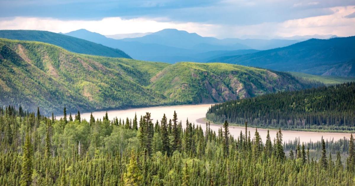
The Yukon River flows through a varied landscape, starting amidst the rolling hills and pine forests near Whitehorse. As you paddle downstream, the terrain gradually opens up, revealing expansive floodplains, dramatic erosion bluffs, and eventually the more open, tundra-like conditions approaching Dawson City. The river itself is wide and powerful, with numerous channels and islands, especially in the larger delta areas. The shoreline is often densely vegetated with spruce, aspen, and willow, providing critical habitat for wildlife. This is a land shaped by glacial forces and the relentless flow of water, offering a dynamic and ever-changing panorama for paddlers.
Season and Weather
The prime paddling season runs from early June to mid-September. June offers longer daylight hours and generally lower mosquito populations, though water levels can be high from spring runoff. July and August bring warmer temperatures but also more insects. By September, the autumn colors begin to emerge, and crowds thin out, but temperatures can drop significantly, especially at night. Weather is highly unpredictable; be prepared for anything from warm sunshine to cold rain and strong winds, sometimes all in the same day. Water temperatures remain cold throughout the season, necessitating proper immersion protection in case of a capsize.
Wildlife Encounters
The Yukon River corridor is teeming with wildlife. Moose are frequently sighted along the banks, often wading in the shallows. Black bears and grizzlies inhabit the surrounding forests, making proper food storage and bear awareness essential. Anglers can find Arctic grayling and various salmon species. Birdwatchers will appreciate the diverse avian life, including bald eagles, ospreys, and numerous waterfowl species. Keep a keen eye out for beaver and muskrat in calmer stretches. These encounters are a highlight of the trip, offering a true taste of northern wilderness, but always remember to observe from a respectful distance.
Routes and Attractions
The classic route covers the approximately 740 km from Whitehorse to Dawson City, typically taking 10-20 days. Key attractions along the way include the remains of the SS Evelyn, the infamous Five Finger Rapids (navigable by experienced paddlers or portaged), and the historic settlement of Fort Selkirk. Smaller routes, like the section from Carmacks to Dawson, offer a shorter trip while still capturing the essence of the river. Dawson City itself, at the journey's end, is a living museum of the Klondike Gold Rush, providing a fitting historical conclusion to a wilderness adventure.
Permits and Access
No specific permits are required for paddling the main stem of the Yukon River itself. However, if you plan to access or camp within specific Territorial Parks or First Nation settlement lands, it's advisable to check local regulations. Access points are straightforward in Whitehorse (various public launches) and Carmacks. Extraction in Dawson City is also well-established, with multiple outfitters offering shuttle and gear services. While formal permits are minimal, responsible backcountry ethics and Leave No Trace principles are strongly encouraged to preserve this pristine environment for future paddlers.
How we chose
We built this ranking from trip reports, agency data, permit records, and our editors' own time on the ground. 10 places made the final cut out of a much longer working list, and each one had to clear the same set of criteria before it earned a spot.
- Quality of the terrain
- Landscape, route variety, and whether the place rewards multiple days rather than one overlook.
- Season and weather windows
- How long the reliable window is, and how badly the shoulder seasons punish a bad forecast.
- Access and permits
- Trailhead logistics, permit odds, quotas, and how much lead time a trip realistically takes.
- Solitude vs. crowding
- How far you have to walk before the place feels like wilderness instead of a queue.
- Wildlife and ecology
- What you can reasonably expect to see, and what you have to plan around.
- Risk and skill required
- Navigation, water crossings, exposure, and rescue distance — stated plainly.
Yukon River corridor — frequently asked questions
- Is Yukon River corridor worth the trip?
- We rank it #3 in Adventure Locations. Multi-week paddle expeditions through history and true wilderness.
- Who is Yukon River corridor best for?
- Best for multi-day canoe expeditions, historical exploration, backcountry self-reliance training and wildlife photography. Standouts: deep immersion in untouched wilderness and rich historical and cultural experience.
- What are the drawbacks of Yukon River corridor?
- Requires significant paddling experience, Logistically challenging for extended trips and Unpredictable weather and cold water.
- What are the key details for Yukon River corridor?
- Primary Activity: Canoeing / Kayaking · Location: Yukon Territory, Canada · Distance (Whitehorse-Dawson): Approx. 740 km (460 miles) · Typical Duration: 10-20 days · Best Season: June - September
- Geography and Terrain — what should I know about the Yukon River corridor?
- The Yukon River flows through a varied landscape, starting amidst the rolling hills and pine forests near Whitehorse. As you paddle downstream, the terrain gradually opens up, revealing expansive floodplains, dramatic erosion bluffs, and eventually the more open, tundra-like conditions approaching Dawson City.
- Season and Weather — what should I know about the Yukon River corridor?
- The prime paddling season runs from early June to mid-September. June offers longer daylight hours and generally lower mosquito populations, though water levels can be high from spring runoff.
Where on earth
Satellite imagery flying in from a world view to Yukon River corridor. Use the + / − buttons, or click the map to zoom with your scroll wheel; drag to pan and pinch to zoom on touch.
Yukon River · 63.578, -149.631
Wildlife found around Yukon River corridor








Compare side by side
Put the Yukon River corridor against any other pick on this list — specs, price, pros, cons and reader ratings.