



- Region
- Oregon, USA
- Best season
- Spring, Summer
- Permits
- A Boater Pass is required year-round for d…
- Managed by
- Oregon Parks and Recreation Department (cooperatively with Prineville District Bureau of Land Management and Confederated Tribes of Warm Springs for Lower Deschutes River)
Plan with verified data
Deschutes River trip tools
Tools for a trip here
Picked for how, when and where you're going. Free, no signup.
Photos of Deschutes River
How to get there
The Deschutes River can be accessed from multiple locations throughout Oregon. Access points are available from areas around Bend, including several day use areas off of Forest Service Road 41. Further north, the Lower Deschutes River Back Country Byway originates from Maupin, and the Trout Creek Trailhead is near Madras.

Photo: Coconino National Forest / CC0 Meadow Day Use AreaThis site is one of many access points to the Deschutes River Trail.

Photo: Rennett Stowe from USA / CC BY 2.0 Lava Island Day UseThis site provides access to the Deschutes River Trail.
- Big Eddy Trailhead
This trailhead provides access to the Deschutes River Trail.
- Aspen Day Use Area
From Bend, travel 7 miles west on Cascade Lakes Highway 46, then approximately 2 miles south on Forest Road 41 to reach this access point. It features a boat launch and access to the Deschutes River Trail.
- Dillon Falls Day Use
This site provides access to the Deschutes River Trail.
- Slough Day Use Area
This site provides access to the Deschutes River Trail.
Sources: stateparks.oregon.gov · Wikipedia · Wikivoyage · USDA Forest Service. Confirm road and trailhead conditions with the managing agency before you leave.
Oregon, USA · Season: Best: Jun – Oct
- Fishing
- Desert Hiking
- Canyoneering
- Canoeing
- Photography
The country
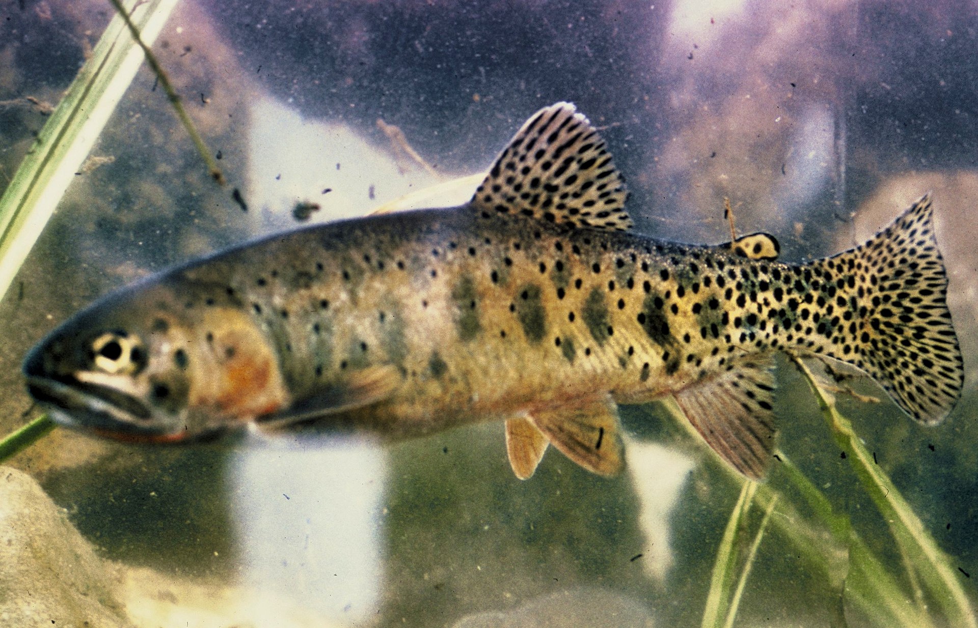
The Lower Deschutes drops 2,000 ft through 100 miles of basalt canyon between Warm Springs and the Columbia. Desert riparian corridor — willows, cottonwoods, sagebrush shoulders. Wild native redside rainbow trout above the falls; wild summer steelhead below.
Why enthusiasts come
The salmonfly hatch in May–early June is one of North America's great dry-fly events. Redsides are famously hard-fighting for their size. Summer steelhead fishing from August onward is the classic PNW two-hander experience.
Top experiences
The salmonfly hatch below Warm Springs, swinging a soft-hackle skater for a Deschutes steelhead at dawn, walking the railroad tracks between Maupin and Sherars, and floating the Warm Springs to Trout Creek overnight.
Planner-relevant notes
Boaters must have a Deschutes River Boater Pass; multi-day floats require permitted camps (BLM lottery). Wading only above the falls if you don't have a boat pass. The lower canyon is genuinely hot in July–August; get on the water early.
Field notes
- Deschutes redsides are legendary in the fight — 4X tippet minimum.
- The salmonfly hatch shifts 2 weeks year-to-year; call local shops in mid-May.
- Walking the tracks below Maupin is legal but keep off the rails; trains run frequently.
- Steelhead fishing here is by tradition a swung-fly game — nymphing is legal but frowned on.
Where on earth
Satellite imagery flying in from a world view to Deschutes River, Oregon, USA. Use the + / − buttons, or click the map to zoom with your scroll wheel; drag to pan and pinch to zoom on touch.
Coordinates
- Decimal degrees
- 44.7500, -121.0000
- Latitude (DMS)
- 44° 45′ 0.0″ N
- Longitude (DMS)
- 121° 0′ 0.0″ W
Coordinates are an access-point reference for Deschutes River, not a route. Carry a paper map and confirm trailhead or put-in access with the managing agency before you go.
Topic summary
The Northwest's best-known desert river — wild steelhead, dry-fly redsides, and a 100-mile Wild and Scenic corridor.
Key takeaways
- Region: Oregon, USA
- Best season: Best: Jun – Oct
- Coordinates: 44.750, -121.000
Climate suitability
Best: Jun – Oct
Keep planning
Popular pursuits at Deschutes River
- Fishing
Resident gamefish, seasons, and the water that holds them.
- Desert Hiking
Water carries and heat management drive the plan.
- Canyoneering
Narrows, downclimbs, and flash-flood timing.
- Canoeing
Paddle routes, portages, and put-ins.
- Photography
Vantage points and the hours worth setting an alarm for.
Animals around Deschutes River






Region Overview
The Deschutes River, a major tributary of the Columbia River, flows north for 252 miles from the Cascade Mountains. Its valley serves as a cultural center for central Oregon. The river provides drainage on the eastern side of the Cascade Range, collecting water from the drier eastern flank of the mountains. Historically, the Deschutes was a significant route for Native Americans and later for pioneers on the Oregon Trail. Today, the river supplies irrigation water and is a popular destination for whitewater rafting and fishing. The last 100 miles of the river, known as the Lower Deschutes, hold a National Wild and Scenic River designation and are an Oregon Scenic Waterway due to outstanding scenery, ecological importance, and recreational value. The Deschutes River State Recreation Area, located near The Dalles, Oregon, serves as a hub for various activities including hiking, mountain biking, camping, whitewater rafting, and fishing. It also provides access to the Lower Deschutes Wildlife Area.
Hiking and Biking
The Deschutes River State Recreation Area offers a network of trails for hiking, biking, and horseback riding. Six miles of looping trails are dedicated to hiking only, including the Ferry Springs Trail, which offers views of the canyon rim, surrounding hills, and the river. For cyclists, the Deschutes River Trail provides a 26-mile round-trip ride along the east bank of the river. This trail features an easy, flat grade, though mountain bikes are recommended due to its dirt and gravel surface. Riders should be prepared with a patch kit. The 2-mile Rock Pile trail on the west bank also welcomes bicycles. Equestrians can use 11 miles of the Deschutes River Trail route from March 1 through June 30. Backcountry camping is allowed along the Deschutes River Trail, but overnight camping with horses is not permitted. E-bikes are restricted to the first 2 miles of the Deschutes River Trail; beyond this point, they are not allowed.
Water Recreation
The Deschutes River is known for whitewater rafting, particularly on the lower 25 miles of its Wild and Scenic section, which includes three rapids: Washout, Rattlesnake, and Moody. It is also a world-class destination for steelhead and trout fishing. Anyone using a watercraft or floating device, including float tubes, on the Deschutes River, requires a Boater Pass. Heritage Landing, located across the river from the campground, features a boat ramp popular with jet boaters. A life jacket loaner station is available at Heritage Landing. Boaters should check for obstructions on the Oregon State Marine Board's alerts page before their trip. The lower 2 miles of the river, from below Moody Rapids to Rattlesnake Rapids, is designated as a pass-through zone, where boaters are prohibited from stopping. This area is reserved for hike-in and bike-in river access.
Camping and Facilities
The Deschutes River State Recreation Area offers year-round camping options. Reservations can be made up to six months in advance. The A Loop, open year-round, provides 34 electrical sites with water for RV or tent camping, though water is shut off in winter. This loop includes flush toilets and hot showers seasonally, along with paved parking pads. The B Loop has 14 primitive RV/tent sites, vault toilets, and nearby potable water, but is closed in winter. The G Loop offers four reservable primitive RV/tent group camping areas, accommodating up to 25 people across five RVs or tents, with vault toilets and potable water, also closed in winter. The T Loop, closed in winter, provides 11 primitive sites for tents only, with vault toilets. Campfires are typically prohibited during summer months. Specific fire restrictions may be in effect, banning wood fires, charcoal, and other devices that emit flames or embers, allowing only liquefied or bottled fuel devices with an on/off valve. Cooking is restricted to campsites and irrigated park areas during these periods.
Wildlife and Environment
The Deschutes River State Recreation Area is a gateway to the Lower Deschutes Wildlife Area. The river supports one of Oregon's premier steelhead and trout fisheries. The landscape greens early in spring, offering a respite from wetter weather further west, with the first wildflowers emerging in late February. Summer temperatures frequently reach into the 100s. Beyond the park boundary, winter marks the upland bird hunting season. The Lower Deschutes River is cooperatively managed by the Prineville District Bureau of Land Management, the Confederated Tribes of Warm Springs, and Oregon Parks and Recreation Department, reflecting its importance for both recreation and ecological value.
Route options
- Deschutes River Trail (East Bank)26-mile round-tripEasy
This 26-mile round-trip trail follows the east bank of the Deschutes River. It has an easy, flat grade, but mountain bikes are recommended due to its dirt and gravel surface. Backcountry camping is allowed along the trail. E-bikes are only permitted on the first 2 miles.
- Rock Pile Trail (West Bank)2-mile
A 2-mile trail that follows the west bank of the river. Bicycles are welcome on this route.
- Ferry Springs Trail
A looping hiking trail within the park that ascends toward the canyon rim, offering views of the surrounding hills and the river.
Sample itineraries
- Weekend Fishing and Camping · 2 days
Spend a weekend targeting steelhead and trout on the Deschutes River. Secure an electrical campsite in the A Loop. Enjoy day-use fishing on Saturday and Sunday, returning to camp in the evenings. Check current fire restrictions before planning any campfire activities.
- River Trail Bike Tour · 1 day
Embark on the 26-mile round-trip Deschutes River Trail (East Bank) for a day of mountain biking. Start early to avoid the summer heat. Pack a patch kit for tire repairs. Consider an overnight backcountry camping stop along the trail if desired.
Seasonal conditions
Spring
Late February - May
Spring arrives early, painting the landscape green. The first wildflowers emerge in late February. Offers a break from rainy weather found further west in Oregon. Equestrians can ride on 11 miles of the Deschutes River Trail route from March 1 through June 30.
Summer
June - August
Heat builds, with summer temperatures regularly reaching the 100s. Anglers frequent the park. Campfires are typically prohibited, and strict open flame restrictions are often in effect. Whitewater rafting is popular.
Fall
September - November
Anglers continue to flock to the park. A Loop campsites transition to first-come, first-served from November 1.
Winter
December - February
A Loop campsites are open year-round on a first-come, first-served basis from November 1 to March 31. Water for RV sites in A Loop is shut off. B, G, and T Loops are closed. Upland bird hunting season occurs beyond the park boundary.
| Season | Window | Conditions |
|---|---|---|
| Spring | Late February - May | Spring arrives early, painting the landscape green. The first wildflowers emerge in late February. Offers a break from rainy weather found further west in Oregon. Equestrians can ride on 11 miles of the Deschutes River Trail route from March 1 through June 30. |
| Summer | June - August | Heat builds, with summer temperatures regularly reaching the 100s. Anglers frequent the park. Campfires are typically prohibited, and strict open flame restrictions are often in effect. Whitewater rafting is popular. |
| Fall | September - November | Anglers continue to flock to the park. A Loop campsites transition to first-come, first-served from November 1. |
| Winter | December - February | A Loop campsites are open year-round on a first-come, first-served basis from November 1 to March 31. Water for RV sites in A Loop is shut off. B, G, and T Loops are closed. Upland bird hunting season occurs beyond the park boundary. |
Permits, fees & closures
A Boater Pass is required year-round for day and overnight use by anyone using a watercraft or floating device (including float tubes) on the Deschutes River. Passes are per person. A Deschutes River Boater Pass is valid above Moody Rapid (from Pelton Dam to the I-84 bridge at Heritage Landing). If accessing the Deschutes River below Moody Rapid only, a Moody Island Boater Pass is required. Confirm specific requirements and purchase passes through recreation.gov or self-pay kiosks for the Moody Island Boater Pass.
Fees: Moody Island Boater Pass: $2 per person per use (at self-pay kiosks).
Reservations: Deschutes River Boater Passes are available for purchase online at recreation.gov.
Official source: Deschutes River State Recreation Area - Oregon State Parks · Verified September 2, 2026
Hazards & regulations
- High summer temperatures (often 100s).
- Dirt and gravel trails require suitable bike tires and patch kits.
- Potential for active wildfires, leading to open flame restrictions and air quality concerns.
- River obstructions, requiring boaters to check alerts from the Oregon State Marine Board.
- Strong currents and rapids, making life jacket use essential for all water activities.
- E-bike restrictions on certain trail sections.
What to pack for Deschutes River
- Life jacket (properly fitting)
- Boater Pass (pre-purchased or kiosk funds)
- Patch kit (for float tubes)
- Mountain bike (for dirt/gravel trails)
- Patch kit (for bike tires)
- Water (especially in summer)
- Liquefied or bottled fuel devices with on/off valve (during fire restrictions)
- Tent (for primitive sites)
- RV (for designated sites)
- Warm layers (for cooler seasons)
Deschutes River FAQ
- Do I need a Boater Pass to access the Deschutes or Columbia River?
- Yes, a boater pass is required for anyone using a watercraft or floating device to access the Deschutes River or the Columbia River. All passes are per person.
- Where can I purchase a Deschutes River Boater Pass?
- The Deschutes River Boater Pass, valid above Moody Rapid, can be purchased online at recreation.gov.
- Is a separate pass needed for the lower section of the river?
- If accessing the Deschutes River below Moody Rapid only, a Moody Island Boater Pass is required. These are available for purchase at self-pay kiosks.
- Are campfires allowed year-round?
- No, campfires are typically prohibited during summer months. Open flame restrictions may be in effect, banning wood fires and charcoal, allowing only liquefied or bottled fuel devices with an on/off valve. Cooking is restricted to campsites and irrigated park areas during these times.
- Are e-bikes permitted on all trails?
- E-bikes are only permitted on the first 2 miles of the Deschutes River Trail (old railbed trail). After mile 2, they are not allowed due to a change in property ownership.
- Where can I find maps of the area?
- Maps for this location are available, created and maintained by Oregon Parks & Recreation Department staff for the public. Specific interactive and PDF maps are available online.