



- Region
- British Columbia, Canada
- Best season
- Spring, Summer
- Permits
- Confirm current permit, access, and bookin…
Plan with verified data
Mount Robson Provincial Park trip tools
Tools for a trip here
Picked for how, when and where you're going. Free, no signup.
Photos of Mount Robson Provincial Park
How to get there
The Yellowhead Highway (Highway 16) provides views of Mount Robson’s south face. Confirm the exact park entrance or trailhead separately before planning travel beyond the highway corridor.
- Yellowhead Highway (Highway 16)
The named road corridor from which Mount Robson’s south face is clearly visible. Use a safe, lawful stopping location for viewing; no specific parking area or trailhead is identified.
- Mount Robson south face
A viewing target visible from Highway 16, not a confirmed trailhead or mountain-access location. Do not assume that visibility from the road establishes an approach route.
Sources: Wikipedia · Wikivoyage. Confirm road and trailhead conditions with the managing agency before you leave.
British Columbia, Canada · Season: Best: July - September
- Climbing
- Mountaineering
- Winter Camping
- Skiing
- Hiking
- Backpacking
- Wildlife Viewing
- Canoeing
The country
The park's namesake, Mount Robson, is a colossal sedimentary giant that entirely dominates its surrounding landscape. The region features steep glacial valleys carved deeply into the limestone and shale rock, discharging huge volumes of silt-laden blue water. The climatic divide creates dense, cedar-hemlock inland rainforests in the lower valleys, transitioning sharply to harsh alpine tundra.
Why enthusiasts come
Backpackers consider the trek to Berg Lake the definitive Canadian Rockies trail experience, highlighting massive waterfalls and tumbling glaciers. Alpinists are drawn to the notorious north face of Mount Robson, an exceedingly dangerous and rarely summited objective.
Top experiences
Backpacking the 21km trail to Berg Lake offers a front-row seat to chunks of the Robson Glacier calving directly into the iceberg-dotted water. Day treks up the Snowbird Pass route provide breathtaking panoramas over the massive Robson Icefield.
Planner-relevant notes
The Berg Lake trail is massively popular, and campsites must be secured via the BC Parks reservation system the exact day they are released. Major trail washouts frequently occur in the lower sections; check park bulletins for unexpected closures. Bicycles are permitted on the first 7 kilometers of the trail up to Kinney Lake, cutting significant time off the approach.
Field notes
- Do not push past the Emperor Falls campground without taking the short spur trail to stand near the massive spray of the falls.
- The hike from Kinney Lake up to Emperor Falls is a brutal, sustained elevation gain affectionately known as 'The Hill.'
- Stove fuel is heavily strictly enforced for cooking; campfires are completely banned in the alpine backcountry.
- Heli-drops are occasionally available to drop gear at Berg Lake, though purists prefer the grueling multi-day trek.
Where on earth
Satellite imagery flying in from a world view to Mount Robson Provincial Park, British Columbia, Canada. Use the + / − buttons, or click the map to zoom with your scroll wheel; drag to pan and pinch to zoom on touch.
Coordinates
- Decimal degrees
- 53.1167, -119.2333
- Latitude (DMS)
- 53° 7′ 0.1″ N
- Longitude (DMS)
- 119° 13′ 59.9″ W
Coordinates are an access-point reference for Mount Robson Provincial Park, not a route. Carry a paper map and confirm trailhead or put-in access with the managing agency before you go.
Topic summary
The highest peak in the Canadian Rockies presides over a high-elevation backcountry teeming with turquoise lakes and massive glaciers.
Key takeaways
- Region: British Columbia, Canada
- Best season: Best: July - September
- Coordinates: 53.117, -119.233
Climate suitability
Best: July - September
Keep planning
Popular pursuits at Mount Robson Provincial Park
- Climbing
Rock and alpine lines with approach beta.
- Mountaineering
Glacier and high-route objectives with real consequence.
- Hiking
Day miles on marked trail, with route notes and trail links below.
- Backpacking
Multi-day travel with everything on your back — see the packing blocks below.
- Winter Camping
Cold-season travel and camp craft; layering matters more than mileage.
- Wildlife Viewing
Best light, best season, and where animals move.
Animals around Mount Robson Provincial Park
 Wildlife guideTimber wolfCanis lupus
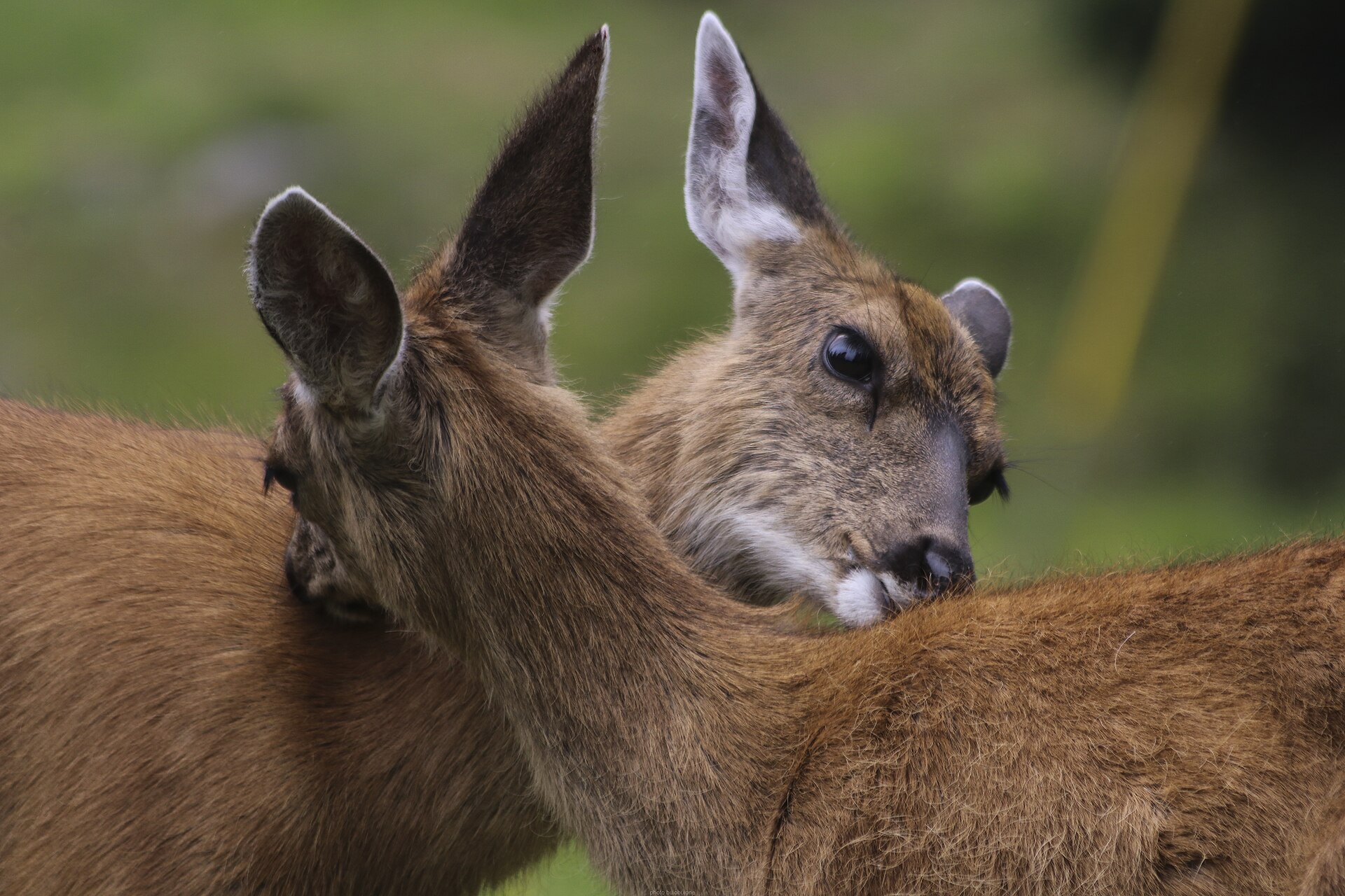 Big gameBlacktail DeerOdocoileus hemionus columbianus
 GamefishPacific SalmonOncorhynchus spp.
 Wildlife guideCanada lynxLynx canadensis
 Big gameElkCervus canadensis
 GamefishRainbow TroutOncorhynchus mykiss
 Wildlife guideBlack bearUrsus americanus
 Big gameBlack BearUrsus americanus
A park centered on the Canadian Rockies’ highest mountain
Mount Robson Provincial Park contains the whole of Mount Robson, the highest point in the Canadian Rockies and the most prominent mountain in North America’s Rocky Mountain range. The mountain belongs to the Rainbow Range in British Columbia. Its south face is clearly visible from the Yellowhead Highway, also called Highway 16, giving travelers a way to see the mountain without committing to a mountain route. That distinction matters when planning a visit: seeing the face from the highway and traveling into mountain terrain are different undertakings. A viewing-focused visit can center on the highway corridor; any walking or climbing plan needs separate confirmation of its route and access. Mount Robson is also the second-highest peak entirely within British Columbia, behind Mount Waddington in the Coast Range.
Planning around the highway view
The clearest starting point for a viewing-focused visit is the Yellowhead Highway, where Mount Robson’s south face is a commonly photographed sight. Make that view the anchor of a short visit rather than assuming that a roadside stop also provides access to a suitable walking route. Choose a safe, lawful stopping place and keep photography separate from driving. For plans beyond highway viewing, establish the exact starting point, terrain and current conditions before setting out. A mountain’s visibility from a major road says little about the effort or skills needed to travel on it. Carry weather protection appropriate to a Rocky Mountain setting, and allow for visibility to change. No particular season should be treated as a guarantee of a clear view.
Names and cultural context
Mount Robson has a naming history that extends beyond the name on modern maps. The Texqa’kallt, a Secwepemc people and the earliest known inhabitants of the area, call the mountain Yexyexéscen, meaning “striped rock.” A historical spelling, Yuh-hai-has-kun, appears with the name “The Mountain of the Spiral Road.” The name Mount Robson likely refers to Colin Robertson, who worked for both the North West Company and the Hudson’s Bay Company in the early nineteenth century. That attribution is not certain; the name has also been mistakenly associated with John Robson, an early premier of British Columbia. Cloud Cap Mountain is another unofficial name. These names offer useful context for a visit, alongside the mountain’s geographic standing and the south-face view from Highway 16.
Route options
- Yellowhead Highway viewing drive
A road-based option focused on seeing and photographing Mount Robson’s south face from the Highway 16 corridor. No specific driving endpoints or designated stopping locations are established here.
- Mount Robson mountain-route planning
No specific walking or climbing route is established here. Before choosing a mountain outing, confirm a named route, its starting point, current access and required skills with the managing agency; the highway view alone is not enough to plan an approach.
Sample itineraries
- Yellowhead Highway mountain-view day · 1 day
Make Mount Robson’s south face the focus of a day along the Yellowhead Highway (Highway 16). The mountain is clearly visible from this route. View and photograph it only from places where stopping is safe and allowed; this plan does not include a hiking route.
- Two-day photography visit · 2 days
Allow two days for viewing Mount Robson from the Yellowhead Highway, giving flexibility for changing mountain weather and visibility. Focus on the south face and its setting in the Rainbow Range. Confirm accommodation and any park activities separately before building them into the visit.
Seasonal conditions
Spring
Spring; plan around current mountain conditions
Do not assume conditions at highway level represent conditions higher on Mount Robson. Prepare for cold and wet weather, and confirm access before planning travel beyond roadside viewing.
Summer
Summer; check conditions before departure
Use current forecasts rather than the season alone to choose clothing and activities. Mountain weather can change, so carry warm layers and rain protection even for a visit centered on south-face views.
Fall
Fall; keep plans weather-dependent
Build flexibility into photography and outdoor plans. Prepare for cold conditions and reduced daylight, and check current access rather than assuming summer arrangements continue.
Winter
Winter; verify road and mountain conditions
Treat a highway viewing visit and mountain travel as very different undertakings. Prepare for cold, check driving conditions, and do not interpret roadside visibility of the peak as evidence of accessible mountain terrain.
| Season | Window | Conditions |
|---|---|---|
| Spring | Spring; plan around current mountain conditions | Do not assume conditions at highway level represent conditions higher on Mount Robson. Prepare for cold and wet weather, and confirm access before planning travel beyond roadside viewing. |
| Summer | Summer; check conditions before departure | Use current forecasts rather than the season alone to choose clothing and activities. Mountain weather can change, so carry warm layers and rain protection even for a visit centered on south-face views. |
| Fall | Fall; keep plans weather-dependent | Build flexibility into photography and outdoor plans. Prepare for cold conditions and reduced daylight, and check current access rather than assuming summer arrangements continue. |
| Winter | Winter; verify road and mountain conditions | Treat a highway viewing visit and mountain travel as very different undertakings. Prepare for cold, check driving conditions, and do not interpret roadside visibility of the peak as evidence of accessible mountain terrain. |
Permits, fees & closures
Confirm current permit, access, and booking requirements with the agency managing Mount Robson Provincial Park before finalizing activities.
Confirm current permits, fees, and closures with the managing agency before you go.
Hazards & regulations
- Rough mountain terrain: a clear view from the highway does not establish a safe or straightforward route into the mountains.
- Mountain weather: carry protection against cold and wet conditions, and change plans when conditions exceed your preparation.
- Water planning: bring sufficient drinking water rather than assuming supplies will be available during outdoor stops.
What to pack for Mount Robson Provincial Park
- Warm insulating layer
- Waterproof outer layer
- Warm hat and gloves
- Drinking water
- Food for the planned outing
- First-aid kit
- Navigation appropriate to the planned activity
- Camera
- Binoculars
- Spare batteries
Mount Robson Provincial Park FAQ
- Where is Mount Robson?
- Mount Robson lies entirely within Mount Robson Provincial Park in British Columbia, Canada. It belongs to the Rainbow Range of the Canadian Rockies.
- What makes the mountain geographically significant?
- Mount Robson is the highest point in the Canadian Rockies and the most prominent mountain in North America’s Rocky Mountain range. It is the second-highest peak entirely within British Columbia, after Mount Waddington.
- Can Mount Robson be seen without a hike?
- Yes. Its south face is clearly visible from the Yellowhead Highway (Highway 16) and is commonly photographed along that route. Choose only safe, legal stopping places.
- What is the mountain’s Indigenous name?
- The Texqa’kallt, a Secwepemc people and the area’s earliest known inhabitants, call it Yexyexéscen, meaning “striped rock.” The name “The Mountain of the Spiral Road” is also recorded.
- Does a roadside visit provide enough information to plan a mountain route?
- No. Viewing the south face is distinct from traveling through mountain terrain. Obtain current route, access, and safety information from the managing agency before adding hiking or other mountain activities.