



- Region
- British Columbia
- Country
- Canada
- Best for
- fishing
- Best season
- Spring, Summer
- Permits
- Confirm fishing licence and any additional…
- Managed by
- Fisheries and Oceans Canada for recreational salmon fishing regulations; Government of British Columbia for freshwater fishing regulations concerning other species.
Plan with verified data
Skeena River System (Bulkley, Babine, Copper) trip tools
Tools for a trip here
Picked for how, when and where you're going. Free, no signup.
How to get there
Terrace’s CNR Railway Bridge is a regulatory landmark separating the upstream Skeena watershed section. On the Morice River, Bymac Bridge on Walcott Road is another named reach boundary. Use these as orientation landmarks, not as assurances of public parking, bank access or boat launching; confirm the actual entrance for the chosen reach before travelling.
- Bymac Bridge on Walcott Road
A named boundary on the Morice River for the reach extending upstream from its confluence with the Bulkley. Confirm lawful river access separately; the bridge’s role as a fishing boundary does not establish a launch or public entrance.
- The Forks — Bulkley–Morice confluence
A river-junction planning landmark marked by four white triangular fishing boundary signs. No fishing for salmon is allowed within the signed area from June 16 to August 15. The closure starts 100 metres upstream of the confluence and ends approximately 1 kilometre downstream. Confirm access and current restrictions before visiting.
Sources: pac.dfo-mpo.gc.ca · Wikipedia · Wikivoyage. Confirm road and trailhead conditions with the managing agency before you leave.
British Columbia · Canada · Season: Late fall through early spring
- Fishing
- Winter Camping
- Skiing
- Canoeing
Overview
While a vast system, the Skeena and its major tributaries (Bulkley, Babine, Copper) represent a collective powerhouse for wild steelhead. Located in northern British Columbia, these rivers are renowned for producing some of the largest and most pristine wild steelhead on Earth, with fish regularly pushing into the 20-pound class. This is a destination for the dedicated steelheader, offering a truly wild and remote experience. The prime season for summer-run steelhead is typically late August through October. Access is often through lodges and guided trips, though some public access exists, particularly on the Bulkley and Copper near Terrace and Smithers. Fly-in camps on the Babine offer unparalleled solitude. The fishing is primarily swinging flies with two-handed rods. Expect cold, often wet weather, and true wilderness conditions. This is not a casual trip; it demands commitment, significant travel, and a healthy budget if opting for guided lodge experiences. Conservation efforts are paramount here, with strict regulations to protect these vital wild populations. The sheer size and power of Skeena system steelhead, combined with the epic backdrop of British Columbia's wilderness, make it a bucket-list destination for serious anglers, though one that requires careful planning and a deep appreciation for the remote.
Why it stands out
Home to some of the largest wild steelhead in the world.
True wilderness experience with stunning B.C. scenery.
Multiple world-class tributaries (Bulkley, Babine, Copper) to explore.
High potential for solitude in remote sections.
Excellent opportunities for two-handed fly fishing.
Know before you go
Significant travel time and expense to reach remote locations.
Often requires booking through lodges or guides for best access.
Limited public access in many prime areas.
Harsh weather conditions (cold, rain, early snow) are common in fall.
Strict regulations and conservation closures are frequently implemented.
Planning notes
Where: British Columbia, Canada Best season: Late fall through early spring Good for: Fishing Featured on: Top 10 Steelhead Rivers in the Pacific Northwest (#5) Access point: Bulkley River, British Columbia, Canada
Check current permits, closures and fire restrictions with the managing agency before you commit to dates.
Field notes
- Home to some of the largest wild steelhead in the world.
- True wilderness experience with stunning B.C. scenery.
- Multiple world-class tributaries (Bulkley, Babine, Copper) to explore.
- High potential for solitude in remote sections.
- Excellent opportunities for two-handed fly fishing.
Where on earth
Satellite imagery flying in from a world view to Skeena River System (Bulkley, Babine, Copper), Canada. Use the + / − buttons, or click the map to zoom with your scroll wheel; drag to pan and pinch to zoom on touch.
Coordinates
- Decimal degrees
- 54.8282, -126.9079
- Latitude (DMS)
- 54° 49′ 41.4″ N
- Longitude (DMS)
- 126° 54′ 28.3″ W
Coordinates are an access-point reference for Skeena River System (Bulkley, Babine, Copper), not a route. Carry a paper map and confirm trailhead or put-in access with the managing agency before you go.
Topic summary
While a vast system, the Skeena and its major tributaries (Bulkley, Babine, Copper) represent a collective powerhouse for wild steelhead.
Key takeaways
- Region: British Columbia
- Country: Canada
- Best season: Late fall through early spring
- Good for: fishing
- Coordinates: 54.828, -126.908
Intended uses
fishing
Climate suitability
Late fall through early spring
Keep planning
Popular pursuits at Skeena River System (Bulkley, Babine, Copper)
- Fishing
Resident gamefish, seasons, and the water that holds them.
- Winter Camping
Cold-season travel and camp craft; layering matters more than mileage.
- Skiing
Ski-touring access when the road closes for the season.
- Canoeing
Paddle routes, portages, and put-ins.
Animals around Skeena River System (Bulkley, Babine, Copper)
 Wildlife guideTimber wolfCanis lupus
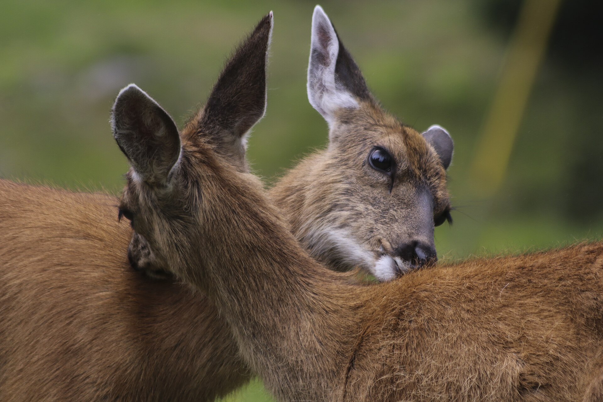 Big gameBlacktail DeerOdocoileus hemionus columbianus
 GamefishPacific SalmonOncorhynchus spp.
 Wildlife guideCanada lynxLynx canadensis
 Big gameElkCervus canadensis
 GamefishRainbow TroutOncorhynchus mykiss
 Wildlife guideBlack bearUrsus americanus
 Big gameBlack BearUrsus americanus
A river system with distinct reaches
The Skeena is the second-longest river entirely within British Columbia, and its basin supports fish, wildlife, vegetation and communities whose lives depend on the river’s health. For trip planning, treat the system as a collection of distinct waters rather than one interchangeable fishing destination. The Bulkley, Babine and Morice have separate regulatory entries, and rules can change at tributary mouths, bridges and posted boundary signs. A plan for one river should not be carried over to another without checking the exact reach. Start with the water you intend to visit, the species you intend to fish for and your travel dates. Then establish lawful bank or boat access separately; a named fishing boundary is not necessarily a public entrance or launch.
Bulkley and Babine fishing planning
The Bulkley downstream of the Morice confluence is treated separately from its tributaries, while the confluence itself has a defined seasonal salmon closure. Locally called the Forks, that area is marked by four white triangular fishing boundary signs. On the Babine River, natural bait is prohibited year-round. Babine Lake has its own rules and should not be treated as an extension of the river’s fishing opportunities. Species-specific notices and overlapping restrictions make a current check essential before choosing a fishing day. Consult Fisheries and Oceans Canada for salmon openings and the B.C. Freshwater Fishing Regulations Synopsis for other species. Confirm licence and permit requirements with the responsible agencies before departure. Neither a regional possession limit nor a nearby opening establishes that the reach you choose is open.
River history and responsible visits
The Skeena has long been a transportation artery, particularly for the Tsimshian and Gitxsan. The Tsimshian are associated with the Lower Skeena, while Gitxsan territory includes the Upper Skeena. During the Omineca Gold Rush, steamboats travelled from the sea to Hazelton, where trails continued toward the goldfields. That history is useful context for a visit: this is a lived-in river corridor, not simply a set of fishing waters. Respect local communities and establish permission wherever access is uncertain. Keep fish-handling and harvest decisions tied to the applicable rules, and leave banks free of line and other waste. Fishing is prohibited within 100 metres of any government facility operated for counting, passing or rearing fish, so account for those facilities when selecting a fishing location.
Route options
- Bulkley River downstream of the Morice confluence
A fishing-reach option rather than a defined travel itinerary. This main-river section excludes tributaries in its regulatory description. Check species-specific openings and distinguish it from the separately signed closure at the Forks. Establish entry and exit locations before committing to an outing.
- Babine River
Plan a river-specific fishing outing rather than applying Babine Lake rules. Natural bait is prohibited throughout the year. Confirm current salmon notices and other-species regulations, then verify access for the intended reach; no defined launch-to-takeout itinerary is established here.
- Morice River — Bulkley confluence to Bymac Bridge
A named regulatory reach ending at Bymac Bridge on Walcott Road. The Forks closure must be considered separately at the confluence, and natural bait is prohibited year-round on the Morice River and its tributaries. This reach description is not a verified paddling route.
Sample itineraries
- Bulkley River scouting and conditional fishing · 2 days
Spend one day checking lawful access and posted boundaries on the Bulkley downstream of the Morice confluence. Use the second for fishing only where current species rules allow. Treat the signed waters at the Forks separately; nearby stretches do not necessarily share the same restrictions.
- Babine River and lake reconnaissance · 2 days
Devote one day each to the Babine River and Babine Lake, confirming access before travel. Keep fishing conditional on current notices and exact boundaries. Lake exclusions around tributary mouths do not match river rules, and natural bait is prohibited year-round on the Babine River.
Seasonal conditions
Spring
Spring; upstream salmon restriction continues through June 15
Skeena watershed waters upstream of the CNR Railway Bridge at Terrace have a general no-salmon-fishing period from January 1 through June 15. Check reach-specific exceptions and separate rules for other species rather than treating spring as an unrestricted fishing season.
Summer
Summer; Forks restriction June 16–August 15
The signed Bulkley–Morice confluence waters are closed to salmon fishing during this window. Elsewhere, permissions differ by species and reach. Babine sockeye opportunities are tightly date-bound; verify current notices before making fishing the purpose of a visit.
Fall
Fall; listed Bulkley coho period ends October 15
The Bulkley downstream of the Morice confluence, excluding tributaries, has a listed coho period through October 15. Do not extend that permission to neighboring tributaries or the Babine. Confirm current notices and gear restrictions for the exact water.
Winter
Winter; general upstream salmon restriction begins January 1
Do not assume salmon fishing remains available through winter. Upstream of the CNR Railway Bridge at Terrace, the general January 1–June 15 prohibition applies, alongside species-specific restrictions. Check local weather and river conditions before any bankside outing.
| Season | Window | Conditions |
|---|---|---|
| Spring | Spring; upstream salmon restriction continues through June 15 | Skeena watershed waters upstream of the CNR Railway Bridge at Terrace have a general no-salmon-fishing period from January 1 through June 15. Check reach-specific exceptions and separate rules for other species rather than treating spring as an unrestricted fishing season. |
| Summer | Summer; Forks restriction June 16–August 15 | The signed Bulkley–Morice confluence waters are closed to salmon fishing during this window. Elsewhere, permissions differ by species and reach. Babine sockeye opportunities are tightly date-bound; verify current notices before making fishing the purpose of a visit. |
| Fall | Fall; listed Bulkley coho period ends October 15 | The Bulkley downstream of the Morice confluence, excluding tributaries, has a listed coho period through October 15. Do not extend that permission to neighboring tributaries or the Babine. Confirm current notices and gear restrictions for the exact water. |
| Winter | Winter; general upstream salmon restriction begins January 1 | Do not assume salmon fishing remains available through winter. Upstream of the CNR Railway Bridge at Terrace, the general January 1–June 15 prohibition applies, alongside species-specific restrictions. Check local weather and river conditions before any bankside outing. |
Permits, fees & closures
Confirm fishing licence and any additional authorization requirements with the managing fisheries agencies before travel. Check current salmon notices and provincial freshwater regulations for the exact river, reach, species and date.
Official source: Region 6 - Skeena: Recreational salmon fishing limits, openings and ... · Verified September 18, 2026
Hazards & regulations
- Moving river water requires conservative decisions: assess conditions from shore and avoid entering water when footing or current is uncertain.
- Regulatory boundaries can divide neighboring waters. At the Forks, use the four white triangular fishing boundary signs rather than assuming the confluence is open.
- Overlapping salmon restrictions require careful checking. The Babine River listings include both species-specific periods and a broader no-salmon-fishing entry; confirm which current notice governs before fishing.
- Fishing is prohibited within 100 meters of any government facility operated for counting, passing or rearing fish.
What to pack for Skeena River System (Bulkley, Babine, Copper)
- Current salmon notices and provincial freshwater fishing regulations saved offline
- Map showing river names, tributaries and confluences
- Required fishing documentation, confirmed before departure
- Personal flotation device for boating or activities with immersion risk
- Footwear suited to wet ground
- First-aid kit
- Waterproof storage for phone and essential documents
- Rain protection and insulating layers suited to the forecast
- Drinking water and food
- Measuring tool for checking legal fork length
- Tackle matched to the current rules for the selected reach
Skeena River System (Bulkley, Babine, Copper) FAQ
- Do the same salmon rules apply throughout the system?
- No. Rules distinguish mainstem waters, tributaries, confluences, species and dates. The upstream Skeena watershed has broad restrictions with specific exceptions. A permission for one Bulkley reach or Babine Lake does not establish permission elsewhere.
- Can natural bait be used on the Babine River?
- No natural bait is allowed on the Babine River from January 1 through December 31. Bulkley tributary bait restrictions have different dates and exceptions, so check the exact tributary rather than applying the Babine rule system-wide.
- Where is the Forks salmon closure?
- It covers Bulkley and Morice waters within four white triangular fishing boundary signs at their confluence. The described area begins 100 meters upstream and ends approximately 1 kilometre downstream. Salmon fishing is prohibited there June 16–August 15.
- Do salmon regulations also establish steelhead rules?
- No. The salmon rules do not establish permission to fish for steelhead or other non-salmon species. Consult the B.C. Freshwater Fishing Regulations Synopsis and confirm any additional requirements before planning that fishing.
- What should visitors understand about the Skeena's cultural setting?
- The Skeena has long been a transportation artery for the Tsimshian and Gitxsan. Tsimshian communities are associated with the Lower Skeena and Gitxsan territory with the Upper Skeena. River health sustains local communities as well as fish and wildlife; respect local access directions.
- Are these itineraries established access routes?
- No. They are suggested allocations of time, not verified access routes or boat trips. Confirm lawful entry, local conditions and current fishing rules before choosing a riverbank or launch location.