



- Region
- Hawaii, USA
- Best season
- Spring, Summer
- Permits
- Confirm current entry, activity and permit…
Plan with verified data
Kōkeʻe and Waimea Canyon State Parks trip tools
Tools for a trip here
Picked for how, when and where you're going. Free, no signup.
Photos of Kōkeʻe and Waimea Canyon State Parks
How to get there
Waimea Canyon is on Kauai’s West Side in Hawaii. Confirm driving directions and the appropriate park entrance with the managing agency before departure.
Sources: Wikipedia · Wikivoyage. Confirm road and trailhead conditions with the managing agency before you leave.
Hawaii, USA · Season: Best: Year-round (Summer is driest)
- Mountaineering
- Winter Camping
- Skiing
- Desert Hiking
- Canyoneering
- Sea Kayaking
- Beachcombing
- Birdwatching
The country
Dubbed the Grand Canyon of the Pacific, Waimea Canyon is a 14-mile-long gorge with deeply etched, red volcanic walls. Adjacent is Kōkeʻe State Park, a high-elevation plateau blanketed in native koa and ʻōhiʻa forests. This highland region shelters the Alakaʻi Swamp, a primordial, rain-drenched montane bog containing rare, endemic Hawaiian bird species.
Why enthusiasts come
These conjoined parks offer the finest upland hiking in Hawaii, accessible via a spectacularly scenic mountain road. Hikers explore trails precipitously clinging to canyon ridges that dramatically open up to sweeping ocean views of the Nā Pali Coast. It is a refuge from the island's coastal heat, known for cool temperatures and shifting mists.
Top experiences
The Awaʻawapuhi Trail takes hikers rapidly downhill along a razor-thin ridge, culminating in awe-inspiring views 4,000 feet straight down to the ocean. The Alakaʻi Swamp trail uses slippery wooden boardwalks to cross a dense, fog-shrouded highland bog. Backpacking into the canyon bottom via the Kukui Trail leads to a secluded wilderness river.
Planner-relevant notes
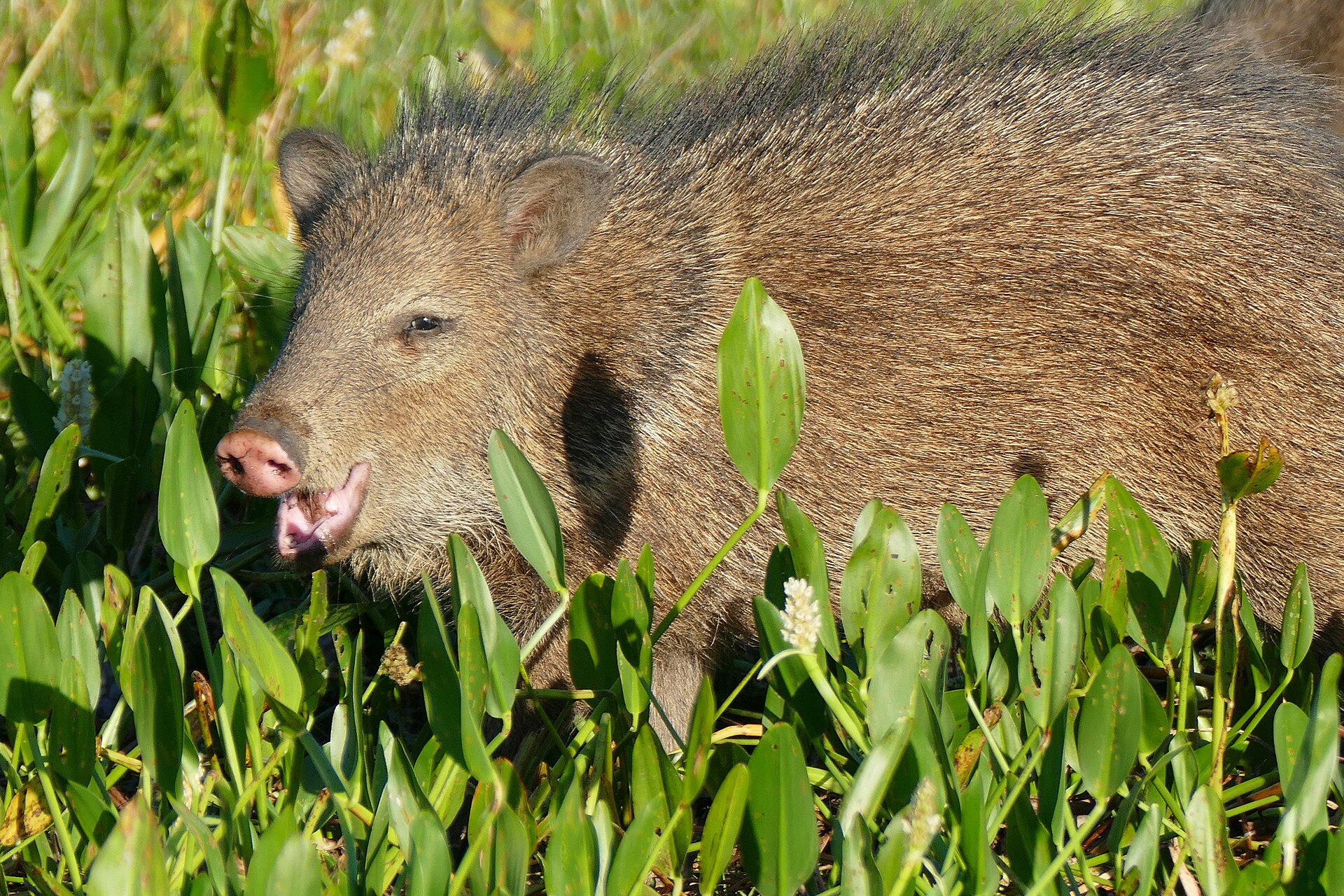
Day parking requires fee payments at kiosks utilizing frequently unreliable credit card machines. Tent camping at Kōkeʻe is available by permit, but heavy rain and deep mud are guaranteed. Many trails are deeply rutted from feral pigs and require sure footing on steep descents.
Field notes
- The clay mud on the trails, known locally as Kauai red dirt, is incredibly slick and stains gear permanently.
- Arrive at trailheads by 7:30 AM; cloud cover consistently fills the canyon and obscures views by lunch.
- Warm clothing is necessary. Temperatures drop rapidly at 4,000 feet, especially when wet and windy.
- There are no water sources on the prominent dry ridge trails; carry a minimum of 3 liters per person.
Where on earth
Satellite imagery flying in from a world view to Kōkeʻe and Waimea Canyon State Parks, Hawaii, USA. Use the + / − buttons, or click the map to zoom with your scroll wheel; drag to pan and pinch to zoom on touch.
Coordinates
- Decimal degrees
- 22.0911, -159.6558
- Latitude (DMS)
- 22° 5′ 28.0″ N
- Longitude (DMS)
- 159° 39′ 20.9″ W
Coordinates are an access-point reference for Kōkeʻe and Waimea Canyon State Parks, not a route. Carry a paper map and confirm trailhead or put-in access with the managing agency before you go.
Topic summary
Walk along plunging canyon rims through native highland bogs draped in mist and brilliant tropical greenery.
Key takeaways
- Region: Hawaii, USA
- Best season: Best: Year-round (Summer is driest)
- Coordinates: 22.091, -159.656
Climate suitability
Best: Year-round (Summer is driest)
Keep planning
Popular pursuits at Kōkeʻe and Waimea Canyon State Parks
- Mountaineering
Glacier and high-route objectives with real consequence.
- Desert Hiking
Water carries and heat management drive the plan.
- Canyoneering
Narrows, downclimbs, and flash-flood timing.
- Sea Kayaking
Coastal crossings, tides, and protected camps.
- Beachcombing
Tide-line walking between camps.
- Birdwatching
Migration windows and the habitat that concentrates birds.
Animals around Kōkeʻe and Waimea Canyon State Parks






Waimea Canyon’s setting and scale
Waimea Canyon lies on Kauai’s West Side in Hawaii. It is 14 miles long, about 1 mile wide, and more than 3,600 feet deep. Those measurements describe the canyon itself, not a hiking route or the distance between visitor access points. For trip planning, the important distinction is between seeing a large landscape and traveling through it: the canyon’s dimensions alone do not establish walking distances, elevation changes, or the difficulty of an outing. Use the canyon as the geographic focus of a visit, but choose a specific destination only after checking access information. A useful plan should identify where the outing begins, where it ends, and what terrain lies between those points.
Understanding the canyon comparison
Waimea Canyon is often called the “Grand Canyon of the Pacific,” although it is neither as large nor as old as the Grand Canyon. The nickname became popular after American explorer John Wesley Powell visited Kauai in 1869; its frequent attribution to Mark Twain is incorrect. That comparison offers a sense of scale, but it should not stand in for practical information about this destination. A canyon more than 3,600 feet deep deserves planning based on the actual outing rather than a familiar nickname. Separate the landscape’s overall dimensions from any proposed walk, and avoid treating its 14-mile length as a trail description. Route length and difficulty need to be established independently before setting out.
Planning a visit to both parks
For a trip combining Kōkeʻe and Waimea Canyon State Parks, confirm each park’s access arrangements separately with its managing agency. Do not assume that a single approach, stopping point, or walking route serves both destinations. Before choosing an itinerary, establish the starting location, the intended turnaround point, and whether the plan involves sightseeing or a hike. The canyon’s broad dimensions are not enough to determine how much time either activity requires. Check current conditions and any applicable entry requirements before departure. For walking, match footwear, water, and supplies to the verified route and expected weather. Keep the itinerary flexible until the practical details are settled, rather than assigning distances or difficulty ratings from the canyon’s size.
Sample itineraries
- Waimea Canyon orientation · 1 day
Focus on Waimea Canyon on Kauai’s West Side. Use its scale—14 miles long, 1 mile wide and more than 3,600 feet deep—to frame a sightseeing day rather than a canyon-crossing objective. Confirm suitable public access and current conditions before choosing stops.
- Two-park planning outline · 2 days
Allocate one day to Waimea Canyon and a separate day to Kōkeʻe, subject to confirmation of access and available activities. Choose specific stops only after checking managing-agency guidance; this outline does not establish a connecting route or overnight accommodation.
Seasonal conditions
Spring
Seasonal timing not established
No destination-specific spring conditions are established here. Check local forecasts and park notices before selecting activities.
Summer
Seasonal timing not established
No destination-specific summer conditions are established here. Do not assume a particular temperature range or reliable dry weather.
Fall
Seasonal timing not established
No destination-specific fall conditions are established here. Confirm weather and access before committing to a route.
Winter
Seasonal timing not established
No destination-specific winter conditions are established here. Check current forecasts rather than relying on a general Hawaii climate assumption.
| Season | Window | Conditions |
|---|---|---|
| Spring | Seasonal timing not established | No destination-specific spring conditions are established here. Check local forecasts and park notices before selecting activities. |
| Summer | Seasonal timing not established | No destination-specific summer conditions are established here. Do not assume a particular temperature range or reliable dry weather. |
| Fall | Seasonal timing not established | No destination-specific fall conditions are established here. Confirm weather and access before committing to a route. |
| Winter | Seasonal timing not established | No destination-specific winter conditions are established here. Check current forecasts rather than relying on a general Hawaii climate assumption. |
Permits, fees & closures
Confirm current entry, activity and permit requirements with the managing agency for each park.
Confirm current permits, fees, and closures with the managing agency before you go.
Hazards & regulations
- Canyon exposure: Waimea Canyon exceeds 3,600 feet in depth. Keep well back from exposed edges.
- Scale and fatigue: the canyon is 14 miles long and 1 mile wide. These are landscape dimensions, not walking distances; choose outings using verified route information.
- Unverified access: canyon dimensions do not establish a safe descent or crossing. Do not improvise either without confirmed route guidance.
What to pack for Kōkeʻe and Waimea Canyon State Parks
- Drinking water appropriate to the confirmed outing
- Food for the planned day
- Comfortable walking footwear
- Sun protection
- Current park map with confirmed public access
- Charged phone
- Weather-appropriate layers selected after checking the forecast
- Basic first-aid kit
Kōkeʻe and Waimea Canyon State Parks FAQ
- Where is Waimea Canyon?
- Waimea Canyon is on Kauai’s West Side in Hawaii.
- How large is the canyon?
- It is approximately 14 miles long, 1 mile wide and more than 3,600 feet deep. Those measurements describe the canyon, not a hiking route.
- Is a specific hiking route established here?
- No. Confirm trail names, access points, distances and current conditions with the managing agency before building a hiking itinerary.
- Can these two days be treated as a confirmed itinerary?
- No. They are planning outlines, not verified routes. Access, activities and any overnight arrangements need separate confirmation, particularly for Kōkeʻe.
- What is the best season to visit?
- A reliable seasonal recommendation is not established here. Choose dates using current local weather information and managing-agency guidance.