



- Region
- British Columbia, Canada
- Best season
- Spring, Summer
- Permits
- Confirm entry requirements, camping permit…
Plan with verified data
Wells Gray Provincial Park trip tools
Tools for a trip here
Picked for how, when and where you're going. Free, no signup.
Photos of Wells Gray Provincial Park
How to get there
Use Clearwater and Clearwater Valley Road as the local geographic anchors for the park approach. A Wells Gray Park entrance is on Clearwater Valley Road. The Clearwater Valley near the park is about 120 km north of Kamloops; this is a regional location, not a confirmed road distance to the entrance.
- Clearwater
A local orientation point south of the Wells Gray Park entrance on Clearwater Valley Road. Confirm onward directions to the specific park destination before travel.
- Wells Gray Park entrance on Clearwater Valley Road
The identified park entrance along Clearwater Valley Road. Distinguish this entrance from locations farther south in the Clearwater Valley.
Sources: Wikipedia · Wikivoyage. Confirm road and trailhead conditions with the managing agency before you leave.
British Columbia, Canada · Season: Best: June - September
- Canoeing
- Kayaking
- Fishing
- Hunting
- Climbing
- Mountaineering
- Hiking
- Backpacking
The country
Wells Gray is defined by fire and ice, featuring dramatic volcanic plateaus that have been drastically sculpted by subsequent glaciation. Deep river canyons give way to dramatic, sheer drops, creating some of North America's most impressive waterfalls. The dark, dense inland rainforest heavily blankets the untamed, mostly trail-less backcountry wilderness.
Why enthusiasts come
Paddlers escape the crowds by traversing the massive, interconnected chains of Clearwater and Azure lakes via canoe. Trekkers who abhor paved paths favor the untamed high alpine meadows of the Trophy Mountains.
Top experiences
A 4-to-6-day canoe trip up Clearwater Lake and portaging into Azure Lake puts paddlers deep into primeval wilderness teeming with moose. Hiking through the high-elevation Trophy Mountain meadows reveals an explosion of alpine wildflowers in late July.
Planner-relevant notes
Watercraft rentals and water-taxi services are available at the south end of Clearwater Lake to help bypass the initial flatwater slog. Backcountry permits are required, but reservations operate largely on a first-come, first-served basis for remote marine campsites. Black bears are highly active and frequently patrol the lake shorelines searching for dead fish; severe camp discipline is mandatory.
Field notes
- The winds blowing south down Clearwater Lake in the afternoon will completely halt up-lake progress; paddle exclusively at dawn.
- Trophy Mountain trail is short but heavily infested with biting insects; pack strong DEET and a head net.
- A water taxi drop-off at Rainbow Falls on Azure Lake allows a spectacular, wind-assisted paddle back to the access point.
- Creek water flowing over volcanic rock can severely lack minerals; use electrolyte drops if filtering from high upland streams.
Where on earth
Satellite imagery flying in from a world view to Wells Gray Provincial Park, British Columbia, Canada. Use the + / − buttons, or click the map to zoom with your scroll wheel; drag to pan and pinch to zoom on touch.
Coordinates
- Decimal degrees
- 52.1833, -119.9500
- Latitude (DMS)
- 52° 10′ 59.9″ N
- Longitude (DMS)
- 119° 57′ 0.0″ W
Coordinates are an access-point reference for Wells Gray Provincial Park, not a route. Carry a paper map and confirm trailhead or put-in access with the managing agency before you go.
Topic summary
Known for immense waterfalls and volcanic plateaus, this vast park provides profound isolation for canoe camping and alpine hiking.
Key takeaways
- Region: British Columbia, Canada
- Best season: Best: June - September
- Coordinates: 52.183, -119.950
Climate suitability
Best: June - September
Keep planning
Popular pursuits at Wells Gray Provincial Park
- Canoeing
Paddle routes, portages, and put-ins.
- Kayaking
Sheltered and open-water paddling lines.
- Fishing
Resident gamefish, seasons, and the water that holds them.
- Hunting
Seasons, tags, and the units that hold animals.
- Climbing
Rock and alpine lines with approach beta.
- Mountaineering
Glacier and high-route objectives with real consequence.
Animals around Wells Gray Provincial Park
 Wildlife guideTimber wolfCanis lupus
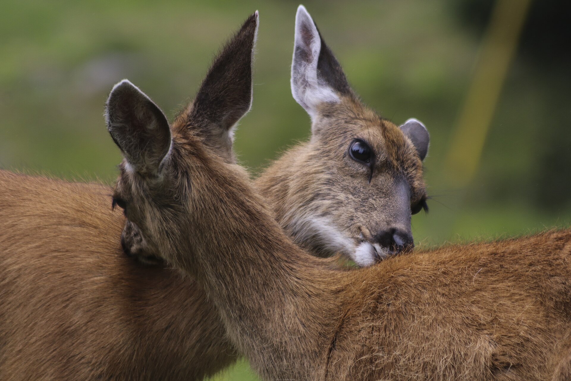 Big gameBlacktail DeerOdocoileus hemionus columbianus
 GamefishPacific SalmonOncorhynchus spp.
 Wildlife guideCanada lynxLynx canadensis
 Big gameElkCervus canadensis
 GamefishRainbow TroutOncorhynchus mykiss
 Wildlife guideBlack bearUrsus americanus
 Big gameBlack BearUrsus americanus
Wells Gray and the Clearwater Valley
Wells Gray Provincial Park is in British Columbia, Canada, with the Clearwater Valley providing the local geographic context for a visit. Clearwater and Clearwater Valley Road are the key names to keep distinct when organizing an approach to the park. The valley near Wells Gray lies about 120 km north of Kamloops; that figure describes the broader location, not a verified driving distance to a particular park facility. Plan around a specific entrance or destination rather than treating the whole valley as the park. Camping locations in the Clearwater Valley are not necessarily inside the provincial park boundary. That distinction matters when checking directions, deciding where to stay, and confirming which rules apply to an overnight stop.
A Regional Approach, Not a Trail Itinerary
British Columbia is a large, mountainous province, and a regional location alone is not enough to build a reliable outdoor itinerary. Several north–south mountain ranges cross the province, while settlements are concentrated in valleys and along the coast. For Wells Gray, keep the practical focus on Clearwater, the Clearwater Valley, and the park entrance on Clearwater Valley Road. Separate the journey to the area from any activity inside the park: reaching an entrance does not establish the length or difficulty of a hike or an overnight outing. Before committing to a route, obtain current local directions and a suitable map. Confirm the exact start point, expected travel time, and return plan rather than estimating them from the park’s regional position.
Planning Conditions and Overnight Stops
British Columbia’s valleys can differ substantially in climate, so province-wide descriptions are a poor substitute for conditions at the intended destination. Choose clothing and equipment using a local forecast and the demands of the actual outing, rather than assuming that conditions elsewhere in British Columbia will apply around Wells Gray. For an overnight visit, distinguish a confirmed camping location from a general mention of camping in the Clearwater Valley. Check whether the location is within the park, whether overnight use is allowed, and what arrangements are required before setting out. Confirm access conditions and applicable requirements with the managing agency. Keep travel and activity plans flexible until the entrance, overnight location, and intended route have all been checked.
Route options
- Kamloops to the Clearwater Valley: regional approach
Use Kamloops as a regional orientation point for reaching the Clearwater Valley near Wells Gray, to the north. This is an approach-planning option, not a turn-by-turn driving itinerary or an established recreation route.
- Clearwater Valley Road to the park entrance
Organize the local park approach around Clearwater Valley Road and its Wells Gray Park entrance north of Clearwater. Confirm the exact destination and current access before adding an in-park outing.
Sample itineraries
- Clearwater Valley orientation · 1 day
Use Clearwater as the starting point for planning an approach along Clearwater Valley Road toward the Wells Gray Park entrance. Confirm current road access and an appropriate park destination before departure; this outline does not establish a hiking route.
- Wells Gray overnight planning outline · 2 days
Plan an arrival through the Clearwater Valley followed by a second day in Wells Gray Provincial Park. Choose activities and overnight arrangements only after confirming available facilities, access and camping rules with the managing agency.
Seasonal conditions
Spring
Confirm locally before choosing dates
Park-specific spring conditions are not established here. Check the forecast and current road and trail conditions before committing to an itinerary.
Summer
Confirm locally before choosing dates
Do not assume summer guarantees access or available camping. Confirm conditions and overnight options for the specific part of Wells Gray you intend to visit.
Fall
Confirm locally before choosing dates
Park-specific fall weather and operating schedules are not established here. Check current access and forecasts, and keep the itinerary flexible.
Winter
Confirm locally before choosing dates
Winter access and suitable activities require local confirmation. British Columbia's broader snowsports opportunities do not establish winter routes or services within Wells Gray.
| Season | Window | Conditions |
|---|---|---|
| Spring | Confirm locally before choosing dates | Park-specific spring conditions are not established here. Check the forecast and current road and trail conditions before committing to an itinerary. |
| Summer | Confirm locally before choosing dates | Do not assume summer guarantees access or available camping. Confirm conditions and overnight options for the specific part of Wells Gray you intend to visit. |
| Fall | Confirm locally before choosing dates | Park-specific fall weather and operating schedules are not established here. Check current access and forecasts, and keep the itinerary flexible. |
| Winter | Confirm locally before choosing dates | Winter access and suitable activities require local confirmation. British Columbia's broader snowsports opportunities do not establish winter routes or services within Wells Gray. |
Permits, fees & closures
Confirm entry requirements, camping permits and booking arrangements with the park's managing agency before departure.
Confirm current permits, fees, and closures with the managing agency before you go.
Hazards & regulations
- Unverified access: confirm Clearwater Valley Road and park access conditions rather than relying on a geographic description.
- Weather uncertainty: British Columbia's climate varies substantially between regions; use a local forecast rather than province-wide assumptions.
- Route uncertainty: no specific park trail or route difficulty is established here. Obtain current maps and choose an outing suited to the group.
What to pack for Wells Gray Provincial Park
- Current park and road maps
- Confirmed access information
- Written itinerary and managing-agency contact details
- Layers appropriate to the local forecast
- Drinking water and food for the planned outing
- First-aid kit
- Footwear suited to the confirmed route
Wells Gray Provincial Park FAQ
- Where is Wells Gray Provincial Park?
- Wells Gray Provincial Park is in British Columbia, Canada. Clearwater and the Clearwater Valley are relevant geographic points for planning an approach.
- Which access road is identified?
- Clearwater Valley Road is identified in connection with the Wells Gray Park entrance. Confirm current access and directions before travel.
- Are these ready-to-follow hiking itineraries?
- No. They are planning outlines. Specific trails, travel times, facilities and route difficulties need confirmation before an outing can be selected.
- Can an overnight stay be planned from this information alone?
- No. Confirm a suitable overnight location, its availability and applicable camping rules with the managing agency before making plans.
- What is the best season to visit?
- A park-specific best season cannot be established here. Choose dates around a confirmed activity, current access and local weather rather than British Columbia's general outdoor reputation.