


- Region
- Utah, USA
- Best season
- Spring, Summer
- Permits
- Confirm current backcountry permit require…
Plan with verified data
Zion Backcountry trip tools
Tools for a trip here
Picked for how, when and where you're going. Free, no signup.
Photos of Zion Backcountry
How to get there
Zion National Park is in southwestern Utah near Springdale. Use Springdale as a geographic starting point for planning; confirm the approach to the specific backcountry access point before traveling.
- Springdale
The town near Zion National Park provides a geographic orientation point for arrival planning. It is not a substitute for identifying the access point required by the chosen route.
- Zion Canyon
The park’s prominent canyon is a useful area around which to organize trip planning. Confirm a specific entry point and established route rather than treating the canyon name as trailhead directions.
Sources: Wikipedia · Wikivoyage. Confirm road and trailhead conditions with the managing agency before you leave.
Utah, USA · Season: Best: Apr – May, Sep – Oct
- Desert Hiking
- Canyoneering
- Hiking
- Backpacking
- Canoeing
- Fishing
The country
The main canyon is only a slice of the park. Kolob to the northwest opens huge, quieter high plateaus with sandstone spires. The Virgin River carves the Narrows and Subway into wet-canyon routes with real rope-work options.
Why enthusiasts come
Wet-canyon routes are a distinct discipline — cold water, technical anchors, and consequential weather calls. Dry backpacks on West Rim and Kolob give quieter classic backpacking.
Planner-relevant notes
Check NOAA flash-flood potential for the exact drainage — not the general forecast. Neoprene socks and canyoneering shoes for Narrows top-down.
Top experiences
The Narrows top-down (16 miles, 1–2 days, permit) is the flagship trip. West Rim overnight is the trail-based classic. Subway (top-down or bottom-up) needs a permit and rope. The Kolob Arch backpack is the least crowded route.
Planning essentials
Wilderness permits via advance lottery + walk-in. Flash-flood danger in every slot canyon — check NWS point forecast to the hour before entering the Narrows or Subway. Angel's Landing chains now permit-required daily.
Field notes
- Angel's Landing chains are a permit-only day hike, not backcountry.
- Springs in Kolob are reliable but bring purifiers — cattle graze the plateau above.
- Rockfall from monsoon rains reshapes trails yearly; check the ranger board.
- Water shoes with a felt sole are the working footwear for the Narrows.
- Slot canyons can heat to lethal temps in July — target April–May and Sep–Oct.
Where on earth
Satellite imagery flying in from a world view to Zion Backcountry, Utah, USA. Use the + / − buttons, or click the map to zoom with your scroll wheel; drag to pan and pinch to zoom on touch.
Coordinates
- Decimal degrees
- 37.3000, -112.9500
- Latitude (DMS)
- 37° 17′ 60.0″ N
- Longitude (DMS)
- 112° 57′ 0.0″ W
Coordinates are an access-point reference for Zion Backcountry, not a route. Carry a paper map and confirm trailhead or put-in access with the managing agency before you go.
Topic summary
Beyond the shuttle — Narrows, subway, and Kolob wilderness in slot-canyon country.
Key takeaways
- Region: Utah, USA
- Best season: Best: Apr – May, Sep – Oct
- Coordinates: 37.300, -112.950
Climate suitability
Best: Apr – May, Sep – Oct
Keep planning
Popular pursuits at Zion Backcountry
- Desert Hiking
Water carries and heat management drive the plan.
- Canyoneering
Narrows, downclimbs, and flash-flood timing.
- Hiking
Day miles on marked trail, with route notes and trail links below.
- Backpacking
Multi-day travel with everything on your back — see the packing blocks below.
- Canoeing
Paddle routes, portages, and put-ins.
- Fishing
Resident gamefish, seasons, and the water that holds them.
Animals around Zion Backcountry








A backcountry landscape of canyons and high country
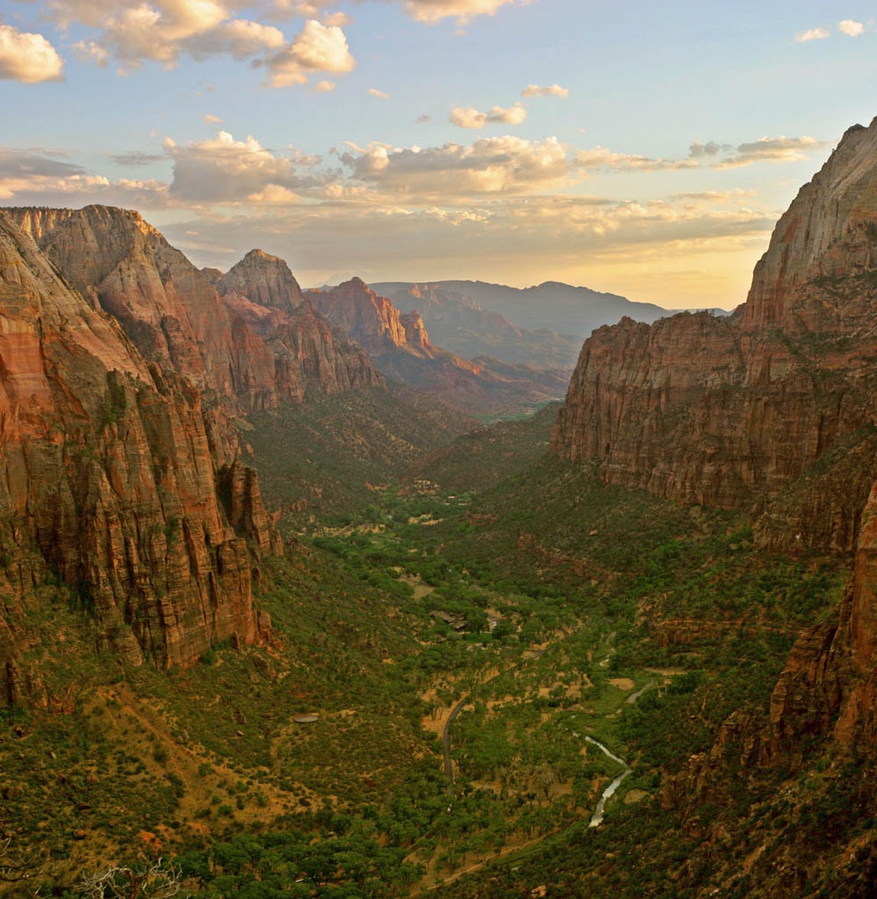
Zion National Park lies in southwestern Utah near Springdale, where the Colorado Plateau, Great Basin, and Mojave Desert regions meet. Its 229 square miles contain mountains, canyons, buttes, mesas, monoliths, rivers, slot canyons, and natural arches. That range of terrain matters when choosing a backcountry objective: a canyon outing and a high-country trip should not be treated as interchangeable. Zion Canyon is the park’s defining feature, extending 15 miles and reaching depths of up to 2,640 feet. Those figures describe the canyon itself, not a hiking route. The North Fork of the Virgin River has cut through reddish and tan Navajo Sandstone to form its walls. Start planning with the terrain you intend to enter, then confirm an established route and its access before setting out.
Elevation and habitats shape the trip
The park rises from 3,666 feet at Coalpits Wash to 8,726 feet at Horse Ranch Mountain. Its four life zones—desert, riparian, woodland, and coniferous forest—make clear why a single packing list or weather assumption will not suit every outing. Plan clothing, water, and protection from the elements around the elevation and setting of the intended route, rather than around conditions near town alone. River corridors and desert terrain require different preparation, while higher ground adds another layer of weather considerations. The meeting of three geographic regions also supports considerable wildlife diversity: the park contains 289 bird species, 75 mammal species, including 19 bat species, and 32 reptile species. Observe animals without approaching or feeding them, and keep food and waste secured.
A landscape with a long human history
Human habitation in the Zion area began about 8,000 years ago with small family groups of Native Americans. Later communities included Basketmaker Ancestral Puebloans, followed by the culture described as Virgin Anasazi and the Parowan Fremont group. By 1300, those latter groups had moved away; the Parrusits and other Southern Paiute groups subsequently lived in the area. Mormon settlers arrived in 1858 and established settlements in the early 1860s. That history is part of the landscape, not separate from a backcountry visit. Leave cultural materials and features undisturbed. For practical planning, distinguish broad geographic objectives from verified trails: a named wash, mountain, or canyon does not by itself establish a usable route. Confirm access, navigation requirements, and current conditions before committing to an itinerary.
Route options
- Zion Canyon
A canyon-area objective centered on Navajo Sandstone walls and the North Fork of the Virgin River. This is a geographic planning option, not a verified hiking itinerary; select and confirm a specific route before departure.
- Coalpits Wash
The location of the park’s lowest point, at 3,666 feet, offers a lower-elevation focus for route research. Confirm an established route, its access, and its requirements before building an outing around the wash.
- Horse Ranch Mountain
The park’s highest peak, at 8,726 feet, provides a high-country focus for planning. Its identification as a summit does not establish a hiking route or public approach; verify both before considering an itinerary.
Sample itineraries
- Zion Canyon Orientation · 1 day
Focus a day on Zion Canyon and its Navajo Sandstone landscape, shaped by the North Fork of the Virgin River. Choose an established outing after confirming access and conditions with park staff. This is a canyon-focused planning outline, not a backcountry route description.
- Canyon and Higher-Country Exploration · 2 days
Spend one day exploring Zion Canyon and a second on an established outing into woodland or coniferous-forest terrain. Confirm suitable routes and access with park staff. Use separate day outings rather than assuming an overnight connection between the park’s different elevations.
Seasonal conditions
Spring
Spring
Plan for differences between low desert terrain and higher forested country. Check forecasts for the elevation of the intended outing, and confirm river and canyon conditions before committing to water-dependent travel.
Summer
Summer
For desert and exposed sandstone outings, plan water capacity, sun protection, and effort around the forecast. Do not assume that conditions in Zion Canyon represent those in higher terrain.
Fall
Fall
Match clothing and turnaround plans to elevation and daylight. Check current conditions rather than assuming canyon floors, woodland, and high forest will offer the same temperatures or footing.
Winter
Winter
Check temperature and footing forecasts before choosing higher-country terrain. Carry insulating layers and select an outing suited to current conditions; do not assume lower elevations guarantee easy travel.
| Season | Window | Conditions |
|---|---|---|
| Spring | Spring | Plan for differences between low desert terrain and higher forested country. Check forecasts for the elevation of the intended outing, and confirm river and canyon conditions before committing to water-dependent travel. |
| Summer | Summer | For desert and exposed sandstone outings, plan water capacity, sun protection, and effort around the forecast. Do not assume that conditions in Zion Canyon represent those in higher terrain. |
| Fall | Fall | Match clothing and turnaround plans to elevation and daylight. Check current conditions rather than assuming canyon floors, woodland, and high forest will offer the same temperatures or footing. |
| Winter | Winter | Check temperature and footing forecasts before choosing higher-country terrain. Carry insulating layers and select an outing suited to current conditions; do not assume lower elevations guarantee easy travel. |
Permits, fees & closures
Confirm current backcountry permit requirements and access rules with Zion National Park before finalizing an itinerary.
Confirm current permits, fees, and closures with the managing agency before you go.
Hazards & regulations
- Steep canyon terrain and large elevation differences: choose an outing that matches fitness and navigation skills.
- Rivers and slot canyons: confirm weather and water conditions before entering confined terrain or planning crossings.
- Desert exposure: carry adequate water and sun protection rather than relying on finding usable water.
- Changing conditions with elevation: prepare separately for low desert and higher forested terrain.
What to pack for Zion Backcountry
- Detailed map of the chosen outing
- Offline navigation with backup power
- Current park access and condition information
- Water capacity matched to the outing
- Sun hat
- Sunscreen
- Sunglasses
- Footwear suited to uneven terrain
- Insulating layer
- Weather-resistant outer layer
- First-aid kit
- Headlamp
Zion Backcountry FAQ
- Where is Zion’s backcountry?
- Zion National Park is in southwestern Utah near Springdale, at the meeting of the Colorado Plateau, Great Basin, and Mojave Desert regions.
- What terrain should be expected?
- The park contains mountains, canyons, buttes, mesas, monoliths, rivers, slot canyons, and natural arches. Backcountry planning needs to account for substantial differences in terrain and elevation.
- How much elevation variation is there?
- The park ranges from 3,666 feet at Coalpits Wash to 8,726 feet at Horse Ranch Mountain. Conditions at one elevation should not be used as a stand-in for the entire park.
- What defines Zion Canyon?
- Zion Canyon is 15 miles long and up to 2,640 feet deep. Its reddish and tan Navajo Sandstone walls were eroded by the North Fork of the Virgin River. Those dimensions describe the canyon, not a hiking route.
- Can these outlines be used as detailed hiking directions?
- No. Select a specific established route, obtain a detailed map, and confirm access, water conditions, and permit requirements with park staff before departure.