


Beyond Alone · Best: June to September
Katmai National Park
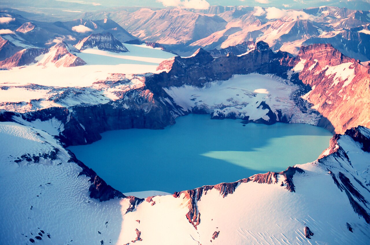
Hike across a surreal, barren landscape of deep volcanic ash born from a massive cataclysm.
Alaska, USA
Where on earth
Satellite imagery flying in from a world view to Katmai National Park, Alaska, USA. Use the + / − buttons, or click the map to zoom with your scroll wheel; drag to pan and pinch to zoom on touch.
- Region
- Alaska, USA
- Fishing
- Mountaineering
- Desert Hiking
- Canyoneering
- Sea Kayaking
- Beachcombing
- Hiking
- Backpacking
- Area/Length
- 4 million acres
- Elevation
- Sea level to 7,606 ft
- Best window
- August for balanced weather and bear viewing
- Key draws
- Volcanic geology, brown bears, isolation
- Access
- Float plane to Brooks Camp, then bus
Topic summary
Hike across a surreal, barren landscape of deep volcanic ash born from a massive cataclysm. In 1912, the Novarupta volcano unleashed the largest eruption of the 20th century, burying a lush valley under up to 700 feet of ash and pumice. Today, the Valley of Ten Thousand Smokes is a barren, deeply incised badlan
Key takeaways
- Area/Length: 4 million acres
- Elevation: Sea level to 7,606 ft
- Best window: August for balanced weather and bear viewing
- Key draws: Volcanic geology, brown bears, isolation
- Access: Float plane to Brooks Camp, then bus
Intended uses
- Wilderness trip planning and destination research
- Access: Float plane to Brooks Camp, then bus
Verification notes
Compiled from published show records, regional agencies, and topographical / satellite imagery. Region: Alaska, USA. Coordinates: 58.271, -155.123.
The country
In 1912, the Novarupta volcano unleashed the largest eruption of the 20th century, burying a lush valley under up to 700 feet of ash and pumice. Today, the Valley of Ten Thousand Smokes is a barren, deeply incised badland carved by the River Lethe and Knife Creek. Surrounding the ash flows are wild coastal stretches and pristine lakes sustaining massive salmon populations.
Why enthusiasts come
While most visitors fly in for an afternoon to watch brown bears fishing at Brooks Falls, backpackers venture into the ash valley for a surreal, otherworldly trek. The sheer desolation, painted canyon walls, and persistent geothermal activity offer an alien environment. It is a striking contrast to Alaska's typical green tundra and glaciated peaks.
Top experiences
Backpacking into the Baked Mountain Huts provides a rudimentary shelter amid the wind-scoured ash plains. Explorers carefully navigate the precipitous gorges carved into the pumice to view the steaming vent of Novarupta itself. Hiking out to the coastal regions reveals an entirely distinct ecosystem dominated by sedge meadows and roaming coastal brown bears.
Planner-relevant notes
Access to the valley requires a float plane to Brooks Camp, followed by a daily 4x4 bus ride to the valley rim at Three Forks. Backcountry permits must be acquired at the Brooks Camp visitor center after mandatory bear orientation. Water sources in the valley are heavily laden with highly abrasive pumice, requiring careful management.
Field notes
- Fierce winds whip up blinding ash storms in the valley; bring tightly sealed goggles and durable rain gear.
- Standard water filters clog instantly in the ash-choked rivers; rely on alum to settle silt or use snowmelt.
- The River Lethe cuts deep, narrow, undercut gorges that are nearly invisible until you are standing on the edge.
- Maintain a 50-yard minimum distance from the world's densest concentration of brown bears near the water systems.
Frequently asked about Katmai National Park
- Where is Katmai National Park?
- Katmai National Park is in Alaska, USA. Hike across a surreal, barren landscape of deep volcanic ash born from a massive cataclysm.
- How do you get to Katmai National Park?
- Access: Float plane to Brooks Camp, then bus. Expect a multi-leg trip — flights to the nearest hub, then float plane, boat, or 4WD depending on conditions.
Build a ten for Katmai National Park
Assemble your own 10-item Alone loadout tuned to this biome — cold, wet, and food strategy already scoped.
Open the builderShelter that suits this terrain
Browse shelter builds and site-selection guides matched to conditions like the ones here.
Wildlife
Wildlife found around Katmai National Park








The gear behind what you just read
Ranked lists for the exact categories that decide a season.
- Top 10 Winter JacketsDown parkas, synthetic belay pieces, and heavy wool coats for real cold.See the ranking
- Top 10 Merino Wool Base LayersNext-to-skin wool that works in real cold, real heat, and days between washes.See the ranking
- Top 10 Three-Season Sleeping BagsDown and synthetic bags that cover the honest 20°F–40°F working range.See the ranking
- Top 10 Winter Camping LocationsCold-country trips built around snow, ice, and quiet skies.See the ranking
- Best Cold-Weather HatsWool watch caps, ushankas, and windproof beanies for real winter.See the ranking