


Beyond Alone · Best: Apr – May, Sep – Oct
Zion Backcountry
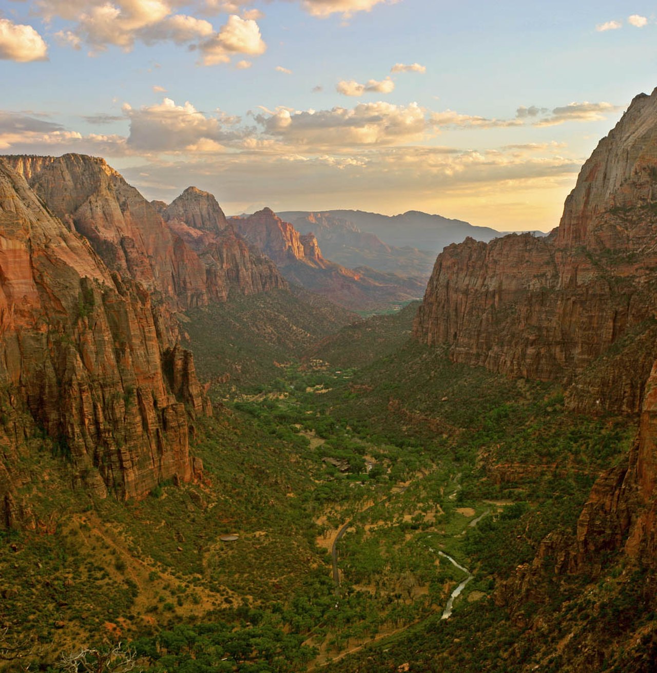
Beyond the shuttle — Narrows, subway, and Kolob wilderness in slot-canyon country.
Utah, USA
Where on earth
Satellite imagery flying in from a world view to Zion Backcountry, Utah, USA. Use the + / − buttons, or click the map to zoom with your scroll wheel; drag to pan and pinch to zoom on touch.
- Region
- Utah, USA
- Biome
- Colorado Plateau canyon / desert
- Desert Hiking
- Canyoneering
- Hiking
- Backpacking
- Canoeing
- Fishing
Key takeaways
- Biome: Colorado Plateau canyon / desert
- Biome
- Colorado Plateau canyon / desert
- Elevation
- 1,100 – 2,660 m
- Best window
- Spring & fall (avoid summer heat and monsoon)
- Key draws
- Narrows top-down, Subway, La Verkin Creek
- Watch for
- Flash floods, exposure, heat
Topic summary
Beyond the shuttle — Narrows, subway, and Kolob wilderness in slot-canyon country. The main canyon is only a slice of the park. Kolob to the northwest opens huge, quieter high plateaus with sandstone spires. The Virgin River carves the Narrows and Subway into wet-canyon routes with real rope-work optio
Key takeaways
- Biome: Colorado Plateau canyon / desert
- Elevation: 1,100 – 2,660 m
- Best window: Spring & fall (avoid summer heat and monsoon)
- Key draws: Narrows top-down, Subway, La Verkin Creek
- Watch for: Flash floods, exposure, heat
Intended uses
Wilderness trip planning and destination research
Climate suitability
Colorado Plateau canyon / desert
Verification notes
Compiled from published show records, regional agencies, and topographical / satellite imagery. Region: Utah, USA. Coordinates: 37.300, -112.950.
The country
The main canyon is only a slice of the park. Kolob to the northwest opens huge, quieter high plateaus with sandstone spires. The Virgin River carves the Narrows and Subway into wet-canyon routes with real rope-work options.
Why enthusiasts come
Wet-canyon routes are a distinct discipline — cold water, technical anchors, and consequential weather calls. Dry backpacks on West Rim and Kolob give quieter classic backpacking.
Planner-relevant notes
Check NOAA flash-flood potential for the exact drainage — not the general forecast. Neoprene socks and canyoneering shoes for Narrows top-down.
Top experiences
The Narrows top-down (16 miles, 1–2 days, permit) is the flagship trip. West Rim overnight is the trail-based classic. Subway (top-down or bottom-up) needs a permit and rope. The Kolob Arch backpack is the least crowded route.
Planning essentials
Wilderness permits via advance lottery + walk-in. Flash-flood danger in every slot canyon — check NWS point forecast to the hour before entering the Narrows or Subway. Angel's Landing chains now permit-required daily.
Field notes
- Angel's Landing chains are a permit-only day hike, not backcountry.
- Springs in Kolob are reliable but bring purifiers — cattle graze the plateau above.
- Rockfall from monsoon rains reshapes trails yearly; check the ranger board.
- Water shoes with a felt sole are the working footwear for the Narrows.
- Slot canyons can heat to lethal temps in July — target April–May and Sep–Oct.
Frequently asked about Zion Backcountry
- Where is Zion Backcountry?
- Zion Backcountry is in Utah, USA. Beyond the shuttle — Narrows, subway, and Kolob wilderness in slot-canyon country.
- What is the climate like at Zion Backcountry?
- Colorado Plateau canyon / desert. The main canyon is only a slice of the park. Kolob to the northwest opens huge, quieter high plateaus with sandstone spires. The Virgin River carves the Narrows and Subway into wet-canyon routes with real rope-work optio
Build a ten for Zion Backcountry
Assemble your own 10-item Alone loadout tuned to this biome — cold, wet, and food strategy already scoped.
Open the builderShelter that suits this terrain
Browse shelter builds and site-selection guides matched to conditions like the ones here.
Wildlife
Wildlife found around Zion Backcountry








The gear behind what you just read
Ranked lists for the exact categories that decide a season.
- Top 10 Winter JacketsDown parkas, synthetic belay pieces, and heavy wool coats for real cold.See the ranking
- Top 10 Merino Wool Base LayersNext-to-skin wool that works in real cold, real heat, and days between washes.See the ranking
- Top 10 Three-Season Sleeping BagsDown and synthetic bags that cover the honest 20°F–40°F working range.See the ranking
- Top 10 Winter Camping LocationsCold-country trips built around snow, ice, and quiet skies.See the ranking
- Best Cold-Weather HatsWool watch caps, ushankas, and windproof beanies for real winter.See the ranking