


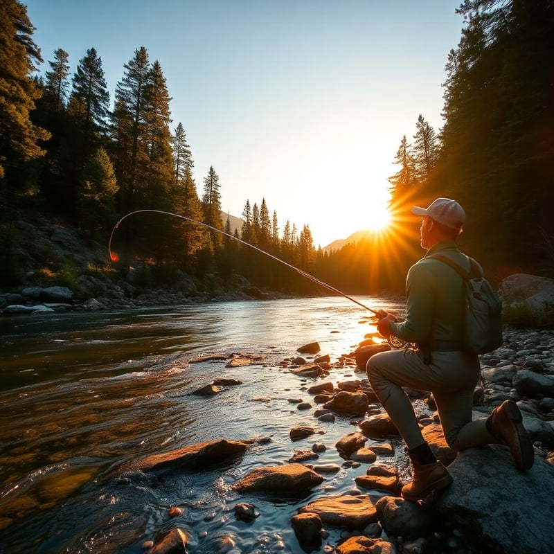
Surf casting for striped bass on Cape Cod is governed by sand, tide, and water volume. The peninsula acts as a massive jetty jutting sixty miles into the North Atlantic, intercepting the coastal striper migration from May through October. For the shore-bound angler, success hinges on reading water that changes with every winter gale. Deep drop-offs on the Outer Cape can vanish overnight, while back-barrier inlets carve new channels that hold bait for a single season before filling in with sand. Foot access dictates your strategy here. While buggy permits exist for certain stretches, the dedicated walker can access the most productive rips, bars, and troughs without a four-wheel-drive vehicle if they are willing to put in miles on soft sand under the cover of darkness. The key variables are current speed and structure. On the south-facing sound shores, tides are gentle and flats-style stalking dominates. Along Cape Cod Bay, massive ten-foot tide swings expose sprawling sand flats and boulder fields. On the Atlantic-facing ocean backside and along the rip-roaring Cape Cod Canal, heavy water demands heavy tackle and disciplined footing. We evaluated these ten locations based entirely on public walk-in accessibility, the reliability of current and sandbar structure, and their historical consistency for holding striped bass. From the boulder-strewn rips of Vineyard Sound to the pounding shorebreak of the National Seashore, these are the proving grounds of modern Northeast surf casting.
Quick picks


Rank this list
Loading community ratings… Ratings re-order the picks — they never change which products make the list.
Sign in to add your own ratings — it's free.
- Pros
- Steep beach shelf brings migratory bass within yards of dry sand
- Massive baitfish concentrations driven by converging ocean and bay tides
- Straightforward foot access from a paved National Park Service lot
- Proven trophy potential for fish exceeding forty pounds
Cons- Dense seal populations persistently intercept and steal hooked fish
- Violent shorebreak and undercutting gravel create dangerous footing
- Summer daytime tourist crowds crowd the beach until nightfall
Key features- Location
- Provincetown, Massachusetts
- Managing Agency
- Cape Cod National Seashore
- Primary Quarry
- Striped bass and bluefish
- Terrain Profile
- Steep shelving sand and coarse gravel
- Access Type
- Paved lot with direct boardwalk crossing
- Optimal Tides
- Half-falling through low-water turn
Best forNighttime needlefish plugging, Fall migration run hunting, Shorebreak sand eel jigging, Low-light topwater blitzes
Pros- Steep beach shelf brings migratory bass within yards of dry sand
- Massive baitfish concentrations driven by converging ocean and bay tides
- Straightforward foot access from a paved National Park Service lot
- Proven trophy potential for fish exceeding forty pounds
Cons- Dense seal populations persistently intercept and steal hooked fish
- Violent shorebreak and undercutting gravel create dangerous footing
- Summer daytime tourist crowds crowd the beach until nightfall
Assessed by Wild10 Editorial Team against our ranking criteria.No ratings yet - Pros
- Unrivaled shore-based access to massive migratory striped bass
- Continuous paved service paths allow rapid bicycle scouting
- Free public parking lots positioned along both banks
- Powerful tidal flow reliably concentrates large forage schools
Cons- Extremely slick riprap creates continuous falling hazards
- High tackle attrition rate from deep boulder snags
- Intense crowds and competitive casting lanes during morning tides
Key features- Bank Length
- 7 miles of continuous fishable shore
- Current Velocity
- 4 to 5 knots at peak flow
- Governing Agency
- U.S. Army Corps of Engineers
- Target Species
- Striped bass and bluefish
- Access Type
- Paved service roads on north and south banks
- Peak Windows
- Late May to late June, late August to September
Best forHeavy soft-plastic jigging, Bicycle-assisted mobile scouting, Hunting first-light surface blitzes, Targeting forty-pound cow stripers
Pros- Unrivaled shore-based access to massive migratory striped bass
- Continuous paved service paths allow rapid bicycle scouting
- Free public parking lots positioned along both banks
- Powerful tidal flow reliably concentrates large forage schools
Cons- Extremely slick riprap creates continuous falling hazards
- High tackle attrition rate from deep boulder snags
- Intense crowds and competitive casting lanes during morning tides
Assessed by Wild10 Editorial Team against our ranking criteria.No ratings yet - Pros
- Massive tidal flow at Nauset Inlet concentrates forage and predatory bass reliably
- Expansive barrier coastline offers miles of open water away from crowded access points
- Classic outer-beach structure produces exceptional big-fish potential on night tides
- Consistent wave energy creates deep feeding troughs tight to the water's edge
Cons- Two-mile soft sand trek to the inlet demands heavy physical stamina
- Dense seal population regularly steals hooked fish and spooks feeding schools
- Rapidly filling inside troughs present dangerous stranding risks on flood tides
- Town parking fees and frequent plover closures limit vehicle access in summer
Key features- Target Species
- Striped bass, bluefish
- Water Type
- Open ocean surf and tidal inlet
- Access Type
- Paid town lot, walk-in or OSV permit
- Prime Season
- June, September through late October
- Key Hazard
- Filling troughs, rogue shorebreak, white sharks
- Tidal Preference
- Dropping tide for inlet, low-water transitions
Best forNighttime autumn surf casting, Ebb-tide inlet plug casting, Heavy-surf pencil popping, Long-distance beach trekking
Pros- Massive tidal flow at Nauset Inlet concentrates forage and predatory bass reliably
- Expansive barrier coastline offers miles of open water away from crowded access points
- Classic outer-beach structure produces exceptional big-fish potential on night tides
- Consistent wave energy creates deep feeding troughs tight to the water's edge
Cons- Two-mile soft sand trek to the inlet demands heavy physical stamina
- Dense seal population regularly steals hooked fish and spooks feeding schools
- Rapidly filling inside troughs present dangerous stranding risks on flood tides
- Town parking fees and frequent plover closures limit vehicle access in summer
Assessed by Wild10 Editorial Team against our ranking criteria.No ratings yet - Pros
- Exceptional water clarity allows rare northeastern sight-casting opportunities
- Powerful tidal rips concentrate bass along predictable ambush seams
- Stunning, undeveloped coastal wilderness setting within a national wildlife refuge
- Diverse structure ranging from shallow flats to deep inlet drop-offs
Cons- Severe gray seal presence frequently leads to lost fish and disrupted bites
- Extremely limited parking at the refuge visitor center fills before dawn
- Treacherous tidal currents and collapsing sand bars create serious wading hazards
Key features- Target Species
- Striped bass, bluefish
- Primary Terrain
- Tidal sand flats, channel drop-offs, and rips
- Access Point
- Monomoy National Wildlife Refuge visitor center
- Peak Season
- Late May through July, September migration
- Tidal Range
- Roughly 4 to 6 feet
- Regulations
- Foot access only; refuge rules apply
Best forSight fishing sandy flats, Dawn light-tackle surfcasting, Bumping bucktails through rips, Late spring topwater stalking
Pros- Exceptional water clarity allows rare northeastern sight-casting opportunities
- Powerful tidal rips concentrate bass along predictable ambush seams
- Stunning, undeveloped coastal wilderness setting within a national wildlife refuge
- Diverse structure ranging from shallow flats to deep inlet drop-offs
Cons- Severe gray seal presence frequently leads to lost fish and disrupted bites
- Extremely limited parking at the refuge visitor center fills before dawn
- Treacherous tidal currents and collapsing sand bars create serious wading hazards
Assessed by Wild10 Editorial Team against our ranking criteria.No ratings yet - Pros
- Heavy ocean troughs bring migratory bass within easy casting distance of the sand
- Raw, wild scenery with miles of fishable structure north and south of the stairs
- Prime fall blitz location when cooling weather triggers northern migration
- Direct oceanfront parking available during the prime autumn run
Cons- Crushing Atlantic shorebreak creates dangerous wading conditions at high tide
- Heavy seal presence routinely harasses baitfish and steals hooked stripers
- Summer daytime parking requires using an inland shuttle bus system
Key features- Managing Agency
- National Park Service (Cape Cod National Seashore)
- Primary Target
- Striped bass and bluefish
- Water Type
- Exposed open-ocean surf
- Best Tides
- Last of the flood through first two hours of ebb
- Season Window
- June through late October
- Bottom Structure
- Shifting outer sandbars, sloughs, and rip cuts
Best forLate-autumn night plugging, Scouting low-tide sloughs, Chasing blitzing fall stripers, Cold-water surf casting
Pros- Heavy ocean troughs bring migratory bass within easy casting distance of the sand
- Raw, wild scenery with miles of fishable structure north and south of the stairs
- Prime fall blitz location when cooling weather triggers northern migration
- Direct oceanfront parking available during the prime autumn run
Cons- Crushing Atlantic shorebreak creates dangerous wading conditions at high tide
- Heavy seal presence routinely harasses baitfish and steals hooked stripers
- Summer daytime parking requires using an inland shuttle bus system
Assessed by Wild10 Editorial Team against our ranking criteria.No ratings yet - Pros
- Miles of open bay shoreline with minimal casting competition after dark
- Massive tidal exchange creates distinct, fish-holding current seams and bars
- Ideal shallow-water stalking ground for unweighted soft plastics and plugs
- Direct proximity to Barnstable Harbor guarantees a constant supply of baitfish
Cons- Rapid flood tides can strand wading anglers behind deep back-sloughs
- Fierce greenhead fly hatches can make dusk summer trips miserable
- Steep town parking and access fees apply during peak summer season
Key features- Location
- West Barnstable, Massachusetts
- Target Species
- Striped bass, bluefish
- Tidal Range
- 9 to 11 feet
- Shoreline Length
- Approximately 6 miles
- Primary Structure
- Cobble flats, sandbars, glacial erratics
- Access Type
- Town gatehouse, foot travel or permitted ORV
Best forLate night plug casting, Shallow water flats stalking, Low tide bar wading, Fall run migration hunting
Pros- Miles of open bay shoreline with minimal casting competition after dark
- Massive tidal exchange creates distinct, fish-holding current seams and bars
- Ideal shallow-water stalking ground for unweighted soft plastics and plugs
- Direct proximity to Barnstable Harbor guarantees a constant supply of baitfish
Cons- Rapid flood tides can strand wading anglers behind deep back-sloughs
- Fierce greenhead fly hatches can make dusk summer trips miserable
- Steep town parking and access fees apply during peak summer season
Assessed by Wild10 Editorial Team against our ranking criteria.No ratings yet - Pros
- Pronounced outer bars and deep inner sloughs create dependable bait traps
- Exceptional fall migration potential with surface blitzes on sand eels
- High chance of uncrowded oceanfront water outside peak daylight hours
- Classic big-water casting where distance setups can truly excel
Cons- Intense gray seal activity frequently steals hooked striped bass
- Strong lateral sweeps require heavy payloads and restrict light lure use
- Strenuous soft-sand dune climb back to the parking area
Key features- Location
- Truro, Massachusetts
- Primary Target
- Striped bass and bluefish
- Water Type
- Exposed Atlantic ocean surf
- Access Authority
- Cape Cod National Seashore & Town of Truro
- Optimal Wind
- Light west, southwest, or calm
- Prime Season
- September through late October
Best forAutumn sand eel migrations, Low-tide night slough hunting, Distance surf rod casting, Open-ocean trophy hunting
Pros- Pronounced outer bars and deep inner sloughs create dependable bait traps
- Exceptional fall migration potential with surface blitzes on sand eels
- High chance of uncrowded oceanfront water outside peak daylight hours
- Classic big-water casting where distance setups can truly excel
Cons- Intense gray seal activity frequently steals hooked striped bass
- Strong lateral sweeps require heavy payloads and restrict light lure use
- Strenuous soft-sand dune climb back to the parking area
Assessed by Wild10 Editorial Team against our ranking criteria.No ratings yet - Pros
- Warms up weeks earlier in spring than outer ocean beaches
- Gentle surf allows the use of light tackle and small plugs
- Reliable tidal rip fed by an active estuarine bait nursery
- Straightforward flat approach with well-maintained public parking
Cons- Heavy drift weed frequently fouls lines on southwest winds
- Inlet jetty stones are dangerously slick after dark
- Seasonal state park parking fees enforced during summer months
Key features- Location
- Mashpee, Massachusetts
- Water Body
- Nantucket Sound and Waquoit Bay
- Primary Target
- Striped bass and bluefish
- Access Point
- South Cape Beach State Park main lot
- Top Structure
- Granite jetties and inlet rip lines
- Optimal Tide
- Mid to late ebb tide
Best forEarly season May schoolie hunting, Light tackle dusk plugging, Inlet drift fishing on outgoing tides, Fall run estuary mouth casting
Pros- Warms up weeks earlier in spring than outer ocean beaches
- Gentle surf allows the use of light tackle and small plugs
- Reliable tidal rip fed by an active estuarine bait nursery
- Straightforward flat approach with well-maintained public parking
Cons- Heavy drift weed frequently fouls lines on southwest winds
- Inlet jetty stones are dangerously slick after dark
- Seasonal state park parking fees enforced during summer months
Assessed by Wild10 Editorial Team against our ranking criteria.No ratings yet - Pros
- Deep shipping channel water accessible directly from foot-friendly stone access
- Reliable food-rich eddy forms on every east-running canal ebb tide
- Provides sheltered casting conditions during hard south or southwest winds
- Options to fish either heavy jetty structure or open sandy surf troughs
Cons- Wet granite stones are exceptionally slick and demand spiked footwear
- Dangerous ship wakes can surge unexpectedly over the lower breakwater rocks
- Summer parking fees apply and beach crowds swell during warm daylight hours
Key features- Water Body
- Cape Cod Bay and Canal East End
- Primary Target
- Striped bass and bluefish
- Access Point
- Scusset Beach State Reservation lot
- Required Footwear
- Carbide-cleated soles on rocks
- Prime Current
- East-flowing canal ebb tide
- Active Window
- Late May through late October
Best forNight tides during southwest blows, Deep-water bucktailing on canal ebbs, Autumn bunker-blitz surf casting, First-light topwater plug casting
Pros- Deep shipping channel water accessible directly from foot-friendly stone access
- Reliable food-rich eddy forms on every east-running canal ebb tide
- Provides sheltered casting conditions during hard south or southwest winds
- Options to fish either heavy jetty structure or open sandy surf troughs
Cons- Wet granite stones are exceptionally slick and demand spiked footwear
- Dangerous ship wakes can surge unexpectedly over the lower breakwater rocks
- Summer parking fees apply and beach crowds swell during warm daylight hours
Assessed by Wild10 Editorial Team against our ranking criteria.No ratings yet - Pros
- Deep ocean water and high-velocity current accessible directly from shore
- Exceptional autumn run for hardtails like false albacore within casting distance
- Concentrated bait migrations funnel tightly around the point structure
- Diverse predator mix including cow stripers, bluefish, and hard-fighting albies
Cons- Extremely slick, uneven boulder terrain makes wading and walking treacherous
- Highly restricted parking near the lighthouse fills fast and is strictly ticketed
- Brutal bottom structure claims an enormous amount of deep-running terminal tackle
Key features- Water Body
- Vineyard Sound and Woods Hole Passage
- Primary Target
- Striped bass
- Secondary Targets
- Bluefish and false albacore
- Shoreline Structure
- Glacial boulder fields and deep rock ledges
- Required Gear
- Cleated wading boots and stout 9-10ft rod
- Access Point
- Church Street pull-offs near Nobska Light
Best forHeavy current bucktail jigging, Autumn false albacore blitzes, Nighttime rocky shoreline casting, Structure-focused striper hunting
Pros- Deep ocean water and high-velocity current accessible directly from shore
- Exceptional autumn run for hardtails like false albacore within casting distance
- Concentrated bait migrations funnel tightly around the point structure
- Diverse predator mix including cow stripers, bluefish, and hard-fighting albies
Cons- Extremely slick, uneven boulder terrain makes wading and walking treacherous
- Highly restricted parking near the lighthouse fills fast and is strictly ticketed
- Brutal bottom structure claims an enormous amount of deep-running terminal tackle
Assessed by Wild10 Editorial Team against our ranking criteria.No ratings yet


Compare all 10 picks at a glance
Editorial ranking, what each pick is best at, and how we assessed it. Tap a name to jump to the full write-up.
| # | Pick | Best for | Key spec | Evidence |
|---|---|---|---|---|
| 1 | Race Point Beach Provincetown, Massachusetts | Nighttime needlefish plugging | Location: Provincetown, Massachusetts | Research only |
| 2 | Cape Cod Canal Bourne and Sandwich, Massachusetts | Heavy soft-plastic jigging | Bank Length: 7 miles of continuous fishable shore | Research only |
| 3 | Nauset Beach and Inlet Orleans, Massachusetts | Nighttime autumn surf casting | Target Species: Striped bass, bluefish | Research only |
| 4 | Monomoy and Morris Island Chatham, Massachusetts | Sight fishing sandy flats | Target Species: Striped bass, bluefish | Research only |
| 5 | Coast Guard Beach Eastham, Massachusetts | Late-autumn night plugging | Managing Agency: National Park Service (Cape Cod National Seashore) | Research only |
| 6 | Sandy Neck Beach Barnstable, Massachusetts | Late night plug casting | Location: West Barnstable, Massachusetts | Research only |
| 7 | Head of the Meadow Beach Truro, Massachusetts | Autumn sand eel migrations | Location: Truro, Massachusetts | Research only |
| 8 | South Cape Beach Mashpee, Massachusetts | Early season May schoolie hunting | Location: Mashpee, Massachusetts | Research only |
| 9 | Scusset Beach and the East End Jetty Sandwich, Massachusetts | Night tides during southwest blows | Water Body: Cape Cod Bay and Canal East End | Research only |
| 10 | Nobska Point Woods Hole, Massachusetts | Heavy current bucktail jigging | Water Body: Vineyard Sound and Woods Hole Passage | Research only |
How we chose
Last updated
Ranked by Wild10 Editorial Team, Research desk
We built this ranking from land-manager and agency sources, permit records and published trip reports. Each of the 10 places was compared against the same criteria below. This is desk research unless a pick is marked field tested.
- Quality of the terrain
- Landscape, route variety, and whether the place rewards multiple days rather than one overlook.
- Season and weather windows
- How long the reliable window is, and how badly the shoulder seasons punish a bad forecast.
- Access and permits
- Trailhead logistics, permit odds, quotas, and how much lead time a trip realistically takes.
- Solitude vs. crowding
- How far you have to walk before the place feels like wilderness instead of a queue.
- Wildlife and ecology
- What you can reasonably expect to see, and what you have to plan around.
- Risk and skill required
- Navigation, water crossings, exposure, and rescue distance — stated plainly.
How often we recheck this: Reviewed on a rolling basis and rechecked at least once a year, or sooner if a pick is discontinued, revised, or beaten by something new.
Best of the Best · Head to Head
Race Point Beach vs Cape Cod Canal
#1 vs #2 — side-by-side specs, pros & cons, and the final verdict.
Compare any two picks
Build your own side-by-side
Choose any two of these 10 picks and compare specs, price, pros, cons and reader ratings.
Topic summary
Public beach access, ripping currents, shifting outer bars, and productive tides for foot anglers chasing migratory stripers.
Key takeaways
- #1 Race Point Beach — Provincetown, Massachusetts
- #2 Cape Cod Canal — Bourne and Sandwich, Massachusetts
- #3 Nauset Beach and Inlet — Orleans, Massachusetts
- #4 Monomoy and Morris Island — Chatham, Massachusetts
- #5 Coast Guard Beach — Eastham, Massachusetts
- #6 Sandy Neck Beach — Barnstable, Massachusetts
Intended uses
Places
Verification notes
Editorial ranked list, 10 entries. Evidence mix — 10 research only. Buy links open the maker or a retailer search.
Best top 10 cape cod bass surf spots for a specific job
Skip the ranking — jump to the pick that matches how you actually use it.
- Best for nighttime needlefish plugging
- #1 Race Point Beach — Provincetown, MassachusettsRace Point sits at the exposed curled fist of Cape Cod where the open Atlantic collides with Cape Cod Bay. This junction creates violent tidal rips, deep coastal troughs, and intense upwellings that push vast schools of sand eels, sea herring, and mackerel within reach of shore casters. The beach profile shelves steeply into deep water, meaning stripers run right through the shorebreak waves rather than holding hundreds of yards off the beach. Access is direct through the Race Point Beach parking area within the Cape Cod National Seashore. From the lot, foot anglers head either east toward the bathing beach or west toward the historic Race Point Light. The sweet spot here is often the drop-off right at your boots during the transition stages of the tide. Wading out past your knees is dangerous and unnecessary; the current sweeps hard along the beach contour and will undercut your footing. Needlefish, metal-lipped swimmers, and heavy sand eel imitations fished at night or during first light produce fish ranging from schoolies to forty-pound cows. Summer brings heavy crowds of day-trippers and sunbathers, but after sunset the beach belongs entirely to surf casters and seals. Gray seals are a persistent challenge here; if multiple seals pin your position, move down the beach rather than feeding them hooked fish. **Highlights** - Target species: Striped bass, bluefish, and occasional false albacore - Structure: Steep drop-offs, deep outside rips, and shifting sand spits - Best tides: Half-falling through low, and the turn of the flood - Recommended gear: 10- to 11-foot surf rod rated up to 4 ounces, 40-50lb braided line - Foot access: 100 yards from National Seashore paved lot to water line **Watch-outs** - Dense gray seal populations frequently steal hooked fish - Steep shoreline drop-off creates treacherous wave wash and undertow - National Seashore daily parking fees apply during daytime hours from late June through Labor DayRead the full profile
- Best for heavy soft-plastic jigging
- #2 Cape Cod Canal — Bourne and Sandwich, MassachusettsThe Cape Cod Canal is not a sandy beach; it is a seven-mile, rock-walled, man-made sea-level cut connecting Buzzards Bay to Cape Cod Bay. Currents here rip at up to five knots, creating an extreme environment where migratory bass trap schools of bunker, mackerel, and whiting against steep granite riprap. Fishing the Canal on foot requires specialized tackle, studded boots for the slick stones, and the physical stamina to cast heavy jigs into a tidal river. Both the north and south sides feature paved service roads operated by the U.S. Army Corps of Engineers, offering free pedestrian and bicycle access. Most serious anglers use modified cruisers with rod racks to patrol the banks and spot breaking fish or current seams. Bouncing heavy soft plastics on three- to five-ounce jig heads along the bottom is the standard technique, requiring precise touch to trace bottom contour without getting permanently wedged in the rocks. The fishing peaks during the spring migration in late May through June, and again during the late-summer 'breaking tides' when new and full moon currents push bait down the ditch at first light. It is one of the most pressured striper fisheries on the planet, meaning you will regularly stand shoulder-to-shoulder with other anglers along the riprap. **Highlights** - Target species: Striped bass and bluefish - Current speed: 4 to 5 knots at peak flow - Key spots: Bourne Gate, the Railroad Bridge, Bell Road, and the Herring Run - Recommended tackle: 10- to 12-foot heavy surf rod, high-capacity reel, 50lb braid with 60lb leader - Access: Free public parking lots along both north and south service roads **Watch-outs** - Wet canal riprap is coated in slimy sea lettuce; studded soles or Korkers are mandatory - Extreme sink rates lead to frequent tackle loss in bottom structure - Heavy angler congestion and competitive casting lanes during morning blitzesRead the full profile
- Best for nighttime autumn surf casting
- #3 Nauset Beach and Inlet — Orleans, MassachusettsNauset Beach is the classic outer beach experience. Stretching south from Orleans down toward Chatham, this barrier system faces the raw Atlantic and takes the full brunt of winter northeasters. The shifting sandbar system creates classic surf structure: outside bars that break heavy swells, deep inside troughs where bass patrol for disoriented bait, and narrow cuts through the bars that act as funnel points on changing tides. Public parking is available at the large town lot at Nauset Beach. Foot anglers can walk north toward Nauset Inlet or head south along the expansive outer beach. The walk north to the inlet mouth is roughly two miles over soft sand, but it leads to one of the most productive rips on the East Coast. Water pouring out of Town Cove and Nauset Marsh through the inlet mouth carves deep, rolling sand rips that hold bass on the dropping tide. Heavy shorebreak is common. Foot anglers need a solid cast to punch darter plugs, sinking needles, or bottle plugs past the first breaker into the strike zone. Pay close attention to sand bars at low water; an outer bar that is wadeable at low tide can strand you when the flood tide quickly fills the inside trough behind your back. **Highlights** - Target species: Striped bass and trophy bluefish - Structure: Classic barrier bar and trough, rolling ocean beach breaks, high-volume tidal inlet - Best tides: Ebbing tide at the inlet mouth; low-water transition on the open beach - Distance: 1.5 to 2.5 miles of soft-sand walking to reach the inlet system - Primary forage: Sand eels, juvenile herring, menhaden, and crabs **Watch-outs** - Inside troughs fill rapidly on flood tides, posing severe stranding risks on sandbars - Great white sharks actively hunt seals along the shallow shoreline lip - Town of Orleans parking fees are strictly enforced from Memorial Day through Labor DayRead the full profile
- Best for sight fishing sandy flats
- #4 Monomoy and Morris Island — Chatham, MassachusettsThe waters off Chatham represent a shifting maze of tidal cuts, flats, and rips where Nantucket Sound meets the open ocean. Morris Island offers public walk-in access to the northern perimeter of the Monomoy National Wildlife Refuge, placing foot anglers within range of the legendary Chatham Harbor rips and Stage Harbor entrance. Parking is located at the Monomoy National Wildlife Refuge visitor center on Morris Island. From there, a marked trail drops down to the shoreline. The environment here transitions rapidly from firm sand flats to deep, terrifying channels where the tide drains Pleasant Bay and Stage Harbor. Anglers fishing on foot must read the current lines carefully. Stripers use the channel drop-offs as ambush points, holding in the dead water beneath the main current seam to pick off crabs, squid, and sand eels. This area is exceptional for light-tackle surf casting and sight fishing on sunny days with clear water. Casting unweighted soft plastics, bucktails, or surface poppers into the rips at dawn pays dividends. Wading belts are non-negotiable; stepping off an submerged sand ledge into a six-knot rip can pull an angler under instantly. **Highlights** - Target species: Striped bass (high numbers of sight-fishable slot and over-slot bass) - Water environment: Sandy flats, heavy current rips, inlet mouths, and sand spit drop-offs - Foot access: Designated walking trails from the Refuge visitor center - Preferred lures: 7-inch soft plastics, 1-ounce bucktails, small pencil poppers - Ideal season: Late May through July for clear-water flats and rip action **Watch-outs** - Shifting channel edges feature sudden drop-offs with lethal tidal currents - High seal density near harbor channels can make landing a clean fish difficult - Parking at the refuge lot is limited and fills before sunrise during peak summer runsRead the full profile
- Best for late-autumn night plugging
- #5 Coast Guard Beach — Eastham, MassachusettsCoast Guard Beach marks the southern anchor of the Cape Cod National Seashore's great outer beach. Backed by towering glacial cliffs and the historic white coast guard station, the shoreline here faces directly east into open ocean swells. The shoreline profile features massive, constantly migrating sandbars separated from the beach by deep troughs that serve as natural travel lanes for migrating striped bass. Access during the peak summer months requires parking at the Little Creek lot on Doane Road and taking the National Seashore shuttle bus down to the beach, or walking in after the shuttles stop running in the evening. During shoulder seasons (spring and autumn), parking is available directly at the ocean pavilion. Foot casters head south toward the marsh spit or north along the sand cliffs. Fishing here is all about locating pockets of deeper, darker water between breaking bars at low tide, then returning to fish those cuts as the water floods back in. Metal-lipped wooden plugs, bottle darters, and rigged eels fished on dark, overcast nights with an onshore breeze will draw fish out of the foam right into the wash. **Highlights** - Target species: Striped bass and heavy autumn bluefish - Scenery: Dramatic glacial bluffs and wild outer Cape ocean surf - Top structure: Outer sandbar cuts, rip currents, and deep inner sloughs - Best tide: Last two hours of incoming through the first two hours of falling - Prime months: June for fresh ocean arrivals; September and October for migratory cows **Watch-outs** - Mid-day summer shuttle requirements complicate gear transport for foot anglers - Heavy east swells create powerful shorebreak that can easily knock over wading casters - Bluff erosion is active; do not set gear or rest directly below steep sand cliffsRead the full profile
- Best for late night plug casting
- #6 Sandy Neck Beach — Barnstable, MassachusettsSandy Neck is a six-mile-long barrier beach protecting the expansive salt marshes of Barnstable Harbor along the southern rim of Cape Cod Bay. Unlike the pounding surf of the Atlantic backside, this bay-facing beach features a wide, gently sloping cobblestone-and-sand flat characterized by a dramatic ten-foot tide differential. Stripers cruise these flats to root out crabs, silversides, and sand eels. Access is through the Sandy Neck public beach gate in West Barnstable. Foot anglers can fish right out in front of the parking area, but the most productive strategy involves walking east along the shoreline toward the trail crossings. At low tide, long bars and scattered glacial boulder fields are exposed. Anglers wade out to casting perches on these bars, working the edge of the deeper blue water. Night fishing is the premier game here. Calm summer nights bring schoolie and keeper bass into water barely deep enough to cover their backs. Black or purple needlefish, Danny-style surface swimmers, and slow-rolled slug-style plastics fished on light jig heads dominate. Watch your exit path behind you; as the tide floods across the flats, it can fill inner sloughs fast and cut off your retreat to the high dunes. **Highlights** - Target species: Striped bass (prolific night fishery) - Structure: Cobble shorelines, isolated glacial erratics, wide sandbars, and harbor inlet rips - Tide swing: 9 to 11 feet between mean low and high water - Tackle requirements: 9- to 10-foot moderate-action surf rod, fluorocarbon leaders - Miles of shoreline: Over 6 miles of undeveloped public barrier beach **Watch-outs** - The vast tide swing can turn dry walking routes into deep, impassable channels within an hour - Town of Barnstable parking permits are required during summer daylight hours - Heavy greenhead fly activity along the marsh edges throughout JulyRead the full profile
- Best for autumn sand eel migrations
- #7 Head of the Meadow Beach — Truro, MassachusettsHead of the Meadow sits squarely along the wild midsection of the Outer Cape in Truro. This beach is famous for its distinct double-sandbar system and shifting offshore sandbars that preserve the skeletons of old shipwrecks. The outer bar takes the brunt of ocean swells, creating a deep, wide lagoon-like slough between the dry beach and the offshore breakers that acts as a natural feeding corral for stripers. Public access is via the town of Truro and National Seashore parking lots at the end of Head of the Meadow Road. Walk straight down the dune stairs and inspect the bar structure at low water. Look for where the offshore white-water breaks stop, signaling a rip or cut through the sandbar. These gaps are where tidal current pulls water, bait, and bass out through the bar into the open Atlantic. Because of the open ocean exposure, current runs hard laterally along the beach. Foot anglers cast up-current with sinking needlefish or diamond jigs with teaser flies, letting the lure drift through the trough before swinging against the beach lip. Late-fall migrations here can be world-class when stripers pin schools of peanut bunker and sand eels into the shore break. **Highlights** - Target species: Striped bass and bluefish - Distinct topography: Outer sand bars, well-defined troughs, and historic shipwreck rips - Ideal wind: Light offshore (west/southwest) or gentle northeast push - Recommended tackle: Long-distance casting setups (11-foot rods capable of hitting the outer bar) - Best tides: Low-water slack through the mid-incoming tide **Watch-outs** - Strong lateral longshore drift sweeps light lures out of the strike zone rapidly - Steep sand paths make the return trek over the dunes physically demanding with full gear - Cold water temperatures persist into early summer; neoprene or breathable waders are necessaryRead the full profile
- Best for early season may schoolie hunting
- #8 South Cape Beach — Mashpee, MassachusettsSouth Cape Beach State Park faces Nantucket and Vineyard Sounds, delivering a completely different surf casting landscape than the heavy ocean beaches of the Outer Cape. The water here warms up weeks earlier in the spring, making it a premier May destination for schoolies and migratory keepers feeding on sea herring, squid, and worms. The shoreline is bordered to the west by the narrow, rock-flanked inlet to Waquoit Bay. Park at the public South Cape Beach lot inside the state park reserve. From there, take the boardwalk over the marsh and head west toward the Waquoit Bay jetty. The jetty produces a fast, sweeping tide rip on both the flood and ebb stages. Stripers hold behind the stone tips, waiting for crabs and baitfish to flush out of the estuary. Tidal current is strong through the inlet, but the open beach surf is usually mild and manageable, allowing anglers to cast lighter tackle than what is required on the Atlantic side. Working floating minnow plugs, small poppers, and soft plastic sand eels around the jetty base at dusk or dawn consistently produces strikes without punishing ocean swells. **Highlights** - Target species: Striped bass, bluefish, and early-season squidding - Top structure: Granite jetties, salt pond inlet mouth, and shallow sound flats - Seasonality: Strong early spring bite (May-June) and reliable fall run (September-October) - Walking distance: Approximately 0.75 miles flat walk along the beach to the jetty - Parking: State park day-use lot with straightforward public footpaths **Watch-outs** - Jetty rocks are uneven, slippery, and hazardous to navigate at night - Weed buildup (mung/drift algae) can choke lures when southwest winds blow hard - Modest Massachusetts DCR parking fees charged from late spring through Labor DayRead the full profile
Our editors test the gear, pick the ten, and set the order the day a list publishes. After that, the ranking is live: every member star rating feeds the community order, so picks climb or slide as real owners report back. Editorial judgment decides what earns a spot — you help decide where it sits.
- Editors set the field
Verified specs, feature and use-case comparison, and outside sources choose the ten and the published order; field-tested picks are labeled.
- Readers re-rank it
Your 1–5 star ratings drive the community order on every list.
- Rankings keep moving
Picks rise or fall over time — nothing is frozen at launch day.
Award picks
The ranking above is price-blind and judged on merit. These awards call out the pick we'd hand a specific person with a specific need.
Best Overall: Race Point Beach — Provincetown, Massachusetts
Race Point sits at the exposed curled fist of Cape Cod where the open Atlantic collides with Cape Cod Bay.
Ranked #1Runner-Up: Cape Cod Canal — Bourne and Sandwich, Massachusetts
The Cape Cod Canal is not a sandy beach; it is a seven-mile, rock-walled, man-made sea-level cut connecting Buzzards Bay to Cape Cod Bay.
Ranked #2Best for Solitude: Head of the Meadow Beach — Truro, Massachusetts
Head of the Meadow sits squarely along the wild midsection of the Outer Cape in Truro.
Ranked #7Best for First-Timers: Nauset Beach and Inlet — Orleans, Massachusetts
Nauset Beach is the classic outer beach experience.
Ranked #3Best Big-Mountain Objective: Monomoy and Morris Island — Chatham, Massachusetts
The waters off Chatham represent a shifting maze of tidal cuts, flats, and rips where Nantucket Sound meets the open ocean.
Ranked #4Best Water Trip: Coast Guard Beach — Eastham, Massachusetts
Coast Guard Beach marks the southern anchor of the Cape Cod National Seashore's great outer beach.
Ranked #5For sheer current and monster fish on heavy tackle, fish the Cape Cod Canal; for classic open-ocean surf and shifting bar systems, walk the midnight tides at Race Point and Coast Guard Beach.
How to choose between these top 10 cape cod bass surf spots
Every pick on this page was judged against the same criteria. If you want the short answer, Race Point Beach by Provincetown, Massachusetts is the one we point most people at. If you want to decide for yourself, here is what actually separates a good top 10 cape cod bass surf spot from an expensive one.
Quality of the terrain
Landscape, route variety, and whether the place rewards multiple days rather than one overlook.
Season and weather windows
How long the reliable window is, and how badly the shoulder seasons punish a bad forecast.
Access and permits
Trailhead logistics, permit odds, quotas, and how much lead time a trip realistically takes.
Solitude vs. crowding
How far you have to walk before the place feels like wilderness instead of a queue.
Wildlife and ecology
What you can reasonably expect to see, and what you have to plan around.
Risk and skill required
Navigation, water crossings, exposure, and rescue distance — stated plainly.
Match the trip to your season and skill
The right top 10 cape cod bass surf spots depends on what you are actually doing with it: Nighttime needlefish plugging; Fall migration run hunting; Shorebreak sand eel jigging; Low-light topwater blitzes; Heavy soft-plastic jigging; Bicycle-assisted mobile scouting. Start from the use case, then work down the ranking until you hit the first pick that covers it.
Common mistakes
- Booking travel before checking permit windows and quota draw dates.
- Planning peak-season mileage without a weather-day buffer.
- Assuming an access road or ferry runs year-round.
- Ignoring local fire, bear, and camping regulations for the unit you are entering.
Frequently asked questions
- What is the best top 10 cape cod bass surf spots?
- Race Point Beach by Provincetown, Massachusetts takes the top spot. Race Point sits at the exposed curled fist of Cape Cod where the open Atlantic collides with Cape Cod Bay.
- How did The Wild10 choose and rank these top 10 cape cod bass surf spots?
- We judged every pick against the same criteria — quality of the terrain, season and weather windows, access and permits, solitude vs. crowding — and ranked them on merit regardless of price. Public beach access, ripping currents, shifting outer bars, and productive tides for foot anglers chasing migratory stripers.
- Which of these top 10 cape cod bass surf spots is easiest to plan on a budget?
- Nobska Point by Woods Hole, Massachusetts — Nobska Point is a rugged, boulder-strewn headland situated near Woods Hole at the southwestern tip of Cape Cod.
- Race Point Beach vs Cape Cod Canal — which should I pick?
- Race Point Beach ranks first: Race Point sits at the exposed curled fist of Cape Cod where the open Atlantic collides with Cape Cod Bay. Cape Cod Canal is the close second: The Cape Cod Canal is not a sandy beach; it is a seven-mile, rock-walled, man-made sea-level cut connecting Buzzards Bay to Cape Cod Bay. Our full head-to-head compares them side by side.
- How often is this list updated?
- We review this ranking on a rolling basis and update it whenever a pick is discontinued, meaningfully revised, or beaten by something new. Rankings are editorial — brands do not see them before publication and affiliate links never change the order.
Get The Field List
One short, honest email a week: gear we actually trust, planning guides, and survival-TV coverage. Free, unsubscribe anytime.