


Reader rating
Rate it and you move it. Community ratings re-rank this product inside its Top 10 list.
Expert-picked, reader-ranked. Our editors choose the products and the launch order; member star ratings move picks up or down over time.
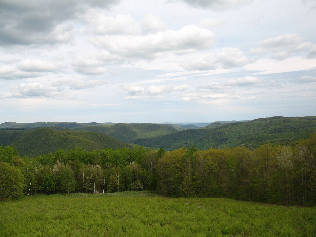
Classic New England foliage with small towns and farm stands.
Pros
- World-class hardwood foliage density and ridgeline color
- Continuous, well-maintained Appalachian Trail ridge infrastructure
- Comfortable daytime hiking temperatures with low insect activity
- High density of working farm stands and small supply hubs
Cons
- Extreme weekend vehicular traffic along primary north-south arteries
- Wet fallen leaves make steep descents exceptionally slippery
- Lodging rates spike sharply and book out months in advance
Best uses
- Peak foliage day hiking
- Three-day section backpacking
- Raptor migration watching
- High-ridge gravel cycling
Specifications
- Primary Range
- Taconic Mountains and Hoosac Plateau
- Highest Elevation
- Mount Greylock (3,491 feet)
- Peak Foliage
- October 5 to October 20
- Land Agency
- Massachusetts DCR
- Primary Trail
- Appalachian Trail (90 miles in MA)
- Hazards
- Slick leaf litter, early summit ice, black bears
Best for
Peak foliage day hiking, Three-day section backpacking, Raptor migration watching, High-ridge gravel cycling
Western Massachusetts swaps coastal maritime air for rugged northern hardwood ridges along the Taconic and Hoosac ranges. In October, the region sheds its summer arts-patron polish and returns to its identity as working woodland, rolling farmland, and cold-water hollows. The backbone of the landscape is defined by long north-south ridges and deep river valleys that channel morning mist, framed by the 90-mile corridor of the Appalachian Trail cutting straight through the county. October delivers the sharpest, most reliable hiking weather of the year in southern New England. Daytime temperatures sit comfortably in the 50s and low 60s, keeping exertion sweat low on steep ascents, while nights routinely dip toward freezing. The canopy turns rapidly from north to south, starting near the Vermont border and high peaks before washing out the lower valley bottoms around Great Barrington and Sheffield with deep bronze, crimson, and yellow. The friction here lies entirely in accessibility and seasonal congestion. Foliage season brings intense vehicle traffic to primary arteries like Route 7 and Route 2, driving up lodging rates and filling trailheads before nine in the morning. Escape requires early boots on the ground or targeting secondary state forests where the leaf-peeping caravans rarely venture.
Topography and Trail Footing
The landscape consists of eroded metamorphic ridges flanking the Housatonic and Hoosic river valleys. Footpaths vary from wide, graded carriage roads to deeply eroded, root-bound lines typical of ancient New England woods. Footing becomes notoriously slick once October leaf drop begins; damp red oak and sugar maple leaves mask ankle-turning limestone channers and wet mica schist. Steep descents, such as the northern approach to Mount Greylock via the Bellows Pipe Trail or the steep drop off Monument Mountain, demand trekking poles to maintain stability on loose, wet duff. Ridges offer expansive lookouts over patchwork pastoral lowlands, but the approaches require honest quad work over sustained stair-step bedrock.
October Weather Windows
October operates on a sliding scale from mild autumn hiking to genuine early-winter exposure. Valley basins frequently see calm, crisp mornings with heavy ground frost that burns off into sunny afternoons in the mid-50s. High ridges tell a different story. Mount Greylock acts as its own weather-maker; winds often exceed 35 miles per hour at the summit, and temperatures on the exposed war memorial plateau sit ten to fifteen degrees colder than in North Adams below. Rime ice and early sleet can coat rocks above 3,000 feet by mid-month. Packing must account for these microclimates: carrying windproof shells, light gloves, and a dry insulating layer is non-negotiable for any ridge trek.
Key High Points and Routes
The crown piece of the region is Mount Greylock State Reservation. Ascending via the Cheshire Harbor Trail offers a steady, well-graded line through transition forest to the high boreal spruce-fir cap. Further south, the Appalachian Trail over Mount Race and Mount Everett along the South Taconic Range delivers some of the finest exposed ridge walking in southern New England, including views across the Hudson Valley. For shorter technical outings, Ice Glen in Stockbridge drops hikers into a jumble of massive, mossy glacial erratics that traps cold air and ice year-round, while Beartown State Forest provides quiet miles around Benedict Pond on soft pine-needle singletrack.
Wildlife and Forest Canopy
Autumn activity peaks in the hardwood stands as wildlife prepares for winter. Black bears roam lower elevations to forage on heavy acorn and beechnut crops; proper food storage remains critical for overnight campers at backcountry shelters along the Appalachian Trail. Migrating raptors use the updrafts along the Taconic crest through early October, making rocky outcrops prime perches for spotting broad-winged hawks, sharp-shinned hawks, and bald eagles. Porcupines frequent the hemlock groves, and white-tailed deer are active during the pre-rut. The canopy itself is an exceptional mix of northern hardwoods—beech, birch, sugar maple—interspersed with eastern hemlock in the damp ravines and red spruce across the highest ridges.
Logistics, Crowds, and Access
Most trailheads fall under the management of the Massachusetts Department of Conservation and Recreation. Day-use parking fees apply at major state reservations like Greylock and Bash Bish Falls, with out-of-state vehicles paying higher rates. Weekend traffic between Lenox and Great Barrington can crawl, transforming a twenty-minute drive to a trailhead into an hour-long ordeal. Securing permits for designated lean-tos along the Appalachian Trail is handled on a first-come, self-registering basis, but sites fill early on dry October weekends. To avoid gridlock, establish your base in northern towns like Adams or Williamstown, stage your vehicle before sunrise, and avoid the commercial orchard corridors during peak afternoon hours.
How we picked
We built this ranking from trip reports, agency data, permit records, and our editors' own time on the ground. 10 places made the final cut out of a much longer working list, and each one had to clear the same set of criteria before it earned a spot.
- Quality of the terrain
- Landscape, route variety, and whether the place rewards multiple days rather than one overlook.
- Season and weather windows
- How long the reliable window is, and how badly the shoulder seasons punish a bad forecast.
- Access and permits
- Trailhead logistics, permit odds, quotas, and how much lead time a trip realistically takes.
- Solitude vs. crowding
- How far you have to walk before the place feels like wilderness instead of a queue.
- Wildlife and ecology
- What you can reasonably expect to see, and what you have to plan around.
- Risk and skill required
- Navigation, water crossings, exposure, and rescue distance — stated plainly.
Berkshires — frequently asked questions
- Is Berkshires worth the trip?
- We rank it #7 in US Destinations in October. Classic New England foliage with small towns and farm stands.
- Who is Berkshires best for?
- Best for peak foliage day hiking, three-day section backpacking, raptor migration watching and high-ridge gravel cycling. Standouts: world-class hardwood foliage density and ridgeline color and continuous, well-maintained appalachian trail ridge infrastructure.
- What are the drawbacks of Berkshires?
- Extreme weekend vehicular traffic along primary north-south arteries, Wet fallen leaves make steep descents exceptionally slippery and Lodging rates spike sharply and book out months in advance.
- What are the key details for Berkshires?
- Primary Range: Taconic Mountains and Hoosac Plateau · Highest Elevation: Mount Greylock (3,491 feet) · Peak Foliage: October 5 to October 20 · Land Agency: Massachusetts DCR · Primary Trail: Appalachian Trail (90 miles in MA)
- Topography and Trail Footing — what should I know about the Berkshires?
- The landscape consists of eroded metamorphic ridges flanking the Housatonic and Hoosic river valleys. Footpaths vary from wide, graded carriage roads to deeply eroded, root-bound lines typical of ancient New England woods.
- October Weather Windows — what should I know about the Berkshires?
- October operates on a sliding scale from mild autumn hiking to genuine early-winter exposure. Valley basins frequently see calm, crisp mornings with heavy ground frost that burns off into sunny afternoons in the mid-50s.
Where on earth
Satellite imagery flying in from a world view to Berkshires, United States. Use the + / − buttons, or click the map to zoom with your scroll wheel; drag to pan and pinch to zoom on touch.
The Berkshires, United States · 42.235, -73.192
Wildlife found around Berkshires






Compare side by side
Put the Berkshires against any other pick on this list — specs, price, pros, cons and reader ratings.