



- Region
- Texas, USA
- Best season
- Spring, Summer
- Permits
- Confirm permit requirements, access rules,…
- Managed by
- National Park Service
Plan with verified data
Big Thicket National Preserve trip tools
Tools for a trip here
Picked for how, when and where you're going. Free, no signup.
Photos of Big Thicket National Preserve
How to get there
Big Thicket National Preserve is in Texas, USA. Its center point is 30.4079, -94.3917. Use these links for live turn-by-turn directions from where you are, then confirm road, trailhead and access conditions with the managing agency before you leave.
Texas, USA · Season: Best: Oct-Mar
- Canoeing
- Kayaking
- Desert Hiking
- Canyoneering
- Sea Kayaking
- Beachcombing
- Backpacking
- Wildlife Viewing
The country
This sprawling East Texas preserve forms a unique biological crossroads where southeastern swamps meet eastern deciduous forests and gulf coastal plains. The incredibly diverse ecology ranges from stagnant, cypress-lined bayous to arid sandhills speckled with rare carnivorous pitcher plants.
Why enthusiasts come
Botanists and kayakers prize the preserve for its sheer botanical density and isolated, slow-moving waterways. The complete lack of established backcountry campsites allows for a genuine, pioneering sandbar camping experience on the river.
Top experiences
Paddling a heavily loaded canoe down Village Creek provides multiday, unstructured camping on pristine, white sandbars. Bushwhacking lightly through the Lance Rosier Unit introduces hikers to a dense, unforgiving jungle-like ecosystem buzzing with life.
Planner-relevant notes
A free backcountry camping permit must be acquired at the visitor center prior to departure. The dense undergrowth harbors numerous venomous snakes, including water moccasins and copperheads; careful foot placement is vital. Summer heat and humidity are dangerously oppressive, making the cooler months the only feasible time for extensive exploration.
Field notes
- Avoid sloughs disconnected from the main channel; they are stagnant mosquito breeding grounds.
- Log jams happen frequently; paddle with enough headway to reverse cleanly out.
- Sandbars disappear entirely during heavy rainfall events upriver.
- Water filters clog immediately in the silt; rely entirely on bringing large jugs of water.
Where on earth
Satellite imagery flying in from a world view to Big Thicket National Preserve, Texas, USA. Use the + / − buttons, or click the map to zoom with your scroll wheel; drag to pan and pinch to zoom on touch.
Coordinates
- Decimal degrees
- 30.4079, -94.3917
- Latitude (DMS)
- 30° 24′ 28.4″ N
- Longitude (DMS)
- 94° 23′ 30.1″ W
Coordinates are an access-point reference for Big Thicket National Preserve, not a route. Carry a paper map and confirm trailhead or put-in access with the managing agency before you go.
Topic summary
A complex biological crossroads of swamps, pine flatwoods, and carnivorous plant bogs best explored via multi-day primitive sandbar canoe camping.
Key takeaways
- Region: Texas, USA
- Best season: Best: Oct-Mar
- Coordinates: 30.408, -94.392
Climate suitability
Best: Oct-Mar
Keep planning
Popular pursuits at Big Thicket National Preserve
- Canoeing
Paddle routes, portages, and put-ins.
- Kayaking
Sheltered and open-water paddling lines.
- Desert Hiking
Water carries and heat management drive the plan.
- Canyoneering
Narrows, downclimbs, and flash-flood timing.
- Sea Kayaking
Coastal crossings, tides, and protected camps.
- Beachcombing
Tide-line walking between camps.
Animals around Big Thicket National Preserve
 Wildlife guideBlack bearUrsus americanus
 Big gameWhitetail DeerOdocoileus virginianus
 GamefishLargemouth BassMicropterus nigricans
 Wildlife guideWild turkeyMeleagris gallopavo
 Big gameWild HogSus scrofa
 GamefishRed DrumSciaenops ocellatus
 Big gameBlack BearUrsus americanus
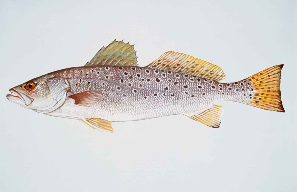 GamefishSpotted SeatroutCynoscion nebulosus
A preserve within a larger forest region
Big Thicket National Preserve protects part of the heavily forested Big Thicket region in Southeast Texas. The National Park Service established the preserve in 1974 to protect its varied plant and animal life. The surrounding landscape belongs to the mixed pine-hardwood forests known as the Piney Woods, but the Big Thicket is not a single, uniform forest. Its character comes from the mix of ecosystems found across the region. For trip planning, the important distinction is between the national preserve and the much larger area called the Big Thicket. That regional name has no single agreed boundary, and a place described as being in the Big Thicket is not necessarily within the preserve. Keep that distinction in mind when choosing a destination and checking access with the National Park Service.
Look closely at the plant diversity
The Big Thicket's defining feature is its complex mix of habitats and plants. Biologists have identified at least eight, and as many as eleven, ecosystems across the region. Recorded plant diversity includes more than 160 species of trees and shrubs, 800 herbs and vines, and 340 types of grasses, along with ferns and carnivorous plants. These are regional figures, not a checklist for any particular preserve outing. Animal diversity is also substantial, with more than 500 vertebrate species reported for the broader area. An outing here benefits from time spent looking closely at vegetation rather than simply covering ground. Carrying a plant guide and allowing time for observation suit a destination whose interest lies in the differences between forest communities and the plants growing within them.
A forest shaped by people and conservation
The forest protected today has a long human history and has undergone major change. Archaeological finds suggest occupation of the broader Big Thicket region extending back to the Clovis culture, though parts of its early settlement history remain uncertain. The Alabama–Coushatta settled in the northeastern part of the region around 1780. Following emancipation, formerly enslaved people also made homes in these woods, relying on homesteading, hunting, and foraging. Logging during the nineteenth and twentieth centuries dramatically reduced what had historically been Texas's densest forest region. Organized efforts to protect the Big Thicket from lumber and oil development began as early as the 1920s, decades before the preserve's establishment. This history matters on a visit: the landscape is both a place of exceptional biological diversity and a forest shaped by settlement, extraction, and conservation.
Sample itineraries
- One-day forest introduction · 1 day
Plan a day outing in Big Thicket National Preserve focused on its mixed pine-hardwood forest. Confirm a suitable public route with the National Park Service before arriving. Keep the outing flexible, allowing time to observe differences in trees, shrubs, and understory plants.
- Two-day ecosystem study · 2 days
Spend the first day observing the preserve’s forest structure and the second comparing vegetation along another agency-confirmed route. The wider Big Thicket contains at least eight recognized ecosystems; focus on habitat differences rather than covering distance. Arrange lodging separately rather than assuming overnight access.
Seasonal conditions
Spring
Spring; choose outing dates using current local forecasts.
Make plant observation a focus in this botanically diverse forest, but do not assume a particular flowering schedule. Confirm route conditions before setting out and carry weather protection.
Summer
Summer; choose outing dates using current local forecasts.
Use the forecast to set your walking pace, water supply, and outing length. Heavy forest cover is not a substitute for weather planning. Keep plans flexible rather than assuming comfortable conditions.
Fall
Fall; choose outing dates using current local forecasts.
Explore the mixed pine-hardwood landscape without planning around an assumed peak foliage period. Check current conditions and available daylight before choosing an outing.
Winter
Winter; choose outing dates using current local forecasts.
Choose clothing and outing length for the actual forecast rather than assuming mild conditions in Southeast Texas. Confirm access and route conditions with the National Park Service.
| Season | Window | Conditions |
|---|---|---|
| Spring | Spring; choose outing dates using current local forecasts. | Make plant observation a focus in this botanically diverse forest, but do not assume a particular flowering schedule. Confirm route conditions before setting out and carry weather protection. |
| Summer | Summer; choose outing dates using current local forecasts. | Use the forecast to set your walking pace, water supply, and outing length. Heavy forest cover is not a substitute for weather planning. Keep plans flexible rather than assuming comfortable conditions. |
| Fall | Fall; choose outing dates using current local forecasts. | Explore the mixed pine-hardwood landscape without planning around an assumed peak foliage period. Check current conditions and available daylight before choosing an outing. |
| Winter | Winter; choose outing dates using current local forecasts. | Choose clothing and outing length for the actual forecast rather than assuming mild conditions in Southeast Texas. Confirm access and route conditions with the National Park Service. |
Permits, fees & closures
Confirm permit requirements, access rules, and any overnight arrangements with the National Park Service before your trip.
Confirm current permits, fees, and closures with the managing agency before you go.
Hazards & regulations
- The heavily forested setting calls for careful navigation. Use a confirmed route and carry a map rather than relying on distant landmarks.
- Plan for the weather despite forest cover. Check the forecast and adjust clothing, water, and outing length accordingly.
- The region supports diverse animal life. Keep wildlife encounters observational: maintain distance and do not feed or approach animals.
What to pack for Big Thicket National Preserve
- Map showing your agency-confirmed route
- Offline navigation backup
- Written outing plan shared with a contact
- Comfortable walking footwear
- Forecast-appropriate layers and weather protection
- Drinking water and food
- Basic first-aid kit
- Regional plant identification guide
- Binoculars
- Notebook or camera for recording habitat differences
Big Thicket National Preserve FAQ
- Where is Big Thicket National Preserve?
- It is in Southeast Texas, within the heavily forested Big Thicket region and the mixed pine-hardwood landscape often called the Piney Woods.
- Is the preserve the same as the Big Thicket region?
- No. The Big Thicket is a broader region with imprecise boundaries. Big Thicket National Preserve is the National Park Service preserve established within that region in 1974.
- What should a visit focus on?
- Focus on the variety of plant communities and forest structure. The wider region contains at least eight recognized ecosystems, along with ferns, carnivorous plants, and a rich mix of trees, shrubs, herbs, and vines.
- How should routes and access be planned?
- Ask the National Park Service for current public routes and access information. Choose an outing that matches your navigation skills and available time; do not treat the wider forested region as uniformly accessible preserve land.
- Why was the preserve established?
- It was established in 1974 to protect the area's many plant and animal species. Logging during the nineteenth and twentieth centuries had substantially reduced the region’s forest concentration.
- Is there a single best season to visit?
- Choose dates around current weather, access conditions, and your interests rather than a fixed seasonal promise. Botanical diversity is a strong reason to visit, but flowering times and wildlife sightings should not be assumed.