


- Region
- Tennessee & North Carolina, USA
- Best season
- Spring, Summer
- Permits
- Confirm current permit requirements with t…
Plan with verified data
Great Smoky Mountains trip tools
Tools for a trip here
Picked for how, when and where you're going. Free, no signup.
Photos of Great Smoky Mountains
How to get there
Great Smoky Mountains is in Tennessee & North Carolina, USA. Its center point is 35.6532, -83.5070. Use these links for live turn-by-turn directions from where you are, then confirm road, trailhead and access conditions with the managing agency before you leave.
- Kuwohi
A summit destination in Great Smoky Mountains National Park, formerly officially named Clingmans Dome. A specific road approach or trailhead is not established here; confirm the approach before traveling.
- Appalachian Trail
The long-distance trail reaches its highest point at Kuwohi. Use it as a route-planning anchor, not as a single entry location; a specific access point must be confirmed separately.
Tennessee & North Carolina, USA · Season: Best: Sep-May
- Mountaineering
- Backpacking
- Wildlife Viewing
The country
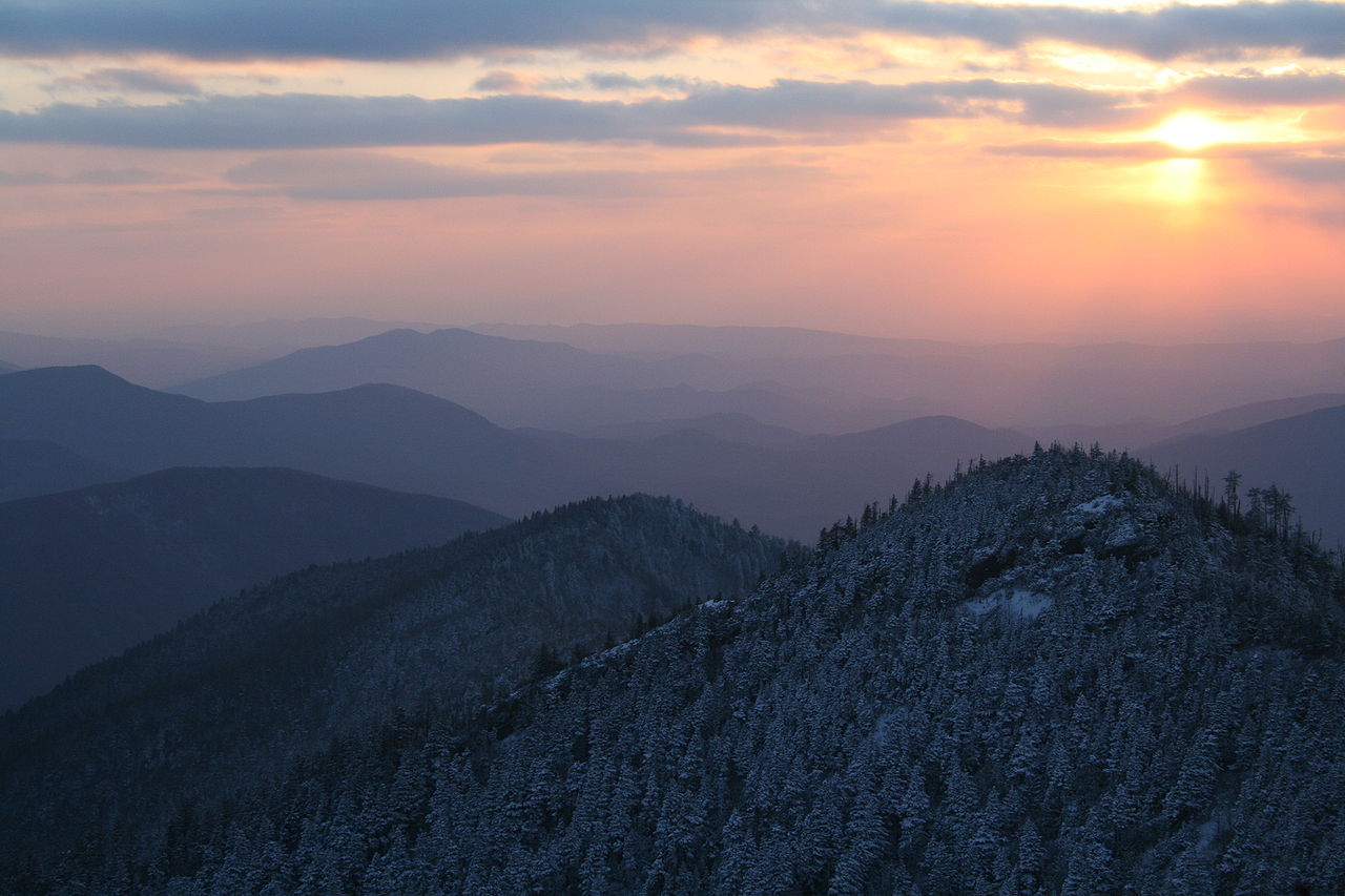
These ancient, heavily eroded Appalachian ridges harbor a staggeringly diverse temperate rainforest draped continuously in a blue mist of organic compounds. Steep valleys choked with dense rhododendron give way to high-elevation spruce-fir forests clinging to rounded summits.
Why enthusiasts come
Backpackers immerse themselves in deep eastern wilderness, relishing the challenge of brutal elevation gains and highly variable mountain weather. The rich biodiversity and haunting beauty of the old-growth groves attract nature purists year-round.
Top experiences
Completing the arduous traverse from Clingmans Dome to Mount LeConte provides sweeping ridge-line views above thick cloud inversions. Navigating the unmaintained manways of the deep drainages offers experienced bushwhackers a taste of impenetrable wilderness.
Planner-relevant notes
Backcountry shelters and campsites require strict adherence to reservations and mandatory permits booked entirely online. Bears are hyper-active and habituated to human smell in some zones, making the use of integrated cable hoists mandatory at campsites. The park receives incredible amounts of rain; high-end waterproofing for gear is critical to survive hypothermic risks.
Field notes
- Ridge trails are exceptionally rocky and punish knees heavily during long descents.
- Park humidity traps sweat under rain gear; prioritize mechanical ventilation over absolute waterproofing.
- Shelter mice are notorious for chewing directly through pack fabrics for dropped crumbs.
- Yellow jacket nests are common directly adjacent to dirt trails in late summer.
Where on earth
Satellite imagery flying in from a world view to Great Smoky Mountains, Tennessee & North Carolina, USA. Use the + / − buttons, or click the map to zoom with your scroll wheel; drag to pan and pinch to zoom on touch.
Coordinates
- Decimal degrees
- 35.6532, -83.5070
- Latitude (DMS)
- 35° 39′ 11.5″ N
- Longitude (DMS)
- 83° 30′ 25.2″ W
Coordinates are an access-point reference for Great Smoky Mountains, not a route. Carry a paper map and confirm trailhead or put-in access with the managing agency before you go.
Topic summary
Dense, rain-soaked temperate rainforests drape over dramatic Appalachian ridges, harboring incredible biodiversity and challenging ascents through frequent thick fog.
Key takeaways
- Region: Tennessee & North Carolina, USA
- Best season: Best: Sep-May
- Coordinates: 35.653, -83.507
Climate suitability
Best: Sep-May
Keep planning
Popular pursuits at Great Smoky Mountains
- Mountaineering
Glacier and high-route objectives with real consequence.
- Backpacking
Multi-day travel with everything on your back — see the packing blocks below.
- Wildlife Viewing
Best light, best season, and where animals move.
Animals around Great Smoky Mountains
 Wildlife guideBlack bearUrsus americanus
 Big gameWhitetail DeerOdocoileus virginianus
 GamefishLargemouth BassMicropterus nigricans
 Wildlife guideNorth American beaverCastor canadensis
 Big gameWild HogSus scrofa
 GamefishRed DrumSciaenops ocellatus
 Wildlife guideSnowshoe hareLepus americanus
 Big gameBlack BearUrsus americanus
A mountain destination across two states
The Great Smoky Mountains span Tennessee and North Carolina in the southeastern United States. They belong to the Appalachians, the much larger mountain system extending along eastern North America from Newfoundland and Labrador to Alabama. For trip planning, distinguish the Great Smoky Mountains as a range from Great Smoky Mountains National Park and from individual destinations within it. Kuwohi is the clearest high-elevation objective: it is the park’s highest mountain and Tennessee’s highest point. The Appalachian Trail provides a different way to approach the landscape, following the main ridges of the broader Appalachian system. A summit-focused visit and a trail journey are different undertakings; choose the scale of the outing before settling on an access point or walking itinerary.
Kuwohi: the park’s highest mountain
Kuwohi rises to 6,643 feet, or 2,025 meters, in the Great Smoky Mountains of Tennessee and North Carolina. Its former official name was Clingmans Dome, so both names identify the same mountain. Beyond being the highest mountain in Great Smoky Mountains National Park, Kuwohi is also the highest point along the Appalachian Trail. That makes it a useful geographic anchor for understanding both the park and the long-distance route. It is the third-highest point in eastern mainland North America, below Mount Mitchell and Mount Craig. Those rankings describe elevation, not the effort required to reach the summit. Do not use summit height alone to judge an outing’s difficulty; establish the actual approach, walking distance, and return plan before heading out.
Choosing the scale of an outing
The broader Appalachian Mountains support both day visits and journeys along part or all of the Appalachian Trail. In the Smokies, Kuwohi connects those two planning perspectives: it is a named mountain destination as well as the trail’s highest point. Start by deciding whether the goal is the mountain itself or time walking a section of the long-distance trail. Neither choice, on its own, defines a complete route. A workable itinerary still needs a confirmed starting point, an endpoint or turnaround, and a distance appropriate to the group. For a mountain outing, carry weather protection and enough water for the chosen walk. Confirm access arrangements and any permit requirements with the managing agency before finalizing plans.
Route options
- Kuwohi summit objective
Plan an outing focused on the 6,643-foot mountain, the highest in the national park. This identifies the objective rather than a verified summit approach; confirm the walking route and return arrangements.
- Appalachian Trail section at Kuwohi
Build a section walk around the Appalachian Trail’s highest point. Select and verify start and finish locations before treating this as a complete itinerary.
Sample itineraries
- Kuwohi-focused day visit · 1 day
Plan a day around Kuwohi, formerly called Clingmans Dome. At 6,643 feet, it is the highest mountain in Great Smoky Mountains National Park and Tennessee's highest point. Confirm access and choose an approach suited to the group's ability before setting out.
- Kuwohi and Appalachian Trail sampler · 2 days
Devote one day to Kuwohi and a second to a separately planned Appalachian Trail day hike in the Great Smoky Mountains. Kuwohi is the trail's highest point. Select access points and turnaround locations after checking current conditions; this plan does not assume an overnight trail stay.
Seasonal conditions
Spring
Spring
For a mountain outing, check the forecast at your intended elevation rather than relying on conditions below. Keep the day's route flexible and carry layers for changing weather.
Summer
Summer
Do not assume summer means mild conditions throughout a high-elevation hike. Check mountain weather, carry water, and choose a turnaround point that leaves time for a safe return.
Fall
Fall
Plan hiking time around available daylight. For Kuwohi or a ridge outing, bring insulating and weatherproof layers and confirm conditions before committing to the day's route.
Winter
Winter
Confirm access and mountain conditions before departure. Treat a high-elevation outing as weather-dependent, and choose a less demanding plan if conditions exceed the group's equipment or experience.
| Season | Window | Conditions |
|---|---|---|
| Spring | Spring | For a mountain outing, check the forecast at your intended elevation rather than relying on conditions below. Keep the day's route flexible and carry layers for changing weather. |
| Summer | Summer | Do not assume summer means mild conditions throughout a high-elevation hike. Check mountain weather, carry water, and choose a turnaround point that leaves time for a safe return. |
| Fall | Fall | Plan hiking time around available daylight. For Kuwohi or a ridge outing, bring insulating and weatherproof layers and confirm conditions before committing to the day's route. |
| Winter | Winter | Confirm access and mountain conditions before departure. Treat a high-elevation outing as weather-dependent, and choose a less demanding plan if conditions exceed the group's equipment or experience. |
Permits, fees & closures
Confirm current permit requirements with the managing agency for your planned Great Smoky Mountains outing.
Confirm current permits, fees, and closures with the managing agency before you go.
Hazards & regulations
- Changing mountain weather can make a ridge outing more demanding; check the forecast and be willing to turn back.
- Kuwohi reaches 6,643 feet. Allow for the effort of hiking at elevation and pace the outing to the least experienced participant.
- An open-ended Appalachian Trail hike can exceed available time or energy. Set a turnaround point before leaving.
What to pack for Great Smoky Mountains
- Waterproof outer layer
- Insulating layer
- Sun protection
- Map covering the chosen outing
- Navigation tool and backup power
- Headlamp
- First-aid kit
- Water appropriate to the planned effort
- Food and extra snacks
- Footwear suited to mountain walking
Great Smoky Mountains FAQ
- Where are the Great Smoky Mountains?
- The Great Smoky Mountains span Tennessee and North Carolina in the southeastern United States. They form part of the Appalachian mountain system.
- What is Kuwohi?
- Kuwohi is a 6,643-foot mountain and the highest point in Great Smoky Mountains National Park. It is also Tennessee's highest point and the third-highest mountain in eastern mainland North America.
- Are Kuwohi and Clingmans Dome the same mountain?
- Yes. Clingmans Dome is Kuwohi's former official name.
- Does the Appalachian Trail reach Kuwohi?
- Yes. Kuwohi is the highest point along the Appalachian Trail. Confirm the appropriate approach and current conditions when planning a visit.
- Can this be planned as a day trip?
- A day visit or a selected Appalachian Trail day hike can be the focus. Choose the actual route after confirming access, walking requirements, weather, and the group's ability.