



- Region
- Alberta
- Country
- Canada
- Best for
- climbing, hiking, backpacking
- Best season
- Spring, Summer
- Permits
- Confirm current entry requirements, activi…
- Managed by
- Parks Canada
Plan with verified data
Icefields Parkway (Banff/Jasper National Parks) trip tools
Tools for a trip here
Picked for how, when and where you're going. Free, no signup.
- Sleep System Temp CalculatorCold nights: check your bag and pad add up to a safe sleep.
- Bear Country Food StorageBear country: canister, Ursack or hang, and the local rules.
- Base Weight CalculatorEvery ounce is carried — total your kit and find your base weight.
- Pack Volume SizerSize the pack for your trip length and season.
- Water Purification MatrixTreat water from streams and lakes on trail.
How to get there
The destination is in Alberta's Rocky Mountains, Canada. Banff National Park lies 110–180 kilometres west of Calgary, and Jasper National Park borders it to the north. The town of Banff, in the Bow River valley, is Banff National Park's main commercial centre. Confirm the specific Parkway approach and current road conditions before travelling.
- Town of Banff
Banff National Park's main commercial centre, located in the Bow River valley. Treat it as a regional planning base rather than a specified Parkway trailhead.
- Jasper National Park
The northern park adjoining Banff, with mountain drives and a park-wide network of day and overnight hiking trails. Select and confirm a specific road access point or trailhead before departure.
Sources: Wikipedia · Wikivoyage. Confirm road and trailhead conditions with the managing agency before you leave.
Alberta · Canada · Season: Winter (Dec–Mar)
- Backpacking
- Hiking
- Climbing
- Winter Camping
- Skiing
- Wildlife Viewing
- Canoeing
- Fishing
Overview
The Icefields Parkway, stretching between Lake Louise and Jasper, is arguably the world's most concentrated corridor of accessible, high-quality ice climbs. This is the heart of Canadian Rockies ice, offering everything from roadside single-pitch flows to multi-pitch alpine adventures. The sheer volume and variety of routes, often visible from the highway, make it an undeniable top pick. Climbs like 'Weeping Wall' and 'Polar Circus' are iconic, drawing climbers from around the globe. Expect a wide range of grades, from WI3 to WI6, often with approachable walk-ins. The scenery is consistently breathtaking, placing you deep within the majestic Canadian Rockies.
The nearest major town for amenities and services is Canmore, followed by Lake Louise and Jasper. Lake Louise is the most central hub for many of the Parkway's popular climbs. The ideal season is typically November through March, with December and January often providing the best conditions. Snowpack can be a significant factor, with heavier snow making approaches more challenging. Skill levels vary wildly from beginner-friendly top-roping opportunities to highly committing expeditions. Banff and Jasper National Parks require park passes, and specific routes may have seasonal access restrictions due to wildlife or avalanche hazards. Trade-offs include cold temperatures, potential for high avalanche danger, and crowds on popular routes, especially on weekends.
Planning notes
Where: Alberta, Canada Best season: Winter (Dec–Mar) Good for: Climbing, Hiking, Backpacking, Wildlife Viewing Featured on: Top 10 Ice Climbing Destinations in the Canadian Rockies (#1) Access point: Icefields Pkwy, Jasper, AB, Canada
Check current permits, closures and fire restrictions with the managing agency before you commit to dates.
Where on earth
Satellite imagery flying in from a world view to Icefields Parkway (Banff/Jasper National Parks), Canada. Use the + / − buttons, or click the map to zoom with your scroll wheel; drag to pan and pinch to zoom on touch.
Coordinates
- Decimal degrees
- 52.8665, -118.0934
- Latitude (DMS)
- 52° 51′ 59.4″ N
- Longitude (DMS)
- 118° 5′ 36.1″ W
Coordinates are an access-point reference for Icefields Parkway (Banff/Jasper National Parks), not a route. Carry a paper map and confirm trailhead or put-in access with the managing agency before you go.
Topic summary
The Icefields Parkway, stretching between Lake Louise and Jasper, is arguably the world's most concentrated corridor of accessible, high-quality ice climbs.
Key takeaways
- Region: Alberta
- Country: Canada
- Best season: Winter (Dec–Mar)
- Good for: climbing, hiking, backpacking, wildlife viewing
- Coordinates: 52.867, -118.093
Intended uses
- climbing
- hiking
- backpacking
- wildlife viewing
Climate suitability
Winter (Dec–Mar)
Keep planning
Popular pursuits at Icefields Parkway (Banff/Jasper National Parks)
- Backpacking
Multi-day travel with everything on your back — see the packing blocks below.
- Hiking
Day miles on marked trail, with route notes and trail links below.
- Climbing
Rock and alpine lines with approach beta.
- Winter Camping
Cold-season travel and camp craft; layering matters more than mileage.
- Skiing
Ski-touring access when the road closes for the season.
- Wildlife Viewing
Best light, best season, and where animals move.
Animals around Icefields Parkway (Banff/Jasper National Parks)
 Wildlife guideTimber wolfCanis lupus
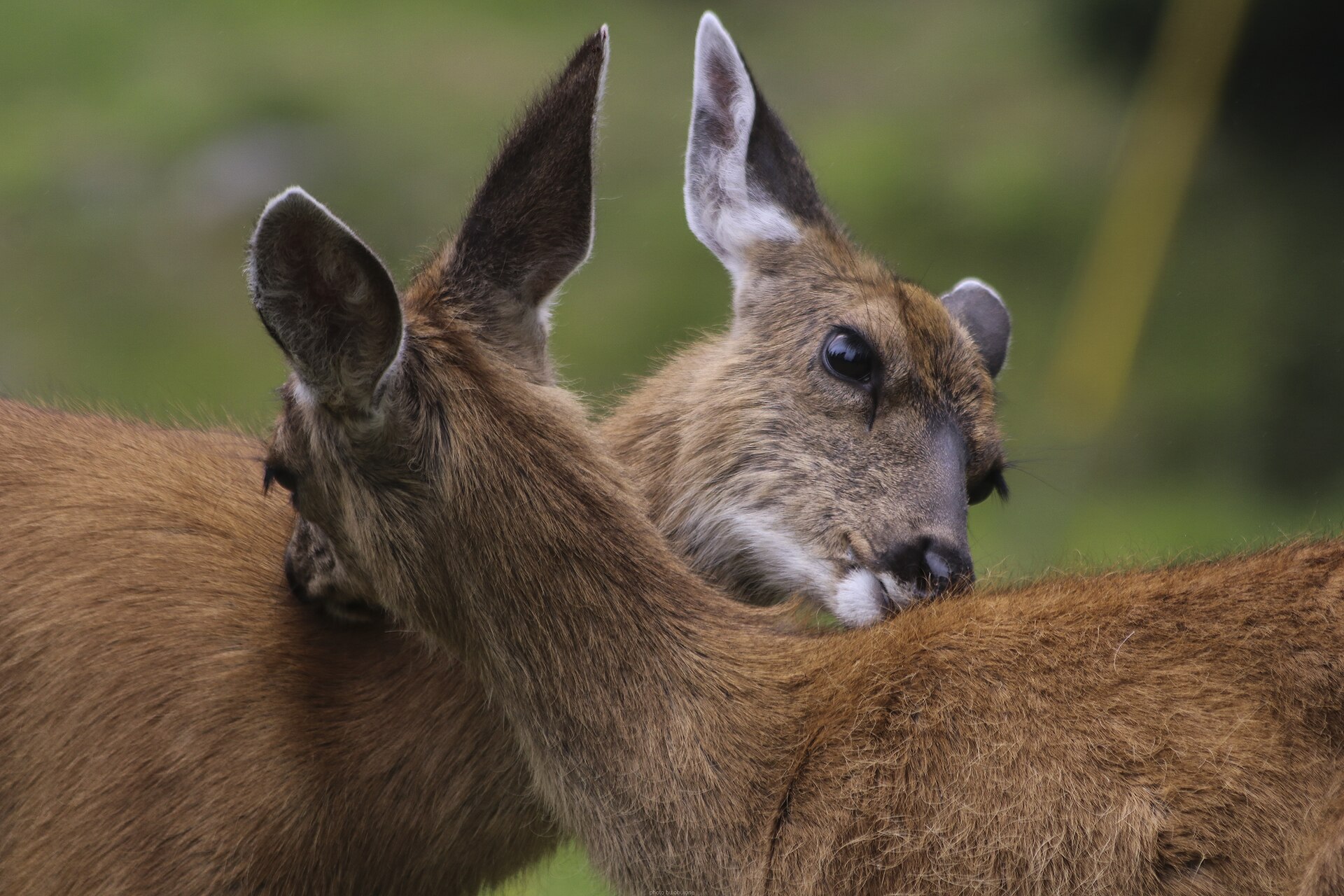 Big gameBlacktail DeerOdocoileus hemionus columbianus
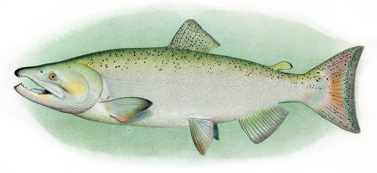 GamefishPacific SalmonOncorhynchus spp.
 Wildlife guideCanada lynxLynx canadensis
 Big gameElkCervus canadensis
 GamefishRainbow TroutOncorhynchus mykiss
 Wildlife guideBlack bearUrsus americanus
 Big gameBlack BearUrsus americanus
A mountain trip across two national parks
The Icefields Parkway destination sits within the larger mountain setting of Banff and Jasper national parks in Alberta, Canada. Banff covers 6,641 square kilometres of mountainous terrain, with glaciers, ice fields, coniferous forest and alpine landscapes. Jasper, bordering Banff to the north, is the largest of Canada's Rocky Mountain Parks at 10,878 square kilometres. Its broad valleys, wild rivers and alpine meadows give the northern part of this setting its own character. Plan around the kind of outing wanted rather than trying to cover every landscape in one trip. Mountain driving and hiking are both part of the region's appeal, but a roadside visit and a day on foot require different preparation. Choose specific walks only after confirming current access and conditions.
Reading the rock, forest and ice
Banff's landscape is shaped by both mountain building and erosion. Sedimentary rocks were pushed east over newer rock layers between 80 million and 55 million years ago. Later, glaciers repeatedly covered much of the park, while water and ice carved the mountains into their present forms. Glaciers now remain on mountain slopes, including the Columbia Icefield, described as the largest uninterrupted glacial mass in the Rockies. Vegetation changes with elevation: lodgepole pine dominates lower forests, while Engelmann spruce grows higher up below treeline. Above the trees, rock and ice become the main features. These changes make elevation an important planning consideration. Clothing and expectations suited to a forested valley may not suit an exposed alpine outing, even within the same trip.
Planning for mountain conditions and wildlife
Banff has a subarctic climate and spans montane, subalpine and alpine environments. Pack layers and weather protection, and let current conditions determine how ambitious a walk should be. Jasper has more than 1,200 kilometres of hiking trails across the park, including day trips and overnight outings; that park-wide total should not be treated as a list of Parkway-accessible routes. Confirm the starting point and demands of any chosen trail before setting out. Banff supports grizzly bears, cougars, wolverines, elk, bighorn sheep and moose, so wildlife awareness belongs in both driving and walking plans. Give animals space and keep food secured. Visitor pressure has challenged Banff's ecological health, making careful travel and respect for park guidance practical responsibilities throughout a visit.
Route options
- Banff National Park landscape outing
A regional outing focused on Banff's coniferous forests, mountain terrain and alpine landscapes. Choose a confirmed local route suited to the desired elevation and current conditions; this is not a turn-by-turn itinerary.
- Jasper National Park day hike or overnight outing
Choose from Jasper's park-wide hiking network for a day trip or overnight walk among valleys, forests and alpine terrain. Confirm whether the selected trail is accessible from the Parkway, along with its length and demands.
Sample itineraries
- One-day Banff landscape sampler · 1 day
Focus on Banff National Park rather than trying to cover both parks. Combine time in the town of Banff and Bow River valley with mountain scenery. Choose any walking objective according to current conditions; the park spans forested valleys, subalpine terrain, and rock-and-ice alpine country.
- Two-park introduction · 2 days
Spend one day exploring Banff's valley and mountain landscapes, then devote a second to Jasper's broad valleys, forests, and rugged mountains. Keep walking plans flexible and confirm access before travel. This is a landscape-focused outline, not a timed driving route.
- Jasper hiking-focused stay · 3 days
Base the trip around Jasper National Park's day-hiking opportunities. Allow separate days for forest and valley scenery, a mountain outing suited to conditions, and a flexible day for weather. Select specific trails only after checking current access and matching the terrain to the group's ability.
Seasonal conditions
Spring
Spring transition
Banff's subarctic climate and high terrain call for conservative plans. Do not assume lower-valley conditions represent the alpine. Check snow and footing conditions before choosing walks, and carry warm layers.
Summer
Summer mountain travel
Plan around elevation rather than assuming uniform warmth. Forested valleys and alpine rock-and-ice terrain require different preparation. Carry insulation and weather protection, and choose hikes suited to current conditions.
Fall
Fall transition
Prepare for cold conditions and keep mountain objectives flexible. In this subarctic setting, check the forecast and ground conditions before committing to higher terrain.
Winter
Winter mountain travel
Treat this as a cold-weather mountain trip. Confirm current road and trail access with the managing agency rather than assuming summer plans remain suitable. Carry substantial insulation and emergency supplies.
| Season | Window | Conditions |
|---|---|---|
| Spring | Spring transition | Banff's subarctic climate and high terrain call for conservative plans. Do not assume lower-valley conditions represent the alpine. Check snow and footing conditions before choosing walks, and carry warm layers. |
| Summer | Summer mountain travel | Plan around elevation rather than assuming uniform warmth. Forested valleys and alpine rock-and-ice terrain require different preparation. Carry insulation and weather protection, and choose hikes suited to current conditions. |
| Fall | Fall transition | Prepare for cold conditions and keep mountain objectives flexible. In this subarctic setting, check the forecast and ground conditions before committing to higher terrain. |
| Winter | Winter mountain travel | Treat this as a cold-weather mountain trip. Confirm current road and trail access with the managing agency rather than assuming summer plans remain suitable. Carry substantial insulation and emergency supplies. |
Permits, fees & closures
Confirm current entry requirements, activity permits, and booking requirements with the managing agency before travel.
Confirm current permits, fees, and closures with the managing agency before you go.
Hazards & regulations
- Glaciers and ice fields are not ordinary walking terrain. Keep casual outings off glacial ice.
- Jasper's wild rivers require caution. Avoid entering fast-moving water or using an unverified crossing.
- Rugged mountains and alpine rock-and-ice terrain demand suitable footwear, navigation, and objectives matched to ability.
- Banff's subarctic climate makes cold exposure a planning concern, particularly at higher elevations.
- Grizzly bears, cougars, and large hoofed mammals occur in Banff. Keep wildlife distant, never feed animals, and secure food.
What to pack for Icefields Parkway (Banff/Jasper National Parks)
- Insulating layers
- Waterproof outer layer
- Warm hat and gloves
- Sun protection
- Sturdy footwear suited to rocky terrain
- Map and offline navigation
- Headlamp
- First-aid kit
- Drinking water
- Food for the outing plus a reserve
- Secure food storage appropriate to the activity
- Emergency insulation
Icefields Parkway (Banff/Jasper National Parks) FAQ
- What landscapes define this destination?
- Banff and Jasper contain Rocky Mountain valleys, coniferous forests, rugged peaks, glaciers, and alpine terrain. Jasper also includes alpine meadows and wild rivers. Elevation strongly shapes the landscape and the preparation needed for an outing.
- Can this be a hiking trip rather than only a drive?
- Yes. Jasper has an extensive trail network supporting both day hikes and overnight trips. Choose specific trails after checking current conditions, access, and requirements with the managing agency.
- What is the Columbia Icefield?
- The Columbia Icefield is the largest uninterrupted glacial mass in the Rockies. It belongs to a mountain landscape shaped by repeated glaciation and erosion. Viewing glacial scenery should not be confused with being equipped to travel on ice.
- Is Banff town the same as Banff National Park?
- No. The town of Banff is the park's main commercial centre, in the Bow River valley. The national park extends across a much larger area of mountains, forests, glaciers, and alpine landscapes.
- Where does Jasper sit relative to Banff?
- Jasper National Park borders Banff National Park to the north. Both are in Alberta's Rocky Mountains; Jasper is the largest of Canada's Rocky Mountain Parks.
- How should wildlife viewing be handled?
- Watch without approaching, feeding, or following animals. Banff supports grizzly bears, cougars, elk, bighorn sheep, moose, and other wildlife. Keep food secure and follow current managing-agency guidance for wildlife encounters.