



- Region
- Minnesota
- Country
- United States
- Best for
- canoeing, camping, fishing
- Best season
- Spring, Summer
- Permits
- Confirm permit requirements and access rul…
Plan with verified data
Kawishiwi Triangle (Entry Point 32, South Kawishiwi River) trip tools
Tools for a trip here
Picked for how, when and where you're going. Free, no signup.
- Water Purification MatrixLake water needs treating — compare filters, chemicals and boiling.
- Layering CalculatorCold water: dress for immersion, not just the air temperature.
- Sleep System Temp CalculatorCold nights: check your bag and pad add up to a safe sleep.
- Bear Country Food StorageBear country: canister, Ursack or hang, and the local rules.
- The 10 EssentialsBackcountry safety basics, printable.
How to get there
The South Kawishiwi River Entry Point 32 is located near Ely, Minnesota. From Ely, drive east on Highway 169 for approximately 0.8 miles, then turn right onto Highway 1 for 12 miles. Turn left onto FR 181/Spruce Road and continue for 4.1 miles to reach the parking area on the left side of the road. Alternatively, from Ely, follow Minnesota Highway 1 east for about 10 miles, then take a left onto Spruce Road (Road 230) and follow it for 4 miles until you reach the parking area.
- BWCA Entry Point 32 - South Kawishiwi River
Access is via a parking area off FR 181/Spruce Road (also known as Road 230). There are two parking lots, with the portage starting from the smaller lot. A 147-rod portage (just under half a mile) leads from the parking lot to the South Kawishiwi River.
Sources: Wikipedia · Wikivoyage · bwca.com · elyoutfittingcompany.com. Confirm road and trailhead conditions with the managing agency before you leave.
Minnesota · United States · Season: Late spring through early fall
- Canoeing
- Kayaking
- Hunting
- Mountaineering
- Wildlife Viewing
- Fishing
- Photography
Overview
This loop offers a scenic and manageable multi-day trip for those seeking a mix of river and lake paddling. Starting on the South Kawishiwi River, the route connects through several lakes like Clear Lake, Hudson Lake, and Lake Insula. The portages are generally short to moderate, making for a relatively smooth flow from one body of water to the next. The river sections provide a meandering, sheltered experience, while the lakes offer more open paddling. This area is less heavily trafficked than some central BWCA routes, providing a better chance for solitude and wildlife viewing, including moose and various waterfowl. Nearest town is Ely. Best visited in late spring or early fall to avoid peak summer crowds and bugs. Wind can be a factor on larger lakes. Campsites are generally good, but planning ahead for popular weekends is always wise. It's a fantastic route for intermediate paddlers.
Planning notes
Where: Minnesota, United States Best season: Late spring through early fall Good for: Canoeing, Camping, Fishing Featured on: Top 10 Flatwater Canoe Routes: Boundary Waters Multi-day (#6) Access point: Kawishiwi River, Fall Lake Township, MN 55731, USA
Check current permits, closures and fire restrictions with the managing agency before you commit to dates.
Where on earth
Satellite imagery flying in from a world view to Kawishiwi Triangle (Entry Point 32, South Kawishiwi River), United States. Use the + / − buttons, or click the map to zoom with your scroll wheel; drag to pan and pinch to zoom on touch.
Coordinates
- Decimal degrees
- 47.9055, -91.7174
- Latitude (DMS)
- 47° 54′ 19.6″ N
- Longitude (DMS)
- 91° 43′ 2.5″ W
Coordinates are an access-point reference for Kawishiwi Triangle (Entry Point 32, South Kawishiwi River), not a route. Carry a paper map and confirm trailhead or put-in access with the managing agency before you go.
Topic summary
This loop offers a scenic and manageable multi-day trip for those seeking a mix of river and lake paddling.
Key takeaways
- Region: Minnesota
- Country: United States
- Best season: Late spring through early fall
- Good for: canoeing, camping, fishing
- Coordinates: 47.905, -91.717
Intended uses
- canoeing
- camping
- fishing
Climate suitability
Late spring through early fall
Keep planning
Popular pursuits at Kawishiwi Triangle (Entry Point 32, South Kawishiwi River)
- Canoeing
Paddle routes, portages, and put-ins.
- Kayaking
Sheltered and open-water paddling lines.
- Hunting
Seasons, tags, and the units that hold animals.
- Mountaineering
Glacier and high-route objectives with real consequence.
- Wildlife Viewing
Best light, best season, and where animals move.
- Fishing
Resident gamefish, seasons, and the water that holds them.
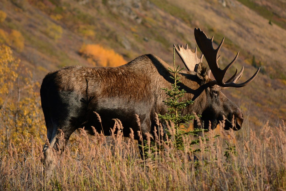
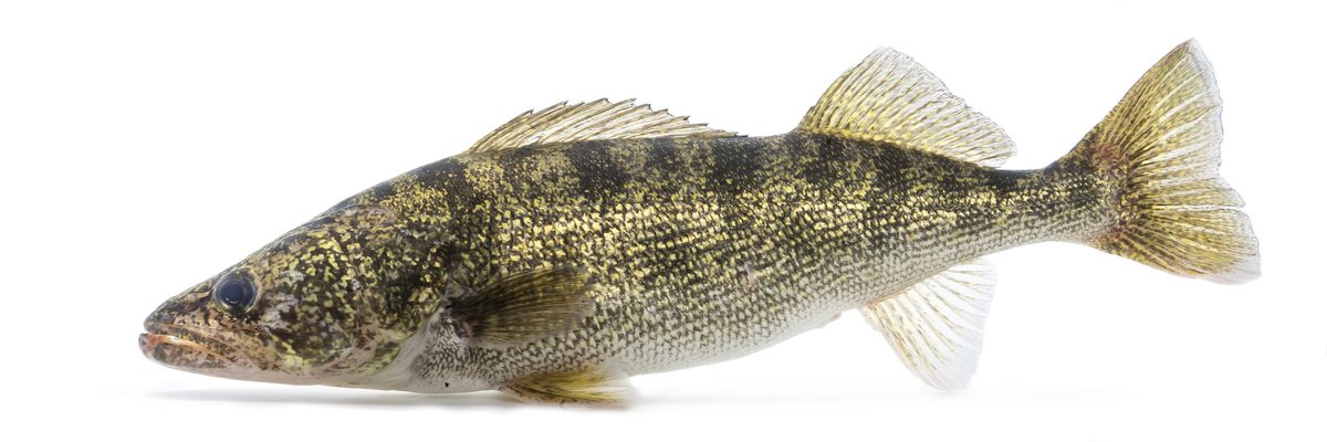
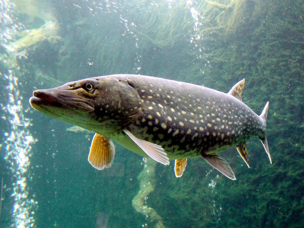
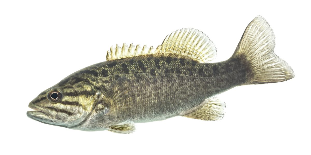
Animals around Kawishiwi Triangle (Entry Point 32, South Kawishiwi River)

Destination overview
The requested destination is the Kawishiwi Triangle, identified in the trip request with Entry Point 32 and the South Kawishiwi River in Minnesota. There is not enough destination-specific information here to describe the triangle’s layout, paddling conditions, landscape, or connections between waterways accurately. Minnesota’s broader river geography does not establish the character of this particular trip. A useful destination profile would need confirmed information about the entry point, the waterways that form the route, and the practical requirements for travel. Until those details are established, this should be treated as an incomplete planning outline rather than a navigational guide. No route length, expected trip duration, or difficulty rating can be responsibly assigned.
Access and route planning
Access directions and route choices remain unconfirmed. The entry-point name supplied in the request is not enough to establish a road approach, parking location, launch arrangement, or connection to a complete circuit. It also does not establish whether any alternative access points are suitable for the intended trip. Before committing to an itinerary, confirm the exact starting location and obtain current route information from the managing agency. That information should distinguish travel on the water from any overland connections and identify the intended return point. There is no supported basis here for listing individual route variants, describing a preferred direction of travel, or estimating driving and travel times. Those details are therefore left unspecified.
Requirements and conditions to confirm
Confirm current access requirements and any permit obligations with the managing agency before making firm plans. No destination-specific rules, fees, reservation procedures, or operating dates are established here. The same limitation applies to camping arrangements, seasonal suitability, and route-specific hazards: none can be described reliably from general information about Minnesota rivers or national scenic areas. A trip-ready plan needs current local guidance that applies to the exact entry point and intended route, rather than assumptions drawn from similarly named places or broader protected-land categories. Ask the managing agency to clarify the applicable requirements and whether there are conditions that affect the proposed itinerary. This outline does not establish that access is currently available or that any particular route is appropriate.
Sample itineraries
- One-day river outing planning outline · 1 day
Use a single-day outing as a planning option, not a verified route. Confirm the launch location, navigable water, return plan and local conditions before choosing a turnaround point.
- Two-day river trip planning outline · 2 days
Consider an overnight trip only after confirming the route, legal overnight locations and access requirements. This outline does not establish that the triangle can be completed in two days.
Seasonal conditions
Spring
Local paddling window unconfirmed
Seasonal access and river conditions are not established here. Check current water and weather conditions before setting departure plans.
Summer
Local paddling window unconfirmed
Do not assume summer guarantees suitable river conditions. Confirm the forecast, water conditions and access before departure.
Fall
Local paddling window unconfirmed
Check weather, available daylight and current river conditions when deciding daily travel goals. Local seasonal patterns are not established here.
Winter
Local access window unconfirmed
Winter travel suitability is not established here. Confirm local conditions and appropriate travel methods rather than assuming the river is accessible.
| Season | Window | Conditions |
|---|---|---|
| Spring | Local paddling window unconfirmed | Seasonal access and river conditions are not established here. Check current water and weather conditions before setting departure plans. |
| Summer | Local paddling window unconfirmed | Do not assume summer guarantees suitable river conditions. Confirm the forecast, water conditions and access before departure. |
| Fall | Local paddling window unconfirmed | Check weather, available daylight and current river conditions when deciding daily travel goals. Local seasonal patterns are not established here. |
| Winter | Local access window unconfirmed | Winter travel suitability is not established here. Confirm local conditions and appropriate travel methods rather than assuming the river is accessible. |
Permits, fees & closures
Confirm permit requirements and access rules with the managing agency.
Confirm current permits, fees, and closures with the managing agency before you go.
Hazards & regulations
- River travel involves immersion risk; wear a properly fitted personal flotation device.
- Local water hazards are unconfirmed; obtain route-specific information before launching.
- Weather can affect safe river travel; check the forecast and maintain a conservative return plan.
What to pack for Kawishiwi Triangle (Entry Point 32, South Kawishiwi River)
- Properly fitted personal flotation device
- Waterproof storage for essential gear
- First-aid kit
- Verified local route map
- Navigation backup
- Written trip plan shared with a trusted contact
- Drinking water
- Food
- Weather-appropriate layers
- Rain protection
Kawishiwi Triangle (Entry Point 32, South Kawishiwi River) FAQ
- Is this a verified guide to the Kawishiwi Triangle?
- No. Local route, access and camping details are not established here. Treat the itineraries as planning outlines, not navigation instructions.
- Where exactly is the launch?
- The launch location and approach are not verified here. Confirm the entry location and access directions with the managing agency before traveling.
- How long does the triangle take?
- A reliable duration cannot be established without verified route length, carries and local conditions. The suggested day counts are planning options, not confirmed completion times.
- Are permits or reservations required?
- Confirm both with the managing agency before committing to travel. No permit terms, reservation schedule or fees are established here.
- Where can overnight travelers camp?
- No overnight locations are verified here. Confirm legal camping options and applicable rules before planning an overnight itinerary.