



- Region
- Wisconsin
- Country
- United States
- Best for
- hiking, wildlife viewing, camping
- Best season
- Spring, Summer
- Permits
- For specific information on activities suc…
- Managed by
- Kickapoo Reserve Management Board
Plan with verified data
Kickapoo Valley Reserve trip tools
Tools for a trip here
Picked for how, when and where you're going. Free, no signup.
- Sleep System Temp CalculatorCold nights: check your bag and pad add up to a safe sleep.
- Bear Country Food StorageBear country: canister, Ursack or hang, and the local rules.
- The 10 EssentialsDay on trail: carry the ten essentials.
- Water Purification MatrixRefilling on trail: compare treatment options.
- Layering CalculatorCool temps: build a layer stack for the climb and the summit.
How to get there
The Kickapoo Valley Reserve is located between the villages of La Farge and Ontario in Vernon County, Wisconsin. Access points to the two State Natural Area units are available at various locations along Highway 131, county highways, and township roads. For specific access information and maps, contact the Kickapoo Valley Reserve Visitor Center in La Farge at S3661 State Highway 131, or call 608-625-2960.
Sources: dnr.wisconsin.gov · Wikipedia. Confirm road and trailhead conditions with the managing agency before you leave.
Wisconsin · United States · Season: Fall hunting seasons
- Hunting
- Hiking
- Wildlife Viewing
- Canoeing
- Fishing
Overview
The Kickapoo Valley Reserve is a bowhunter's dream, offering over 8,500 acres of rugged, unglaciated terrain. Its steep-sided valleys, hardwood ridges, and significant agricultural interface create exceptional whitetail habitat. The Kickapoo River meanders through the heart of the property, adding to the diversity. Access is generally good, with numerous parking areas off State Highway 131 and local county roads. The Reserve is managed primarily for natural resource protection, meaning timber stands are mature, offering excellent cover and food sources. Ideal season is late October through mid-November, during the rut, when bucks are most active. This is not a hunt for the faint of heart; expect steep climbs and long walks to get into prime areas. Fitness is a must. Permits are required, but general hunting licenses apply. The biggest trade-off can be pressure on easier-to-access fringes, but once you put in the miles, the crowds thin out considerably. Weather can be unpredictable; be prepared for cold, wet conditions in the late season.
Why it stands out
Over 8,500 acres of contiguous public land
Mature oak, maple, and basswood forests
Steep coulees and bluff tops providing natural funnels
Numerous creek crossings and river bottom habitat
Significant agricultural lands bordering the reserve
Known for producing mature bucks
Know before you go
High pressure near main access points
Very steep terrain requires good physical fitness
Limited cell service in some areas
Permits/licenses required by WI DNR
Planning notes
Where: Wisconsin, United States Best season: Fall hunting seasons Good for: Hiking, Wildlife Viewing, Camping Featured on: Top 10 Public-Land Bowhunting Units for Whitetails in the Driftless Area (#1) Access point: Kickapoo Valley Reserve, WI-131, La Farge, WI 54639, USA
Check current permits, closures and fire restrictions with the managing agency before you commit to dates.
Field notes
- Over 8,500 acres of contiguous public land
- Mature oak, maple, and basswood forests
- Steep coulees and bluff tops providing natural funnels
- Numerous creek crossings and river bottom habitat
- Significant agricultural lands bordering the reserve
- Known for producing mature bucks
Where on earth
Satellite imagery flying in from a world view to Kickapoo Valley Reserve, United States. Use the + / − buttons, or click the map to zoom with your scroll wheel; drag to pan and pinch to zoom on touch.
Coordinates
- Decimal degrees
- 43.6600, -90.5967
- Latitude (DMS)
- 43° 39′ 35.9″ N
- Longitude (DMS)
- 90° 35′ 48.3″ W
Coordinates are an access-point reference for Kickapoo Valley Reserve, not a route. Carry a paper map and confirm trailhead or put-in access with the managing agency before you go.
Topic summary
The Kickapoo Valley Reserve is a bowhunter's dream, offering over 8,500 acres of rugged, unglaciated terrain.
Key takeaways
- Region: Wisconsin
- Country: United States
- Best season: Fall hunting seasons
- Good for: hiking, wildlife viewing, camping
- Coordinates: 43.660, -90.597
Intended uses
- hiking
- wildlife viewing
- camping
Climate suitability
Fall hunting seasons
Keep planning
Popular pursuits at Kickapoo Valley Reserve
- Hunting
Seasons, tags, and the units that hold animals.
- Hiking
Day miles on marked trail, with route notes and trail links below.
- Wildlife Viewing
Best light, best season, and where animals move.
- Canoeing
Paddle routes, portages, and put-ins.
- Fishing
Resident gamefish, seasons, and the water that holds them.
Animals around Kickapoo Valley Reserve
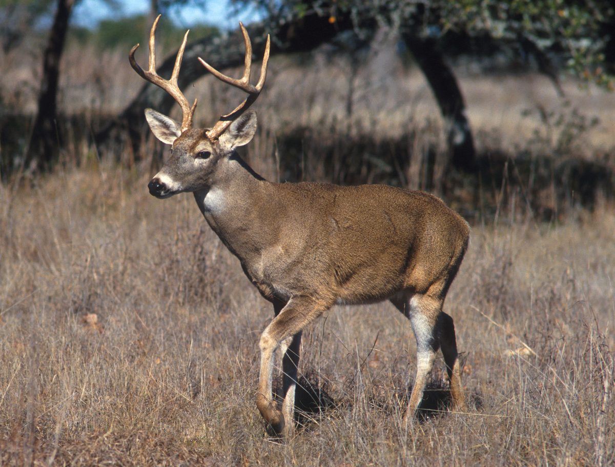




An Ecological Gem in the Driftless Area
Kickapoo Valley Reserve is situated in the unglaciated Driftless Area of southwestern Wisconsin. This 3,600-acre landscape is notable for its exceptional diversity of plant communities, supporting numerous rare plant and animal species, alongside significant archeological and geological features. The scenic Kickapoo River meanders through the reserve, flanked by sheer cliffs and forested bluffs. The varied topography and microclimates create a rich mosaic of habitats, including northern white pine and hemlock stands, extensive southern hardwood forests dominated by sugar maple and oaks, forested spring seeps, sedge meadows, shrub-carr, alder thickets, and hardwood swamps. These unique conditions contribute to a vibrant ecosystem, making the Reserve a critical natural area within Wisconsin.
Rich Biodiversity and Unique Habitats
The Reserve's diverse plant communities are a highlight. Shady, sandstone cliffs, marked by numerous seeps, provide a cool, moist microclimate essential for many rare plants, including one of Wisconsin's largest populations of a federally threatened species. An endemic plant, found nowhere else in the world, thrives within the central Wisconsin portion of the reserve. Other habitats include oak savanna with native grasses like robin's plantain, culver's-root, hoary puccoon, and spiderwort. Dry prairie remnants host little blue-stem, side-oats grama, pasqueflower, and rough blazing-star. Floodplain forests feature silver maple, green ash, and American elm. This variety supports a multitude of species, including many rare and uncommon birds. Ongoing restoration efforts aim to enhance native vegetation and expand habitat for these sensitive species.
Shared Stewardship and Public Access
Kickapoo Valley Reserve is jointly owned by the State of Wisconsin and the Bureau of Indian Affairs, held in trust for the Ho-Chunk Nation. It is managed by the Kickapoo Reserve Management Board and was officially designated a State Natural Area in 2002. While the Reserve shares a border with Wildcat Mountain State Park, forming a continuous protected area, it operates with different guidelines. Many State Natural Areas have limited facilities; however, the Reserve is generally open for various recreational activities. Visitors should be aware that facilities like picnic areas, restrooms, or developed trails are not common. Parking may be in designated areas or access lanes, which are not plowed during winter. A compass and topographic map or a GPS unit are recommended for exploring this expansive area.
Riverine Landscape and Geological Formations
The Kickapoo River is central to the Reserve's character, carving a narrow valley through the Driftless Area. The surrounding bluffs and cliffs, notably sandstone topped with limestone, offer scenic views. This geological history contributes to the unique conditions that support the Reserve's plant and animal life. The river itself provides numerous access points for paddlers, with 20 bridge crossings and landings along a 22.5-mile stretch between Ontario and La Farge. The five-mile segment between Landing 5 on Highway 131 and Landing 10 on County Highway P passes directly through the heart of the State Natural Area units, offering intimate views of the riverine landscape and its associated ecosystems.
Sample itineraries
- Paddling the Kickapoo River · 1 day
Paddlers can explore a 22.5-mile stretch of the Kickapoo River between Ontario and La Farge. There are 20 bridge crossings and landings available for river access. A particularly scenic five-mile segment between Landing 5 on Highway 131 and Landing 10 on County Highway P winds through the core of the Reserve's State Natural Area units, offering an immersive river experience.
- Day Hiking and Exploration · 1 day
Spend a day exploring the Reserve's diverse landscapes on foot. While developed trails may be limited, undeveloped footpaths are present. Use a GPS unit or a compass and a detailed topographic map to navigate the larger, isolated areas. Focus on discovering the unique plant communities, observing rare birds, and appreciating the geological features like sandstone cliffs and forested bluffs. Parking lots or designated parking areas are noted on individual State Natural Area pages and maps.
Seasonal conditions
Spring
Spring
Spring brings new growth and migrating birds to the Reserve. Access to parking areas and lanes may be affected by melting snow and wet conditions. Undeveloped footpaths can be muddy.
Summer
Summer
Summer offers lush greenery and opportunities for paddling the Kickapoo River. Be prepared for potential insects and ensure adequate water and sun protection when exploring.
Fall
Fall
Fall foliage provides scenic views. Conditions are generally favorable for hiking and exploring. River levels may vary.
Winter
Winter
Parking lots and access lanes are not plowed during winter. Accessibility may be limited by snow and ice. Cross-country skiing is an option, though undeveloped trails may not be groomed. Be prepared for cold weather and remote conditions.
| Season | Window | Conditions |
|---|---|---|
| Spring | Spring | Spring brings new growth and migrating birds to the Reserve. Access to parking areas and lanes may be affected by melting snow and wet conditions. Undeveloped footpaths can be muddy. |
| Summer | Summer | Summer offers lush greenery and opportunities for paddling the Kickapoo River. Be prepared for potential insects and ensure adequate water and sun protection when exploring. |
| Fall | Fall | Fall foliage provides scenic views. Conditions are generally favorable for hiking and exploring. River levels may vary. |
| Winter | Winter | Parking lots and access lanes are not plowed during winter. Accessibility may be limited by snow and ice. Cross-country skiing is an option, though undeveloped trails may not be groomed. Be prepared for cold weather and remote conditions. |
Permits, fees & closures
For specific information on activities such as camping, geocaching, bicycling, hunting, and trapping, contact the Kickapoo Valley Reserve Management Board directly or visit their website for details. As this is not a DNR-owned SNA, contact the landowner for more information.
Official source: Kickapoo Valley Reserve | No. 354 - Wisconsin DNR · Verified August 22, 2026
Hazards & regulations
- Remote conditions with few or no facilities
- Undeveloped footpaths
- Limited or unplowed winter access to parking areas
- Access restrictions for public safety or to protect endangered species
What to pack for Kickapoo Valley Reserve
- Compass
- Topographic map
- GPS unit
- Water
- Appropriate footwear for varied terrain
- Layered clothing
- Sun protection
Kickapoo Valley Reserve FAQ
- Are there developed trails at Kickapoo Valley Reserve?
- Developed trails are not common. If a developed trail is present, it will typically be noted on the State Natural Area map or under the Maps tab on the official website. Many areas feature undeveloped footpaths.
- Are there facilities like restrooms or picnic areas?
- Generally, State Natural Areas, including Kickapoo Valley Reserve, do not have picnic areas, restrooms, or other developed facilities. Visitors should plan accordingly.
- How can I get maps or more information about the Reserve?
- Contact the Kickapoo Valley Reserve Visitor Center in La Farge at S3661 State Highway 131, or call 608-625-2960. You can also visit their official website for more information and resources.
- Is the Reserve accessible in winter?
- While generally open year-round, parking lots and access lanes are not plowed during winter. Accessibility may vary depending on weather conditions, snow, and ice. Be prepared for remote conditions.
- Can I hunt or trap at Kickapoo Valley Reserve?
- Opportunities for hunting and trapping are determined by the landowner. Please contact the Kickapoo Valley Reserve Management Board directly to inquire about their specific rules and policies for these activities.
- Who owns and manages Kickapoo Valley Reserve?
- Kickapoo Valley Reserve is owned by the State of Wisconsin and the Bureau of Indian Affairs (in Trust for the Ho-Chunk Nation). It is managed by the Kickapoo Reserve Management Board and was designated a State Natural Area in 2002.