



- Region
- AR/OK, USA
- Best season
- Spring, Summer
- Permits
- Confirm permit requirements for your route…
- Managed by
- USDA Forest Service — Ouachita National Forest, for the national forest section. The eastern continuation crosses private and other public lands.
Plan with verified data
Ouachita National Recreation Trail trip tools
Tools for a trip here
Picked for how, when and where you're going. Free, no signup.
Photos of Ouachita National Recreation Trail
How to get there
The western trailhead is at Talimena State Park on Highway 271 near Talihina, Oklahoma. Highway 9 south of Perryville, Arkansas, marks the eastern boundary of the national forest section. The trail continues to Pinnacle Mountain State Park, 15 miles west of Little Rock. Choose access points to suit the section being hiked and arrange return transportation for a point-to-point trip.
- Talimena State Park
Western starting point of the trail, on Highway 271 near Talihina, Oklahoma.
- Highway 9 south of Perryville
Access at the eastern boundary of the 192-mile national forest section, where the trail continues toward Pinnacle Mountain State Park.
- Pinnacle Mountain State Park
Eastern endpoint of the continuation across private and other public lands, 15 miles west of Little Rock, Arkansas.
Sources: fs.usda.gov · Wikipedia · Wikivoyage. Confirm road and trailhead conditions with the managing agency before you leave.
AR/OK, USA · Season: Best: November to April
- Mountaineering
- Winter Camping
- Skiing
- Hiking
- Backpacking
- Wildlife Viewing
The country
The Ouachita Mountains are structurally unique in North America, forming long, parallel east-to-west running ridges rather than north-to-south. The trail rides the rocky, pine-covered crests of these mountains and drops intermittently into deep hardwood valleys crossed by numerous creeks. The rugged geological folding creates miles of challenging, fractured rock underfoot, punishing on hikers' joints.
Why enthusiasts come
It represents an extensive and well-established thru-hiking opportunity featuring distinct backcountry shelters roughly every ten miles. Hikers seek the trail out for its profound isolation; it lacks the social crowds found on prominent eastern trails. Winter hiking allows for sweeping views off the ridge line through the leafless canopy without the oppressive southern humidity.
Top experiences
Traversing the spectacular, boulder-strewn ridges of Winding Stair Mountain in Oklahoma kickstarts the challenging western terminus of the trail. Thru-hikers frequently rely on the well-crafted trailside shelters that dot the route, often experiencing empty camps night after night. Stashing caches at rural forest road crossings creates a rugged, rewarding logistical puzzle.
Planner-relevant notes
No permits are required to hike or camp anywhere along the primary trail corridor. Given the ridge-running nature of the path, water availability becomes dangerously scarce during dry spells, forcing long carries or caching. The terrain is exceedingly rocky and unstable; approach with supportive trail runners or solid hiking boots.
Field notes
- The ridge lines trap heat during the day and radiate it away rapidly at night; bring layers.
- Summer hiking is strongly discouraged due to massive seed tick populations, heavy overgrowth, and dry creeks.
- To avoid carrying extreme water weight, cache gallons at road crossings, hiding them from local wildlife.
- Hunters heavily utilize the forest from October to January; hi-vis blaze orange caps and vests are functionally mandatory.
Where on earth
Satellite imagery flying in from a world view to Ouachita National Recreation Trail, AR/OK, USA. Use the + / − buttons, or click the map to zoom with your scroll wheel; drag to pan and pinch to zoom on touch.
Coordinates
- Decimal degrees
- 34.6933, -94.3414
- Latitude (DMS)
- 34° 41′ 35.9″ N
- Longitude (DMS)
- 94° 20′ 29.0″ W
Coordinates are an access-point reference for Ouachita National Recreation Trail, not a route. Carry a paper map and confirm trailhead or put-in access with the managing agency before you go.
Topic summary
Undertake a quiet, long-distance ridge traverse traversing an ancient mountain range layered with rich pioneer history.
Key takeaways
- Region: AR/OK, USA
- Best season: Best: November to April
- Coordinates: 34.693, -94.341
Climate suitability
Best: November to April
Keep planning
Popular pursuits at Ouachita National Recreation Trail
- Mountaineering
Glacier and high-route objectives with real consequence.
- Winter Camping
Cold-season travel and camp craft; layering matters more than mileage.
- Skiing
Ski-touring access when the road closes for the season.
- Hiking
Day miles on marked trail, with route notes and trail links below.
- Backpacking
Multi-day travel with everything on your back — see the packing blocks below.
- Wildlife Viewing
Best light, best season, and where animals move.
Animals around Ouachita National Recreation Trail
 Wildlife guideBlack bearUrsus americanus
 Big gameWhitetail DeerOdocoileus virginianus
 GamefishLargemouth BassMicropterus nigricans
 Wildlife guideWild turkeyMeleagris gallopavo
 Big gameWild HogSus scrofa
 GamefishRed DrumSciaenops ocellatus
 Big gameBlack BearUrsus americanus
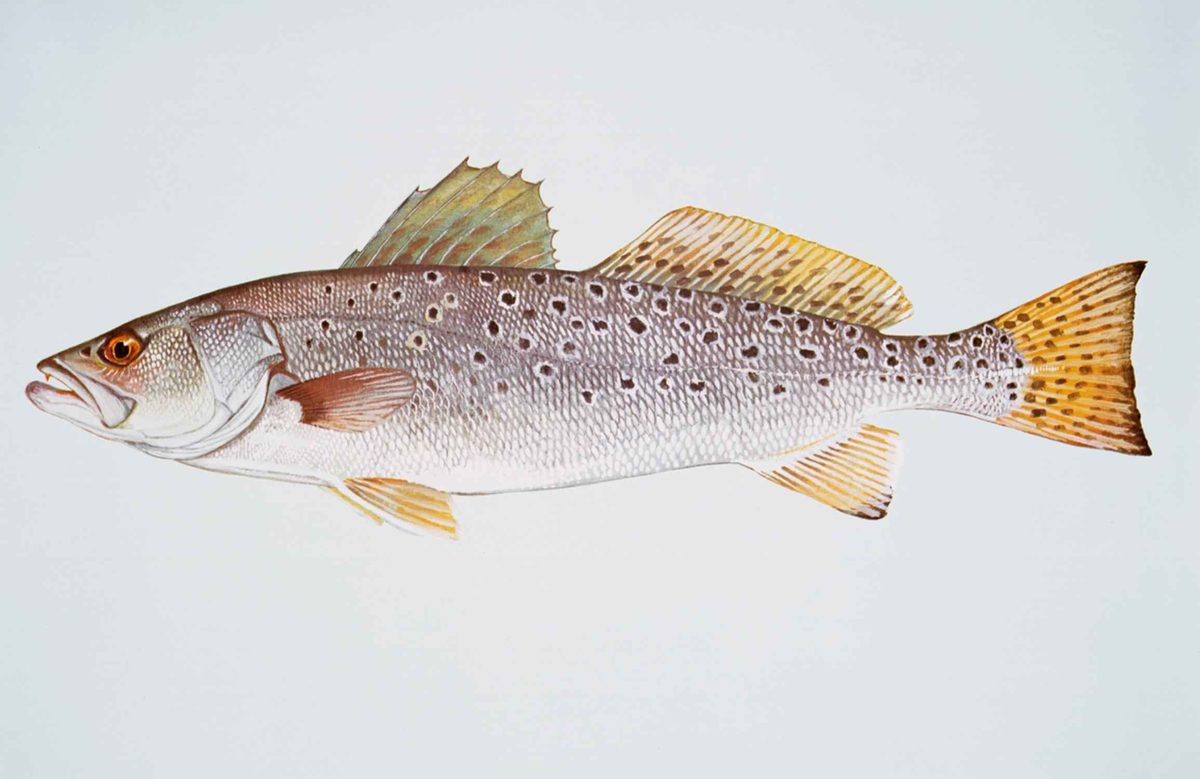 GamefishSpotted SeatroutCynoscion nebulosus
A long trail through the Ouachita Mountains
The Ouachita National Recreation Trail crosses forested mountains and broad valleys in Oklahoma and Arkansas, passing near clear-running streams along the way. Its 192-mile national forest section is the longest trail in the Ouachita National Forest. That section begins at Talimena State Park near Talihina, Oklahoma, and reaches the forest’s eastern boundary on Highway 9 south of Perryville, Arkansas. Another 32 miles continue across private and other public lands to Pinnacle Mountain State Park, west of Little Rock. Elevations range from 600 to 2,600 feet, so planning should account for mountain terrain rather than mileage alone. These are the Ouachita Mountains of western-central Arkansas and adjoining Oklahoma, not the Ozarks farther north. The trail offers both a long-distance backpacking objective and shorter trips built around its many road crossings.
Choose a section before arranging transportation
Numerous road crossings and access points make point-to-point hikes of different lengths possible without committing to the entire trail. Spur trails also connect the main route with recreation areas and points of interest. Start by choosing whether the trip is a day hike, a backpacking section, or a longer traverse, then match the entry and exit points to that plan. For a point-to-point hike, arrange transportation between the two ends before setting out; an out-and-back avoids that transfer. Highway 271 at Talimena State Park and Highway 9 south of Perryville are useful named anchors for the national forest section. Pinnacle Mountain State Park is the eastern endpoint of the continuation beyond the forest. Mountain biking is also a listed activity, but confirm which sections allow it before planning a ride.
Conditions, water, and trail care
Check current trail conditions with Friends of the Ouachita Trail, the nonprofit group that maintains the route, and review Ouachita National Forest alerts before departure. Fire danger and bear awareness are relevant planning concerns here; check current fire restrictions and use appropriate food storage rather than assuming conditions are uniform across the route. The trail passes near streams, but that does not establish reliable drinking-water sources for every section. Confirm water availability for the intended itinerary, carry enough between confirmed sources, and treat collected water. Pack for changing weather and the demands of forested mountain travel. The Forest Service lists no fee for the trail; confirm any separate requirements at the access points or on lands beyond the national forest. Keep the national forest section and the eastern continuation distinct when checking local rules.
Route options
- Talimena State Park to Highway 9192 miles
Follow the national forest section from Oklahoma into Arkansas, crossing forested mountains and valleys to Highway 9 south of Perryville. This is a long-distance backpacking itinerary requiring section-by-section planning.
- Highway 9 to Pinnacle Mountain State Park32 miles
Follow the eastern continuation beyond the national forest across private and other public lands. Confirm applicable access rules and conditions along the chosen itinerary.
- Shorter point-to-point sections
Use the trail’s numerous road crossings and access points to build a day hike or backpacking section. Select entry and exit points using current trail information and arrange transportation between them.
Sample itineraries
- Western Start: Talimena Day Hike · 1 day
Start at Talimena State Park on Highway 271 near Talihina, Oklahoma. Follow the Ouachita National Recreation Trail into the forested mountains, then retrace the route. Set the turnaround according to daylight, conditions and fitness rather than committing to a fixed distance.
- Highway 9 Section Sampler · 1 day
Access the trail on Highway 9 south of Perryville, Arkansas, at the eastern boundary of its national forest section. Walk west for an out-and-back introduction. For a point-to-point alternative, identify another established access point and arrange transportation before starting.
Seasonal conditions
Spring
Spring; choose dates using the local forecast.
Plan for the conditions forecast along your chosen mountain and valley section. Carry rain protection, check trail updates and confirm water availability rather than assuming nearby streams will meet all drinking needs.
Summer
Summer; choose hiking hours using the local forecast.
If hot weather is forecast, shorten the outing or adjust the start time. Carry sufficient water between confirmed sources. Check fire danger and burn restrictions before departure.
Fall
Fall; confirm conditions before selecting a section.
Check wildfire alerts and local burn restrictions rather than assuming fire conditions are mild. Match clothing and turnaround time to the forecast and available daylight.
Winter
Winter; select dates around suitable weather.
Use the forecast to judge whether a mountain outing is appropriate. Carry insulation and weather protection, and allow enough daylight to return to the access point. Confirm trail conditions before committing to a longer section.
| Season | Window | Conditions |
|---|---|---|
| Spring | Spring; choose dates using the local forecast. | Plan for the conditions forecast along your chosen mountain and valley section. Carry rain protection, check trail updates and confirm water availability rather than assuming nearby streams will meet all drinking needs. |
| Summer | Summer; choose hiking hours using the local forecast. | If hot weather is forecast, shorten the outing or adjust the start time. Carry sufficient water between confirmed sources. Check fire danger and burn restrictions before departure. |
| Fall | Fall; confirm conditions before selecting a section. | Check wildfire alerts and local burn restrictions rather than assuming fire conditions are mild. Match clothing and turnaround time to the forecast and available daylight. |
| Winter | Winter; select dates around suitable weather. | Use the forecast to judge whether a mountain outing is appropriate. Carry insulation and weather protection, and allow enough daylight to return to the access point. Confirm trail conditions before committing to a longer section. |
Permits, fees & closures
Confirm permit requirements for your route and any overnight stops with the Forest Service and other relevant land managers.
Fees: The Forest Service lists no fee for the Ouachita National Recreation Trail.
Official source: Ouachita National Recreation Trail - USDA Forest Service · Verified October 2, 2026
Hazards & regulations
- Wildfire risk: check current Forest Service alerts, fire danger and county burn restrictions before departure.
- Bears: follow Forest Service bear-safety guidance and secure food and scented items.
- Mountain travel: elevations range from 600 to 2,600 feet. Allow time and energy for travel through mountains and valleys.
- Water planning: confirm usable sources and carry treatment for stream water; clear-running water should not be assumed safe to drink.
What to pack for Ouachita National Recreation Trail
- Trail map covering the selected section
- Offline navigation and backup power
- Written access-point and transportation plan
- Water bottles or reservoir
- Water treatment for stream sources
- Food and secure storage for scented items
- Rain protection
- Insulating layers matched to the forecast
- Headlamp
- First-aid kit
- Comfortable hiking footwear
Ouachita National Recreation Trail FAQ
- How long is the trail?
- The trail spans 192 miles across the Ouachita National Forest. An additional 32 miles crosses private and other public lands to Pinnacle Mountain State Park.
- Where are the main endpoints?
- The western start is Talimena State Park on Highway 271 near Talihina, Oklahoma. The national forest section ends at Highway 9 south of Perryville, Arkansas. The eastern extension reaches Pinnacle Mountain State Park, 15 miles west of Little Rock.
- Can this trail work for a day hike?
- Yes. Numerous road crossings and access points support shorter outings and point-to-point hikes. Choose established access points, verify conditions and arrange transportation if not returning along the same route.
- What terrain should hikers expect?
- The route passes through forested mountains, across broad valleys and near clear-running streams. Elevations range from 600 to 2,600 feet. Spur trails connect with recreation areas and points of interest.
- Where can hikers check trail conditions?
- Check Friends of the Ouachita Trail for trail-condition updates. This nonprofit maintains the route. Also check Forest Service alerts for fire danger and other notices affecting the planned outing.
- Is drinking water available?
- The Forest Service lists drinking water as available, but does not identify locations or spacing. Confirm sources for the chosen section, carry enough between them and treat water collected from streams.