



- Region
- Arkansas, USA
- Best season
- Spring, Summer
- Permits
- Confirm current permit, camping and reserv…
Plan with verified data
Ozark Highlands Trail trip tools
Tools for a trip here
Picked for how, when and where you're going. Free, no signup.
Photos of Ozark Highlands Trail
How to get there
Ozark Highlands Trail is in Arkansas, USA. Its center point is 35.6888, -93.8184. Use these links for live turn-by-turn directions from where you are, then confirm road, trailhead and access conditions with the managing agency before you leave.
Arkansas, USA · Season: Best: Nov-Apr
- Climbing
- Mountaineering
- Winter Camping
- Skiing
- Hiking
- Backpacking
- Wildlife Viewing
- Canoeing
The country
The Boston Mountains sub-range of the Ozarks forms an intensely dissected plateau of deep, V-shaped valleys and rugged sandstone bluffs. The mature upland hardwood forest conceals incredibly clear, spring-fed streams and countless seasonal waterfalls cascading over mossy ledges.
Why enthusiasts come
The sheer physical exertion required to continually climb and descend the steep drainages draws hikers seeking a serious athletic and mental challenge. The route offers one of the best winter thru-hiking windows in the United States.
Top experiences
Trudging up White Rock Mountain rewards backpackers with magnificent panoramic vistas from a sheer sandstone promontory. Foraging for camp spots in the Hurricane Creek Wilderness immerses hikers in deep, fern-choked grottos cut off from all outside noise.
Planner-relevant notes
The 165-mile main section entails thousands of feet of elevation change despite lacking incredibly high peaks. Heavy rains create extremely dangerous creek crossings that can block progress for days until water subsides. Cell service is virtually nonexistent in the deep hollers, making a satellite messenger highly recommended.
Field notes
- Bring dedicated water shoes; you will constantly ford shin-to-thigh deep creeks.
- Leaf litter in late fall hides slippery underlying rocks and obscuring the trail completely.
- Feral hogs are aggressive locally; if encountered, yield the trail to the herd safely.
- Drop off food caches at rural highway crossings, as hitchhiking into towns is difficult.
Where on earth
Satellite imagery flying in from a world view to Ozark Highlands Trail, Arkansas, USA. Use the + / − buttons, or click the map to zoom with your scroll wheel; drag to pan and pinch to zoom on touch.
Coordinates
- Decimal degrees
- 35.6888, -93.8184
- Latitude (DMS)
- 35° 41′ 19.7″ N
- Longitude (DMS)
- 93° 49′ 6.2″ W
Coordinates are an access-point reference for Ozark Highlands Trail, not a route. Carry a paper map and confirm trailhead or put-in access with the managing agency before you go.
Topic summary
Deep ravines, hidden waterfalls, and rocky creek beds characterize this exceptionally rugged, long-distance winter hiking route through the Boston Mountains.
Key takeaways
- Region: Arkansas, USA
- Best season: Best: Nov-Apr
- Coordinates: 35.689, -93.818
Climate suitability
Best: Nov-Apr
Keep planning
Popular pursuits at Ozark Highlands Trail
- Climbing
Rock and alpine lines with approach beta.
- Mountaineering
Glacier and high-route objectives with real consequence.
- Winter Camping
Cold-season travel and camp craft; layering matters more than mileage.
- Skiing
Ski-touring access when the road closes for the season.
- Hiking
Day miles on marked trail, with route notes and trail links below.
- Backpacking
Multi-day travel with everything on your back — see the packing blocks below.
Animals around Ozark Highlands Trail
 Wildlife guideBlack bearUrsus americanus
 Big gameWhitetail DeerOdocoileus virginianus
 GamefishLargemouth BassMicropterus nigricans
 Wildlife guideWild turkeyMeleagris gallopavo
 Big gameWild HogSus scrofa
 GamefishRed DrumSciaenops ocellatus
 Big gameBlack BearUrsus americanus
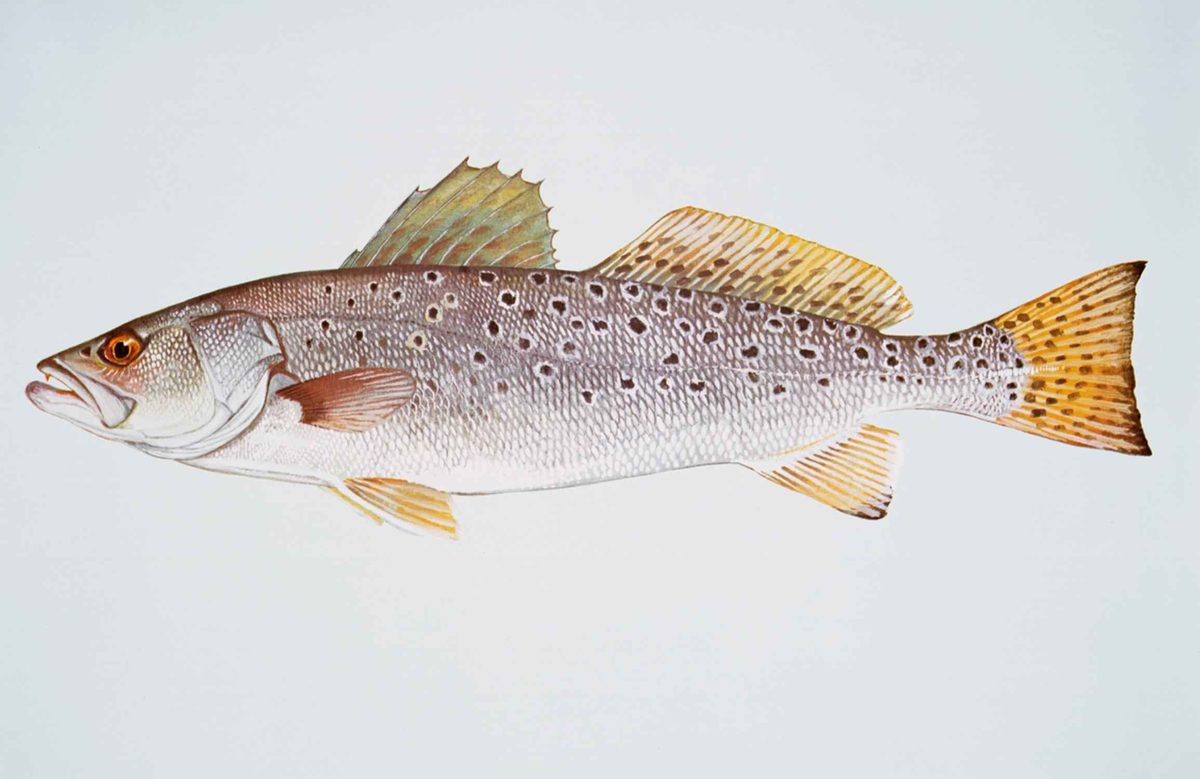 GamefishSpotted SeatroutCynoscion nebulosus
Regional setting
Planning an Ozark Highlands Trail trip starts with distinguishing the Arkansas destination from the much larger Ozarks region. The Ozarks cover a significant portion of northern Arkansas, most of southern Missouri, parts of Oklahoma, and a small corner of southeastern Kansas. Across that area, the landscape forms the most extensive highland region between the Appalachians and the Rockies, covering nearly 47,000 square miles. Those regional boundaries are not trail boundaries, and they should not be used to infer the trail’s length or endpoints. For an Arkansas itinerary, keep the focus on a verified trail map rather than a general Ozarks map. The regional geography provides useful orientation, but it does not establish where to park, enter the trail, or finish a walk.
Understanding the highlands
The Ozarks are also called the Ozark Mountains, Ozark Highlands, and Ozark Plateau. That range of names reflects a region whose geography includes both plateaus and mountain ranges, rather than a single continuous mountain chain. Its two mountain ranges are the Boston Mountains of Arkansas and Oklahoma and the St. Francois Mountains of Missouri. Geologically, the region is a broad dome with an exposed ancient core in the St. Francois Mountains. The Salem Plateau is its largest geologic area, followed by the Springfield Plateau. Together with the separate Ouachita Mountains, the Ozarks belong to the U.S. Interior Highlands. This background helps explain the destination’s name, but regional landforms alone do not establish the terrain, elevation change, or difficulty of a particular trail section.
Turning regional context into a trail plan
Northern Arkansas has several cities that can help orient a regional map, including Fayetteville, Harrison, Mountain Home, and Batesville. Their presence in the Ozarks does not establish any of them as an Ozark Highlands Trail access point or the best base for a hike. Likewise, the region’s broad reach from Interstate 40 in central Arkansas toward Interstate 70 in central Missouri describes the Ozarks, not driving directions to the trail. Before choosing an itinerary, confirm the actual trail alignment, legal access, parking arrangements, and the suitability of the intended section with its managing agency. Use trail-specific information to decide between a shorter walk and a longer outing. Without verified endpoints and section details, assigning mileage, travel times, or difficulty would give a false sense of precision.
Sample itineraries
- One-day trail outing · 1 day
Plan a day hike on a verified section of the Ozark Highlands Trail in Arkansas. Confirm the access point, route length and current conditions before choosing a turnaround point. This is a planning outline, not a mapped route.
- Two-day backpacking outline · 2 days
Build an overnight trip around a confirmed trail section, legal campsite and reliable water plan. Verify access and camping rules before departure. Allow enough time for highland terrain rather than setting mileage from a regional overview.
Seasonal conditions
Spring
Spring; timing depends on current conditions
Check local forecasts and trail reports before selecting a section. The Ozarks' regional geography alone does not establish spring footing, water availability or access conditions on the trail.
Summer
Summer; timing depends on current conditions
Use the forecast to set walking hours, water needs and daily effort. Confirm water sources rather than assuming a highland route will provide dependable drinking water.
Fall
Fall; timing depends on current conditions
Check temperatures and available daylight when setting daily goals. No trail-specific fall conditions or preferred travel dates are established here.
Winter
Winter; timing depends on current conditions
Confirm access, forecast temperatures and ground conditions before departure. Choose clothing, shelter and turnaround limits for the actual forecast rather than assuming winter travel will be mild.
| Season | Window | Conditions |
|---|---|---|
| Spring | Spring; timing depends on current conditions | Check local forecasts and trail reports before selecting a section. The Ozarks' regional geography alone does not establish spring footing, water availability or access conditions on the trail. |
| Summer | Summer; timing depends on current conditions | Use the forecast to set walking hours, water needs and daily effort. Confirm water sources rather than assuming a highland route will provide dependable drinking water. |
| Fall | Fall; timing depends on current conditions | Check temperatures and available daylight when setting daily goals. No trail-specific fall conditions or preferred travel dates are established here. |
| Winter | Winter; timing depends on current conditions | Confirm access, forecast temperatures and ground conditions before departure. Choose clothing, shelter and turnaround limits for the actual forecast rather than assuming winter travel will be mild. |
Permits, fees & closures
Confirm current permit, camping and reservation requirements with the managing agency for the intended trail section.
Confirm current permits, fees, and closures with the managing agency before you go.
Hazards & regulations
- Highland terrain can demand more time and effort than expected; confirm the chosen section's elevation profile before setting daily goals.
- Weather exposure requires a local forecast and suitable layers; regional geography is not enough to judge trail conditions.
- Unverified water availability can undermine a trip plan; confirm sources and carry a drinking-water treatment method.
What to pack for Ozark Highlands Trail
- Current trail map with verified access points
- Offline navigation and backup power
- Written route and turnaround plan
- Footwear suited to highland walking
- Rain protection
- Layers matched to the local forecast
- Headlamp
- Water containers sized to confirmed source spacing
- Drinking-water treatment
- Food and first-aid supplies
- Shelter and sleep system for overnight plans
Ozark Highlands Trail FAQ
- What is the geographic setting?
- The destination is in Arkansas's Ozark Highlands region. The Ozarks cover much of northern Arkansas and form an extensive highland region between the Appalachians and Rockies.
- Are the Ozarks a single mountain range?
- No. The region is geologically a broad dome and includes two mountain ranges: the Boston Mountains of Arkansas and Oklahoma, and the St. Francois Mountains of Missouri.
- Which trailhead should a trip use?
- A specific trailhead cannot be recommended here. Obtain a current trail map and confirm legal access, parking and the intended section with the managing agency before arranging transportation.
- How many days should a trip take?
- Choose the duration after verifying section mileage, terrain, water and camping options. The one-day and two-day outlines are trip formats, not confirmed routes or estimates for completing the trail.
- What needs checking before an overnight hike?
- Confirm camping rules, any permit or reservation requirements, current access, water sources and the forecast. Do not assume that rules are identical across the intended route.