



Where on earth
Satellite imagery flying in from a world view to Six Foot Track (NSW), Australia. Use the + / − buttons, or click the map to zoom with your scroll wheel; drag to pan and pinch to zoom on touch.
- Region
- Australia
- Biome
- Sandstone plateau (200–1,000 m)
- Best season
- March – November
- Difficulty
- moderate
- Backpacking
- Hiking
Key takeaways
- Biome: Sandstone plateau (200–1,000 m)
- Best season: March – November
- Difficulty: moderate
- Top activity: backpacking
Photos of Six Foot Track (NSW)
Topic summary
A 45-km 3-day trek from Katoomba to Jenolan Caves in the Blue Mountains.
Key takeaways
- Difficulty: moderate
- Best season: March – November
Intended uses
backpacking
Climate suitability
Sandstone plateau (200–1,000 m)
Tools for a trip here
Picked for how, when and where you're going. Free, no signup.
- Sleep System Temp CalculatorCold nights: check your bag and pad add up to a safe sleep.
- Base Weight CalculatorEvery ounce is carried — total your kit and find your base weight.
- Pack Volume SizerSize the pack for your trip length and season.
- Water Purification MatrixTreat water from streams and lakes on trail.
- Layering CalculatorCold-season miles: layer for climbs and camp.
Plan with verified data
Six Foot Track (NSW) trip tools
How to get there
The walk starts near Katoomba in the Blue Mountains and currently finishes at Binda Bush cabins. Arrange your own transport from the finish: there is no public transport to or from the cabins. Check current track alerts and confirm access details with Crown Land on 1300 886 235 before departure.
- Katoomba
The Six Foot Track starts near Katoomba, in the Katoomba area of Blue Mountains National Park. Confirm the starting access arrangements before setting out.
- Binda Bush cabins
The current endpoint while Jenolan Karst Conservation Reserve is closed. There is no public transport to or from the cabins, so arrange your own onward transport.
Sources: nationalparks.nsw.gov.au · Wikipedia · Wikivoyage. Confirm road and trailhead conditions with the managing agency before you leave.
Popular pursuits at Six Foot Track (NSW)
- Backpacking
Multi-day travel with everything on your back — see the packing blocks below.
- Hiking
Day miles on marked trail, with route notes and trail links below.
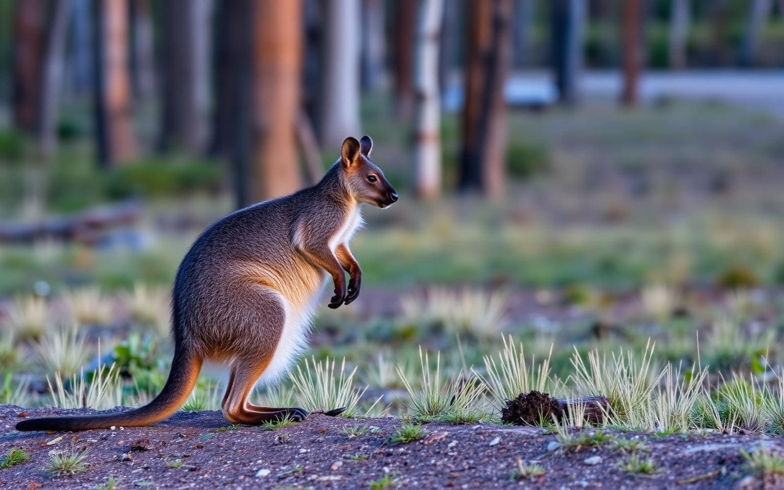
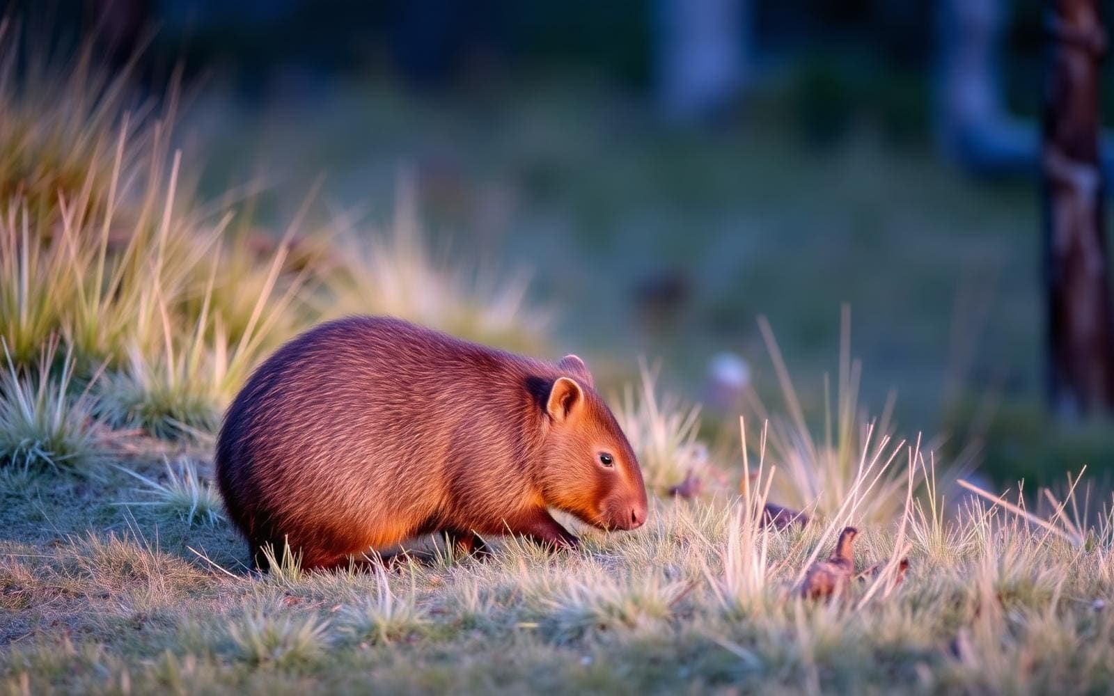
Animals around Six Foot Track (NSW)


Maps, GPS & compass for this trip
Carry a waterproof paper map and a compass you can steer by, and treat the GPS as the backup — not the other way round. Buying links go to Amazon; Wild10 earns a commission at no cost to you.
Waterproof topo maps
- Waterproof topographic map — Six Foot Track (NSW)Amazon search for waterproof, tear-resistant topo maps covering this area.
- National Geographic Trails IllustratedThe waterproof Trails Illustrated series — check for a sheet covering this area.
- Waterproof map case & compass lanyardKeep a paper map readable in rain, spray and a swamped boat.
Fishing at Six Foot Track (NSW)
Planning to fish Six Foot Track (NSW), Australia? Fishing licences, open seasons and catch limits in Australia are set by the local wildlife authority and change every year — check the official source before you cast a line.
Do I need a fishing licence at Six Foot Track (NSW)?
- A Australia fishing licence is normally required for anyone over the local youth age.
- Read the current Australia fishing regulations for special waters, barbless-hook or catch-and-release rules.
- Clean, drain and dry boats and gear between waters to stop invasive species.
Hunting near Six Foot Track (NSW)
Thinking about hunting Six Foot Track (NSW), Australia? Hunting seasons, tags and draws in Australia are set by the wildlife authority each year. Confirm the rules for your species and unit before you go.
Is hunting allowed at Six Foot Track (NSW)?
- Confirm the land around Six Foot Track (NSW) is open to hunting and which management unit it falls in.
What do I need to hunt in Australia?
- A Australia hunting licence — most jurisdictions also require hunter education certification.
- Species tags or draw results for big game such as deer, elk, moose or bear where they occur.
- Knowledge of firearm and bow transport rules, which differ by land type and border crossing.
A historic crossing of the Blue Mountains
The Six Foot Track follows an 1884 horse track from near Katoomba through the Blue Mountains, crossing state forests and Kanangra-Boyd National Park. The current walking route is 42km one-way, with three days suggested and a hard difficulty rating. It ends at Binda Bush cabins while Jenolan Karst Conservation Reserve is closed, rather than continuing to the historic destination of Jenolan Caves. Along the way, the country changes between heath, woodland and rainforest, with heritage sites, cascading waterfalls and wild rivers adding variety to the walk. The route passes into the Megalong Valley and village, crosses a swing bridge and climbs the range toward its current finish. This is a multi-day bushwalk with sustained physical demands, not simply a long stroll along a historic trail.
Choosing a walk and arranging the finish
Allow three days for the full crossing, and plan overnight stops around the track's camping opportunities. Carry a tent and sleeping bag rather than treating the route's cabin endpoint as an accommodation booking. Shorter sections are also possible for walkers who do not want to complete the whole track, but their turnaround points and transport arrangements need to be settled before departure. The most important logistical detail is the finish: there is no public transport to or from Binda Bush cabins, so a one-way trip requires independently arranged transport. Check current alerts before committing to an itinerary, because the track is affected by closures. Crown Land manages the walk and can provide detailed track and closure information on 1300 886 235. Confirm access requirements with the agency when planning the trip.
Weather, equipment and safety
Check the weather before setting out: the Six Foot Track can become boggy when it rains. Pack clothing for changing conditions, sturdy shoes, a hat and sunscreen, and carry drinking water. The combination of a hard grade, a range climb and several days on foot makes a manageable pack and realistic daily pacing important. Carry a topographic map and compass, and know how to use them rather than relying only on a phone. A personal locator beacon is recommended; free hire is available at the Blue Mountains Heritage Centre in Blackheath. Leave your route, planned overnight stops, finish arrangements and expected return with an emergency contact, using a trip intention form if useful. Recheck alerts close to departure, and adjust the walk if weather or access conditions make the planned crossing unsuitable.
Route options
- Six Foot Track: Katoomba to Binda Bush cabins42km one-wayHard
A suggested three-day crossing following the historic horse track through the Megalong Valley, across a swing bridge and over the range. Passes through state forests and Kanangra-Boyd National Park, with overnight camping opportunities. Check closures before departure.
- Shorter sections of the Six Foot Track
Walk a shorter section instead of completing the full crossing. Confirm an open section, suitable access and a turnaround or pickup plan with Crown Land before choosing the itinerary.
Sample itineraries
- Katoomba to Binda Bush cabins · 3 days
Walk the challenging 42km one-way track through the Megalong Valley, state forests and Kanangra-Boyd National Park. Follow the historic horse track past waterfalls, cross the swing bridge and climb the range. Plan overnight camping and arrange collection at Binda Bush cabins. Check closures before committing.
- Short-section day walk · 1 day
Explore a shorter section of Six Foot Track rather than completing the through-walk. Confirm an open section and suitable access with Crown Land, then choose a turnaround that suits your fitness and daylight. Carry navigation equipment, drinking water and clothing for changing weather.
Seasonal conditions
Spring
Choose dates around forecasts and current alerts
Plan for changing weather across the valleys and range. Rain can make the track boggy. Carry all-weather clothing and check the forecast before setting out; do not assume a dry walking surface.
Summer
Choose dates around forecasts and fire-danger alerts
Account for heat on a hard walk with substantial climbing. Carry drinking water, a hat and sunscreen. Check current alerts: locations in the Katoomba area may close because of poor weather or fire danger.
Fall
March can still bring hot conditions
March race conditions can exceed 30 degrees, so an autumn departure does not guarantee cool walking. Match your pace and water supply to the forecast and the demanding elevation changes. Rain can leave the track boggy.
Winter
Choose dates around forecasts and current alerts
Prepare clothing and overnight equipment for the forecast rather than relying on the season alone. The three-day route requires a sleeping bag and shelter. Wet weather can make the track boggy; check conditions before departure.
| Season | Window | Conditions |
|---|---|---|
| Spring | Choose dates around forecasts and current alerts | Plan for changing weather across the valleys and range. Rain can make the track boggy. Carry all-weather clothing and check the forecast before setting out; do not assume a dry walking surface. |
| Summer | Choose dates around forecasts and fire-danger alerts | Account for heat on a hard walk with substantial climbing. Carry drinking water, a hat and sunscreen. Check current alerts: locations in the Katoomba area may close because of poor weather or fire danger. |
| Fall | March can still bring hot conditions | March race conditions can exceed 30 degrees, so an autumn departure does not guarantee cool walking. Match your pace and water supply to the forecast and the demanding elevation changes. Rain can leave the track boggy. |
| Winter | Choose dates around forecasts and current alerts | Prepare clothing and overnight equipment for the forecast rather than relying on the season alone. The three-day route requires a sleeping bag and shelter. Wet weather can make the track boggy; check conditions before departure. |
Permits, fees & closures
Confirm permit requirements, camping arrangements and current access with Crown Land on 1300 886 235.
Official source: Six Foot track - NSW National Parks · Verified September 20, 2026
Hazards & regulations
- Rain can make Six Foot Track boggy. Check the forecast and allow your plans to change with conditions.
- The route is graded hard, with demanding climbing and substantial elevation changes. Choose a shorter section if a three-day through-walk exceeds your fitness.
- Heat can be significant: March race conditions can exceed 30 degrees. Carry drinking water and sun protection.
- The track is affected by closures and currently ends at Binda Bush cabins while Jenolan Karst Conservation Reserve is closed. Check current alerts before departure.
- There is no public transport to or from Binda Bush cabins. Arrange your own transport before starting the one-way walk.
- Poor weather and fire danger can cause location closures in the Katoomba area. Follow current access advice.
What to pack for Six Foot Track (NSW)
- Topographic map
- Compass
- Personal locator beacon
- Trip intention details shared with an emergency contact
- Drinking water
- Hat
- Sunscreen
- Clothes for all weather conditions
- Sturdy shoes
- Tent
- Sleeping bag
Wildlife you may see
- Kangaroos occur around Binda Bush cabins. Watch from a distance and give them room.
Six Foot Track (NSW) FAQ
- How long is the current walking route?
- The current route is 42km one-way, with three days suggested. It starts near Katoomba and ends at Binda Bush cabins. It is graded hard.
- Can the walk finish at Jenolan Caves?
- The track currently ends at Binda Bush cabins while Jenolan Karst Conservation Reserve is closed. Check current alerts and confirm access with Crown Land before planning your endpoint.
- How does transport work at the finish?
- There is no public transport to or from Binda Bush cabins. Arrange your own collection or other transport before beginning the walk.
- Is a shorter walk possible?
- Yes. Shorter sections can be walked without completing the full route. Confirm current closures and access with Crown Land, and choose a section suited to your fitness and available time.
- Where can a personal locator beacon be obtained?
- A personal locator beacon can be hired free at Blue Mountains Heritage Centre in Blackheath. Also leave trip details with an emergency contact.
- What distinguishes this track?
- It follows an 1884 heritage horse track through heath, woodland and rainforest. The route passes waterfalls and the Megalong Valley, crosses a swing bridge and climbs the range, with opportunities for overnight camping.