



Where on earth
Satellite imagery flying in from a world view to Icelandic Highlands (Laugavegur), Iceland. Use the + / − buttons, or click the map to zoom with your scroll wheel; drag to pan and pinch to zoom on touch.
- Region
- Iceland
- Biome
- Sub-arctic volcanic highlands — rhyolite ranges, geothermal areas, black-sand plains
- Best season
- Summer
- Trip length
- 4–6 days
- Difficulty
- hard
- Backpacking
- Hiking
- Winter Camping
- Snowshoeing
- Desert Hiking
- Canyoneering
- Wildlife Viewing
- Canoeing
Key takeaways
- Biome: Sub-arctic volcanic highlands — rhyolite ranges, geothermal areas, black-sand plains
- Best season: Summer
- Trip length: 4–6 days
- Difficulty: hard
- Top activity: backpacking
- Key hazard: Unbridged glacial river crossings — coldest and lowest in the morning; levels rise with afternoon melt.
Photos of Icelandic Highlands (Laugavegur)
Topic summary
Rhyolite mountains, geothermal streams, and lava fields on the Laugavegur trek.
Key takeaways
- Difficulty: hard
- Trip length: 4–6 days
- Best season: Summer
- Laugavegur, 54 km, 4 days: Landmannalaugar → Hrafntinnusker → Álftavatn → Emstrur (Botnar) → Þórsmörk.
- Fimmvörðuháls extension, ~25 km, 1–2 days: Þórsmörk → Skógar over the 2010 eruption zone between Eyjafjallajökull and Mýrdalsjökull.
Intended uses
- backpacking
- cold weather
Climate suitability
Sub-arctic volcanic highlands — rhyolite ranges, geothermal areas, black-sand plains
Verification notes
Permit source: Ferðafélag Íslands — hut booking and trail info. Last verified October 17, 2026.
Tools for a trip here
Picked for how, when and where you're going. Free, no signup.
- Sleep System Temp CalculatorCold nights: check your bag and pad add up to a safe sleep.
- Base Weight CalculatorEvery ounce is carried — total your kit and find your base weight.
- Pack Volume SizerSize the pack for your trip length and season.
- Water Purification MatrixTreat water from streams and lakes on trail.
- Layering CalculatorCold-season miles: layer for climbs and camp.
Plan with verified data
Icelandic Highlands (Laugavegur) trip tools
Route options
- Laugavegur, 54 km, 4 days: Landmannalaugar → Hrafntinnusker → Álftavatn → Emstrur (Botnar) → Þórsmörk.
- Fimmvörðuháls extension, ~25 km, 1–2 days: Þórsmörk → Skógar over the 2010 eruption zone between Eyjafjallajökull and Mýrdalsjökull.
Seasonal conditions
| Season | Window | Conditions |
|---|---|---|
| Summer | Late Jun – early Sep | The only reliable window. Highland buses run, huts are open, and trails are snow-free most years by early July. Expect wind, rain, and single-digit °C nights even in August. |
| Shoulder | Sep – Oct | Huts close and buses stop in September. First winter storms can shut the highlands with little warning; only for experienced, fully self-sufficient parties. |
| Winter | Nov – May | F-roads are closed to normal traffic and the route is a serious ski/snowmobile expedition, not a hiking trip. |
How to get there
Icelandic Highlands (Laugavegur) is in Iceland, Iceland. Its center point is 63.9800, -19.0600. Use these links for live turn-by-turn directions from where you are, then confirm road, trailhead and access conditions with the managing agency before you leave.
- Þórsmörk
An oasis-like area in the Highlands. Confirm the practical approach and suitability as an entry point for the intended itinerary before arranging transport.
- Herðubreiðarlindir
An oasis-like area within the Highlands, useful for geographic orientation. Confirm local access rather than assuming it serves as a trailhead.
Permits & closures
No hiking permit is required for the Laugavegur. Mountain huts are run by Ferðafélag Íslands and must be booked well in advance — they sell out for summer. Camping is allowed only at the designated hut campsites along the trail, for a per-night fee paid at the hut warden.
Official permit source: Ferðafélag Íslands — hut booking and trail info
Safety & stewardship
- Unbridged glacial river crossings — coldest and lowest in the morning; levels rise with afternoon melt.
- Storms and whiteouts can arrive in under an hour at any time of summer; carry full navigation and storm gear.
- F-road access is summer-only; check road.is before travelling to trailheads.
Water: Clear spring streams are generally drinkable without treatment. Avoid silty glacial rivers, and treat water taken near busy hut areas. Carry capacity for the dry ridge section between Landmannalaugar and Hrafntinnusker.
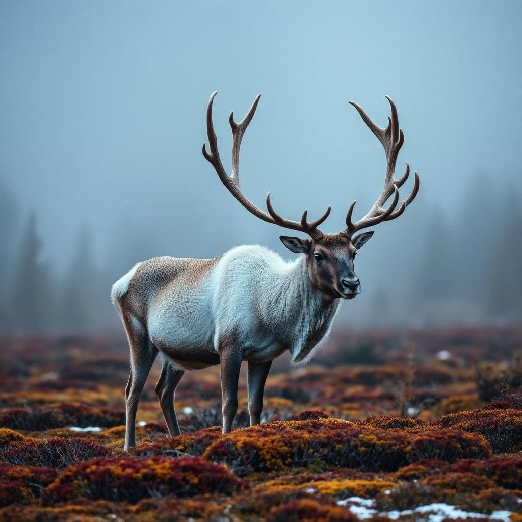
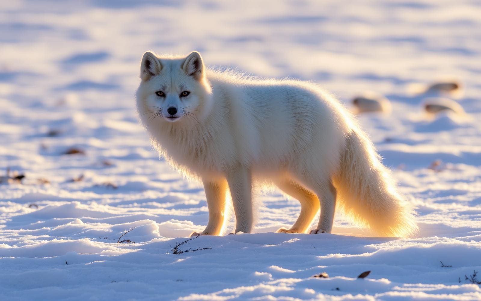
Wildlife: The Arctic fox is Iceland's only native land mammal and is occasionally seen near huts. Rock ptarmigan, pink-footed geese, and whooper swans are common around Álftavatn. There are no bears or other dangerous land predators.
Emergency planning: Register your travel plan at safetravel.is before setting out. Hut wardens carry radios and are the first point of contact in an emergency; Iceland's emergency number is 112.
Leave No Trace: Stay on the marked trail — highland moss and soil crusts take decades to recover. Camp only at designated hut campsites and pack out all rubbish.
Popular pursuits at Icelandic Highlands (Laugavegur)
- Backpacking
Multi-day travel with everything on your back — see the packing blocks below.
- Hiking
Day miles on marked trail, with route notes and trail links below.
- Winter Camping
Cold-season travel and camp craft; layering matters more than mileage.
- Snowshoeing
Packed-snow travel when the trail disappears.
- Desert Hiking
Water carries and heat management drive the plan.
- Canyoneering
Narrows, downclimbs, and flash-flood timing.
Animals around Icelandic Highlands (Laugavegur)





Recommended gear
Maps, GPS & compass for this trip
Carry a waterproof paper map and a compass you can steer by, and treat the GPS as the backup — not the other way round. Buying links go to Amazon; Wild10 earns a commission at no cost to you.
Waterproof topo maps
- Waterproof topographic map — Icelandic Highlands (Laugavegur)Amazon search for waterproof, tear-resistant topo maps covering this area.
- National Geographic Trails IllustratedThe waterproof Trails Illustrated series — check for a sheet covering this area.
- Waterproof map case & compass lanyardKeep a paper map readable in rain, spray and a swamped boat.
Fishing at Icelandic Highlands (Laugavegur)
Planning to fish Icelandic Highlands (Laugavegur)? Fishing licences, open seasons and catch limits in Iceland are set by the local wildlife authority and change every year — check the official source before you cast a line.
Do I need a fishing licence at Icelandic Highlands (Laugavegur)?
- A Iceland fishing licence is normally required for anyone over the local youth age.
- Read the current Iceland fishing regulations for special waters, barbless-hook or catch-and-release rules.
- Clean, drain and dry boats and gear between waters to stop invasive species.
Hunting near Icelandic Highlands (Laugavegur)
Thinking about hunting Icelandic Highlands (Laugavegur)? Hunting seasons, tags and draws in Iceland are set by the wildlife authority each year. Confirm the rules for your species and unit before you go.
Is hunting allowed at Icelandic Highlands (Laugavegur)?
- Confirm the land around Icelandic Highlands (Laugavegur) is open to hunting and which management unit it falls in.
What do I need to hunt in Iceland?
- A Iceland hunting licence — most jurisdictions also require hunter education certification.
- Species tags or draw results for big game such as deer, elk, moose or bear where they occur.
- Knowledge of firearm and bow transport rules, which differ by land type and border crossing.
The interior landscape
Iceland’s Highlands occupy much of the country’s interior, above roughly 300–400 meters. This is a largely uninhabitable landscape of basalt mountains, lava fields and ground made primarily of volcanic ash. Those features are the foundation of a Highlands trip: open volcanic terrain rather than a settled countryside. Plan around the demands of walking through that environment, with footwear and clothing suited to exposed ground and changing weather. The region contains many natural features and hiking trails, but a regional description is not enough to choose a particular walking line. Before committing to an itinerary, establish the actual route, its access arrangements and the conditions expected during the trip. Keep broader Highlands geography separate from the practical details of any individual trail.
Snow and seasonal planning
Snow covers the Highlands from October until the beginning of June, making season a central part of planning rather than a minor detail. That broad snow pattern should not be treated as a trail-opening calendar or a guarantee of clear ground after early June. Choose travel dates with the intended terrain in mind, then confirm current conditions before departure. Clothing, shelter and footwear should match a high-elevation interior landscape where snow occupies much of the year. Leave room in the itinerary to change plans if conditions do not suit the group’s experience or equipment. A summer visit still calls for a route-specific assessment; the general seasonal pattern alone cannot establish whether a particular hike is suitable.
Oases and regional context
The Highlands are not uniform volcanic barrens. Herðubreiðarlindir and Þórsmörk are described as oasis-like areas within the interior, offering a useful contrast to its basalt mountains, ash soils and lava fields. These named places help orient a broader trip, but their presence does not establish a connecting walking route or a practical entry point. South Iceland provides another layer of geographic context: its landscape includes waterfalls, glaciers and distinctive geology. In its eastern part, Vatnajökull and the rivers flowing from it shape extensive coastal flood plains, while the glacier and some surrounding land form Vatnajökull National Park. Do not assume that this national park’s identity or management applies to the Highlands as a whole; establish responsibility for the specific area being visited.
Sample itineraries
- Highland terrain introduction · 1 day
Plan a short Highland outing focused on volcanic-ash terrain, basalt mountains and lava fields. Choose the walking location after confirming access and snow conditions locally. This is a flexible day plan, not a staged Laugavegur itinerary.
- Þórsmörk-focused day · 1 day
Devote a day to Þórsmörk, one of the Highland’s oasis-like areas. Confirm a suitable walking route and access before setting out. Keep the plan modest rather than assuming a connection to a longer trek.
What to pack for Icelandic Highlands (Laugavegur)
- Supportive hiking footwear with good traction
- Warm layers appropriate to an elevated interior
- Weather-resistant outer layers
- Route-specific map and navigation tools
- Backup navigation
- First-aid kit
- Emergency shelter
- Food sufficient for the planned outing and delays
- Water supply planned without assuming nearby services
Icelandic Highlands (Laugavegur) FAQ
- What kind of landscape defines the Icelandic Highlands?
- The Highlands occupy much of Iceland’s interior, above roughly 300–400 meters. Volcanic ash, basalt mountains and lava fields dominate the terrain, with oasis-like areas including Þórsmörk and Herðubreiðarlindir.
- When is snow a major planning concern?
- Snow covers the Highland from October until the beginning of June. Treat that as a broad regional pattern, not a guarantee of trail conditions on a particular day.
- Are these complete Laugavegur trekking itineraries?
- No. These are Highland day-planning concepts. Before organizing a Laugavegur trek, confirm its stages, access points, overnight arrangements and current conditions with the managing agency.
- Can this profile establish driving access?
- No. Confirm the approach to your chosen walking area locally before departure. Do not assume that a destination’s location in the Highlands establishes vehicle access.
- How self-sufficient should a Highland outing be?
- The interior is largely uninhabitable. Carry navigation, food, water and contingency equipment appropriate to the outing, and establish access and return arrangements before setting out.