



- Region
- British Columbia
- Country
- Canada
- Best for
- climbing, hiking
- Best season
- Spring, Summer
- Permits
- Confirm activity-specific permit requireme…
Plan with verified data
Field, British Columbia Area trip tools
Tools for a trip here
Picked for how, when and where you're going. Free, no signup.
How to get there
The Field, British Columbia area is located within Yoho National Park, near the Alberta border. It is accessible via Highway 1, also known as the Trans-Canada Highway, which runs through the center of the park. Field is situated 27 km west of Lake Louise, Alberta, and 58 km east of Golden, British Columbia, along this highway.
- Wapta Falls Day-use area
This trailhead is located 26 km west of Field, B.C., and 32 km east of Golden, B.C., on the south side of the Trans-Canada Highway. Note that Wapta Falls Road (2 km) is closed from late October to late May.
- Burgess Pass / Mount Field Trailhead
From Field, take the Trans-Canada Highway East for 1.4 km. A gravel road will be on your left; turn left at the junction to reach the trailhead parking lot. Alternatively, the trailhead is off Hwy 1 just 0.4 km before the Field turn-off, accessible via a paved pot-holed road paralleling Hwy 1.
- Emerald Lake parking lot
Turn off to Emerald Lake / Natural Bridge about 1 km west of Field. Follow the road to the Emerald Lake parking lot, where the trailhead is at the end of the lot. Note that Emerald Lake parking areas are extremely popular and fill up early.
- Yoho Visitor Centre
The Yoho Visitor Centre and Friends of Yoho gift shop are located on the Trans-Canada Highway at Field, B.C. An electric vehicle charging station is available in the parking lot.
- Takakkaw parking area
The Takakkaw parking area is extremely popular and fills up early during the summer months and on weekends. The Little Yoho Valley Road, leading to Takakkaw Falls, is a seasonal road closed each winter due to avalanche hazard.
Sources: parks.canada.ca · Wikipedia · Wikivoyage · Parks Canada. Confirm road and trailhead conditions with the managing agency before you leave.
British Columbia · Canada · Season: Winter (Dec–Mar)
- Climbing
- Mountaineering
- Winter Camping
- Skiing
- Hiking
- Canoeing
- Fishing
Overview
The area immediately surrounding the small town of Field, BC, within Yoho National Park, offers a cluster of excellent, easily accessible ice climbs that deserve their own mention. These routes often see good conditions early in the season and can be a solid alternative to the busier sections of the Parkway. The proximity to the Trans-Canada Highway makes for quick access, and the impressive mountain backdrop of the President Range provides a truly inspiring setting. It's a great spot for a focused day trip or as a base for exploring Yoho and further into the BC Rockies.
Field itself offers very limited services (a small store, a few accommodations). Lake Louise, Alberta, is the nearest full-service town, about 25 minutes east. The season runs from late November to late March. Climbs here generally range from WI3 to WI5, offering good options for intermediate climbers and those looking for reliable, shorter routes. A Parks Canada pass is required. The main trade-offs are the limited local amenities and the potential for heavy snow on the BC side, which can increase avalanche risk on approaches.
Planning notes
Where: British Columbia, Canada Best season: Winter (Dec–Mar) Good for: Climbing, Hiking Featured on: Top 10 Ice Climbing Destinations in the Canadian Rockies (#9) Access point: Field, BC V0A 0A4, Canada
Check current permits, closures and fire restrictions with the managing agency before you commit to dates.
Where on earth
Satellite imagery flying in from a world view to Field, British Columbia Area, Canada. Use the + / − buttons, or click the map to zoom with your scroll wheel; drag to pan and pinch to zoom on touch.
Coordinates
- Decimal degrees
- 51.3950, -116.4900
- Latitude (DMS)
- 51° 23′ 41.8″ N
- Longitude (DMS)
- 116° 29′ 24.1″ W
Coordinates are an access-point reference for Field, British Columbia Area, not a route. Carry a paper map and confirm trailhead or put-in access with the managing agency before you go.
Topic summary
The area immediately surrounding the small town of Field, BC, within Yoho National Park, offers a cluster of excellent, easily accessible ice climbs that deserve their own mention.
Key takeaways
- Region: British Columbia
- Country: Canada
- Best season: Winter (Dec–Mar)
- Good for: climbing, hiking
- Coordinates: 51.395, -116.490
Intended uses
- climbing
- hiking
Climate suitability
Winter (Dec–Mar)
Keep planning
Popular pursuits at Field, British Columbia Area
- Climbing
Rock and alpine lines with approach beta.
- Mountaineering
Glacier and high-route objectives with real consequence.
- Winter Camping
Cold-season travel and camp craft; layering matters more than mileage.
- Skiing
Ski-touring access when the road closes for the season.
- Hiking
Day miles on marked trail, with route notes and trail links below.
- Canoeing
Paddle routes, portages, and put-ins.
Animals around Field, British Columbia Area
 Wildlife guideTimber wolfCanis lupus
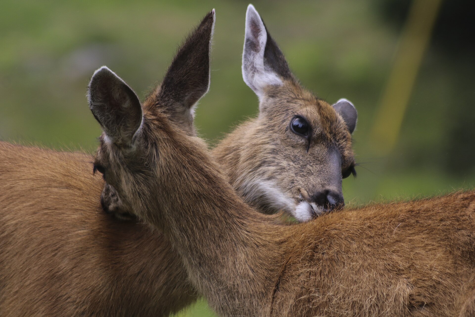 Big gameBlacktail DeerOdocoileus hemionus columbianus
 GamefishPacific SalmonOncorhynchus spp.
 Wildlife guideCanada lynxLynx canadensis
 Big gameElkCervus canadensis
 GamefishRainbow TroutOncorhynchus mykiss
 Wildlife guideBlack bearUrsus americanus
 Big gameBlack BearUrsus americanus
Destination details need confirmation
Field-specific access, routes, terrain, and travel logistics could not be established. A dependable trip profile requires verified local information before recommending access points or outings. Confirm the destination’s managing agency, approach roads, trail details, and current conditions before making plans. Details for Hope and Abbotsford should not be used as substitutes for Field-area guidance.
Sample itineraries
- One-day planning outline · 1 day
Before setting out around Field, confirm a suitable outing, its access point and current conditions with the managing agency. Keep the day flexible. No specific local route or travel distance is established here.
- Two-day planning outline · 2 days
Use separate day outings rather than assuming an overnight route is available. Confirm access, route suitability and any accommodation arrangements before departure. This is a planning outline, not a verified Field itinerary.
Seasonal conditions
Spring
Local activity window unconfirmed
Field-specific spring conditions are not established here. Confirm current weather and route conditions before choosing an outing.
Summer
Local activity window unconfirmed
Field-specific summer conditions are not established here. Do not assume that a route or access point is available solely because it is summer.
Fall
Local activity window unconfirmed
Field-specific fall conditions are not established here. Check current conditions and available daylight when planning the day.
Winter
Local activity window unconfirmed
Field-specific winter access and suitable activities are not established here. Obtain local guidance before selecting an outdoor route.
| Season | Window | Conditions |
|---|---|---|
| Spring | Local activity window unconfirmed | Field-specific spring conditions are not established here. Confirm current weather and route conditions before choosing an outing. |
| Summer | Local activity window unconfirmed | Field-specific summer conditions are not established here. Do not assume that a route or access point is available solely because it is summer. |
| Fall | Local activity window unconfirmed | Field-specific fall conditions are not established here. Check current conditions and available daylight when planning the day. |
| Winter | Local activity window unconfirmed | Field-specific winter access and suitable activities are not established here. Obtain local guidance before selecting an outdoor route. |
Permits, fees & closures
Confirm activity-specific permit requirements with the managing agency. Parks Canada lists Yoho National Park among locations where the Discovery Pass can be purchased and used for admission.
Fees: Regular Parks Canada fees apply as of September 8, 2026. Confirm current admission and service charges for the intended location.
Official source: Passes, permits and fees - Parks Canada · Verified September 19, 2026
Hazards & regulations
- Local route hazards are unconfirmed; obtain a current assessment before committing to an outing.
- Access conditions are unconfirmed; verify the intended approach before departure.
- Seasonal suitability is unconfirmed; do not treat these planning outlines as evidence that an activity is safe.
What to pack for Field, British Columbia Area
- Current local route information
- Confirmed access details
- Managing agency contact information
- Discovery Pass, if using it for admission at Yoho National Park
Field, British Columbia Area FAQ
- Are these verified Field itineraries?
- No. They are planning outlines. Specific Field routes, access points, distances and travel times are not established here.
- Can a Discovery Pass be used at Yoho National Park?
- Yes. Parks Canada lists Yoho National Park as a location where the Discovery Pass can be purchased and presented for daily admission.
- How long does a Discovery Pass last?
- The annual Parks Canada Discovery Pass covers admission to more than 80 destinations for 12 months. Some locations have conditions or extra fees.
- Are admission and activity permits the same thing?
- Do not assume an admission pass resolves activity-specific requirements. Confirm permits and any reservation requirements with the managing agency.
- What is the best season to visit Field?
- A reliable local activity window is not established here. Choose dates after confirming conditions and access for the activities being considered.