


- Region
- Montana
- Country
- United States
- Best for
- hiking, wildlife viewing, camping
- Best season
- Spring, Summer
- Permits
- Confirm applicable license, permit and acc…
Plan with verified data
Hunting District 330 (Gallatin Mountains) trip tools
Tools for a trip here
Picked for how, when and where you're going. Free, no signup.
- Sleep System Temp CalculatorCold nights: check your bag and pad add up to a safe sleep.
- Bear Country Food StorageBear country: canister, Ursack or hang, and the local rules.
- The 10 EssentialsDay on trail: carry the ten essentials.
- Water Purification MatrixRefilling on trail: compare treatment options.
- Layering CalculatorCool temps: build a layer stack for the climb and the summit.
Photos of Hunting District 330 (Gallatin Mountains)
How to get there
Hunting District 330 is located in southwest Montana, near the Idaho border, and encompasses portions of Beaverhead and Madison Counties. Most of the area is easily accessed by road, with a significant portion lying within the Custer Gallatin National Forest. The district's boundary description starts near U.S. Highway 287 and Johnny Gulch Road (near Indian Creek).
- Johnny Gulch Road (near Indian Creek)
This point marks a boundary for the district, beginning at its intersection with U.S. Highway 287.

Photo: Wilson44691 / Public domain Red Rock PassThe district boundary extends along the Montana-Idaho border to Red Rock Pass.
- Centennial Valley Road
The boundary follows Centennial Valley Road to the east end of the Red Rock Refuge.
- North Centennial Road
The boundary proceeds along the north Centennial Road to the junction of Metzel Creek Road, near the Staudenmeyer Ranch.
- Metzel Creek Road
The boundary follows Metzel Creek Road northerly to the Gravelly Range Road, near Eureka Basin.
- Gravelly Range Road
The boundary runs northeasterly along the Gravelly Range Road to the junction of Johnny Gulch (McAtee Bridge) Road.
Sources: Wikipedia · Wikivoyage · HuntScore · HuntScore. Confirm road and trailhead conditions with the managing agency before you leave.
Montana · United States · Season: Fall hunting seasons
- Hunting
- Climbing
- Mountaineering
- Winter Camping
- Skiing
- Desert Hiking
- Canyoneering
- Hiking
Overview
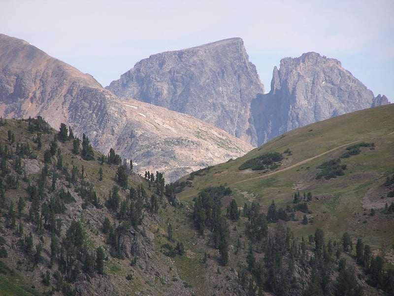
HD 330, nestled in the Gallatin Mountains, offers prime elk habitat just south of Bozeman. This unit features steep, heavily timbered slopes, high alpine basins, and dense creek bottoms. Public access is excellent, primarily through Gallatin National Forest lands. Its proximity to Bozeman means it can see significant pressure, especially on weekends and during the rifle opener. However, for hunters willing to put in the vertical miles, solitude and success are attainable. Elk here are tough, often residing in steep, dark timber, making them challenging to hunt. Archery hunting can be fantastic with aggressive calling tactics. For rifle hunters, persistence in breaking down the steep terrain is key. Finding unpressured pockets of elk, often several miles from trailheads, is the strategy. Snow can play a significant role, pushing elk to lower elevations later in the season. Trophy potential is good, especially for those who can navigate the demanding terrain.
Best access is from various trailheads off Highway 191 (Gallatin Canyon) or from roads south of Bozeman. Ideal seasons are mid-September for archery (peak rut) and the general rifle season, especially after some snow. This unit requires good physical fitness and mountain hunting experience. Permits are standard general tags. Trade-offs include high hunting pressure near popular access points and extremely steep, physically demanding terrain.
Planning notes
Where: Montana, United States Best season: Fall hunting seasons Good for: Hiking, Wildlife Viewing, Camping Featured on: Top 10 Public Land Elk Units in Montana: High-Percentage Archery and Rifle (#4) Access point: Gallatin Range, Montana 59030, USA
Check current permits, closures and fire restrictions with the managing agency before you commit to dates.
Where on earth
Satellite imagery flying in from a world view to Hunting District 330 (Gallatin Mountains), United States. Use the + / − buttons, or click the map to zoom with your scroll wheel; drag to pan and pinch to zoom on touch.
Coordinates
- Decimal degrees
- 45.0053, -110.8367
- Latitude (DMS)
- 45° 0′ 19.0″ N
- Longitude (DMS)
- 110° 50′ 12.0″ W
Coordinates are an access-point reference for Hunting District 330 (Gallatin Mountains), not a route. Carry a paper map and confirm trailhead or put-in access with the managing agency before you go.
Topic summary
HD 330, nestled in the Gallatin Mountains, offers prime elk habitat just south of Bozeman.
Key takeaways
- Region: Montana
- Country: United States
- Best season: Fall hunting seasons
- Good for: hiking, wildlife viewing, camping
- Coordinates: 45.005, -110.837
Intended uses
- hiking
- wildlife viewing
- camping
Climate suitability
Fall hunting seasons
Keep planning
Popular pursuits at Hunting District 330 (Gallatin Mountains)
- Hunting
Seasons, tags, and the units that hold animals.
- Climbing
Rock and alpine lines with approach beta.
- Mountaineering
Glacier and high-route objectives with real consequence.
- Winter Camping
Cold-season travel and camp craft; layering matters more than mileage.
- Skiing
Ski-touring access when the road closes for the season.
- Desert Hiking
Water carries and heat management drive the plan.
Animals around Hunting District 330 (Gallatin Mountains)








Destination details unavailable
A place-specific profile of Hunting District 330 cannot be established with confidence. District boundaries, terrain, public access, routes, and the responsible managing agency remain unverified. Confirm the district identity and current access arrangements with the responsible agency before planning a trip. No access points or routes are recommended here because their connection to this district has not been established.
Sample itineraries
- One-day planning outline · 1 day
Use this as a planning placeholder, not a field itinerary. Before visiting Hunting District 330, confirm district boundaries, legal access and a suitable route with the managing agency. No specific access point or route can be recommended here.
- Two-day planning outline · 2 days
A two-day field itinerary cannot be established without verified routes and overnight options. Confirm access, overnight rules and current conditions before choosing daily objectives.
Seasonal conditions
Spring
Not established
District-specific spring conditions and access status are unverified. Confirm both before selecting trip dates.
Summer
Not established
District-specific summer conditions and route suitability are unverified. No preferred travel window can be established.
Fall
Not established
District-specific fall conditions and hunting dates are unverified. Confirm current regulations and access before planning a visit.
Winter
Not established
District-specific winter conditions and access status are unverified. No winter route recommendation can be made.
| Season | Window | Conditions |
|---|---|---|
| Spring | Not established | District-specific spring conditions and access status are unverified. Confirm both before selecting trip dates. |
| Summer | Not established | District-specific summer conditions and route suitability are unverified. No preferred travel window can be established. |
| Fall | Not established | District-specific fall conditions and hunting dates are unverified. Confirm current regulations and access before planning a visit. |
| Winter | Not established | District-specific winter conditions and access status are unverified. No winter route recommendation can be made. |
Permits, fees & closures
Confirm applicable license, permit and access requirements with the managing agency.
Confirm current permits, fees, and closures with the managing agency before you go.
Hazards & regulations
- Terrain hazards are unverified; this profile does not establish route safety.
- Seasonal access hazards are unverified; do not assume a planned approach is usable.
- Wildlife hazards are unverified; obtain district-specific safety guidance before travel.
What to pack for Hunting District 330 (Gallatin Mountains)
- Verified district boundary map
- Current access guidance
- Applicable regulations
- Confirmed route details
- Current local conditions
- District-specific safety guidance
Hunting District 330 (Gallatin Mountains) FAQ
- Is this a field-ready destination guide?
- No. District boundaries, access points, routes and local conditions have not been established. These gaps need resolving before a field itinerary can be recommended.
- Which trailhead should a trip start from?
- No trailhead or other access point can be verified for this district here. Confirm legal entry points with the managing agency.
- What hunting licenses or permits are required?
- District-specific requirements are not established. Confirm current regulations with the managing agency before making hunting plans.
- What wildlife should visitors expect?
- No district-specific species list can be established here. Obtain local wildlife and safety guidance before travel.
- Can Yellowstone information be applied to this district?
- Not without confirming the geographic relationship and jurisdiction. Yellowstone information alone does not establish Hunting District 330 boundaries, access or regulations.