



Where on earth
Satellite imagery flying in from a world view to Nevado de Toluca Crater, Latin America. Use the + / − buttons, or click the map to zoom with your scroll wheel; drag to pan and pinch to zoom on touch.
- Region
- Mexico
- Country
- Latin America
- Biome
- Mexican alpine volcano (4,000–4,680 m)
- Best season
- November – April
- Difficulty
- moderate
- Backpacking
- Hiking
- Climbing
- Mountaineering
Key takeaways
- Biome: Mexican alpine volcano (4,000–4,680 m)
- Best season: November – April
- Difficulty: moderate
- Top activity: backpacking
Photos of Nevado de Toluca Crater
Topic summary
A dormant stratovolcano with two crater lakes at 4,200 m — a day-hike playground west of Mexico City.
Key takeaways
- Difficulty: moderate
- Best season: November – April
Intended uses
backpacking
Climate suitability
Mexican alpine volcano (4,000–4,680 m)
Verification notes
Last verified January 1, 1970.
Tools for a trip here
Picked for how, when and where you're going. Free, no signup.
- Sleep System Temp CalculatorCold nights: check your bag and pad add up to a safe sleep.
- Base Weight CalculatorEvery ounce is carried — total your kit and find your base weight.
- Pack Volume SizerSize the pack for your trip length and season.
- Water Purification MatrixTreat water from streams and lakes on trail.
- Layering CalculatorCold-season miles: layer for climbs and camp.
Plan with verified data
Nevado de Toluca Crater trip tools
How to get there
Nevado de Toluca is southwest of Toluca in Mexico State, approximately 135 kilometers from Mexico City. Road access is described as reaching a summit parking area, with the onward road into the caldera closed to vehicles. An indefinite park closure was reported in August 2025; confirm current access before setting out.
- Summit parking area
The road-accessible starting point described for the walk into the crater. Its availability depends on current park access restrictions.
- Caldera base
The walking-access destination reached by the road descending from the summit parking area. The road is closed to vehicle traffic, and other trails also descend into the basin.
Sources: Wikipedia · Wikivoyage. Confirm road and trailhead conditions with the managing agency before you leave.
Popular pursuits at Nevado de Toluca Crater
- Backpacking
Multi-day travel with everything on your back — see the packing blocks below.
- Hiking
Day miles on marked trail, with route notes and trail links below.
- Climbing
Rock and alpine lines with approach beta.
- Mountaineering
Glacier and high-route objectives with real consequence.
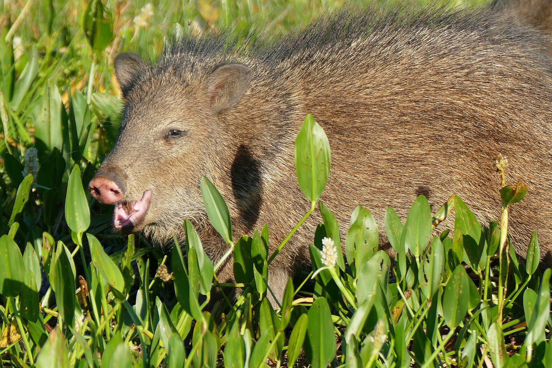
Animals around Nevado de Toluca Crater



Maps, GPS & compass for this trip
Carry a waterproof paper map and a compass you can steer by, and treat the GPS as the backup — not the other way round. Buying links go to Amazon; Wild10 earns a commission at no cost to you.
Waterproof topo maps
- Waterproof topographic map — Nevado de Toluca CraterAmazon search for waterproof, tear-resistant topo maps covering this area.
- National Geographic Trails IllustratedThe waterproof Trails Illustrated series — check for a sheet covering this area.
- Waterproof map case & compass lanyardKeep a paper map readable in rain, spray and a swamped boat.
Fishing at Nevado de Toluca Crater
Planning to fish Nevado de Toluca Crater, Mexico? Fishing licences, open seasons and catch limits in Mexico are set by the local wildlife authority and change every year — check the official source before you cast a line.
Do I need a fishing licence at Nevado de Toluca Crater?
- A Mexico fishing licence is normally required for anyone over the local youth age.
- Read the current Mexico fishing regulations for special waters, barbless-hook or catch-and-release rules.
- Clean, drain and dry boats and gear between waters to stop invasive species.
Hunting near Nevado de Toluca Crater
Thinking about hunting Nevado de Toluca Crater, Mexico? Hunting seasons, tags and draws in Mexico are set by the wildlife authority each year. Confirm the rules for your species and unit before you go.
Is hunting allowed at Nevado de Toluca Crater?
- Confirm the land around Nevado de Toluca Crater is open to hunting and which management unit it falls in.
What do I need to hunt in Mexico?
- A Mexico hunting licence — most jurisdictions also require hunter education certification.
- Species tags or draw results for big game such as deer, elk, moose or bear where they occur.
- Knowledge of firearm and bow transport rules, which differ by land type and border crossing.
A high volcanic crater above Toluca
Nevado de Toluca, also known as Xinantecatl, rises southwest of Toluca in Mexico State. At 4,680 meters, it is Mexico’s fourth-highest mountain. The long-extinct volcano holds a caldera roughly 1.5 kilometers wide, with two shallow lakes on its floor. Those lakes and the surrounding crater are the main focus of a visit, while forest lands around the mountain contain additional hiking paths. The contrast between the wooded lower slopes and the high crater makes this more than a lakeside walk: reaching the basin means entering a cold, high-elevation mountain environment. Although a road reaches a parking area described as being at the summit, convenient road access should not be confused with low-altitude conditions. Plan the outing around the elevation as well as the walking involved.
Walking into the caldera
The clearest walking option is the road from the summit parking area down to the base of the caldera. This road is closed to vehicle traffic and serves as an easy walking path when visitor access is allowed. Other trails also descend into the basin; the shortest is the steepest, so choosing by distance alone is not a useful way to judge effort. Allow energy for the climb back out rather than treating the descent as the whole outing. Snow draws visitors to the crater, but the mountain’s altitude makes it significantly colder than the surrounding area. Carry warm layers and footwear suited to the conditions, and choose a route that matches both the footing and the group’s response to elevation.
Access status and a sensitive landscape
An indefinite park closure was reported in August 2025 following an accident. Do not assume that the summit road, parking area, or crater walks are currently open; confirm access with the managing agency before traveling. The walking options described here are for planning only if access is permitted. The landscape also has a cultural history that calls for care around the lakes. Pre-Hispanic offerings, including copal and other items, were deposited in their waters, and archaeological sites occur elsewhere in the park. Leave any objects undisturbed and avoid treating the lake basins as places to collect souvenirs. Protection of the mountain extends beyond the crater: surrounding forests face pressure from metropolitan growth and illegal logging, making low-impact travel important throughout the area.
Route options
- Summit parking area to caldera baseEasy walking path at high elevation
Follow the vehicle-closed road downhill into the caldera when park access is allowed. Account for the return climb and the high elevation even though the walking path is described as easy.
- Shortest trail into the calderaSteepest of the described caldera approaches
One of the alternative trails descending into the crater basin. The shortest option is also the steepest; do not select it solely to reduce walking distance. Confirm access before using it.
Sample itineraries
- Crater road and two lakes, if access resumes · 1 day
Only undertake this outing if the managing agency confirms reopening: the park was closed indefinitely in August 2025 after an accident. From the upper parking area, follow the road down into the caldera on foot to see its two shallow lakes. The crater road is closed to vehicles.
- Forest-focused visit, if access resumes · 1 day
If reopening is confirmed, choose a walking outing on the trails through the forest lands around Nevado de Toluca rather than heading directly into the crater. Confirm which trails are open before setting out. Keep plans flexible around altitude, cold and any snow.
Seasonal conditions
Spring
Spring; subject to confirmed reopening
The high mountain is significantly colder than the surrounding area. Do not use temperatures in Toluca as a guide to clothing needs at the crater. Check mountain weather and access before departure.
Summer
Summer; subject to confirmed reopening
Altitude remains an important consideration even in summer. Carry warm layers and choose an outing suited to the group's response to thin air. No reliable snow-free period is established.
Fall
Fall; subject to confirmed reopening
Expect a colder environment than nearby lower elevations. Check conditions before committing to a crater descent, and allow enough energy for the return climb.
Winter
Winter; subject to confirmed reopening
Snow can draw visitors to the crater and lakes, but snowfall does not establish safe access. Cold and slippery footing call for conservative decisions. Confirm reopening and actual surface conditions before traveling.
| Season | Window | Conditions |
|---|---|---|
| Spring | Spring; subject to confirmed reopening | The high mountain is significantly colder than the surrounding area. Do not use temperatures in Toluca as a guide to clothing needs at the crater. Check mountain weather and access before departure. |
| Summer | Summer; subject to confirmed reopening | Altitude remains an important consideration even in summer. Carry warm layers and choose an outing suited to the group's response to thin air. No reliable snow-free period is established. |
| Fall | Fall; subject to confirmed reopening | Expect a colder environment than nearby lower elevations. Check conditions before committing to a crater descent, and allow enough energy for the return climb. |
| Winter | Winter; subject to confirmed reopening | Snow can draw visitors to the crater and lakes, but snowfall does not establish safe access. Cold and slippery footing call for conservative decisions. Confirm reopening and actual surface conditions before traveling. |
Permits, fees & closures
Confirm current access and any permit requirements with the managing agency before traveling. The park was closed indefinitely in August 2025 after an accident; do not assume it has reopened.
Confirm current permits, fees, and closures with the managing agency before you go.
Hazards & regulations
- High altitude: Nevado de Toluca reaches 4,680 meters. Pace conservatively and descend if altitude symptoms develop.
- Cold: the upper mountain is significantly colder than the surrounding area; dress for mountain conditions rather than city temperatures.
- Snow can make walking surfaces slippery and obscure footing. Turn back if conditions exceed the group's equipment or experience.
- The shortest trail into the caldera is also the steepest. Consider the return climb before descending.
What to pack for Nevado de Toluca Crater
- Warm insulating layers
- Windproof outer layer
- Warm hat and gloves
- Footwear suited to the confirmed surface conditions
- Drinking water
- Food for the outing
- Supportive walking boots
- Small first-aid kit
- Offline map
- Charged phone
- Headlamp
- Sun protection
Nevado de Toluca Crater FAQ
- Is Nevado de Toluca Crater open?
- The park was closed indefinitely in August 2025 after an accident. Confirm its current status with the managing agency before traveling. These outing ideas apply only if access has resumed.
- Where is the crater?
- Nevado de Toluca lies southwest of Toluca in Mexico State, in central Mexico. The volcano is also known as Xinantecatl and is Mexico's fourth-highest mountain.
- Can visitors drive into the caldera?
- The road from the upper parking area to the caldera basin is closed to vehicle traffic and serves as a walking route. That does not override the park-wide closure; confirm reopening and road access first.
- Which walking route is less steep?
- The road into the caldera is described as an easy walking path. Other trails descend into the basin, but the shortest is also the steepest. High altitude can make even a straightforward walk demanding.
- What is inside the crater?
- The roughly 1.5-kilometer-wide caldera contains two shallow lakes. The lakes are also archaeological sites containing pre-Hispanic offerings, including copal. Leave objects undisturbed and treat the lakes as cultural sites as well as natural features.
- What other activities are associated with the park?
- The surrounding forest lands have hiking paths, and the park is also associated with mountain biking, horseback riding and rock climbing. Confirm reopening and activity-specific access before making plans.