



- Region
- Wyoming
- Country
- United States
- Best for
- backpacking, hiking, camping
- Best season
- Spring, Summer
- Permits
- Confirm applicable permit requirements and…
Plan with verified data
Teton Wilderness (Units 99/100) trip tools
Tools for a trip here
Picked for how, when and where you're going. Free, no signup.
- Sleep System Temp CalculatorCold nights: check your bag and pad add up to a safe sleep.
- Bear Country Food StorageBear country: canister, Ursack or hang, and the local rules.
- Base Weight CalculatorEvery ounce is carried — total your kit and find your base weight.
- Pack Volume SizerSize the pack for your trip length and season.
- Water Purification MatrixTreat water from streams and lakes on trail.
How to get there
The Teton Wilderness is located in northwestern Wyoming, bordering Yellowstone and Grand Teton National Parks. It is accessible along US 287 from Yellowstone's South Entrance to Moran to the top of Togwotee Pass. Major access points include trailheads near Moran, Wyoming.

Photo: BLM Oregon & Washington / Public domain Pacific Creek TrailheadFrom Moran, Wyoming, head west on US Highway 26/287 for approximately 0.2 miles. Turn right onto US 89/191/287 and continue for about 1 mile. Make a right onto Pacific Creek Road/Wilderness Access Road/Forest Service (FS) Road 30090, following it for 2.2 miles. Veer left to continue on FS 30090 for approximately 6 miles to reach the trailhead.

Photo: U.S. Forest Service- Pacific Northwest Region / Public domain Pacific Creek Campground and TrailheadJust north of the Moran Junction, turn right onto the Pacific Creek Road. A campground and trailhead are at the end of the road.

Photo: Kateregga1 / CC BY-SA 4.0 Buffalo Valley Wildlife Viewing AreaThis roadside viewing area with interpretive signs is located just 1 mile west of the Blackrock Forest Service Ranger Station along Highway 287.
- Holmes Cave Hiking Trail
Drive 21 miles east of Moran Junction and look for an unsigned road running north. Drive 0.25 miles on this road to the trailhead.
- Turpin Meadow Trailhead
This trailhead serves as the starting point for routes like the South Fork Buffalo, Angles Cutoff, and Angles Loop, and Soda Fork Cutoff via Turpin Meadow Trailhead.
- Sheffield Creek Trailhead
There is an established campground at this trailhead, which leads to Huckleberry Mountain.
Sources: Wikipedia · Wikivoyage · fs.usda.gov · jacksonholenet.com. Confirm road and trailhead conditions with the managing agency before you leave.
Wyoming · United States · Season: Fall hunting seasons
- Backpacking
- Hiking
- Hunting
- Climbing
- Winter Camping
- Skiing
- Wildlife Viewing
- Canoeing
Overview
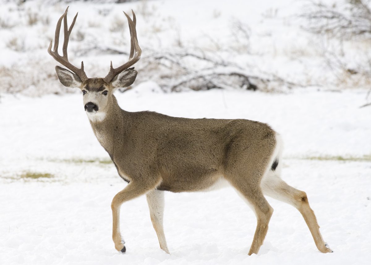
The Teton Wilderness lies immediately south of Yellowstone National Park and east of Grand Teton National Park, a vast expanse of rolling timbered hills, high meadows, and broad river valleys. While not as dramatically alpine as some other wilderness areas, its sheer size and strategic location make it a prime mule deer haven, particularly for migratory bucks. Access is typically from trailheads originating near Turpin Meadow or from the Buffalo Fork drainage, requiring significant pack-in distances, often 8-15 miles, or longer for the interior. The ideal season is late archery or early rifle, usually late September into early October, when bucks are beginning to move or have settled into their fall ranges. This hunt is for physically fit individuals comfortable with navigating large, forested areas and dealing with significant grizzly bear activity. Standard Wyoming deer tags are required; wilderness permits are generally self-issued at trailheads. Trade-offs include the dense timber which can make glassing challenging, widespread grizzly presence, and the potential for heavy snows, particularly in October, which can make egress difficult.
Why it stands out
Vast, relatively untrammeled wilderness, offering extensive habitat
Critical migratory corridor for mule deer and other ungulates
Good potential for finding older, more reclusive bucks
Excellent opportunities for multi-day, deep backcountry hunting
Less steep than other wilderness areas, allowing for more cover-based hunting
Know before you go
High density of grizzly bears; constant vigilance and bear spray essential
Dense timber can limit visibility and make travel challenging
Potential for deep snow in later seasons, impacting travel and deer location
Navigation in large, uniform timbered areas can be tricky
Long pack-in distances mean significant logistical planning
Planning notes
Where: Wyoming, United States Best season: Fall hunting seasons Good for: Backpacking, Hiking, Camping, Wildlife Viewing Featured on: Top 10 High-Country Mule Deer Backpacking Units in Wyoming (#7) Access point: Teton County, WY, USA
Check current permits, closures and fire restrictions with the managing agency before you commit to dates.
Field notes
- Vast, relatively untrammeled wilderness, offering extensive habitat
- Critical migratory corridor for mule deer and other ungulates
- Good potential for finding older, more reclusive bucks
- Excellent opportunities for multi-day, deep backcountry hunting
- Less steep than other wilderness areas, allowing for more cover-based hunting
Where on earth
Satellite imagery flying in from a world view to Teton Wilderness (Units 99/100), United States. Use the + / − buttons, or click the map to zoom with your scroll wheel; drag to pan and pinch to zoom on touch.
Coordinates
- Decimal degrees
- 43.8536, -110.6314
- Latitude (DMS)
- 43° 51′ 13.1″ N
- Longitude (DMS)
- 110° 37′ 53.2″ W
Coordinates are an access-point reference for Teton Wilderness (Units 99/100), not a route. Carry a paper map and confirm trailhead or put-in access with the managing agency before you go.
Topic summary
The Teton Wilderness lies immediately south of Yellowstone National Park and east of Grand Teton National Park, a vast expanse of rolling timbered hills, high meadows, and broad river valleys.
Key takeaways
- Region: Wyoming
- Country: United States
- Best season: Fall hunting seasons
- Good for: backpacking, hiking, camping, wildlife viewing
- Coordinates: 43.854, -110.631
Intended uses
- backpacking
- hiking
- camping
- wildlife viewing
Climate suitability
Fall hunting seasons
Keep planning
Popular pursuits at Teton Wilderness (Units 99/100)
- Backpacking
Multi-day travel with everything on your back — see the packing blocks below.
- Hiking
Day miles on marked trail, with route notes and trail links below.
- Hunting
Seasons, tags, and the units that hold animals.
- Climbing
Rock and alpine lines with approach beta.
- Winter Camping
Cold-season travel and camp craft; layering matters more than mileage.
- Skiing
Ski-touring access when the road closes for the season.
Animals around Teton Wilderness (Units 99/100)






Regional context
Teton Wilderness (Units 99/100) is the Wyoming destination addressed here, but its unit boundaries and on-the-ground access are not established. The broader regional context is Teton County, whose county seat is Jackson. The county contains all of Grand Teton National Park and part of Yellowstone National Park, along with the Jackson Hole ski area. Those county-level facts help distinguish the region’s major named places, but they do not establish a connection to a wilderness trailhead or a route within either unit. Jackson should therefore be treated as regional context rather than a verified departure point. A practical itinerary requires more specific information about the intended unit, its boundary, and its actual access.
Separate the destination from nearby park geography
Teton County’s western boundary follows Wyoming’s state boundary with Idaho and the southern tip of Montana. Within the county are 40.4 percent of Yellowstone National Park’s total area and more than 96.6 percent of its water area, largely in Yellowstone Lake. These figures describe the county’s relationship to Yellowstone, not the extent or character of Teton Wilderness. Likewise, the presence of Grand Teton National Park within the county does not establish wilderness access through that park. Keep county geography, national park boundaries, and the requested unit labels separate when planning. Neither a park name nor the county boundary is enough to identify a usable entry point, an overnight route, or the authority responsible for a particular trip.
What to establish before choosing a trip
A route-specific plan for Units 99/100 needs a verified boundary map, a named entry point, and confirmation of the responsible managing agency. No trailhead, road approach, named wilderness route, distance, or difficulty rating can be established here. That prevents a useful comparison of day trips, overnight walks, or longer itineraries without adding unsupported detail. Before committing to travel, confirm that the chosen access actually serves the intended destination and that the unit labels match the current map being used. Ask the responsible agency about applicable access requirements and current conditions. Until those basics are settled, treat this as regional orientation rather than a navigation guide or a basis for estimating driving or walking time.
Sample itineraries
- One-day trip planning · 1 day
A one-day route cannot be established from the available destination details. Before selecting an outing, confirm the Units 99/100 boundaries, legal access, route length, and current conditions with the managing agency.
- Two-day trip planning · 2 days
An overnight route cannot be established from the available destination details. Confirm access, camping rules, water availability, and a suitable return route before committing to a two-day trip.
Seasonal conditions
Spring
Not established
Destination-specific spring conditions and access are not established. Confirm current conditions before choosing travel dates.
Summer
Not established
Destination-specific summer conditions and route availability are not established. Do not assume a route is accessible based on the season alone.
Fall
Not established
Destination-specific fall conditions are not established. Confirm access and the current forecast before setting an itinerary.
Winter
Not established
Destination-specific winter access and travel conditions are not established. A winter route recommendation requires additional local information.
| Season | Window | Conditions |
|---|---|---|
| Spring | Not established | Destination-specific spring conditions and access are not established. Confirm current conditions before choosing travel dates. |
| Summer | Not established | Destination-specific summer conditions and route availability are not established. Do not assume a route is accessible based on the season alone. |
| Fall | Not established | Destination-specific fall conditions are not established. Confirm access and the current forecast before setting an itinerary. |
| Winter | Not established | Destination-specific winter access and travel conditions are not established. A winter route recommendation requires additional local information. |
Permits, fees & closures
Confirm applicable permit requirements and trip rules with the managing agency.
Confirm current permits, fees, and closures with the managing agency before you go.
Hazards & regulations
- Route-specific hazards are not established; obtain current local guidance before selecting a route.
- Access points and unit boundaries are unverified; do not use this profile as navigation guidance.
- Water availability and emergency exit options are not established; resolve both before committing to an itinerary.
What to pack for Teton Wilderness (Units 99/100)
- Verified boundary and route information
- Confirmed access details
- Build a gear list after confirming terrain and expected conditions
- Set water-carrying needs after confirming water availability
Teton Wilderness (Units 99/100) FAQ
- What do Units 99/100 identify?
- Their designation and boundaries are not established here. Confirm what these numbers identify before using them to plan access or activities.
- Which trailhead should be used?
- No destination-specific trailhead or access point is established. Obtain a verified access map from the managing agency before choosing a starting point.
- Is this the same destination as Grand Teton National Park?
- Do not treat those names as interchangeable. Teton County contains Grand Teton National Park, but that county-level fact does not establish the wilderness boundaries, access, or applicable rules.
- When is the best time to visit?
- A reliable seasonal recommendation cannot be made from the available destination details. Choose dates only after confirming local access and expected travel conditions.
- Are these ready-to-follow itineraries?
- No. They are planning outlines, not verified routes. Distances, access points, camping locations, and destination-specific conditions still need confirmation.