



- Region
- AK, USA
- Country
- United States
- Best for
- hiking
- Best season
- Spring, Summer
- Permits
- Confirm current permit requirements and ac…
- Managed by
- U.S. Fish and Wildlife Service — Alaska Maritime National Wildlife Refuge
Plan with verified data
Unimak Wilderness trip tools
Tools for a trip here
Picked for how, when and where you're going. Free, no signup.
Photos of Unimak Wilderness
How to get there
Reaching Unimak Wilderness almost always involves a boat, and no refuge lands are accessible from the road system. Scheduled air service and ferry service reach regional communities including False Pass and Cold Bay; onward travel to the wilderness requires separate planning. Do not assume a regional transport stop provides direct wilderness access. Confirm access arrangements, current conditions, and permit requirements with Alaska Maritime National Wildlife Refuge at 907-235-6546. Its headquarters and the Alaska Islands & Ocean Visitor Center are at 95 Sterling Highway #1 in Homer.
- False Pass
A regional transport community served by scheduled air service and ferry service. Treat it as a place to investigate onward transportation, not as a confirmed wilderness landing or trailhead.
- Cold Bay
A regional community with scheduled air service and ferry service. Arrange and confirm the onward connection to Unimak separately; arrival here does not establish access to a particular wilderness site.
Sources: recreation.gov · University of Montana / federal agency partners · Wilderness Connect / federal wilderness boundary inventory. Confirm road and trailhead conditions with the managing agency before you leave.
AK, USA · United States
- Canoeing
- Kayaking
- Fishing
- Hunting
- Mountaineering
- Winter Camping
- Skiing
- Sea Kayaking
An island wilderness beyond the road system
Unimak Wilderness covers 910,000 acres on Unimak Island, which extends west from the tip of the Alaska Peninsula. About 93 percent of the island is designated wilderness, separated from Izembek National Wildlife Refuge by a relatively narrow strip of sea. Designated in 1980, it is managed by the U.S. Fish and Wildlife Service through Alaska Maritime National Wildlife Refuge. This is not a drive-up hiking destination: refuge lands have no road-system access, and reaching Unimak almost always involves a boat. Plan transportation and the wilderness portion of the trip together rather than treating arrival as a simple transfer. The main travel possibilities are coastal sea kayaking and cross-country hiking through an interior that is typically wet and virtually without trails.
Volcanoes, snowfields, and wet tundra
Shishaldin Volcano rises to 9,372 feet, forming the highest volcanic cone in the Aleutians. Its nearly symmetrical shape served as a navigational aid for Aleuts and later Russian seafarers. Shishaldin and two other volcanoes on Unimak are active, with extensive lava flows and bare ash fields around them. Perpetual snowfields occupy the highest peaks, sometimes covering glaciers, while dormant Fisher Caldera holds icy water. These features give the island a very different character from a straightforward tundra walk. Hiking opportunities lie across rolling tundra and treeless grasslands, but a visible landmark is not a substitute for a workable route. Prepare for wet ground and independent navigation, and do not assume that open terrain provides easy passage through volcanic ground or into the snow-covered high country.
Coastal wildlife and self-supported travel
Unimak's coast combines steep bluffs, offshore sea stacks, and shoreline wetlands. Seabirds and marine mammals are frequently seen around the coast, while wetlands provide nesting, feeding, and resting habitat for waterfowl and shorebirds. Whistling swans, emperor geese, black brant, sea ducks, and several kinds of dabbling ducks use these areas. Inland wildlife includes brown bears, caribou, wolves, and wolverines; brown bears reached the island by swimming from the mainland. Give wildlife space, keep food secure, and avoid disturbing birds using shoreline habitat. Coastal kayaking requires careful attention to weather and the availability of suitable landing places along bluff-backed shores. For either paddling or hiking, carry a stove and ample fuel. Driftwood occurs along the shore, but firewood is scarce away from it.
Where on earth
Satellite imagery flying in from a world view to Unimak Wilderness, United States. Use the + / − buttons, or click the map to zoom with your scroll wheel; drag to pan and pinch to zoom on touch.
Coordinates
- Decimal degrees
- 54.7209, -164.0409
- Latitude (DMS)
- 54° 43′ 15.2″ N
- Longitude (DMS)
- 164° 2′ 27.2″ W
Coordinates are an access-point reference for Unimak Wilderness, not a route. Carry a paper map and confirm trailhead or put-in access with the managing agency before you go.
Topic summary
Huge Unimak Island, which gives this Wilderness its name, extends west from the tip of the Alaska Peninsula. Only a relatively thin strip of sea separates Unimak from Izembek National Wildlife Refuge....
Key takeaways
- Region: AK, USA
- Country: United States
- Good for: hiking
- Coordinates: 54.721, -164.041
Intended uses
hiking
Keep planning
Popular pursuits at Unimak Wilderness
- Canoeing
Paddle routes, portages, and put-ins.
- Kayaking
Sheltered and open-water paddling lines.
- Fishing
Resident gamefish, seasons, and the water that holds them.
- Hunting
Seasons, tags, and the units that hold animals.
- Mountaineering
Glacier and high-route objectives with real consequence.
- Winter Camping
Cold-season travel and camp craft; layering matters more than mileage.
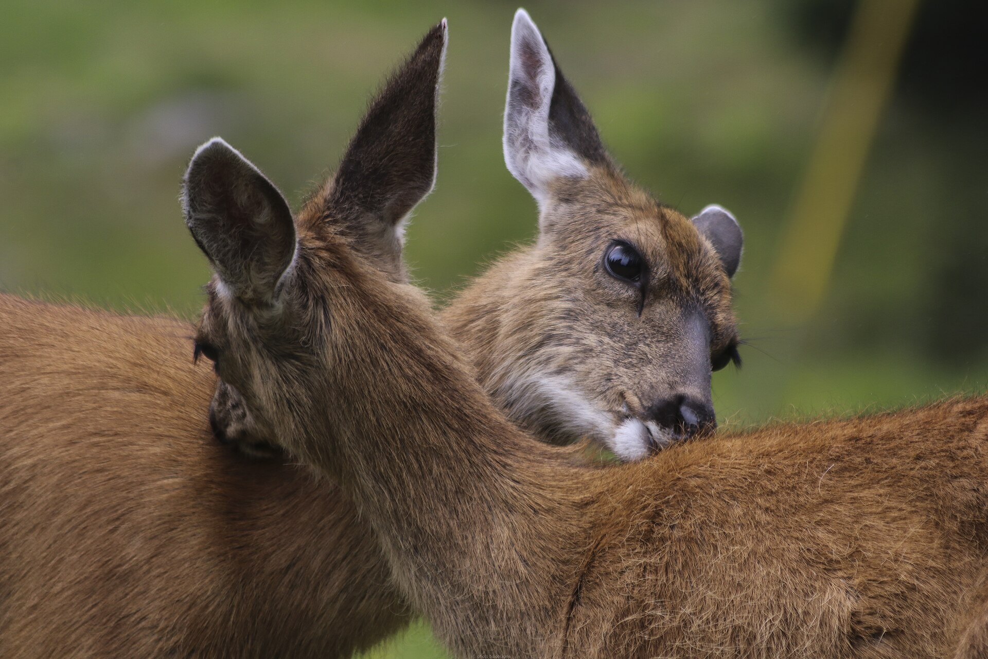
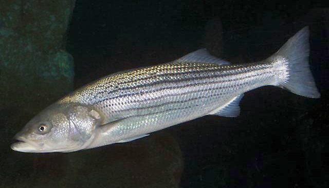
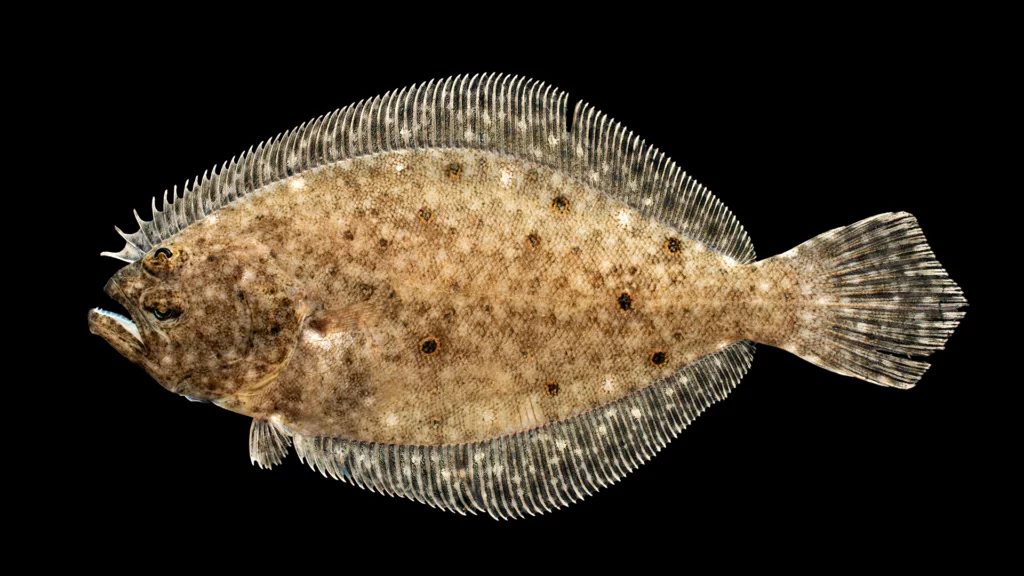
Animals around Unimak Wilderness
An island wilderness beyond the road system
Unimak Wilderness covers 910,000 acres on Unimak Island, which extends west from the tip of the Alaska Peninsula. About 93 percent of the island is designated wilderness, separated from Izembek National Wildlife Refuge by a relatively narrow strip of sea. Designated in 1980, it is managed by the U.S. Fish and Wildlife Service through Alaska Maritime National Wildlife Refuge. This is not a drive-up hiking destination: refuge lands have no road-system access, and reaching Unimak almost always involves a boat. Plan transportation and the wilderness portion of the trip together rather than treating arrival as a simple transfer. The main travel possibilities are coastal sea kayaking and cross-country hiking through an interior that is typically wet and virtually without trails.
Volcanoes, snowfields, and wet tundra
Shishaldin Volcano rises to 9,372 feet, forming the highest volcanic cone in the Aleutians. Its nearly symmetrical shape served as a navigational aid for Aleuts and later Russian seafarers. Shishaldin and two other volcanoes on Unimak are active, with extensive lava flows and bare ash fields around them. Perpetual snowfields occupy the highest peaks, sometimes covering glaciers, while dormant Fisher Caldera holds icy water. These features give the island a very different character from a straightforward tundra walk. Hiking opportunities lie across rolling tundra and treeless grasslands, but a visible landmark is not a substitute for a workable route. Prepare for wet ground and independent navigation, and do not assume that open terrain provides easy passage through volcanic ground or into the snow-covered high country.
Coastal wildlife and self-supported travel
Unimak's coast combines steep bluffs, offshore sea stacks, and shoreline wetlands. Seabirds and marine mammals are frequently seen around the coast, while wetlands provide nesting, feeding, and resting habitat for waterfowl and shorebirds. Whistling swans, emperor geese, black brant, sea ducks, and several kinds of dabbling ducks use these areas. Inland wildlife includes brown bears, caribou, wolves, and wolverines; brown bears reached the island by swimming from the mainland. Give wildlife space, keep food secure, and avoid disturbing birds using shoreline habitat. Coastal kayaking requires careful attention to weather and the availability of suitable landing places along bluff-backed shores. For either paddling or hiking, carry a stove and ample fuel. Driftwood occurs along the shore, but firewood is scarce away from it.
Route options
- Unimak coast sea kayaking
A self-planned coastal paddling option rather than a defined route. The shoreline includes steep bluffs, offshore sea stacks, and wildlife habitat. Choose an itinerary around conditions, suitable landings, and confirmed transport arrangements.
- Unimak interior cross-country hiking
Explore rolling tundra and treeless grasslands in an interior that is typically wet and virtually without trails. This is independent cross-country travel, not a marked hiking circuit. Carry navigation equipment, a stove, and enough fuel rather than relying on inland firewood.
Sample itineraries
- Unimak Coast Wildlife Visit · 2 days
A suggested short visit, dependent on arranged boat transport. Spend one day observing coastal bluffs, offshore sea stacks, seabirds and marine mammals. Use the second for shoreline wetland observation where access allows. Confirm landing locations and return transport before departure; this is not an established route.
- Rolling Tundra Backpack · 3 days
A suggested backpacking framework for experienced off-trail travelers. Arrange arrival and pickup, then explore rolling tundra and treeless grasslands from a suitable base. Allow the final day for return travel. Choose terrain around current conditions rather than committing to a fixed crossing; the interior is typically wet and virtually trail-less.
Seasonal conditions
Spring
Spring trip planning
Confirm local snow and ground conditions before selecting an inland route. Plan for wet, trail-less terrain and avoid assuming that higher ground is snow-free; the highest peaks hold perpetual snowfields, some covering glaciers.
Summer
Summer trip planning
Do not count on dry hiking conditions: the interior is typically wet. Perpetual snowfields remain on the highest peaks. For coastal kayaking, assess weather and water conditions before committing to travel along steep bluffs.
Fall
Fall trip planning
Confirm current weather, ground conditions and transport arrangements before departure. Wet tundra and treeless grasslands call for waterproof gear and reliable shelter. Keep the route flexible rather than relying on trails.
Winter
Winter trip planning
Seek current local advice on snow, weather and coastal access. Remote transport and virtually trail-less terrain require conservative planning. High peaks include permanent snowfields and glaciers; do not treat them as ordinary hiking terrain.
| Season | Window | Conditions |
|---|---|---|
| Spring | Spring trip planning | Confirm local snow and ground conditions before selecting an inland route. Plan for wet, trail-less terrain and avoid assuming that higher ground is snow-free; the highest peaks hold perpetual snowfields, some covering glaciers. |
| Summer | Summer trip planning | Do not count on dry hiking conditions: the interior is typically wet. Perpetual snowfields remain on the highest peaks. For coastal kayaking, assess weather and water conditions before committing to travel along steep bluffs. |
| Fall | Fall trip planning | Confirm current weather, ground conditions and transport arrangements before departure. Wet tundra and treeless grasslands call for waterproof gear and reliable shelter. Keep the route flexible rather than relying on trails. |
| Winter | Winter trip planning | Seek current local advice on snow, weather and coastal access. Remote transport and virtually trail-less terrain require conservative planning. High peaks include permanent snowfields and glaciers; do not treat them as ordinary hiking terrain. |
Permits, fees & closures
Confirm current permit requirements and access rules with the Alaska Maritime National Wildlife Refuge, managed by the U.S. Fish and Wildlife Service, at 907-235-6546.
Official source: Unimak Wilderness | Alaska - Recreation.gov · Verified November 5, 2026
Hazards & regulations
- Shishaldin and two other Unimak volcanoes are active. Check current volcanic conditions before planning nearby travel; extensive lava flows and bare ash complicate route selection.
- The interior is typically wet and virtually without trails. Carry independent navigation tools and allow for slow progress across tundra and grasslands.
- Steep coastal bluffs and offshore sea stacks require careful shoreline and kayaking decisions. Assess weather, water conditions and landing options before committing.
- Perpetual snowfields cover some glaciers on the highest peaks. Avoid glaciated terrain without appropriate training and equipment.
- Brown bears inhabit the island. Maintain distance, manage food securely and avoid surprising wildlife.
- Access almost always involves a boat, and refuge lands are not accessible from the road system. Arrange dependable pickup and carry emergency communication.
What to pack for Unimak Wilderness
- Waterproof jacket and pants
- Water-resistant footwear and spare socks
- Insulating layers
- Weather-resistant shelter
- Topographic map and compass
- GPS with spare power
- Satellite communication device
- Written transport and pickup plan
- Stove and plenty of fuel; firewood is scarce inland
- Bear-resistant food storage
- Water treatment equipment
- First-aid kit and emergency supplies
Unimak Wilderness FAQ
- Where is Unimak Wilderness?
- Unimak Island extends west from the tip of the Alaska Peninsula. The wilderness covers 910,000 acres, approximately 93 percent of the island, and is managed as part of Alaska Maritime National Wildlife Refuge.
- How do visitors get there?
- A journey to Unimak Wilderness almost always involves a boat. No refuge lands are accessible from the road system. Arrange island-specific transport and landing details directly; service to nearby communities does not establish access to a particular wilderness location.
- Are there hiking trails?
- The interior is virtually without trails. Hiking means navigating rolling tundra and treeless grasslands, often in wet conditions. Plan an off-trail route suited to the group's skills rather than expecting marked paths.
- What volcanic features define the island?
- Shishaldin Volcano rises to 9,372 feet and is the highest cone in the Aleutians. It and two other Unimak volcanoes are active. Extensive lava flows and bare ash surround them. Dormant Fisher Caldera contains icy water.
- Is sea kayaking an option?
- The coast offers sea kayaking possibilities, but steep bluffs and offshore sea stacks demand careful planning. Confirm suitable access, landing options, transport and current marine conditions before choosing a route.
- Can a campfire replace a stove?
- Carry a stove and plenty of fuel. Firewood is scarce away from the driftwood-littered shore, so do not depend on finding wood for cooking.