



Where on earth
Satellite imagery flying in from a world view to Kola Peninsula Salmon, Worldwide. Use the + / − buttons, or click the map to zoom with your scroll wheel; drag to pan and pinch to zoom on touch.
- Region
- Russia
- Country
- Worldwide
- Biome
- Sub-arctic (100 m)
- Best season
- June – September
- Difficulty
- moderate
- Backpacking
- Hiking
- Fishing
- Winter Camping
- Wildlife Viewing
Key takeaways
- Biome: Sub-arctic (100 m)
- Best season: June – September
- Difficulty: moderate
- Top activity: backpacking
Photos of Kola Peninsula Salmon
Topic summary
The world's premier Atlantic salmon rivers — Ponoi and Yokanga.
Key takeaways
- Difficulty: moderate
- Best season: June – September
Intended uses
backpacking
Climate suitability
Sub-arctic (100 m)
Tools for a trip here
Picked for how, when and where you're going. Free, no signup.
- Sleep System Temp CalculatorCold nights: check your bag and pad add up to a safe sleep.
- Base Weight CalculatorEvery ounce is carried — total your kit and find your base weight.
- Pack Volume SizerSize the pack for your trip length and season.
- Water Purification MatrixTreat water from streams and lakes on trail.
- Layering CalculatorCold-season miles: layer for climbs and camp.
Plan with verified data
Kola Peninsula Salmon trip tools
How to get there
Locate the trip within Murmansk Oblast in Russia’s extreme northwest. Murmansk is the peninsula’s largest settlement, but onward transport to salmon water must be established for the specific river. Confirm the meeting point and full transfer arrangements before booking travel.
- Murmansk
The peninsula’s largest settlement provides a regional orientation point. Confirm whether the chosen river itinerary actually uses Murmansk; direct fishing access and onward transfer details are not established here.
- Lovozero
A named settlement with an important place in the peninsula’s Sámi history. It is not an established salmon access point in this profile; include it only if a confirmed itinerary specifies a connection.
Sources: Wikipedia · Wikivoyage. Confirm road and trailhead conditions with the managing agency before you leave.
Popular pursuits at Kola Peninsula Salmon
- Backpacking
Multi-day travel with everything on your back — see the packing blocks below.
- Hiking
Day miles on marked trail, with route notes and trail links below.
- Fishing
Resident gamefish, seasons, and the water that holds them.
- Winter Camping
Cold-season travel and camp craft; layering matters more than mileage.
- Wildlife Viewing
Best light, best season, and where animals move.
Animals around Kola Peninsula Salmon
 Wildlife guideTimber wolfCanis lupus
 Wildlife guideCanada lynxLynx canadensis
 Wildlife guideWolverineGulo gulo
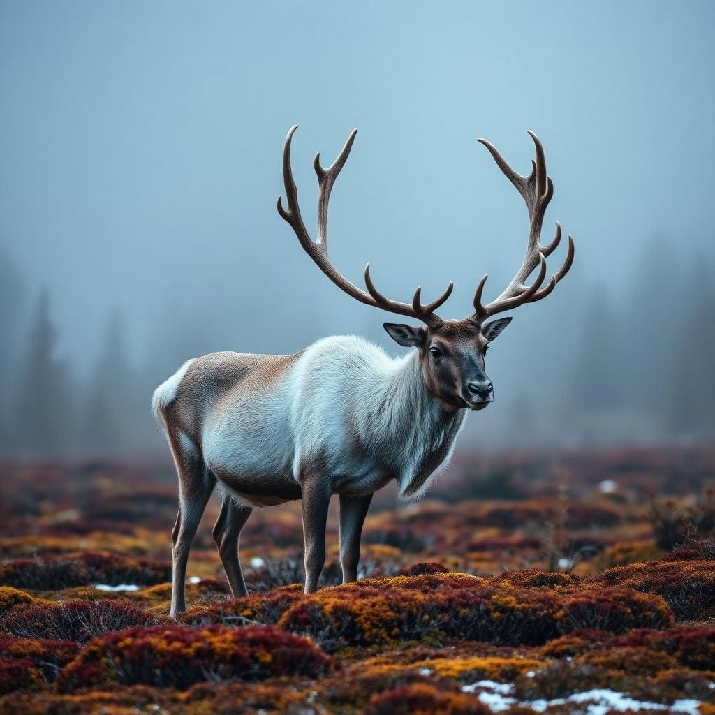 Wildlife guideWoodland caribouRangifer tarandus caribou
 Wildlife guideNorth American beaverCastor canadensis
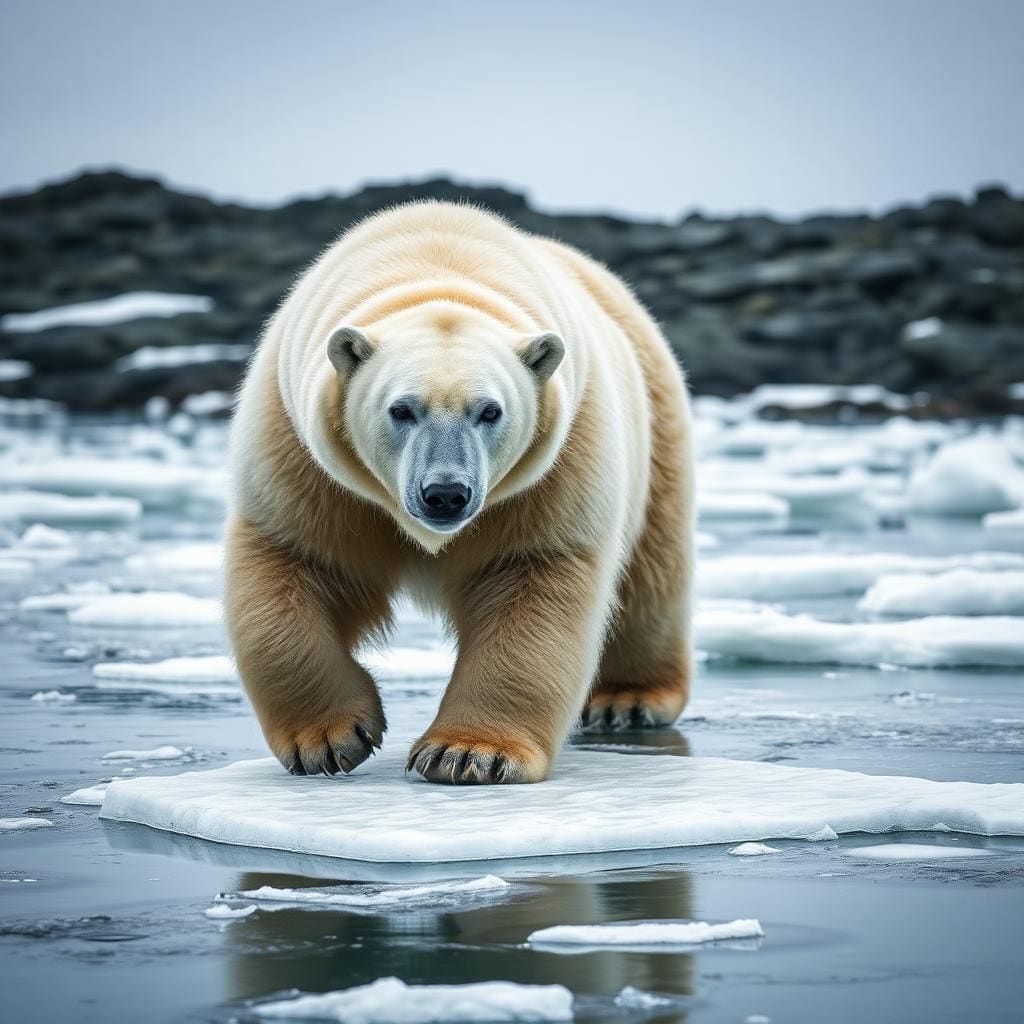 Wildlife guidePolar bearUrsus maritimus
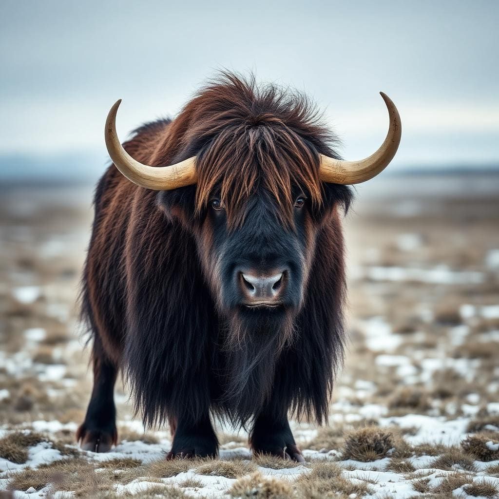 Wildlife guideMuskoxOvibos moschatus
 Wildlife guideMooseAlces alces
Maps, GPS & compass for this trip
Carry a waterproof paper map and a compass you can steer by, and treat the GPS as the backup — not the other way round. Buying links go to Amazon; Wild10 earns a commission at no cost to you.
Waterproof topo maps
- Waterproof topographic map — Kola Peninsula SalmonAmazon search for waterproof, tear-resistant topo maps covering this area.
- National Geographic Trails IllustratedThe waterproof Trails Illustrated series — check for a sheet covering this area.
- Waterproof map case & compass lanyardKeep a paper map readable in rain, spray and a swamped boat.
Fishing at Kola Peninsula Salmon
Planning to fish Kola Peninsula Salmon, Russia? Fishing licences, open seasons and catch limits in Russia are set by the local wildlife authority and change every year — check the official source before you cast a line.
Do I need a fishing licence at Kola Peninsula Salmon?
- A Russia fishing licence is normally required for anyone over the local youth age.
- Read the current Russia fishing regulations for special waters, barbless-hook or catch-and-release rules.
- Clean, drain and dry boats and gear between waters to stop invasive species.
We don't have a verified licensing link on file for Russia yet — contact the park or land manager listed on this page for current hunting and fishing rules.
Hunting near Kola Peninsula Salmon
Thinking about hunting Kola Peninsula Salmon, Russia? Hunting seasons, tags and draws in Russia are set by the wildlife authority each year. Confirm the rules for your species and unit before you go.
Is hunting allowed at Kola Peninsula Salmon?
- Confirm the land around Kola Peninsula Salmon is open to hunting and which management unit it falls in.
What do I need to hunt in Russia?
- A Russia hunting licence — most jurisdictions also require hunter education certification.
- Species tags or draw results for big game such as deer, elk, moose or bear where they occur.
- Knowledge of firearm and bow transport rules, which differ by land type and border crossing.
We don't have a verified licensing link on file for Russia yet — contact the park or land manager listed on this page for current hunting and fishing rules.
Atlantic Salmon in an Arctic Peninsula
The Kola Peninsula occupies Russia’s extreme northwest, with the Barents Sea to the north and the White Sea to the east and southeast. Almost all of it lies inside the Arctic Circle, and its rivers provide important habitat for Atlantic salmon. That makes salmon the focus here, but a workable fishing trip needs more detail than a regional destination name: a specific river, an agreed access arrangement, and confirmation of the rules governing that water. Do not treat the peninsula’s broad salmon habitat as evidence that every river is open to visiting anglers. Confirm fishing permissions and current requirements with the managing agency before committing to a trip. Murmansk is the peninsula’s largest settlement; it is a geographic reference point, not a substitute for a confirmed river-access plan.
Terrain, Wind, and Cold-Weather Preparation
The peninsula changes from taiga in the south to tundra in the north. In the northern landscape, permafrost limits tree growth, leaving shrubs and grasses rather than continuous forest. This distinction matters when planning time outdoors: an open tundra setting offers less shelter from wind than a wooded one. The nearby North Atlantic Current moderates winter temperatures for this latitude, but temperature differences between the land and the Barents Sea also produce high winds. Summer is still chilly, with an average July temperature of about 11 °C. Pack insulating layers and windproof, waterproof outerwear rather than assuming a summer fishing trip will be warm. Keep spare clothing protected from water, and make weather exposure part of the decision about how long to stay beside a river.
A Fishing Landscape with a Human History
Kola is not an uninhabited wilderness. It forms most of Murmansk Oblast and is northern Russia’s most industrially developed and urbanized region. Soviet-era industrialization and militarization caused major ecological damage, so broad descriptions of Arctic scenery should not be mistaken for a river-by-river assessment of environmental conditions. The peninsula also has a long Sámi history, followed by Russian Pomor settlement linked to fishing and other resources. During the Soviet period, Sámi communities experienced forced collectivization and relocation to Lovozero and other centralized settlements. Treat inhabited places as communities rather than simply staging points for fishing. A responsible itinerary should establish the actual river destination, local access arrangements, and current conditions before adding transfers or extra days elsewhere on the peninsula.
Route options
- Southern Kola: Taiga Trip Planning
A regional planning option rather than a mapped fishing route. Southern Kola is characterized by taiga. Identify the specific salmon river and confirm its access arrangements before choosing this part of the peninsula for a fishing itinerary.
- Northern Kola: Tundra Trip Planning
A regional planning option rather than a mapped fishing route. Northern Kola has tundra dominated by shrubs and grasses, with limited tree growth. Establish the river destination and transfer plan first, and account for wind exposure when preparing for time outdoors.
Sample itineraries
- Murmansk and a Kola river outing · 3 days
Suggested framework: spend a day in Murmansk, allow a day for an arranged river outing, and keep a weather buffer. Confirm the river, transport, fishing authorization and local conditions before committing; this is not a verified access route.
- Salmon-focused Kola stay · 5 days
Suggested framework: allow arrival and departure days around three flexible days of arranged river fishing or observation. Kola rivers support Atlantic salmon, but river selection, fishing timing and access need local confirmation. Prioritize one confirmed location rather than assuming easy travel across the peninsula.
Seasonal conditions
Spring
Confirm local spring timing
Almost all of the peninsula lies inside the Arctic Circle. Do not assume spring brings mild river conditions. Confirm weather and river access locally rather than treating the season as a verified salmon-fishing window.
Summer
Summer; July temperature benchmark
Summers are chilly, with an average July temperature of about 11°C. Carry insulation and wind protection for time beside rivers. Summer weather alone does not establish when salmon fishing is available.
Fall
Confirm local fall timing
Plan conservatively for outdoor time at this Arctic latitude. Check current weather and river conditions before outings; no specific fall salmon-fishing window is established here.
Winter
Winter; check current conditions
The North Atlantic Current moderates winter temperatures despite the northern latitude. Temperature differences between the land and Barents Sea also produce high winds. Relative warmth does not remove the need for cold-weather protection.
| Season | Window | Conditions |
|---|---|---|
| Spring | Confirm local spring timing | Almost all of the peninsula lies inside the Arctic Circle. Do not assume spring brings mild river conditions. Confirm weather and river access locally rather than treating the season as a verified salmon-fishing window. |
| Summer | Summer; July temperature benchmark | Summers are chilly, with an average July temperature of about 11°C. Carry insulation and wind protection for time beside rivers. Summer weather alone does not establish when salmon fishing is available. |
| Fall | Confirm local fall timing | Plan conservatively for outdoor time at this Arctic latitude. Check current weather and river conditions before outings; no specific fall salmon-fishing window is established here. |
| Winter | Winter; check current conditions | The North Atlantic Current moderates winter temperatures despite the northern latitude. Temperature differences between the land and Barents Sea also produce high winds. Relative warmth does not remove the need for cold-weather protection. |
Permits, fees & closures
Confirm fishing permissions and site-access requirements with the managing agency before arranging a river outing.
Confirm current permits, fees, and closures with the managing agency before you go.
Hazards & regulations
- High winds can affect exposed outdoor outings; reassess plans when conditions deteriorate.
- Chilly summers can make long periods beside water uncomfortable or unsafe without insulation and weather protection.
- River outings require water-safety judgment. Assess conditions before entering water and avoid treating unfamiliar rivers as safe to wade.
- The peninsula has suffered major ecological damage from industrialization. Do not assume untreated surface water is safe to drink.
What to pack for Kola Peninsula Salmon
- Insulating layers
- Windproof and waterproof outerwear
- Warm hat and gloves
- Dry spare clothing
- Footwear suited to the confirmed outing
- Personal flotation device for on-water activity
- Waterproof bag
- Fishing equipment selected after local confirmation
- Safe drinking water
- Food for the outing
- First-aid kit
Wildlife you may see
- Atlantic salmon: the peninsula's rivers are important habitat.
- Common eider: Kandalaksha Nature Reserve was established to protect its population.
Kola Peninsula Salmon FAQ
- Where is the Kola Peninsula?
- It lies in Russia's extreme northwest and forms most of Murmansk Oblast. Almost entirely inside the Arctic Circle, it borders the Barents Sea to the north and the White Sea to the east and southeast.
- What makes it relevant for a salmon trip?
- Its rivers are important Atlantic salmon habitat. That establishes the destination's ecological relevance, not a guaranteed catch or a confirmed fishing season.
- Which river should be booked?
- A specific river cannot be recommended here. Confirm river identity, legal fishing access, transport and current conditions with the managing agency and any prospective operator before booking.
- Is summer warm enough for light clothing alone?
- No. Average July temperatures are about 11°C, and summers are described as chilly. Pack insulating layers and wind protection rather than relying on light summer clothing.
- What landscape should visitors expect?
- Southern Kola is covered by taiga. Northern Kola is tundra, where permafrost limits tree growth and shrubs and grasses dominate. The peninsula also has substantial urban and industrial development.
- Is Murmansk a confirmed gateway to every fishing area?
- Murmansk is the peninsula's most populous settlement, but that does not establish river-transfer options. Confirm onward transport for the specific fishing location rather than assuming straightforward access.