



- Region
- MA, USA
- Country
- United States
- Best for
- hiking
- Best season
- Spring, Summer
- Permits
- Confirm permit requirements and current ac…
- Managed by
- U.S. Fish & Wildlife Service, Monomoy National Wildlife Refuge, Eastern Massachusetts National Wildlife Refuge Complex
Plan with verified data
Monomoy Wilderness trip tools
Tools for a trip here
Picked for how, when and where you're going. Free, no signup.
Photos of Monomoy Wilderness
How to get there
Monomoy National Wildlife Refuge is in Chatham, Massachusetts, on southeastern Cape Cod. For mainland walking trails, use the Morris Island unit parking lot at 30 Wikis Way. The visitor center and staff offices are at 791 Main Street; opening depends on volunteer availability. North Monomoy, South Monomoy, and Minimoy require boat access, which the U.S. Fish & Wildlife Service does not provide. Contact refuge staff at (508) 945-0594 for current access guidance.
- Morris Island unit
Mainland trail access from the parking lot at 30 Wikis Way, Chatham. Trails are accessible year round, but intertidal sections may be inaccessible at high tide. This unit is outside the wilderness.
- North Monomoy Island
Offshore access is by boat only. Confirm current access and landing guidance with the refuge. The Service does not operate public boat access, and pets are prohibited.
- South Monomoy Island
Boat-only island access, with a lighthouse complex on the island. Pets are prohibited. All island access, including the lighthouse, will be restricted during the prescribed burn planned for October or November 2026.
Sources: fws.gov · University of Montana / federal agency partners · Wilderness Connect / federal wilderness boundary inventory · Wikipedia. Confirm road and trailhead conditions with the managing agency before you leave.
MA, USA · United States
- Fishing
- Winter Camping
- Skiing
- Sea Kayaking
- Beachcombing
- Hiking
- Wildlife Viewing
An offshore wilderness shaped by storms
Monomoy Wilderness lies within Monomoy National Wildlife Refuge south of Chatham, at the southeastern corner of Cape Cod. Designated in 1970, the wilderness covers 3,244 acres. Its setting is a shifting coastal landscape: dunes face the Atlantic on the eastern shores, while salt marshes and mudflats occupy the western side. Severe winter storms separated Monomoy Point from the mainland in 1958; North and South Monomoy became separate islands twenty years later. That history matters when planning a visit: this is a coast shaped by erosion and storms, not a fixed network of inland trails. The broader refuge includes North Monomoy, South Monomoy, and Minimoy islands, plus the mainland Morris Island unit. Morris Island provides walking access to refuge habitat, but it is outside the designated wilderness.
Choose between mainland trails and offshore access
The main planning decision is whether to walk the mainland refuge trails or arrange an offshore visit. Morris Island trails are accessible year round from the parking lot at 30 Wikis Way in Chatham. Parts of the Morris Island Trail are intertidal and may be inaccessible at high tide, so check tides before setting out and avoid relying on an exposed section for the return. North Monomoy, South Monomoy, and Minimoy are accessible only by boat; the U.S. Fish & Wildlife Service does not operate public boat access. Confirm current landing and access guidance with refuge staff rather than treating an island shoreline as an unrestricted arrival point. The visitor center and staff offices are at 791 Main Street, separate from the trail parking, and open on a limited basis depending on volunteer availability.
Wildlife comes first
Monomoy protects feeding, resting, and nesting habitat for coastal wildlife. Migratory birds use the islands' dunes, marshes, and mudflats, with piping plovers and roseate terns among the notable species. The wider refuge also supports horseshoe crabs, tiger beetles, and gray seals; gray and harbor seals winter along the coast. Bring binoculars and watch from a distance rather than approaching animals for a closer view. Pet rules reflect the sensitivity of these habitats: pets are never allowed on North Monomoy, South Monomoy, or Minimoy. On the mainland Morris Island trails, dogs are prohibited from May 1 through September 15 to protect nesting wildlife. Leashed dogs are allowed there from September 16 through April 30. Keep the mainland and offshore rules distinct when deciding whether a visit can include a dog.
Check access before committing to a trip
Use current refuge access guidance when planning an island visit, especially if South Monomoy's lighthouse is part of the plan. A prescribed burn is planned for October or November 2026, with the actual date dependent on weather and fuel conditions. The work is expected to take one day, with active burning lasting several hours and covering up to 90 acres. All of South Monomoy Island, including the lighthouse, will have restricted access while burning is in progress. Smoke may be visible for several miles and may linger afterward. The burn is intended to reduce hazardous fuels and improve common and roseate tern habitat by reducing thick beach grass, thatch, and woody vegetation. For ordinary visits as well, check the public access map, tides, and coastal weather before leaving; mainland trail availability does not establish offshore access.
Where on earth
Satellite imagery flying in from a world view to Monomoy Wilderness, United States. Use the + / − buttons, or click the map to zoom with your scroll wheel; drag to pan and pinch to zoom on touch.
Coordinates
- Decimal degrees
- 41.5957, -69.9903
- Latitude (DMS)
- 41° 35′ 44.7″ N
- Longitude (DMS)
- 69° 59′ 25.0″ W
Coordinates are an access-point reference for Monomoy Wilderness, not a route. Carry a paper map and confirm trailhead or put-in access with the managing agency before you go.
Topic summary
As recently as 1958, this area was an extension of the mainland, the eroding shoreline at the elbow of Cape Cod. Severe winter storms isolated Monomoy Point from the mainland and, 20 years later, separated...
Key takeaways
- Region: MA, USA
- Country: United States
- Good for: hiking
- Coordinates: 41.596, -69.990
Intended uses
hiking
Keep planning
Popular pursuits at Monomoy Wilderness
- Fishing
Resident gamefish, seasons, and the water that holds them.
- Winter Camping
Cold-season travel and camp craft; layering matters more than mileage.
- Skiing
Ski-touring access when the road closes for the season.
- Sea Kayaking
Coastal crossings, tides, and protected camps.
- Beachcombing
Tide-line walking between camps.
- Hiking
Day miles on marked trail, with route notes and trail links below.
Animals around Monomoy Wilderness
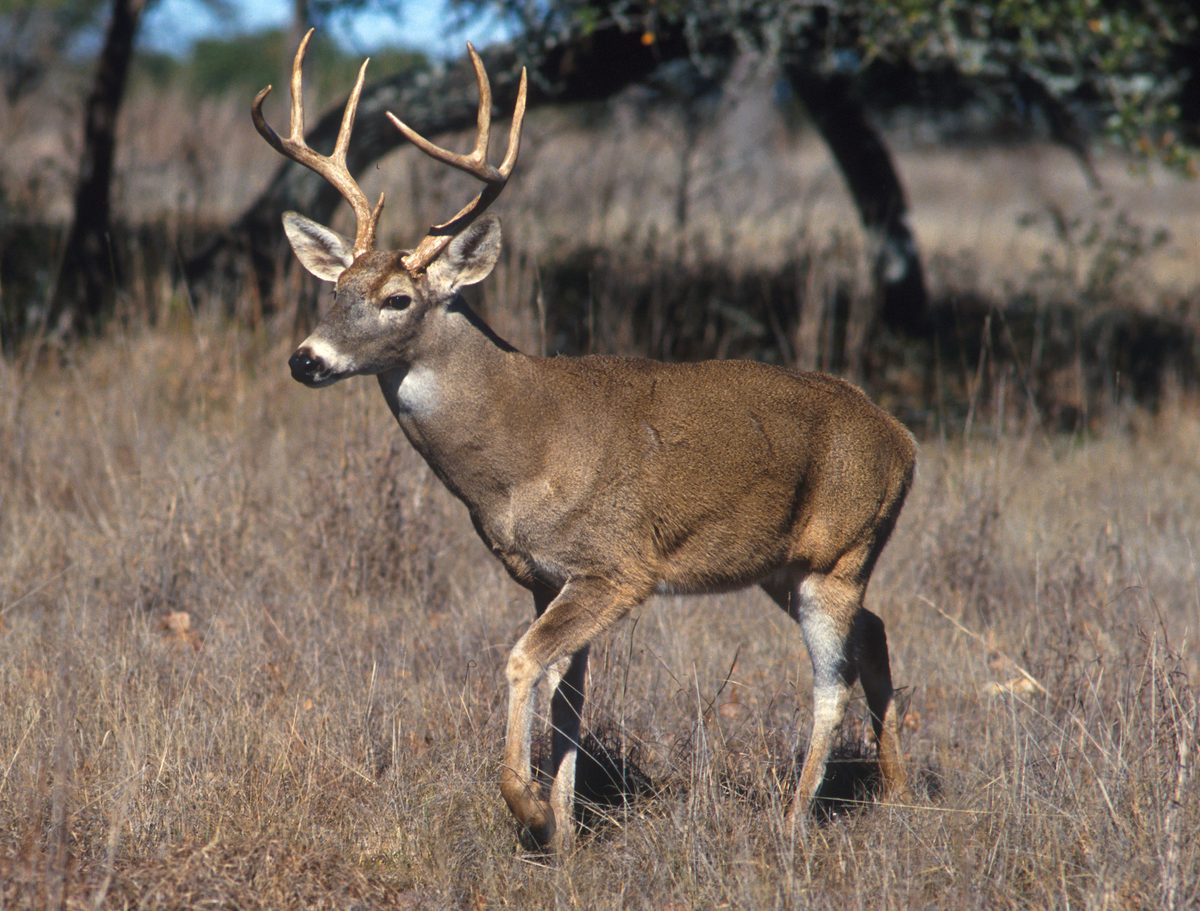


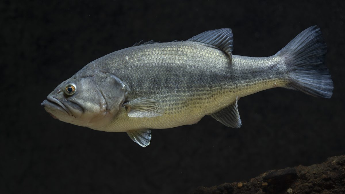

An offshore wilderness shaped by storms
Monomoy Wilderness lies within Monomoy National Wildlife Refuge south of Chatham, at the southeastern corner of Cape Cod. Designated in 1970, the wilderness covers 3,244 acres. Its setting is a shifting coastal landscape: dunes face the Atlantic on the eastern shores, while salt marshes and mudflats occupy the western side. Severe winter storms separated Monomoy Point from the mainland in 1958; North and South Monomoy became separate islands twenty years later. That history matters when planning a visit: this is a coast shaped by erosion and storms, not a fixed network of inland trails. The broader refuge includes North Monomoy, South Monomoy, and Minimoy islands, plus the mainland Morris Island unit. Morris Island provides walking access to refuge habitat, but it is outside the designated wilderness.
Choose between mainland trails and offshore access
The main planning decision is whether to walk the mainland refuge trails or arrange an offshore visit. Morris Island trails are accessible year round from the parking lot at 30 Wikis Way in Chatham. Parts of the Morris Island Trail are intertidal and may be inaccessible at high tide, so check tides before setting out and avoid relying on an exposed section for the return. North Monomoy, South Monomoy, and Minimoy are accessible only by boat; the U.S. Fish & Wildlife Service does not operate public boat access. Confirm current landing and access guidance with refuge staff rather than treating an island shoreline as an unrestricted arrival point. The visitor center and staff offices are at 791 Main Street, separate from the trail parking, and open on a limited basis depending on volunteer availability.
Wildlife comes first
Monomoy protects feeding, resting, and nesting habitat for coastal wildlife. Migratory birds use the islands' dunes, marshes, and mudflats, with piping plovers and roseate terns among the notable species. The wider refuge also supports horseshoe crabs, tiger beetles, and gray seals; gray and harbor seals winter along the coast. Bring binoculars and watch from a distance rather than approaching animals for a closer view. Pet rules reflect the sensitivity of these habitats: pets are never allowed on North Monomoy, South Monomoy, or Minimoy. On the mainland Morris Island trails, dogs are prohibited from May 1 through September 15 to protect nesting wildlife. Leashed dogs are allowed there from September 16 through April 30. Keep the mainland and offshore rules distinct when deciding whether a visit can include a dog.
Check access before committing to a trip
Use current refuge access guidance when planning an island visit, especially if South Monomoy's lighthouse is part of the plan. A prescribed burn is planned for October or November 2026, with the actual date dependent on weather and fuel conditions. The work is expected to take one day, with active burning lasting several hours and covering up to 90 acres. All of South Monomoy Island, including the lighthouse, will have restricted access while burning is in progress. Smoke may be visible for several miles and may linger afterward. The burn is intended to reduce hazardous fuels and improve common and roseate tern habitat by reducing thick beach grass, thatch, and woody vegetation. For ordinary visits as well, check the public access map, tides, and coastal weather before leaving; mainland trail availability does not establish offshore access.
Route options
- Morris Island Trail
A mainland refuge walk starting from 30 Wikis Way, rather than an entry into the designated wilderness. Plan around tides because portions of the trail are intertidal and may be inaccessible at high water.
- North Monomoy Island boat-access visit
An offshore option for experiencing the island's coastal habitats. Arrange boat access independently and confirm where public access is currently allowed; do not assume a maintained walking route or unrestricted landing.
- South Monomoy Island boat-access visit
An offshore visit to an island with dunes, marsh habitat, and a historic lighthouse complex. Confirm landing and walking access before departure, including restrictions associated with the planned October–November 2026 prescribed burn.
Sample itineraries
- Morris Island orientation day · 1 day
Start at the Morris Island unit parking lot at 30 Wikis Way in Chatham. Walk accessible portions of the trails, planning around high tide. Look for coastal birds and learn the refuge’s layout. This mainland outing is within the refuge, not the designated wilderness.
- Offshore wilderness day · 1 day
Arrange boat transportation independently for a visit to North or South Monomoy. Confirm permitted landing areas and current access with refuge staff before departure. Focus on observing the dunes, marshes, and coastal wildlife from accessible areas. The refuge does not operate public boat access; arrange your return before setting out.
Seasonal conditions
Spring
Spring
Marshes and mudflats provide habitat for migratory birds. Keep wildlife observation unobtrusive and check tides before walking Morris Island trails. Dogs are prohibited on those trails beginning May 1 to protect nesting wildlife.
Summer
Memorial Day to Labor Day
Boaters visit the offshore islands in summer. The Morris Island information kiosk is generally staffed from 10 AM to 4 PM during this window, though hours vary. High tides can limit trail access. Pets are prohibited on all three offshore islands.
Fall
Fall; planned burn October–November 2026
A prescribed burn is planned for October or November 2026, depending on weather and fuel conditions. All South Monomoy Island access, including the lighthouse, will be restricted during burning. Smoke may linger afterward. Confirm current conditions before arranging an island visit.
Winter
Winter
Gray and harbor seals winter along the coastline. Severe winter storms have reshaped and separated the islands; treat offshore travel as weather-dependent. Morris Island trails remain accessible year-round, subject to tidal limitations.
| Season | Window | Conditions |
|---|---|---|
| Spring | Spring | Marshes and mudflats provide habitat for migratory birds. Keep wildlife observation unobtrusive and check tides before walking Morris Island trails. Dogs are prohibited on those trails beginning May 1 to protect nesting wildlife. |
| Summer | Memorial Day to Labor Day | Boaters visit the offshore islands in summer. The Morris Island information kiosk is generally staffed from 10 AM to 4 PM during this window, though hours vary. High tides can limit trail access. Pets are prohibited on all three offshore islands. |
| Fall | Fall; planned burn October–November 2026 | A prescribed burn is planned for October or November 2026, depending on weather and fuel conditions. All South Monomoy Island access, including the lighthouse, will be restricted during burning. Smoke may linger afterward. Confirm current conditions before arranging an island visit. |
| Winter | Winter | Gray and harbor seals winter along the coastline. Severe winter storms have reshaped and separated the islands; treat offshore travel as weather-dependent. Morris Island trails remain accessible year-round, subject to tidal limitations. |
Permits, fees & closures
Confirm permit requirements and current access rules with the U.S. Fish & Wildlife Service before visiting.
Official source: Monomoy National Wildlife Refuge | U.S. Fish & Wildlife Service · Verified November 2, 2026
Hazards & regulations
- High tides can make parts of the Morris Island Trail inaccessible. Check tide information and avoid committing to a route that could be cut off.
- Severe winter storms and exposed surf shape the offshore islands. Check marine weather before boat travel and be prepared to cancel.
- Shifting sands, shoals, and mudflats complicate coastal travel. Use current navigation information rather than assuming shorelines remain unchanged.
- During the planned October–November 2026 prescribed burn, South Monomoy Island access will be restricted. Smoke may be visible for miles and can linger after burning.
- The islands support sensitive nesting and migratory birds. Keep your distance and avoid disturbing wildlife or entering restricted habitat.
What to pack for Monomoy Wilderness
- Current refuge public access map
- Local tide information
- Marine forecast for offshore trips
- Reliable communication device
- Windproof and waterproof layers
- Footwear suitable for sand and wet trails
- Drinking water
- Sun protection
- Warm layers for cold-weather visits
- Properly fitted life jacket for boat travel
- Waterproof bag for essentials
- Binoculars
- Camera with a zoom lens
Monomoy Wilderness FAQ
- Where is Monomoy Wilderness, and what does it protect?
- Monomoy Wilderness lies within Monomoy National Wildlife Refuge south of Chatham, Massachusetts, on Cape Cod. Designated in 1970, it covers 3,244 acres. Eastern dunes give way to western salt marshes and mudflats, supporting migratory birds and other coastal wildlife.
- Can the wilderness be reached on foot from the mainland?
- Access to North Monomoy, South Monomoy, and Minimoy islands is by boat only. The U.S. Fish & Wildlife Service does not operate public boat access. Morris Island offers mainland refuge trails but is not part of the designated wilderness.
- Where should a mainland visit begin?
- Use the Morris Island unit parking lot at 30 Wikis Way in Chatham for year-round walking trails. Parts of the trail are intertidal. The visitor center and staff offices are at 791 Main St.; opening depends on volunteer availability.
- Are dogs allowed?
- Pets are never allowed on North Monomoy, South Monomoy, or Minimoy islands. Dogs are prohibited on Morris Island trails from May 1 through September 15. Leashed dogs are allowed on those mainland trails from September 16 through April 30.
- Can visitors see the South Monomoy lighthouse?
- A lighthouse complex stands on South Monomoy Island. Confirm access before arranging boat transportation; do not assume the buildings are open. All island access, including the lighthouse, will be restricted while the planned October–November 2026 prescribed burn is underway.
- How can current access information be checked?
- Contact the refuge at (508) 945-0594 and consult its current public access map. Ask about permitted island landing areas, wildlife protections, tidal trail access, and any burn-related restrictions before departure.