



Where on earth
Satellite imagery flying in from a world view to Alta River (Norway), Worldwide. Use the + / − buttons, or click the map to zoom with your scroll wheel; drag to pan and pinch to zoom on touch.
- Region
- Norway
- Country
- Worldwide
- Biome
- Sub-arctic (100 m)
- Best season
- June – August
- Difficulty
- moderate
- Backpacking
- Hiking
- Fishing
- Winter Camping
- Wildlife Viewing
- Canoeing
Key takeaways
- Biome: Sub-arctic (100 m)
- Best season: June – August
- Difficulty: moderate
- Top activity: backpacking
Photos of Alta River (Norway)
Topic summary
Norway's most exclusive Atlantic salmon river — 40-lb fish still landed.
Key takeaways
- Difficulty: moderate
- Best season: June – August
Intended uses
backpacking
Climate suitability
Sub-arctic (100 m)
Tools for a trip here
Picked for how, when and where you're going. Free, no signup.
- Sleep System Temp CalculatorCold nights: check your bag and pad add up to a safe sleep.
- Base Weight CalculatorEvery ounce is carried — total your kit and find your base weight.
- Pack Volume SizerSize the pack for your trip length and season.
- Water Purification MatrixTreat water from streams and lakes on trail.
- Layering CalculatorCold-season miles: layer for climbs and camp.
Plan with verified data
Alta River (Norway) trip tools
How to get there
Alta is in Alta Municipality, Finnmark, Norway, at the southern end of Altafjorden where Altaelva reaches the fjord. Use Alta as the geographic starting point for planning; confirm onward directions to any intended river access locally.
- Alta
The town at the mouth of Altaelva provides a geographic starting point for a visit. A specific public river entrance or launch is not established here; confirm activity-specific access before setting out.
- Altaelva mouth at Altafjorden
The river meets the southern end of Altafjorden at Alta. This is an orientation location, not a confirmed launch, landing, or trailhead.
Sources: Wikipedia · Wikivoyage. Confirm road and trailhead conditions with the managing agency before you leave.
Popular pursuits at Alta River (Norway)
- Backpacking
Multi-day travel with everything on your back — see the packing blocks below.
- Hiking
Day miles on marked trail, with route notes and trail links below.
- Fishing
Resident gamefish, seasons, and the water that holds them.
- Winter Camping
Cold-season travel and camp craft; layering matters more than mileage.
- Wildlife Viewing
Best light, best season, and where animals move.
- Canoeing
Paddle routes, portages, and put-ins.
Animals around Alta River (Norway)
 Wildlife guideTimber wolfCanis lupus
 Wildlife guideCanada lynxLynx canadensis
 Wildlife guideWolverineGulo gulo
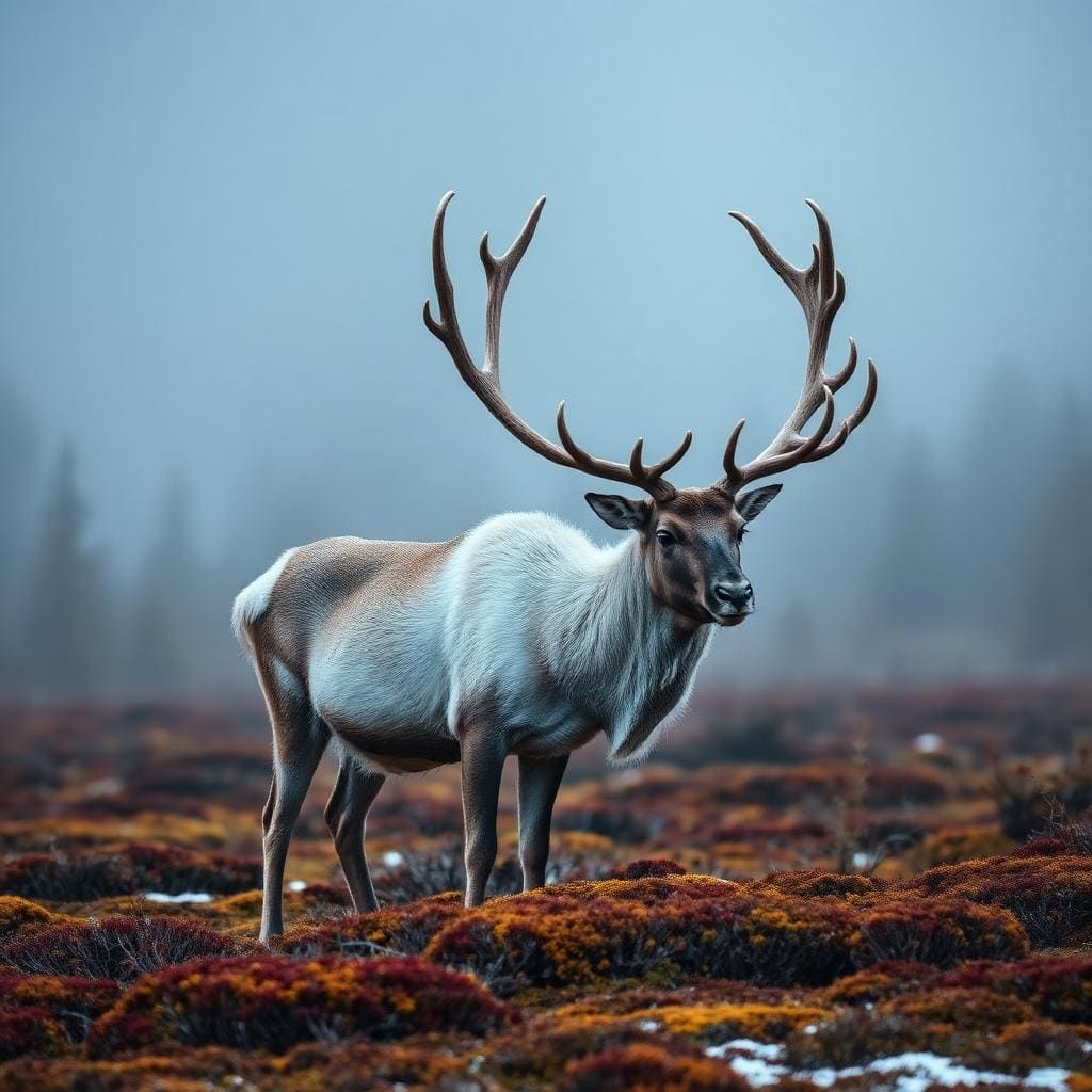 Wildlife guideWoodland caribouRangifer tarandus caribou
 Wildlife guideNorth American beaverCastor canadensis
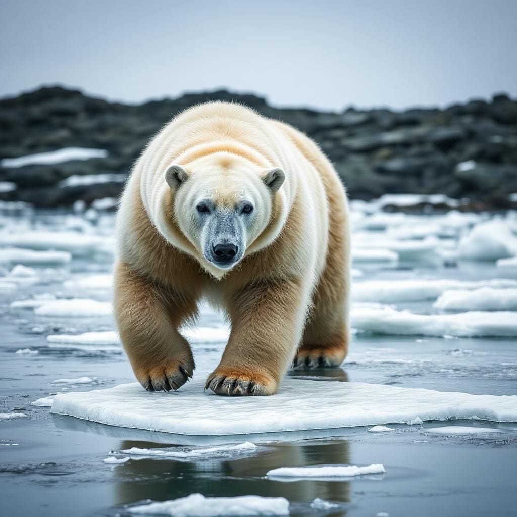 Wildlife guidePolar bearUrsus maritimus
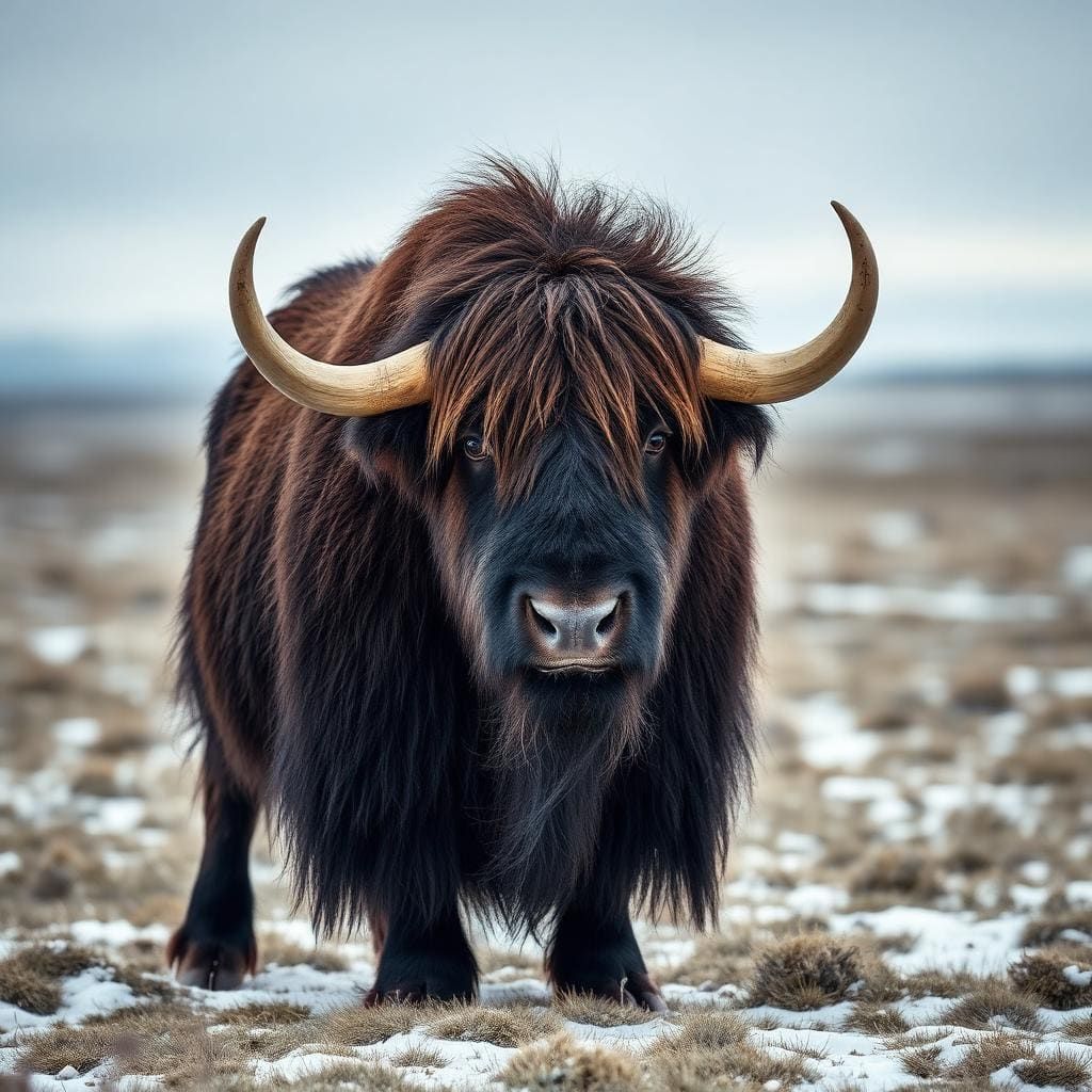 Wildlife guideMuskoxOvibos moschatus
 Wildlife guideMooseAlces alces
Maps, GPS & compass for this trip
Carry a waterproof paper map and a compass you can steer by, and treat the GPS as the backup — not the other way round. Buying links go to Amazon; Wild10 earns a commission at no cost to you.
Waterproof topo maps
- Waterproof topographic map — Alta River (Norway)Amazon search for waterproof, tear-resistant topo maps covering this area.
- National Geographic Trails IllustratedThe waterproof Trails Illustrated series — check for a sheet covering this area.
- Waterproof map case & compass lanyardKeep a paper map readable in rain, spray and a swamped boat.
Fishing at Alta River (Norway)
Planning to fish Alta River (Norway)? Fishing licences, open seasons and catch limits in Norway are set by the local wildlife authority and change every year — check the official source before you cast a line.
Do I need a fishing licence at Alta River (Norway)?
- A Norway fishing licence is normally required for anyone over the local youth age.
- Read the current Norway fishing regulations for special waters, barbless-hook or catch-and-release rules.
- Clean, drain and dry boats and gear between waters to stop invasive species.
Hunting near Alta River (Norway)
Thinking about hunting Alta River (Norway)? Hunting seasons, tags and draws in Norway are set by the wildlife authority each year. Confirm the rules for your species and unit before you go.
Is hunting allowed at Alta River (Norway)?
- Confirm the land around Alta River (Norway) is open to hunting and which management unit it falls in.
What do I need to hunt in Norway?
- A Norway hunting licence — most jurisdictions also require hunter education certification.
- Species tags or draw results for big game such as deer, elk, moose or bear where they occur.
- Knowledge of firearm and bow transport rules, which differ by land type and border crossing.
Altaelva and its town setting
The Alta River, called Altaelva in Norwegian, meets Altafjorden at the town of Alta in Finnmark, Norway. That river-mouth setting is the clearest starting point for planning a visit: Alta sits at the southern end of the fjord, with the river linking the destination’s name to an inhabited coastal landscape. Alta is Finnmark’s largest town and the main commercial centre of the county’s western part, so this is not solely a remote-river destination. A trip can combine time around the town with an interest in the river and fjord. Keep that geographic overview separate from practical river access, however. A town at a river mouth does not establish a public launch, a riverside trail, or a suitable crossing. Confirm the exact access arrangements before choosing a river activity.
Northern light and outdoor planning
Alta belongs to Northern Norway, a region characterised by a rugged coast, widely varying landscapes, and sparse settlement outside its population centres. Seasonal daylight is an important part of planning here. Northern Norway has continuous daylight and midnight sun in summer, while the darker season brings opportunities to see the northern lights. Alta itself is known as Nordlysbyen, or the Northern Lights City. For an outdoor visit, treat daylight as a planning condition rather than a guarantee of easy travel: long light does not establish river conditions or safe access, and an aurora-focused visit requires planning around darkness. Carry clothing suited to changing weather and choose activities that match current conditions. No specific river season can be assumed from the region’s general daylight pattern.
Town geography and time away from the river
Alta’s surrounding settlements help make sense of the wider destination without treating every named place as an established river access point. Øvre Alta and Tverrelvdalen lie south of town; Kåfjord, Kvenvik, and Jiepmaluokta are to the west; Rafsbotn is to the east. The rock carvings at Alta also lie just west of town and offer a separate focus for a visit beyond the river mouth. Within Alta, landmarks include the historic Alta Church in Bossekop, Elvebakken Church in Elvebakken, and the Northern Lights Cathedral. These places provide geographic and cultural context for a town-based itinerary, not a mapped outdoor circuit. Plan individual visits around confirmed local access rather than assuming a continuous path connects the river, churches, and rock carvings. Leave river-specific decisions until the intended activity and access location have been checked.
Route options
- Alta town orientation
A town-focused planning option centred on Alta’s river-mouth and fjord setting. Arrange individual stops after checking local access; this is not a described riverside trail or paddling route.
- Rock carvings west of Alta
Consider a separate visit to the rock carvings just west of town as an alternative to river time. Confirm the approach locally rather than assuming a connecting walking route from the river.
Sample itineraries
- Altaelva and Altafjorden orientation · 1 day
Base the day in Alta, where Altaelva reaches the southern end of Altafjorden. Focus on the river-mouth setting and the town rather than a backcountry route. Confirm public access locally before approaching the water; add the Northern Lights Cathedral for a town stop.
- River setting and rock carvings · 2 days
Spend the first day getting oriented in Alta and its river-and-fjord setting. On the second day, visit the rock carvings west of town and explore Bossekop, home to historic Alta Church. Confirm site access and visiting arrangements before setting out.
- Alta in the darker season · 2 days
Use daylight for exploring Alta and understanding its position at the mouth of Altaelva. Include the Northern Lights Cathedral and allow an evening for watching the sky. Northern lights occur frequently across Northern Norway in the darker season, but a sighting is not guaranteed.
Seasonal conditions
Spring
Transition toward the summer daylight season
Plan around the daylight and weather expected during the visit. Check local riverbank and ground conditions before choosing an outing; do not assume that increasing daylight means easy access along Altaelva.
Summer
Long-day and midnight-sun season
Northern Norway has continuous summer daylight and midnight sun. The extended light allows flexible sightseeing, but should not replace a sensible turnaround time or checks on weather and river access.
Fall
Transition into the darker season
Allow for decreasing daylight when planning outdoor time. The region's darker season brings opportunities to see northern lights. Keep evening plans flexible and check weather before heading away from town.
Winter
Darker season
Limited light shapes outdoor planning in this far-northern setting. Prioritize short, weather-appropriate outings and carry lighting and warm layers. Northern lights are a possibility, not a dependable itinerary stop.
| Season | Window | Conditions |
|---|---|---|
| Spring | Transition toward the summer daylight season | Plan around the daylight and weather expected during the visit. Check local riverbank and ground conditions before choosing an outing; do not assume that increasing daylight means easy access along Altaelva. |
| Summer | Long-day and midnight-sun season | Northern Norway has continuous summer daylight and midnight sun. The extended light allows flexible sightseeing, but should not replace a sensible turnaround time or checks on weather and river access. |
| Fall | Transition into the darker season | Allow for decreasing daylight when planning outdoor time. The region's darker season brings opportunities to see northern lights. Keep evening plans flexible and check weather before heading away from town. |
| Winter | Darker season | Limited light shapes outdoor planning in this far-northern setting. Prioritize short, weather-appropriate outings and carry lighting and warm layers. Northern lights are a possibility, not a dependable itinerary stop. |
Permits, fees & closures
Confirm access requirements and any activity-specific permissions with the managing agency before planning river activities.
Confirm current permits, fees, and closures with the managing agency before you go.
Hazards & regulations
- River and fjord edges require caution. Check footing and local conditions, and avoid entering unfamiliar water.
- Darkness can complicate navigation and footing during the darker season; carry a light and keep outings within available daylight when practical.
- Weather exposure matters in this far-northern setting. Carry protective layers and shorten outings when conditions deteriorate.
- Northern Norway is generally sparsely populated. Beyond Alta, verify transport and support arrangements rather than assuming help or services will be nearby.
What to pack for Alta River (Norway)
- Insulating layers suited to the forecast
- Windproof and waterproof outer layers
- Warm hat and gloves
- Sturdy footwear with reliable grip
- Map and locally confirmed access information
- Charged phone
- Headlamp for darker-season outings
- Drinking water
- Food for the planned outing
- Small first-aid kit
- Sun protection for long summer days
Alta River (Norway) FAQ
- Where is the Alta River in relation to town?
- Alta sits at the mouth of Altaelva, at the southern end of Altafjorden in Finnmark, Norway. This makes the town a practical starting point for understanding the river's coastal setting.
- Is this a confirmed river-travel itinerary?
- No. These plans focus on Alta and its river-mouth setting, not a verified riverside trail, paddling route, or fishing trip. Confirm suitable access and activity arrangements locally.
- What else can be visited around Alta?
- The rock carvings lie west of town. Other named stops include historic Alta Church in Bossekop, Elvebakken Church, and the Northern Lights Cathedral. Check visiting arrangements before building a day around them.
- When does daylight most affect planning?
- Summer brings continuous daylight and midnight sun across Northern Norway. The darker season requires more deliberate timing and lighting. Check daylight for the actual travel period rather than relying on a fixed daily sightseeing schedule.
- Can northern lights be part of the trip?
- Yes. Alta is known as the Northern Lights City, and aurora displays are frequent across Northern Norway during the darker season. Treat viewing as a flexible evening possibility rather than a guaranteed event.